Homersfield

Settlement in Suffolk Waverley

England

Homersfield

A143 east at turning for Alburgh
A143 east at turning for Alburgh Credit: Roy Hughes

Homersfield is a small village located in the county of Suffolk, in the eastern part of England. Situated on the Norfolk-Suffolk border, the village lies on the banks of the River Waveney, which forms the boundary between the two counties. With a population of around 200 residents, Homersfield offers a peaceful and rural environment.

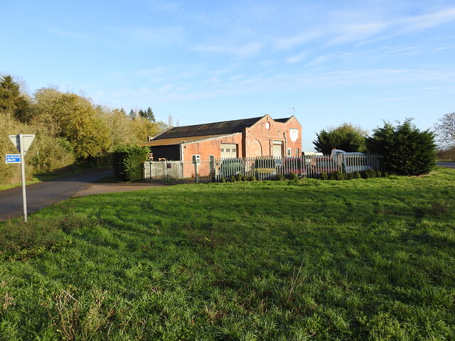
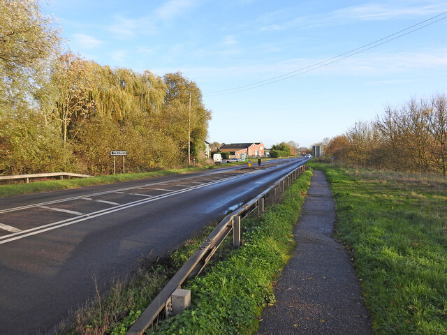
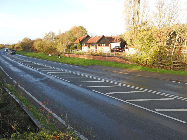
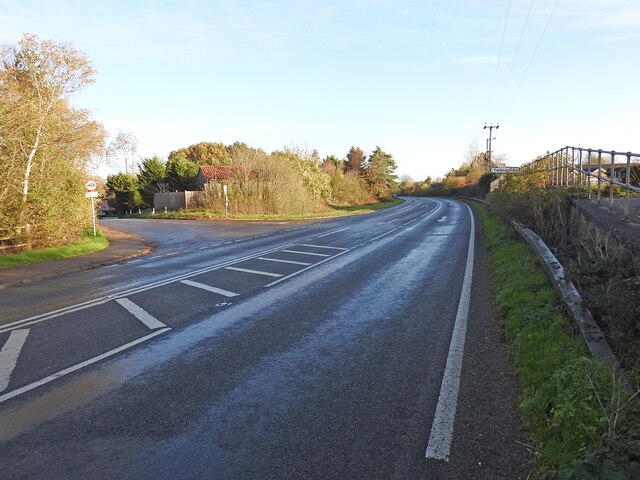
The village is known for its picturesque setting, characterized by beautiful countryside and charming old cottages. The area is surrounded by farmland and meadows, providing an idyllic backdrop for long walks and outdoor activities. The River Waveney also offers opportunities for boating, fishing, and wildlife spotting.

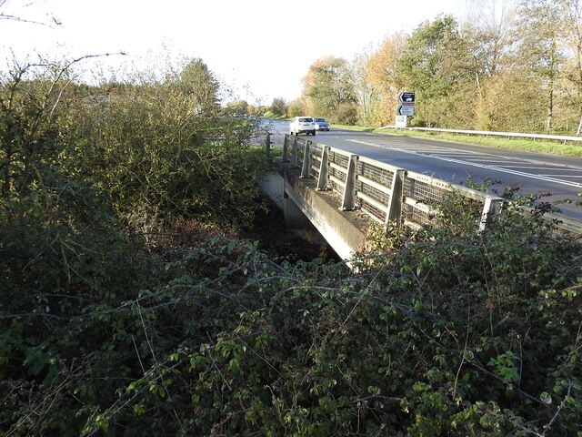
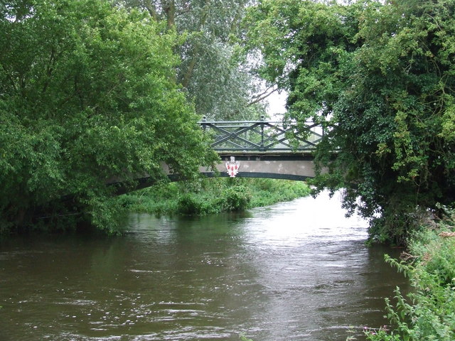
Homersfield is home to the historic Homersfield Bridge, a Grade II listed structure that spans the river and connects Suffolk and Norfolk. This bridge, which was built in the 19th century, is renowned for its architectural beauty and attracts visitors interested in its engineering design.

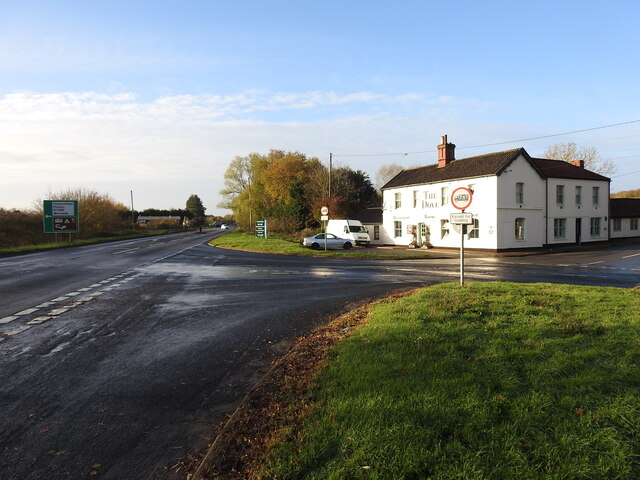
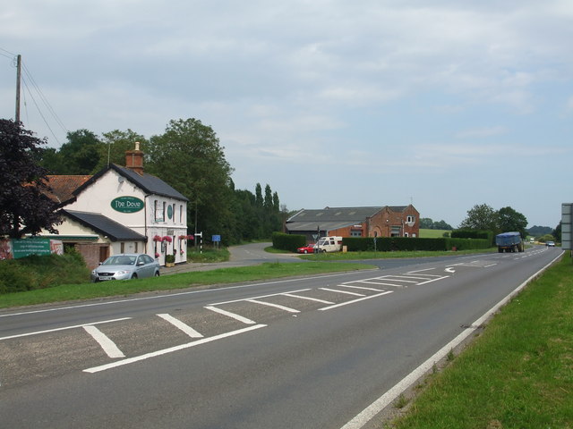
Despite its small size, Homersfield has a strong sense of community. The village features a local pub, The Swan Inn, which serves as a hub for social gatherings and events. The pub offers traditional British cuisine and a selection of local ales, providing a warm and welcoming atmosphere for both locals and visitors.

Overall, Homersfield offers a tranquil and scenic escape from the hustle and bustle of city life. Its natural beauty, historic bridge, and close-knit community make it a charming destination for those seeking a quintessential English village experience.

If you have any feedback on the listing, please let us know in the comments section below.
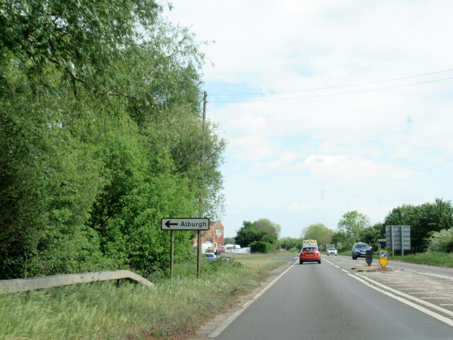
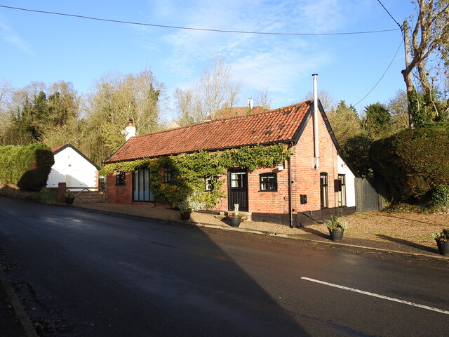
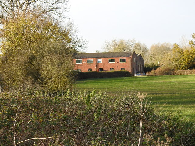
Homersfield Images

Images are sourced within 2km of 52.420343/1.3586851 or Grid Reference TM2885. Thanks to Geograph Open Source API. All images are credited.

A143 east at turning for Alburgh
The Old Armoury This is probably the Armoury belonging to Flixton Hall before the demise of the Hall.
((Adair of Ballymena Castle and Flixton Hall, baronets)
"During the Second World War he sold the contents of the armoury at Flixton Hall to support the war effort; they are now in the Powder Magazine and the Governor’s Palace at Colonial Williamsburg (USA).")
<span class="nowrap"><a title="https://www.facebook.com/ArtMuseumsofCWF/posts/we-love-to-share-collection-connections-this-magnificent-fan-of-21-infantry-swor/1358477954307042/" rel="nofollow ugc noopener" href="https://www.facebook.com/ArtMuseumsofCWF/posts/we-love-to-share-collection-connections-this-magnificent-fan-of-21-infantry-swor/1358477954307042/">Link</a><img style="margin-left:2px;" alt="External link" title="External link - shift click to open in new window" src="https://s1.geograph.org.uk/img/external.png" width="10" height="10"/></span>
The Old Armoury
This is probably the Armoury belonging to Flixton Hall before the demise of the Hall. ((Adair of Ballymena Castle and Flixton Hall, baronets) "During the Second World War he sold the contents of the armoury at Flixton Hall to support the war effort; they are now in the Powder Magazine and the Governor’s Palace at Colonial Williamsburg (USA).") LinkExternal link
The site of the former Station House at Homersfield Homersfield station was just under 9 miles from Tivetshall and 10 from Beccles, about midway. The platform was rebuilt in 1912 after serious flooding caused much damage. The station had all the usual facilities, with the station master's accommodation on the upper floor. The goods yard has two sidings to a cattle pen and a turntable with three short spur sidings with a connection to a large goods shed and adjoining grain store, which remains extant and in use as a vehicle repair facility.
During WW2 the station served as the rail-link for the nearby USAAF Hardwick airfield.
The site of the former Station House at Homersfield
Homersfield station was just under 9 miles from Tivetshall and 10 from Beccles, about midway. The platform was rebuilt in 1912 after serious flooding caused much damage. The station had all the usual facilities, with the station master's accommodation on the upper floor. The goods yard has two sidings to a cattle pen and a turntable with three short spur sidings with a connection to a large goods shed and adjoining grain store, which remains extant and in use as a vehicle repair facility. During WW2 the station served as the rail-link for the nearby USAAF Hardwick airfield.
Homersfield goods shed from the former track Homersfield goods shed had an adjoining grain store attached in 1898 and the building is still in use today as a vehicle repair facility.
Homersfield goods shed from the former track
Homersfield goods shed had an adjoining grain store attached in 1898 and the building is still in use today as a vehicle repair facility.
The site of the former goods yard at Homersfield The goods yard has two sidings to a cattle pen and a turntable (centre - right of the picture near the tree) with three short spur sidings with a connection to a large goods shed and adjoining grain store added in 1898. The building remains extant and in use as a vehicle repair facility.
The site of the former goods yard at Homersfield
The goods yard has two sidings to a cattle pen and a turntable (centre - right of the picture near the tree) with three short spur sidings with a connection to a large goods shed and adjoining grain store added in 1898. The building remains extant and in use as a vehicle repair facility.
The modern bridge over The Beck This modern bridge replaced the earlier 19th century railway bridge built for the Waveney Valley Railway.
The modern bridge over The Beck
This modern bridge replaced the earlier 19th century railway bridge built for the Waveney Valley Railway.
Site of Homersfield level crossing The crossing #48 was necessarily very wide as the line crossed the road diagonally, centred on where the bollards are located in the road. The crossing was encountered about 90 yards after leaving Homersfield station. and just another 40 yards from the bridge over The Beck.
Site of Homersfield level crossing
The crossing #48 was necessarily very wide as the line crossed the road diagonally, centred on where the bollards are located in the road. The crossing was encountered about 90 yards after leaving Homersfield station. and just another 40 yards from the bridge over The Beck.
The location of the former Wortwell Station The station house and 180 feet platform was situated roughly where the path terminates. The 'platform' in the background is in the original location but has been rebuilt on a smaller scale.
Wortwell Station was built in the second phase, Harleston to Bungay and opened in January 1861, and was closed in January 1878, as an economy measure. The station house became the gatekeeper's house. The Tunbeck Road level crossing #44 was just to the right of the scene.
The location of the former Wortwell Station
The station house and 180 feet platform was situated roughly where the path terminates. The 'platform' in the background is in the original location but has been rebuilt on a smaller scale. Wortwell Station was built in the second phase, Harleston to Bungay and opened in January 1861, and was closed in January 1878, as an economy measure. The station house became the gatekeeper's house. The Tunbeck Road level crossing #44 was just to the right of the scene.
The location of the Tunbeck Road level crossing Wortwell Station closed in 1878, 17 years after it opened. The station building remained until the Old Railway Road was built.
The location of the Tunbeck Road level crossing
Wortwell Station closed in 1878, 17 years after it opened. The station building remained until the Old Railway Road was built.
Site of a former occupation crossing #45 The road has been straightened here and diverted slightly from line of the railway track which ran along the high ground on the opposite side of the road. The crossing was in line with the remains of the road left of the banner. 
The other end of the former roadway remains extant in Wortwell High Road.
Site of a former occupation crossing #45
The road has been straightened here and diverted slightly from line of the railway track which ran along the high ground on the opposite side of the road. The crossing was in line with the remains of the road left of the banner. The other end of the former roadway remains extant in Wortwell High Road.
Homersfield, St Mary
Church of St Mary, Denton <span class="nowrap"><a title="https://historicengland.org.uk/listing/the-list/list-entry/1373626?section=official-list-entry" rel="nofollow ugc noopener" href="https://historicengland.org.uk/listing/the-list/list-entry/1373626?section=official-list-entry">Link</a><img style="margin-left:2px;" alt="External link" title="External link - shift click to open in new window" src="https://s1.geograph.org.uk/img/external.png" width="10" height="10"/></span>
Church of St Mary, Denton
Cottages at Homersfield These are right opposite the triangular green at the centre of the village.
Cottages at Homersfield
These are right opposite the triangular green at the centre of the village.
The village green at Homersfield The triangular green is right at the centre of the village.
The village green at Homersfield
The triangular green is right at the centre of the village.
Cottages at Homersfield These are seen from the triangular green at the centre of the village.
Cottages at Homersfield
These are seen from the triangular green at the centre of the village.
The village green at Homersfield The triangular green is right at the centre of the village.
The village green at Homersfield
The triangular green is right at the centre of the village.
Former Ford at Broadwash Farm The ford was overgrown at the time of our visit and Broadwash Farm with 25 acres of woodland and grazing land was up for sale.
Former Ford at Broadwash Farm
The ford was overgrown at the time of our visit and Broadwash Farm with 25 acres of woodland and grazing land was up for sale.
Homersfield Village Sign Apparently, this fellow, his boat, and the fish beneath him are all carved from the trunk of a cedar from Blickling Hall, in North Norfolk.

The sculptor is Mark Goldsworthy, from nearby Bungay.
Homersfield Village Sign
Apparently, this fellow, his boat, and the fish beneath him are all carved from the trunk of a cedar from Blickling Hall, in North Norfolk. The sculptor is Mark Goldsworthy, from nearby Bungay.
Show me another place!

Homersfield is located at Grid Ref: TM2885 (Lat: 52.420343, Lng: 1.3586851)

Administrative County: Suffolk

District: Waverley

Police Authority: Norfolk

What 3 Words

///contemplate.approve.disposal. Near Harleston, Norfolk

Nearby Locations

Homersfield

Related Wikis

Homersfield

Homersfield, also known as St Mary, South Elmham, is a village and civil parish in the north of the English county of Suffolk. It is in the East Suffolk...

Homersfield Bridge

Homersfield Bridge is a road bridge across the River Waveney between Norfolk and Suffolk, and stands partly in the civil parishes of Alburgh and Wortwell...

Homersfield railway station

Homersfield was a railway station which served the village of Homersfield in Suffolk, England, although the station was located in Alburgh, across the...
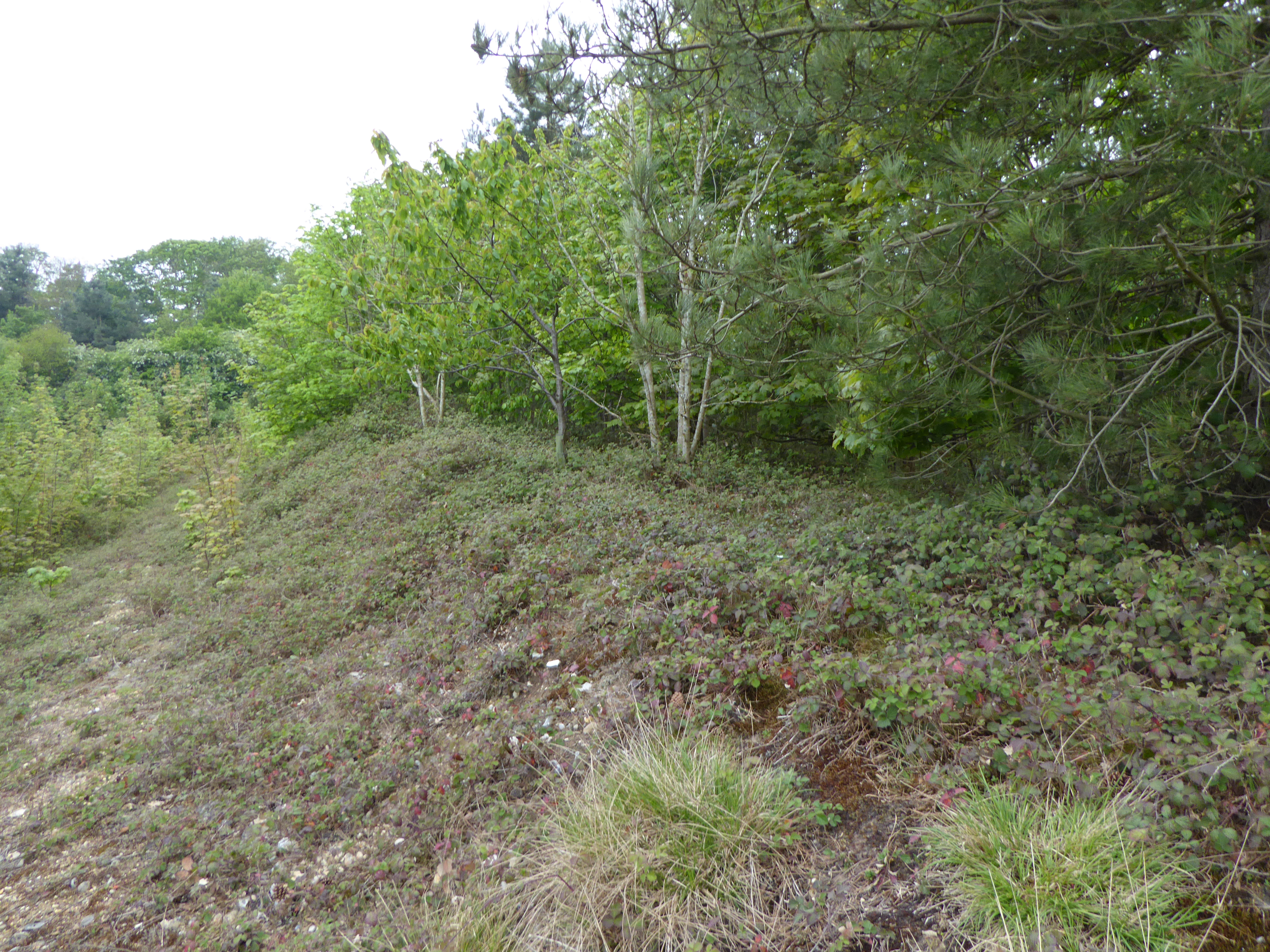
Flixton Quarry

Flixton Quarry is a 0.7 hectares (1.7 acres) geological Site of Special Scientific Interest 3.75 miles (6.04 km) south-west of Bungay in the English county...

Nearby Amenities

Located within 500m of 52.420343,1.3586851
Homersfield
Place: village
Wikidata: Q9293459
Lat/Long: 52.4190236/1.3600598
Pub
The Black Swan
Addr Postcode: IP20 0ET
Addr Street: Church Lane
Url: http://www.blackswanhomersfield.co.uk/
Lat/Long: 52.4209935/1.3577127
Bus Stop
Playing Field
Naptan AtcoCode: 390070183
Naptan Bearing: NE
Naptan CommonName: Playing Field
Naptan Indicator: adj
Naptan Landmark: Playing Field
Naptan NaptanCode: sufgwjmd
Naptan Street: B1062
Naptan Verified: no
Source: naptan_import
Lat/Long: 52.4205997/1.359268
Bus Stop
Playing Field
Bus: yes
Naptan AtcoCode: 390070184
Naptan Bearing: SW
Naptan BusStopType: CUS
Naptan CommonName: Playing Field
Naptan Indicator: opp
Naptan Landmark: Playing Field
Naptan NaptanCode: sufgwjmg
Naptan Street: B1062
Naptan Verified: no
Public Transport: platform
Source: naptan_import
Lat/Long: 52.4205288/1.3593291
Denton Low Road, adj
Naptan AtcoCode: 2900A0410
Naptan Bearing: NW
Naptan BusStopType: CUS
Naptan CommonName: Denton Low Road
Naptan Indicator: adj
Naptan Landmark: Dove Tea Rooms
Naptan Locality: Wortwell
Naptan NaptanCode: nfoadajg
Naptan Street: Station Road
Naptan Verified: no
Source: naptan_import
Lat/Long: 52.423736/1.3542569
Denton Low Road, opp
Naptan AtcoCode: 2900A0411
Naptan Bearing: SE
Naptan BusStopType: CUS
Naptan CommonName: Denton Low Road
Naptan Indicator: opp
Naptan Landmark: Dove Tea Rooms
Naptan Locality: Wortwell
Naptan NaptanCode: nfoadajm
Naptan Street: Station Road
Naptan Verified: no
Source: naptan_import
Lat/Long: 52.4238913/1.3544894
Bus Stop
Station Farm, adj
Bus: yes
Naptan AtcoCode: 2900W492
Naptan Bearing: NE
Naptan CommonName: Station Farm
Naptan Indicator: adj
Naptan Landmark: Station Farm
Naptan Locality: Wortwell
Naptan NaptanCode: nfogjagt
Naptan Street: High Road
Naptan Verified: no
Public Transport: platform
Source: naptan_import
Lat/Long: 52.421703/1.3529991
Bus Stop
Station Farm, opp
Bus: yes
Naptan AtcoCode: 2900W494
Naptan Bearing: SW
Naptan CommonName: Station Farm
Naptan Indicator: opp
Naptan Landmark: Station Farm
Naptan Locality: Wortwell
Naptan NaptanCode: nfogjaja
Naptan Street: High Road
Naptan Verified: no
Public Transport: platform
Source: naptan_import
Lat/Long: 52.4218639/1.3533497
Barrier: bollard
Bicycle: yes
Foot: yes
Horse: yes
Lat/Long: 52.4216372/1.3563461
Cafe
The Dove Inn
Addr Postcode: IP20 0EP
Addr Street: Station Road
Addr Village: Wortwell
Fhrs Id: 817909
Old Name: The Farmers Kitchen
Source Addr: FSA Food Hygiene Ratings Database
Website: https://www.thedove.restaurant/
Lat/Long: 52.423635/1.3544079
Homersfield
Historic Railway: station
Railway: site
Source: OS 1:25k
Wikidata: Q5890363
Wikipedia: en:Homersfield railway station
Lat/Long: 52.4234872/1.3547518
Crossing
Crossing Island: yes
Lat/Long: 52.4231796/1.3542198
Tourism: picnic_site
Lat/Long: 52.4205281/1.3586506
Bench
Backrest: yes
Material: wood
Seats: 3
Lat/Long: 52.420564/1.3590759
Tourism: picnic_site
Lat/Long: 52.420595/1.3591322
Leisure: picnic_table
Lat/Long: 52.4217274/1.3566433
Board Type: nature
Information: board
Tourism: information
Lat/Long: 52.4217487/1.3563822
Leisure: picnic_table
Lat/Long: 52.4218166/1.3565946
Leisure: picnic_table
Lat/Long: 52.4218369/1.3567588
Maxheight: 2.1
Lat/Long: 52.4219647/1.3558538
Homersfield
Man Made: village_sign
Tourism: village_sign
Lat/Long: 52.420361/1.3585468
Telephone
Booth: K6
Covered: booth
Listed Status: Grade II
Man Made: telephone_box
Tourism: information
Lat/Long: 52.4203148/1.3583441
Bench
Backrest: yes
Material: wood
Note: circular bench around tree
Seats: 6
Lat/Long: 52.4203711/1.3582505
The Farmers Kitchen
Addr Housename: The Dove
Addr Postcode: IP20 0EP
Addr Street: Station Road
Addr Village: Wortwell
Fhrs Id: 817909
Shop: farm
Source Addr: FSA Food Hygiene Ratings Database
Url: http://www.farmers-kitchen.co.uk/
Lat/Long: 52.423678/1.3542523
Post Box
Collection Times: Mo-Fr 16:30; Sa 09:00
Operator: Royal Mail
Post Box Mounting: pier
Post Box Type: lamp
Ref: IP20 7032
Royal Cypher: EIIR
Royal Cypher Wikidata: Q33102113
Lat/Long: 52.4205953/1.3592546
Cafe
The Shed
Lat/Long: 52.422196/1.3530014
The data included in this document is from www.openstreetmap.org. The data is made available under ODbL.

Have you been to Homersfield?

Leave your review of Homersfield below (or comments, questions and feedback).