Brottos

Hill, Mountain in Merionethshire

Wales

Brottos

Recently-burnt heather South of Foel-boeth.
Recently-burnt heather Credit: John H Darch

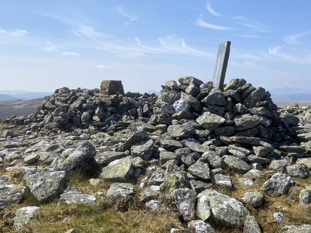
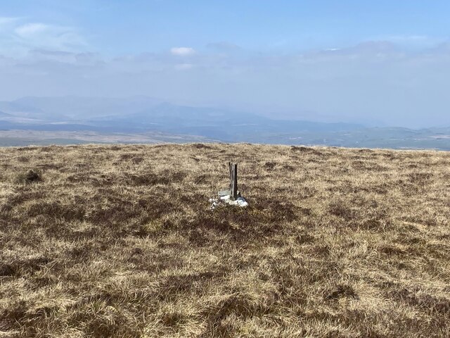
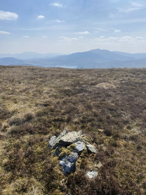
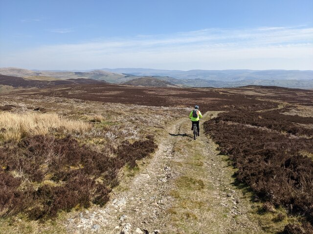
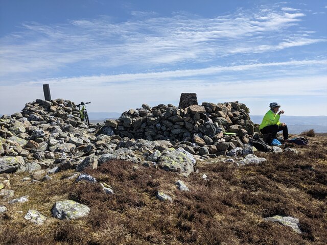
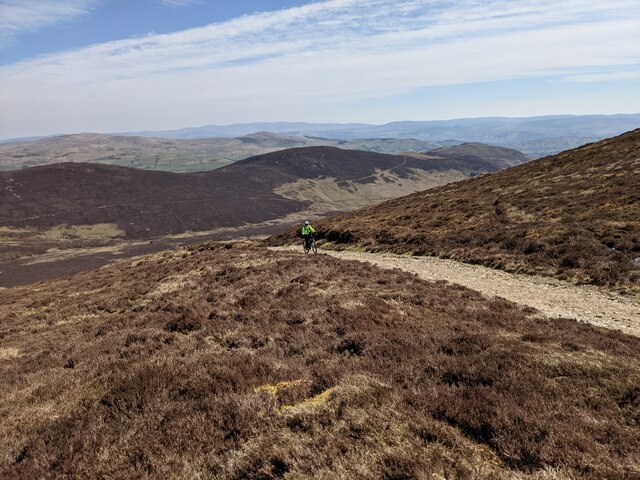
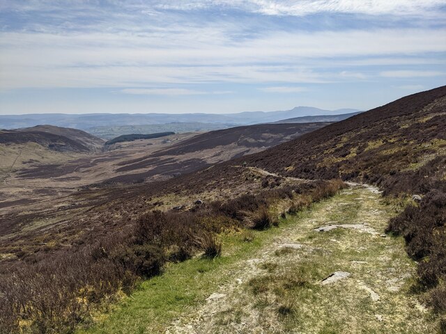
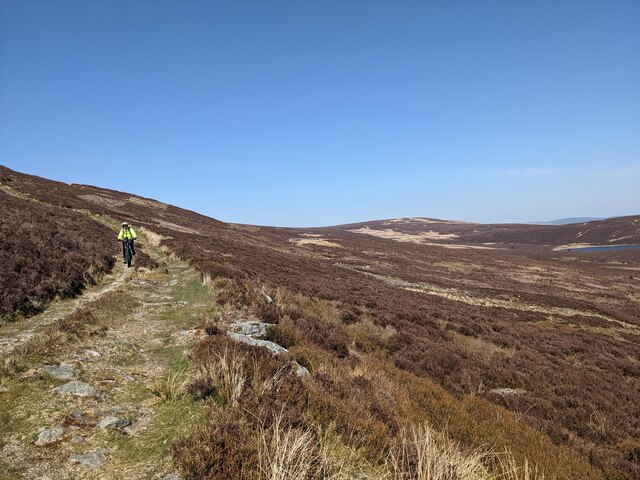
Brottos is a prominent hill/mountain located in the county of Merionethshire, Wales, within the Snowdonia National Park. Standing at an elevation of approximately 566 meters (1,857 feet), it offers breathtaking panoramic views of the surrounding landscape.

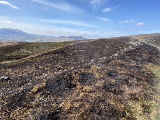
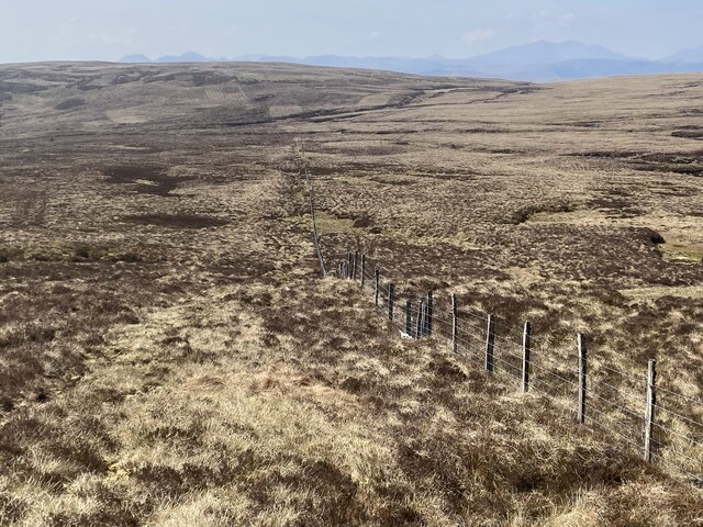
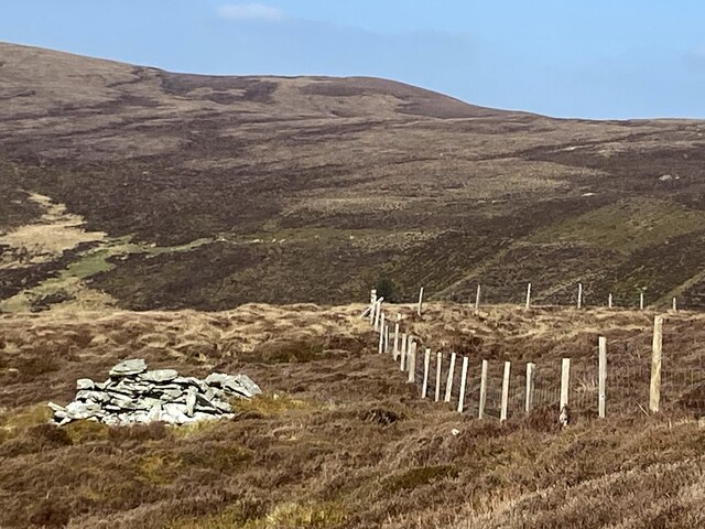
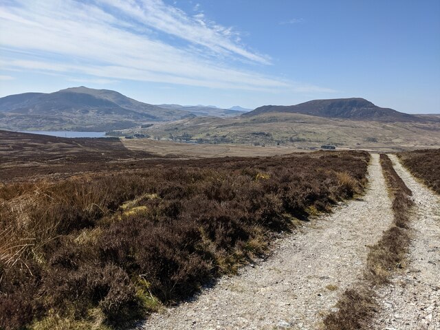
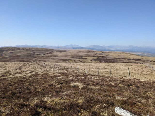
Situated near the village of Bala, Brottos is a popular destination for hikers and nature enthusiasts. Its location within Snowdonia National Park means that it is surrounded by diverse flora and fauna, making it a haven for wildlife. The hill/mountain is covered in heather and grasses, creating a picturesque scene throughout the year.

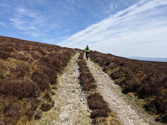
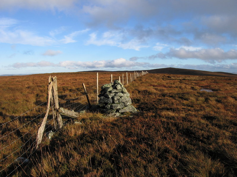
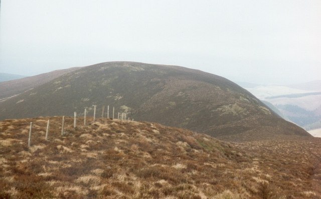
Access to Brottos is relatively easy, with several well-marked footpaths leading to the summit. As visitors ascend, they may encounter some steep sections, but the effort is rewarded with stunning vistas. On a clear day, it is possible to see the nearby peaks of Snowdon and Cadair Idris, as well as the expansive Bala Lake.

The hill/mountain is also home to a variety of bird species, including red kites, buzzards, and peregrine falcons. Birdwatchers often visit Brottos to observe these magnificent creatures in their natural habitat.

Overall, Brottos offers a wonderful opportunity to engage with nature and enjoy the stunning Welsh countryside. With its accessible trails and breathtaking views, it is an ideal destination for outdoor enthusiasts seeking a memorable experience in Merionethshire.

If you have any feedback on the listing, please let us know in the comments section below.

Brottos Images

Images are sourced within 2km of 52.979567/-3.6806805 or Grid Reference SH8743. Thanks to Geograph Open Source API. All images are credited.

Recently-burnt heather South of Foel-boeth.
Recently-burnt heather
South of Foel-boeth.
Mountain track South of Brottos.
Mountain track
South of Brottos.
Nant-y-Coed Immediately downstream from the ford.
Nant-y-Coed
Immediately downstream from the ford.
The summit of Carnedd-y-Filiast (2195' / 669m)
A stake marks the spot The flat summit of Waun Garnedd-y-filiast (2133'/650).
A stake marks the spot
The flat summit of Waun Garnedd-y-filiast (2133'/650).
Boundary fence west of Carnedd-y-Filiast
The summit of Carnedd Llechwedd-llyfn? Though the actual summit of this 2110' / 643m mountain is virtually impossible to ascertain on this flat plateau, Someone has constructed this small, symbolic cairn.
The summit of Carnedd Llechwedd-llyfn?
Though the actual summit of this 2110' / 643m mountain is virtually impossible to ascertain on this flat plateau, Someone has constructed this small, symbolic cairn.
Pile of rocks by fence On the northern slopes of Foel Boeth.
Pile of rocks by fence
On the northern slopes of Foel Boeth.
The track below Foel-boeth Llyn Celyn can be seen in the distance on the left.
The track below Foel-boeth
Llyn Celyn can be seen in the distance on the left.
Looking east on the track below Foel-boeth
A track through the wilderness Heading towards Cwm Hesgyn.
A track through the wilderness
Heading towards Cwm Hesgyn.
Looking down the boundary fence From the summit of Carnedd y Filiast.
Looking down the boundary fence
From the summit of Carnedd y Filiast.
Complex 'furniture' on the summit of Carnedd y Filiast Two cairns, a boundary post and a trig point. And, temporarily, a bicycle!
Complex 'furniture' on the summit of Carnedd y Filiast
Two cairns, a boundary post and a trig point. And, temporarily, a bicycle!
The track below Carnedd y Filiast
The old gate posts These were once part of a boundary wall/fence which is still visible on the aerial photos. Presumably the gate was too narrow for the vehicles using the current track towards Carnedd y Filiast.
The old gate posts
These were once part of a boundary wall/fence which is still visible on the aerial photos. Presumably the gate was too narrow for the vehicles using the current track towards Carnedd y Filiast.
The excellent, though rocky, track along the side of Brottos
Looking north along the track below Brottos
The track across Ffridd Cwmhesgyn
Show me another place!

Brottos is located at Grid Ref: SH8743 (Lat: 52.979567, Lng: -3.6806805)

Unitary Authority: Gwynedd

Police Authority: North Wales

What 3 Words

///kinks.dockers.himself. Near Bala, Gwynedd

Nearby Locations

Brottos

Related Wikis

Carnedd y Filiast (Cerrigydrudion)

Carnedd y Filiast is a mountain near Cerrigydrudion on the border of the Snowdonia National Park, North Wales and is 669 metres (2,195 ft) high. ��2...

Waun Garnedd-y-filiast

Waun Garnedd-y-filiast is a top of Carnedd y Filiast on the border of the Snowdonia National park near Cerrigydrudion in North Wales. It is part of the...

Carnedd Llechwedd-llyfn

Carnedd Llechwedd-llyfn is a subsidiary summit of Carnedd y Filiast on the border of Snowdonia National Park in Llandderfel, in Gwynedd. The northern...

Trum y Gwragedd

Trum y Gwragedd is a top of Foel y Geifr in the Hirnantau. These hills rise from the south east shores of Bala Lake.The summit is boggy and marked by a...

Nearby Amenities

Located within 500m of 52.979567,-3.6806805
Brottos
Ele: 626
Natural: peak
Lat/Long: 52.9794921/-3.6807335
Man Made: cairn
Lat/Long: 52.983529/-3.6809121
Generator Method: photovoltaic
Generator Output Electricity: yes
Generator Solar Modules: 1
Generator Source: solar
Generator Type: solar_photovoltaic_panel
Location: surface
Power: generator
Lat/Long: 52.9834921/-3.6806137
The data included in this document is from www.openstreetmap.org. The data is made available under ODbL.

Have you been to Brottos?

Leave your review of Brottos below (or comments, questions and feedback).