Barcloy Hill

Hill, Mountain in Kirkcudbrightshire

Scotland

Barcloy Hill

Piper's Cove A fabulous cove, in which one wall shows how red granite intrusion has followed the structure of the folded rocks which it has forced its way into.
Piper's Cove Credit: Jonathan Wilkins

Barcloy Hill is a prominent hill located in the region of Kirkcudbrightshire, Scotland. Rising to a height of approximately 147 meters (482 feet), it stands as a notable landmark within the area. The hill is situated near the town of Gatehouse of Fleet, offering picturesque views of the surrounding countryside.

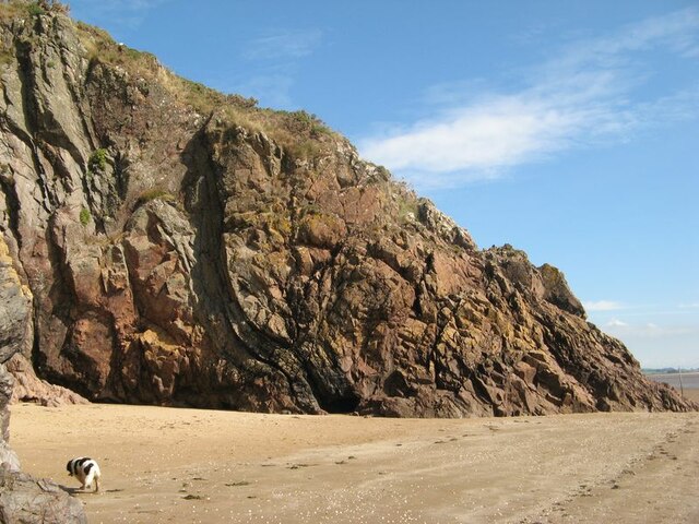
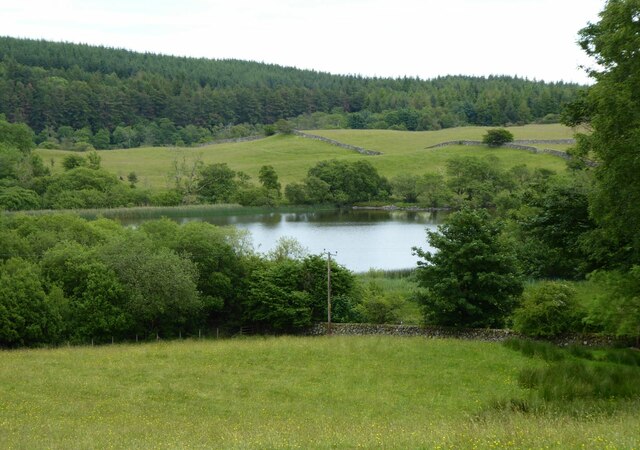
Barcloy Hill is characterized by its gentle slopes and lush vegetation, making it a popular destination for outdoor enthusiasts and nature lovers. The hill is covered in a mixture of grasses, heather, and scattered trees, enhancing its natural beauty. It is home to a diverse range of flora and fauna, including various species of wildflowers and birds.

The summit of Barcloy Hill provides breathtaking panoramic views of the Galloway Hills, the Solway Firth, and the surrounding countryside. On a clear day, visitors can even catch a glimpse of the Lake District in England. The hill's location and height make it an excellent spot for photography, hiking, and picnicking.

Access to Barcloy Hill is relatively easy, with well-defined paths leading to the top. It is recommended to wear appropriate footwear and carry water and snacks, especially during longer hikes. The hill is open to the public year-round, allowing visitors to enjoy its beauty in every season.

Overall, Barcloy Hill offers a serene escape into nature, providing a tranquil and picturesque setting for outdoor activities and exploration.

If you have any feedback on the listing, please let us know in the comments section below.

Barcloy Hill Images

Images are sourced within 2km of 54.877876/-3.7601768 or Grid Reference NX8755. Thanks to Geograph Open Source API. All images are credited.

Piper's Cove A fabulous cove, in which one wall shows how red granite intrusion has followed the structure of the folded rocks which it has forced its way into.
Piper's Cove
A fabulous cove, in which one wall shows how red granite intrusion has followed the structure of the folded rocks which it has forced its way into.
Tilted strata Strata belonging to the Ross Formation (Silurian, Wenlock) are standing almost vertical on the cliffs here.
Tilted strata
Strata belonging to the Ross Formation (Silurian, Wenlock) are standing almost vertical on the cliffs here.
Sea stacks at Brandy Cove Fabulous sea-stacks and rugged coast which is well on the way to producing more!
Sea stacks at Brandy Cove
Fabulous sea-stacks and rugged coast which is well on the way to producing more!
Needle's Eye A fabulous natural arch formed by failure of the rocks and erosion at sea level. What is particularly satisfying is that the fault responsible for the failure is clearly visible, running slightly obliquely up the cliff above the crown of the arch.
Needle's Eye
A fabulous natural arch formed by failure of the rocks and erosion at sea level. What is particularly satisfying is that the fault responsible for the failure is clearly visible, running slightly obliquely up the cliff above the crown of the arch.
Fault failure Erosion of the cliff is proceeding where the presence of a fault plane has created weakness in the rocks. A nice cave is developing at the tide mark.
Fault failure
Erosion of the cliff is proceeding where the presence of a fault plane has created weakness in the rocks. A nice cave is developing at the tide mark.
Ripples and mirage Quite by accident I succeeded in capturing a classic mirage by kneeling for this shot of the rippled sand running out from the coast, apparently without end. The distant promontory of Southerness appears to float above the horizon. My assistant Tegid is the other feature on the horizon, stretching his legs at a gallop.
Ripples and mirage
Quite by accident I succeeded in capturing a classic mirage by kneeling for this shot of the rippled sand running out from the coast, apparently without end. The distant promontory of Southerness appears to float above the horizon. My assistant Tegid is the other feature on the horizon, stretching his legs at a gallop.
Carboniferous strata Rocks on the shore to the south of Portling are much younger than those forming the adjacent cliffs which run along the coast. It is immediately obvious that they are not steeply inclined, and in fact they are unconformable with the immediately adjacent Silurian strata (see <a href="https://www.geograph.org.uk/photo/6970240">NX8954 : Tilted strata</a> for a good contrasting example) and post-date the continental collision responsible for the deformation of the older rocks. Sadly, it is not possible to see the older and younger rocks anywhere in contact, and generally here a steeply-inclined fault separates them. See also <a href="https://www.geograph.org.uk/photo/6970311">NX8853 : Carboniferous strata 2</a> for another view of the Carboniferous rocks.
Carboniferous strata
Rocks on the shore to the south of Portling are much younger than those forming the adjacent cliffs which run along the coast. It is immediately obvious that they are not steeply inclined, and in fact they are unconformable with the immediately adjacent Silurian strata (see NX8954 : Tilted strata for a good contrasting example) and post-date the continental collision responsible for the deformation of the older rocks. Sadly, it is not possible to see the older and younger rocks anywhere in contact, and generally here a steeply-inclined fault separates them. See also NX8853 : Carboniferous strata 2 for another view of the Carboniferous rocks.
Carboniferous strata 2 The rocks here, of Carboniferous (Arundian to Holkerian) age are the Rascarrel Member of the Fell Sandstone Formation. The beds are of sandstone and conglomerate, which include angular clasts of granite and other igneous material eroded from the exposed granite pluton nearby, indicating rapid uplift on the faults which run along its margin to form a faulted unconformity on the norther margin of the Upper Palaeozoic Solway Basin. See also <a href="https://www.geograph.org.uk/photo/6970289">NX8853 : Carboniferous strata</a>.
Carboniferous strata 2
The rocks here, of Carboniferous (Arundian to Holkerian) age are the Rascarrel Member of the Fell Sandstone Formation. The beds are of sandstone and conglomerate, which include angular clasts of granite and other igneous material eroded from the exposed granite pluton nearby, indicating rapid uplift on the faults which run along its margin to form a faulted unconformity on the norther margin of the Upper Palaeozoic Solway Basin. See also NX8853 : Carboniferous strata.
Portling shore Looking from the intertidal sands to the houses on the Portling Shore. I was impressed by the sky that had developed.
Portling shore
Looking from the intertidal sands to the houses on the Portling Shore. I was impressed by the sky that had developed.
Lichens on sandstone Still in the splash zone, these rocks bear a fantastic community of lichens including Caloplaca, Ramalina and Ochrolechia. What a fabulous garden!
Lichens on sandstone
Still in the splash zone, these rocks bear a fantastic community of lichens including Caloplaca, Ramalina and Ochrolechia. What a fabulous garden!
Forest lodges, Barend A very well appointed leisure park development.
Forest lodges, Barend
A very well appointed leisure park development.
Fairgirth fields Marginal woodland and fields by Fairgirth House.
Fairgirth fields
Marginal woodland and fields by Fairgirth House.
Lake at Fairgirth Lake by Fairgirth with a herd of fine, leisured cows.
Lake at Fairgirth
Lake by Fairgirth with a herd of fine, leisured cows.
Clonyard Hotel 'Clonyard Hotel is a small, friendly, family run hotel located in the heart of Dumfries and Galloway. Situated on seven acres of beautiful mature gardens and woodlands, Clonyard offers the perfect location to escape from the hussle and bussle of daily life.' <span class="nowrap"><a title="https://www.clonyardhotel.co.uk/" rel="nofollow ugc noopener" href="https://www.clonyardhotel.co.uk/">Link</a><img style="margin-left:2px;" alt="External link" title="External link - shift click to open in new window" src="https://s1.geograph.org.uk/img/external.png" width="10" height="10"/></span>
Clonyard Hotel
'Clonyard Hotel is a small, friendly, family run hotel located in the heart of Dumfries and Galloway. Situated on seven acres of beautiful mature gardens and woodlands, Clonyard offers the perfect location to escape from the hussle and bussle of daily life.' LinkExternal link
Clonyard Loch In the hollow below Clonyard Hotel.
Clonyard Loch
In the hollow below Clonyard Hotel.
Colvend Parish Church An Early Christian church by P MacGregor Chalmers 1911, of granite with red sandstone dressings and set on a rise overlooking the Solway Firth. Its bell-tower is topped by a steep pyramid roof.
Colvend Parish Church
An Early Christian church by P MacGregor Chalmers 1911, of granite with red sandstone dressings and set on a rise overlooking the Solway Firth. Its bell-tower is topped by a steep pyramid roof.
Colvend House Just to the left of the house, through a gap between the trees, is White Loch.
Colvend House
Just to the left of the house, through a gap between the trees, is White Loch.
Facilities at Sandyhills Caravan Park 'The park is secluded and ideal for anyone looking for a relaxing, peaceful holiday beside the sea. It’s a place where you can do as much or as little as you like.' <span class="nowrap"><a title="https://www.sandyhillsbaycaravanpark.co.uk/" rel="nofollow ugc noopener" href="https://www.sandyhillsbaycaravanpark.co.uk/">Link</a><img style="margin-left:2px;" alt="External link" title="External link - shift click to open in new window" src="https://s1.geograph.org.uk/img/external.png" width="10" height="10"/></span>
Facilities at Sandyhills Caravan Park
'The park is secluded and ideal for anyone looking for a relaxing, peaceful holiday beside the sea. It’s a place where you can do as much or as little as you like.' LinkExternal link
Show me another place!

Barcloy Hill is located at Grid Ref: NX8755 (Lat: 54.877876, Lng: -3.7601768)

Unitary Authority: Dumfries and Galloway

Police Authority: Dumfries and Galloway

What 3 Words

///headboard.repay.gross. Near Dalbeattie, Dumfries & Galloway

Nearby Locations

Barcloy Hill

Related Wikis

Colvend and Southwick

Colvend and Southwick is a community council area and civil parish within the Stewartry area of Dumfries and Galloway, Scotland. It is also part of the...

Rockcliffe, Dumfries and Galloway

Rockcliffe is a small, coastal village in Kirkcudbrightshire, Dumfries and Galloway in Scotland, with a view of Rough Island, Hestan Island, the Solway...

Kippford

Kippford (/ˈkɪpfəd/; otherwise Scaur) is a small village along the Solway coast, in the historic county of Kirkcudbrightshire in Dumfries and Galloway...

Rough Island, Scotland

"Rough Island" is also used as a translation of "Garbh Eilean", a common Scottish name for islandsRough Island is a 20-acre (8 ha) uninhabited tidal island...

Rough Firth

Rough Firth is an inlet on the northern coast of the Solway Firth in the Stewartry area of Dumfries and Galloway, Scotland. The firth lies between Almorness...

Palnackie

Palnackie is a village in the parish of Buittle in the historical county of Kirkcudbrightshire in Dumfries and Galloway, Scotland. It has a population...

Hestan Island

Hestan Island is a small coastal island at the southern foot of the River Urr estuary in the Solway Firth, in the historical county of Kirkcudbrightshire...

Orchardton Castle

Orchardton Castle overlooks the Solway Coast. Built in the 1880s, this is a Grade B listed property formerly known as Orchardton House. Built around a...

Nearby Amenities

Located within 500m of 54.877876,-3.7601768
Barclay Hill
Natural: peak
Source: OS7
Lat/Long: 54.8772658/-3.7591436
Peat Hill
Ele: 60
Natural: peak
Lat/Long: 54.8794621/-3.76699
Power: pole
Lat/Long: 54.8741441/-3.7571226
The data included in this document is from www.openstreetmap.org. The data is made available under ODbL.

Have you been to Barcloy Hill?

Leave your review of Barcloy Hill below (or comments, questions and feedback).