Pen-aran

Hill, Mountain in Merionethshire

Wales

Pen-aran

Cairn on Erw y Ddafad ddu
Cairn on Erw y Ddafad ddu Credit: Steven Brown

Pen-aran, located in the historic county of Merionethshire, is a prominent hill/mountain that stands proudly in the Snowdonia National Park of Wales. Situated approximately 10 miles southwest of the town of Dolgellau, it is a well-known landmark in the region.

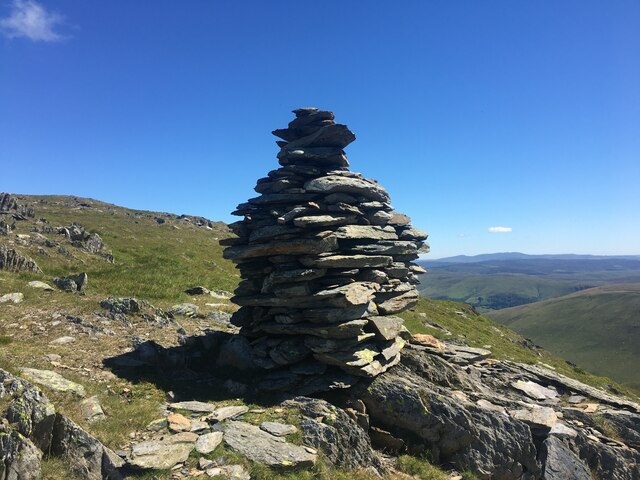
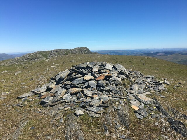
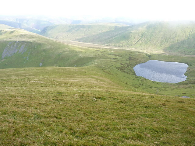
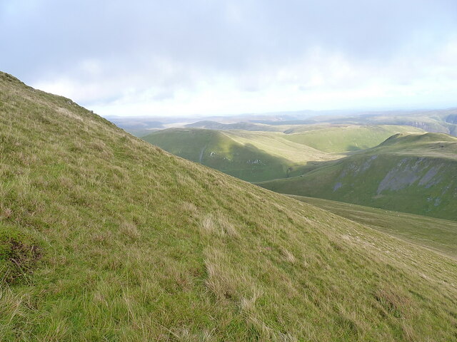
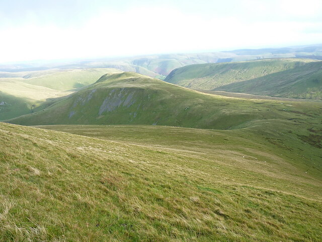
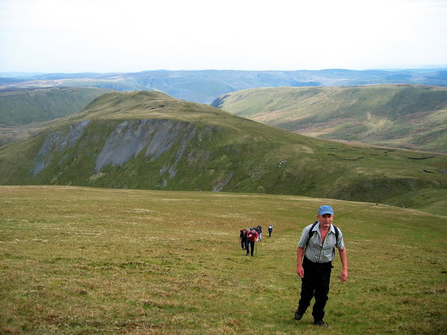
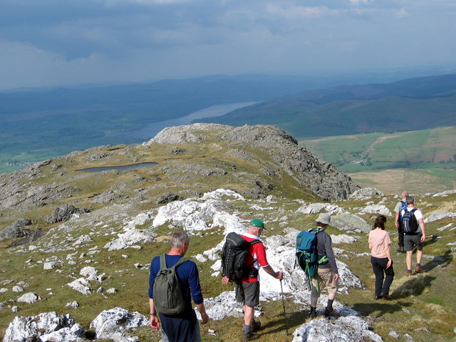
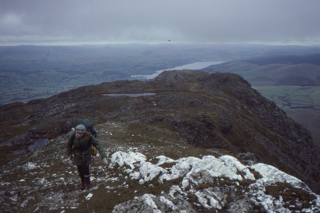
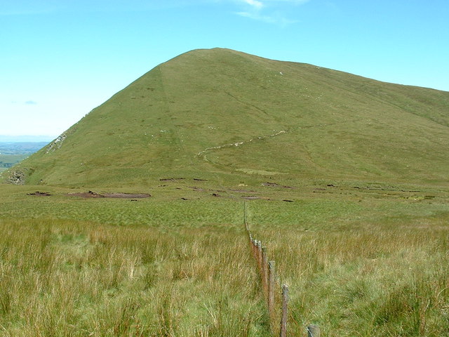
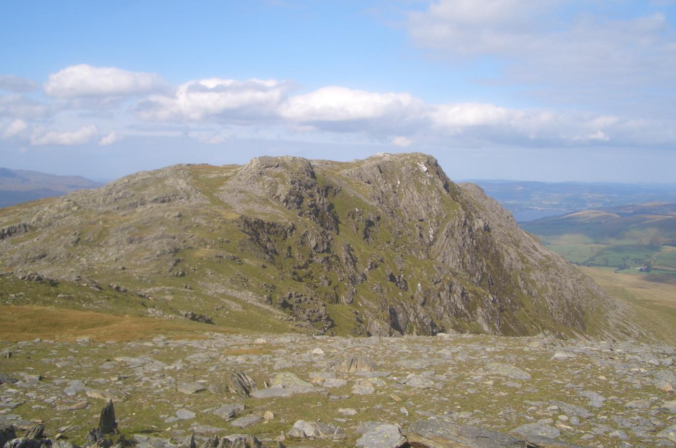
With an elevation of around 1,622 feet (494 meters), Pen-aran offers stunning panoramic views of the surrounding landscape. Its distinctive shape and rugged terrain make it a popular destination for hikers and nature enthusiasts. The hill/mountain is composed of slate and shale, giving it a unique geological character.

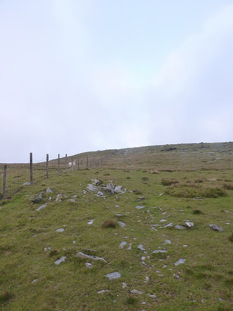
Pen-aran is home to a diverse range of flora and fauna, including heather, bilberry, and a variety of grasses. Bird species such as red kites, ravens, and peregrine falcons can often be spotted soaring overhead. The hill/mountain also supports a healthy population of livestock, with sheep grazing on its slopes.

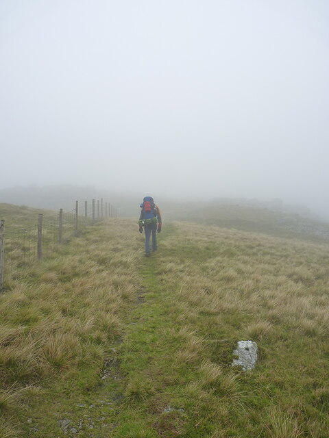
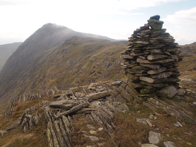
A network of footpaths and trails crisscross the hill/mountain, offering both challenging and more leisurely routes for visitors to explore. The ascent to the summit provides breathtaking views of the surrounding peaks, valleys, and lakes, including the nearby Tal-y-llyn Lake.

The area surrounding Pen-aran is steeped in history and folklore, with ancient ruins and burial sites scattered throughout the landscape. The hill/mountain has been a source of inspiration for artists and writers, including the renowned Welsh poet R. Williams Parry.

Overall, Pen-aran in Merionethshire stands as a majestic natural landmark, offering visitors a chance to connect with the beauty and history of the Snowdonia National Park.

If you have any feedback on the listing, please let us know in the comments section below.

Pen-aran Images

Images are sourced within 2km of 52.80793/-3.6788881 or Grid Reference SH8624. Thanks to Geograph Open Source API. All images are credited.

Cairn on Erw y Ddafad ddu
Moorland rocks below Craig y Geifr
'Clag' A common term used by walkers for light hill mist, the inside of a cloud, a bit of temporary fog etc. Here it's not really a problem, as the way is marked by the fence on the ridge.
'Clag'
A common term used by walkers for light hill mist, the inside of a cloud, a bit of temporary fog etc. Here it's not really a problem, as the way is marked by the fence on the ridge.
Hillside on the way towards Aran Benllyn
Looking down Erw y Ddafad-ddu to Creiglyn Dyfi The lower slopes to the east of Aran Fawddwy, and realistically just about the only way down from the ridge for a mile or two in either direction without encountering some very steep ground indeed. The lake Creiglyn Dyfi is considered to be the headwaters of the Afon Dyfi, reaching the sea at Aberdyfi/Aberdovey.
Looking down Erw y Ddafad-ddu to Creiglyn Dyfi
The lower slopes to the east of Aran Fawddwy, and realistically just about the only way down from the ridge for a mile or two in either direction without encountering some very steep ground indeed. The lake Creiglyn Dyfi is considered to be the headwaters of the Afon Dyfi, reaching the sea at Aberdyfi/Aberdovey.
Grassy slopes on Erw y Ddafad-ddu This photo gives a good idea of the angle of the slope from the Aran ridge down to Creiglyn Dyfi - it's all walkable in either direction, but carrying a big pack it can become a bit of a drag. The view is northeast towards the hills around Cwm-ffynnon.
Grassy slopes on Erw y Ddafad-ddu
This photo gives a good idea of the angle of the slope from the Aran ridge down to Creiglyn Dyfi - it's all walkable in either direction, but carrying a big pack it can become a bit of a drag. The view is northeast towards the hills around Cwm-ffynnon.
Down Erw y Ddafad-ddu towards Foel Hafod-fynydd Pretty much the opposing view to that seen in <a href="https://www.geograph.org.uk/photo/6490135">SH8623 : Erw y Ddafad-ddu as seen from Foel Hafod-fynydd</a>
Down Erw y Ddafad-ddu towards Foel Hafod-fynydd
Pretty much the opposing view to that seen in SH8623 : Erw y Ddafad-ddu as seen from Foel Hafod-fynydd
Cairn On Erw Y Ddafad-ddu
Erw y Ddafad-ddu Cerddwyr yn dringo Erw y Ddafad-ddu. 

Walkers ascending Erw y Ddafad-ddu (trans. black sheep acre).
Erw y Ddafad-ddu
Cerddwyr yn dringo Erw y Ddafad-ddu. Walkers ascending Erw y Ddafad-ddu (trans. black sheep acre).
Aran Benllyn Cerddwyr yn mynd i lawr o gopa Aran Benllyn.

Walkers descending from the summit of Aran Benllyn.
Aran Benllyn
Cerddwyr yn mynd i lawr o gopa Aran Benllyn. Walkers descending from the summit of Aran Benllyn.
On Aran Benllyn White quartz outcrop north of the summit with a view along the ridge past Llyn Pen Aran towards Llyn Tegid.
On Aran Benllyn
White quartz outcrop north of the summit with a view along the ridge past Llyn Pen Aran towards Llyn Tegid.
Rocky foreground and mountain view View from the Aran ridge path near Craig y Geifr.  View to Moel Llyfnant (left) and Arenig Fawr, now looking more distant (than when setting off from Llanuwchllyn) with fair height now gained as well.
Rocky foreground and mountain view
View from the Aran ridge path near Craig y Geifr. View to Moel Llyfnant (left) and Arenig Fawr, now looking more distant (than when setting off from Llanuwchllyn) with fair height now gained as well.
View past Craig y Geifr to Llyn Tegid Fine views open out during the gradual ascent from Llanuwchllyn south towards Aran Benllyn.
View past Craig y Geifr to Llyn Tegid
Fine views open out during the gradual ascent from Llanuwchllyn south towards Aran Benllyn.
Hillside below Aran Benllyn Wide open hillside with an area of forestry in the next square east.  Rhobell Fawr in the background.
Hillside below Aran Benllyn
Wide open hillside with an area of forestry in the next square east. Rhobell Fawr in the background.
Hillside path below Craig y Llyn View north towards Llanuwchllyn and Llyn Tegid.
Hillside path below Craig y Llyn
View north towards Llanuwchllyn and Llyn Tegid.
Approaching the steepest part of the climb to Aran Benllyn Although it looks formidable, it is only steep in relation to the gentle approach, and is not too taxing.
Approaching the steepest part of the climb to Aran Benllyn
Although it looks formidable, it is only steep in relation to the gentle approach, and is not too taxing.
Rock outcrop on north slope of Aran Benllyn A feature just west of the path providing an excellent excuse to stop on the steepest section of the climb.  Snowdon in view right of centre on the skyline.
Rock outcrop on north slope of Aran Benllyn
A feature just west of the path providing an excellent excuse to stop on the steepest section of the climb. Snowdon in view right of centre on the skyline.
Show me another place!

Pen-aran is located at Grid Ref: SH8624 (Lat: 52.80793, Lng: -3.6788881)

Unitary Authority: Gwynedd

Police Authority: North Wales

What 3 Words

///costs.lonely.scoop. Near Llanuwchllyn, Gwynedd

Related Wikis

Esgeiriau Gwynion

Esgeiriau Gwynion (Welsh for "white shanks") is a mountain in north Wales. It is the smallest of the three Marilyns that form the Aran range, the others...

Aran Benllyn

Aran Benllyn is a subsidiary summit of Aran Fawddwy in southern Snowdonia, North Wales, Wales, United Kingdom. It is the second highest peak in the Aran...

Gwaun y Llwyni

Gwaun y Llwyni is a subsidiary summit of Aran Fawddwy in southern Snowdonia, Wales. It forms a part of the Aran mountain range. The peak's southern face...

Foel Hafod-fynydd

Foel Hafod-fynydd is a subsidiary summit of Aran Fawddwy in southern Snowdonia, North Wales, Wales, United Kingdom. It tops the east ridge of Erw y Ddafad...

Nearby Amenities

Located within 500m of 52.80793,-3.6788881
Aran Benllyn
Ele: 884
Natural: peak
Source Ele: npe
Source Name: Wikipedia
Wikidata: Q4784047
Wikipedia: en:Aran Benllyn
Lat/Long: 52.8044652/-3.6818188
Creigiau Llwydion
Place: locality
Lat/Long: 52.8093451/-3.6823382
Barrier: stile
Lat/Long: 52.8097601/-3.6786766
Barrier: stile
Lat/Long: 52.8078181/-3.6794142
Barrier: stile
Lat/Long: 52.8064041/-3.6810133
Man Made: cairn
Lat/Long: 52.8080218/-3.6788622
Man Made: cairn
Lat/Long: 52.8116183/-3.677499
The data included in this document is from www.openstreetmap.org. The data is made available under ODbL.

Have you been to Pen-aran?

Leave your review of Pen-aran below (or comments, questions and feedback).