Carn an t-Sean-Liathanaich

Hill, Mountain in Nairnshire

Scotland

Carn an t-Sean-Liathanaich

Peat Haggs on Carn an t-Sean-liathanaich
Peat Haggs on Carn an t-Sean-liathanaich Credit: Sarah McGuire

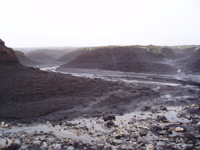
Carn an t-Sean-Liathanaich is a prominent hill located in Nairnshire, Scotland. It is situated in the eastern part of the country, close to the town of Nairn. The hill has an elevation of approximately 503 meters (1,650 feet) above sea level, making it a popular destination for hikers and outdoor enthusiasts.

Carn an t-Sean-Liathanaich is known for its stunning panoramic views of the surrounding countryside. On a clear day, visitors can enjoy breathtaking vistas of the Moray Firth, the Black Isle, and the Cairngorms National Park. The hill is also surrounded by diverse flora and fauna, including heather, gorse, and various bird species.

The ascent to the summit of Carn an t-Sean-Liathanaich is moderately challenging, with a well-defined path leading to the top. The climb typically takes around two to three hours, depending on the fitness level of the hiker. Along the way, there are several viewpoints that offer opportunities to rest and admire the scenery.

At the summit, hikers are rewarded with a cairn, a man-made pile of stones, which serves as a marker and a point of interest. This spot is an ideal location for a picnic or simply to take in the surrounding beauty.

Overall, Carn an t-Sean-Liathanaich is a captivating hill in Nairnshire, offering a picturesque and invigorating outdoor experience for those seeking to explore the natural wonders of Scotland.

If you have any feedback on the listing, please let us know in the comments section below.

Carn an t-Sean-Liathanaich Images

Images are sourced within 2km of 57.365198/-3.8816994 or Grid Reference NH8632. Thanks to Geograph Open Source API. All images are credited.

Peat Haggs on Carn an t-Sean-liathanaich
Shooting Butt on Carn an t-Sean-liathanaich After spending 1 hour crossing this plateau decided to go back. Will try another day.
Shooting Butt on Carn an t-Sean-liathanaich
After spending 1 hour crossing this plateau decided to go back. Will try another day.
Track above Allt an Tairbhidh
Crossing Allt an Tairbhidh
Plantation fence going down to Allt an Tairbhidh
Track leaving Plantation near Airial
Peat haggs going up to Carn an t-Sean-liathanaich after leaving track
Entering cloud on approach to Carn an t-Sean-liathanaich Plateau
New Bulldozed track coming up from Balvraid Lodge meets Allt an Tairbhidh
Juniper Allt an Tairbhidh going into Forestry plantation through Juniper bushes
Watershed for Allt Loisgte
Above watershed for Allt Loisgte
Looking NW from Sgoran Liath
Looking NE from Leac an Daimh across Allt an  Daimh
Looking NE from Leac an Daimh across Allt an Daimh
Moorland SE of Tom nan Clach Cawdor Estate grouse moors.  This is just outside the boundary of Tom nan Clach windfarm which has recently been given planning permission by the Scottish Government after being refused by Highland Council:  <span class="nowrap"><a title="http://www.tomnanclachwindfarm.co.uk/" rel="nofollow ugc noopener" href="http://www.tomnanclachwindfarm.co.uk/">Link</a><img style="margin-left:2px;" alt="External link" title="External link - shift click to open in new window" src="https://s1.geograph.org.uk/img/external.png" width="10" height="10"/></span>
Moorland SE of Tom nan Clach
Cawdor Estate grouse moors. This is just outside the boundary of Tom nan Clach windfarm which has recently been given planning permission by the Scottish Government after being refused by Highland Council: LinkExternal link
Moorland on Cawdor Estate Cawdor Estate grouse moors.  This is just outside the boundary of Tom Nan Clach windfarm which has recently been given planning permission by the Scottish Government after being refused by Highland Council:  <span class="nowrap"><a title="http://www.tomnanclachwindfarm.co.uk/" rel="nofollow ugc noopener" href="http://www.tomnanclachwindfarm.co.uk/">Link</a><img style="margin-left:2px;" alt="External link" title="External link - shift click to open in new window" src="https://s1.geograph.org.uk/img/external.png" width="10" height="10"/></span>
Moorland on Cawdor Estate
Cawdor Estate grouse moors. This is just outside the boundary of Tom Nan Clach windfarm which has recently been given planning permission by the Scottish Government after being refused by Highland Council: LinkExternal link
Frozen Bogs on Carn Leathan The frozen ground made walking across here much easier than usual.
Frozen Bogs on Carn Leathan
The frozen ground made walking across here much easier than usual.
Boggy Moorland with Lichen On The north end of Carn Leathan looking towards Carn an t-Sean-liathanaich.
Boggy Moorland with Lichen
On The north end of Carn Leathan looking towards Carn an t-Sean-liathanaich.
Show me another place!

Carn an t-Sean-Liathanaich is located at Grid Ref: NH8632 (Lat: 57.365198, Lng: -3.8816994)

Unitary Authority: Highland

Police Authority: Highlands and Islands

What 3 Words

///issue.army.momentous. Near Grantown-on-Spey, Highland

Nearby Locations

Carn an t-Sean-Liathanaich

Related Wikis

Carn Glas-choire

Càrn Glas is a mountain with the Ardgoil Peninsula and the Arrochar Alps near Lochgoilhead. It reaches a height of over 502 metres (1,647 ft).

Balvraid

Balvraid (Scottish Gaelic: Baile a' Bhràghaid) is a small remote settlement, located 8 miles south east of Inverness in Inverness-shire, Scottish Highlands...

Inverness, Nairn, Badenoch and Strathspey (UK Parliament constituency)

Inverness, Nairn, Badenoch and Strathspey is a constituency of the House of Commons of the UK Parliament. As with all seats since 1950 it elects one Member...

Diocese of Moray

The Diocese of Moray was one of the most important of the medieval dioceses of the Roman Catholic Church in Scotland. Its territory was in central northern...

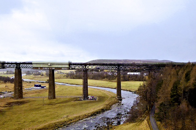
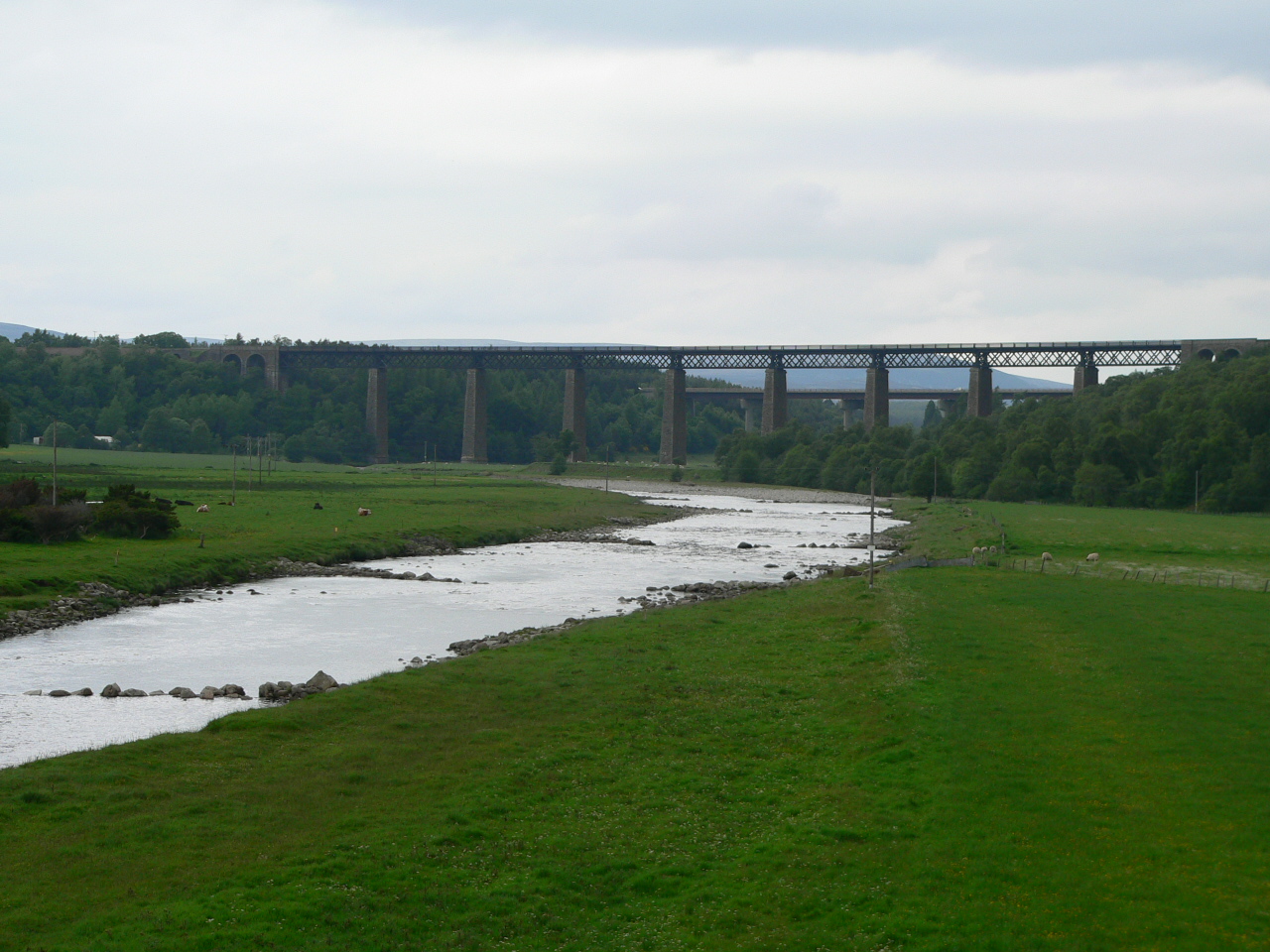
Findhorn Viaduct (Tomatin)

The Findhorn Viaduct is a railway bridge approximately 500 metres (550 yd) east of the village of Tomatin in the Scottish Highlands, which carries the...
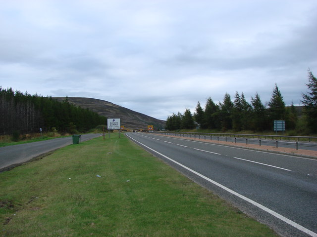
Slochd Summit

The Slochd Summit (; Scottish Gaelic: An Sloc) is a mountain pass on the A9 road and the Highland Main Line Railway in the Scottish Highlands between Inverness...
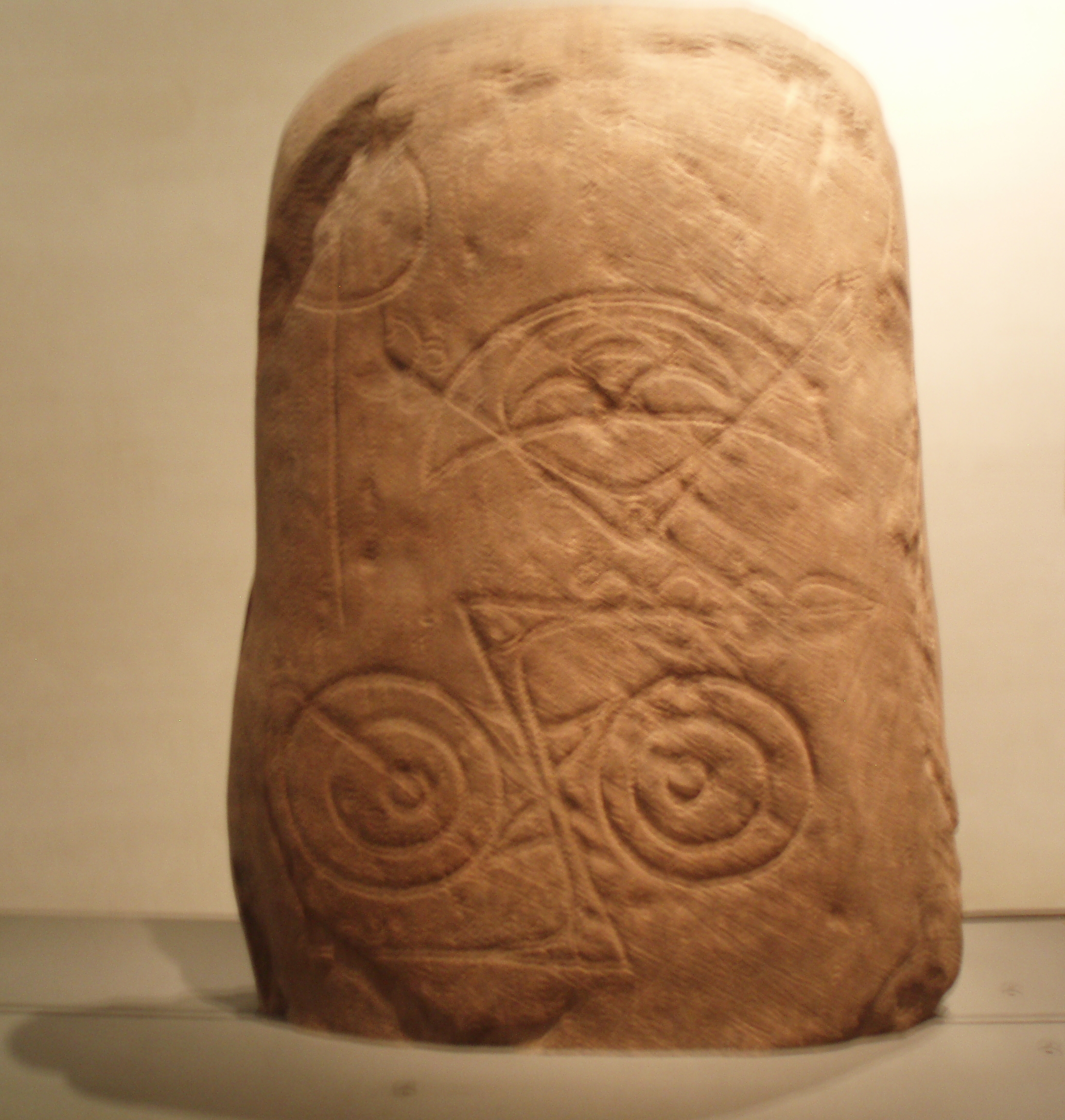
Invereen Stone

The Invereen Stone is a Class I incised Pictish stone that was unearthed near Invereen, Inverness in 1932. It is now on display at the National Museums...

Tomatin

Tomatin (Scottish Gaelic: Tom Aitinn) is a small village on the River Findhorn in Strathdearn in the Scottish Highlands, about 16 miles (26 km) southeast...

Have you been to Carn an t-Sean-Liathanaich?

Leave your review of Carn an t-Sean-Liathanaich below (or comments, questions and feedback).