Barscraigh Hill
Hill, Mountain in Kirkcudbrightshire
Scotland
Barscraigh Hill

Barscraigh Hill is a prominent natural landmark located in Kirkcudbrightshire, a historic county in southwest Scotland. Rising to an elevation of 252 meters (827 feet), it is categorized as a hill rather than a mountain. The hill is situated within the Dumfries and Galloway region, near the village of Borgue.
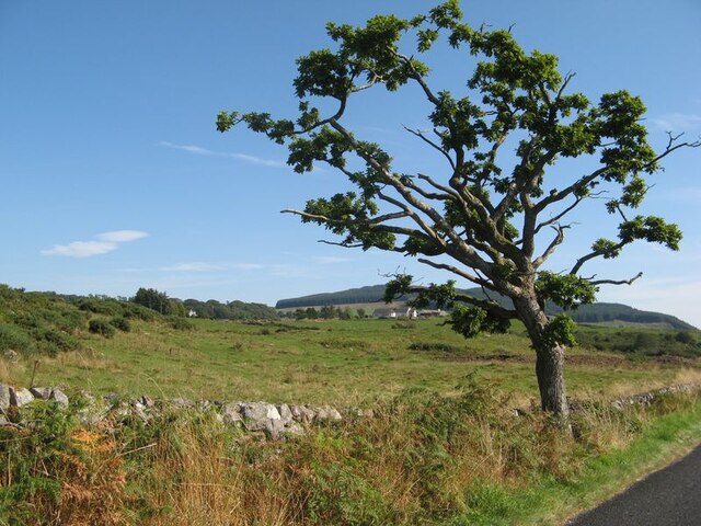
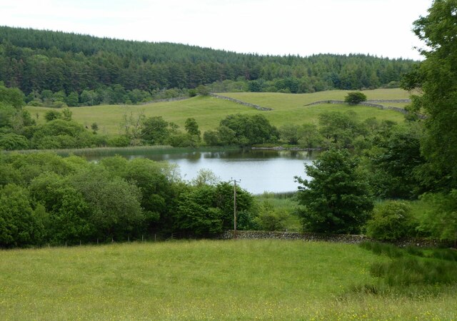
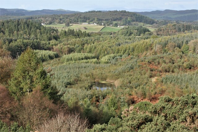
Barscraigh Hill offers breathtaking panoramic views of the surrounding countryside. From its summit, visitors can enjoy sweeping vistas of rolling green hills, picturesque farmland, and the nearby Solway Firth coastline. The hill is renowned for its natural beauty and is a popular destination for hikers, walkers, and nature enthusiasts.
The terrain of Barscraigh Hill is predominantly composed of heather-clad moorland, with scattered patches of woodland and rocky outcrops adding to its rugged charm. The hill is home to a diverse range of flora and fauna, including various species of birds, small mammals, and wildflowers. This rich biodiversity makes it an ideal location for nature observation and photography.
Access to Barscraigh Hill is relatively easy, with a well-maintained footpath leading to the summit. The hill is also part of an extensive network of trails, allowing visitors to explore the surrounding countryside further. Additionally, there are information boards at key points, providing details about the local wildlife and historical significance of the area.
Barscraigh Hill is not only a natural gem but also holds cultural and historical importance. Its strategic location has made it a site of interest throughout the centuries, with traces of ancient settlements and fortifications found nearby. The hill stands as a testament to the rich heritage of Kirkcudbrightshire and continues to captivate visitors with its natural allure.
If you have any feedback on the listing, please let us know in the comments section below.
Barscraigh Hill Images
Images are sourced within 2km of 54.894409/-3.7673382 or Grid Reference NX8656. Thanks to Geograph Open Source API. All images are credited.


![Drumstinchall House Category B listed house [<span class="nowrap"><a title="http://portal.historicenvironment.scot/designation/LB3713" rel="nofollow ugc noopener" href="http://portal.historicenvironment.scot/designation/LB3713">Link</a><img style="margin-left:2px;" alt="External link" title="External link - shift click to open in new window" src="https://s1.geograph.org.uk/img/external.png" width="10" height="10"/></span>], dating from 1832.](https://s0.geograph.org.uk/geophotos/05/78/11/5781120_81f550eb.jpg)

Barscraigh Hill is located at Grid Ref: NX8656 (Lat: 54.894409, Lng: -3.7673382)
Unitary Authority: Dumfries and Galloway
Police Authority: Dumfries and Galloway
What 3 Words
///founding.prongs.apprehend. Near Dalbeattie, Dumfries & Galloway
Nearby Locations
Related Wikis

Colvend and Southwick
Colvend and Southwick is a community council area and civil parish within the Stewartry area of Dumfries and Galloway, Scotland. It is also part of the...

Rockcliffe, Dumfries and Galloway
Rockcliffe is a small, coastal village in Kirkcudbrightshire, Dumfries and Galloway in Scotland, with a view of Rough Island, Hestan Island, the Solway...

Kippford
Kippford (/ˈkɪpfəd/; otherwise Scaur) is a small village along the Solway coast, in the historic county of Kirkcudbrightshire in Dumfries and Galloway...
Rough Firth
Rough Firth is an inlet on the northern coast of the Solway Firth in the Stewartry area of Dumfries and Galloway, Scotland. The firth lies between Almorness...

Rough Island, Scotland
"Rough Island" is also used as a translation of "Garbh Eilean", a common Scottish name for islandsRough Island is a 20-acre (8 ha) uninhabited tidal island...

Palnackie
Palnackie is a village in the parish of Buittle in the historical county of Kirkcudbrightshire in Dumfries and Galloway, Scotland. It has a population...

Dalbeattie
Dalbeattie (, Scots: Dawbeattie, Scottish Gaelic: Dail Bheithe meaning 'haugh of the birch' or Dail bhàite 'drowned (i.e. liable to flood) haugh') is a...

Dalbeattie Star F.C.
Dalbeattie Star Football Club is a Scottish association football club based in Dalbeattie, Dumfries and Galloway. It currently competes in the South of...
Nearby Amenities
Located within 500m of 54.894409,-3.7673382Have you been to Barscraigh Hill?
Leave your review of Barscraigh Hill below (or comments, questions and feedback).