Bettyknowes Hill
Hill, Mountain in Kirkcudbrightshire
Scotland
Bettyknowes Hill

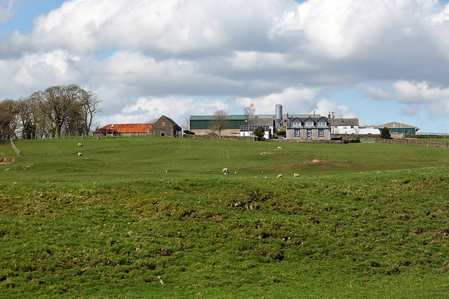
Bettyknowes Hill is a prominent geographic feature located in Kirkcudbrightshire, Scotland. With an elevation of approximately 227 meters (745 feet), it is classified as a hill rather than a mountain. The hill is situated within the picturesque rural landscape of Dumfries and Galloway, near the village of Gatehouse of Fleet.
Bettyknowes Hill offers breathtaking panoramic views of the surrounding countryside, including the rolling hills, farmland, and nearby forests. On a clear day, visitors can even catch glimpses of the Solway Firth and the distant hills of the Lake District in England.
The hill is accessible to both hikers and nature enthusiasts, with various trails and footpaths leading to its summit. The routes are well-maintained and provide opportunities for individuals of all fitness levels to enjoy the outdoors. Along the way, walkers can appreciate the diverse flora and fauna that call Bettyknowes Hill home, including heather, gorse, and various bird species.
At the summit, visitors are rewarded with breathtaking panoramic views that make the ascent worthwhile. The hill's location also lends itself to stunning sunsets, offering a picturesque spot for photographers and nature lovers alike.
Bettyknowes Hill is not only a natural landmark but also holds historical significance. It is said to have been a site of ancient settlements, with remnants of prehistoric structures and artifacts discovered in the surrounding area. This adds an extra layer of fascination and intrigue for those exploring the hill's natural beauty.
If you have any feedback on the listing, please let us know in the comments section below.
Bettyknowes Hill Images
Images are sourced within 2km of 55.044175/-3.7818019 or Grid Reference NX8673. Thanks to Geograph Open Source API. All images are credited.


Bettyknowes Hill is located at Grid Ref: NX8673 (Lat: 55.044175, Lng: -3.7818019)
Unitary Authority: Dumfries and Galloway
Police Authority: Dumfries and Galloway
What 3 Words
///shameless.paces.positives. Near Dumfries, Dumfries & Galloway
Nearby Locations
Related Wikis
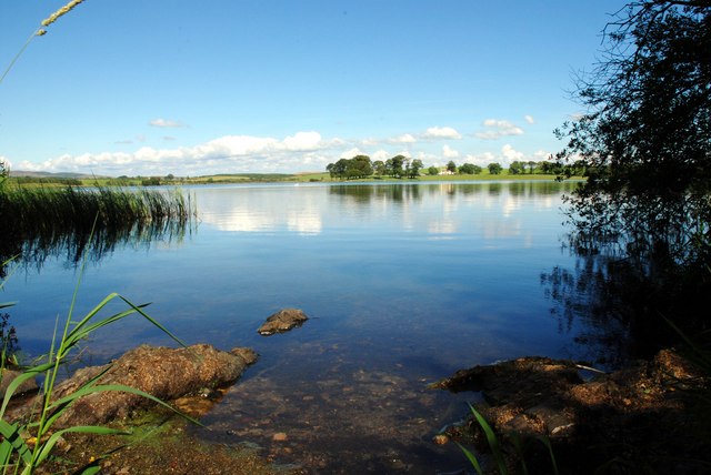
Milton Loch
Milton Loch is an alkaline freshwater loch located in Dumfries and Galloway, Scotland. In the loch and nearby are archaeological sites including three...

Crocketford
Crocketford (/ˈkrɒkɪtfɔːd/, also frequently /ˈkrɒkɪtfəd/) also known as Ninemile Bar (Scottish Gaelic: Ath Crogaid), as it is approximately equidistant...

Lochrutton Loch
Lochrutton Loch is a large, lowland freshwater loch that lies to the west of Dumfries, Scotland. The loch trends from north to south and is 0.75 mi (1...
Killywhan railway station
Killywhan railway station served the hamlet of Killywhan, Dumfries and Galloway, Scotland from 1859 to 1959 on the Castle Douglas and Dumfries Railway...

Glenkiln Sculpture Park
Glenkiln Sculpture Park was a sculpture landscape in the historic county of Kirkcudbrightshire in Dumfries and Galloway, south-west Scotland. After one...
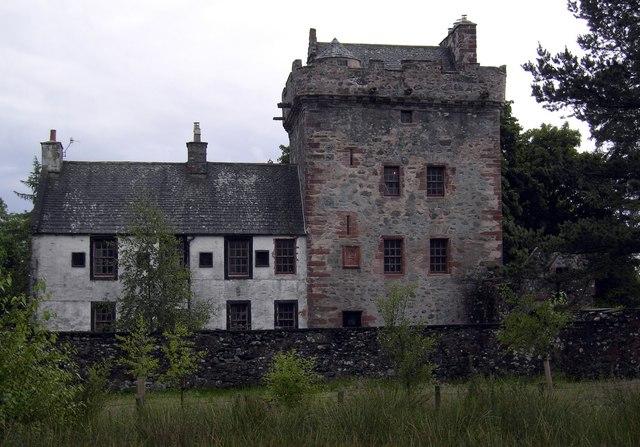
Hills Tower
Hills Tower is a sixteenth-century square tower house, with an adjoining eighteenth-century wing, near Dumfries in Scotland. Originally built around 1527...

Beeswing, Dumfries and Galloway
Beeswing is a small village in the historical county of Kirkcudbrightshire in Scotland. == Etymology == Before Beeswing became known as Beeswing, it was...

Lochanhead railway station
Lochanhead railway station served the settlement of Lochanhead, Dumfries and Galloway, Scotland from 1859 to 1965 on the Castle Douglas and Dumfries Railway...
Nearby Amenities
Located within 500m of 55.044175,-3.7818019Have you been to Bettyknowes Hill?
Leave your review of Bettyknowes Hill below (or comments, questions and feedback).