An Eilrig

Hill, Mountain in Inverness-shire

Scotland

An Eilrig

Upper Glen Feshie Small lochan in Upper Glen Feshie with remnant Caledonian Forest tree stumps. The hills beyond are Carn an Fhidhleir Lorgaidh (left with long snow covered shoulder) & Sron na Ban-righ (right, lower, & with more brown heather visible but snowy top). The central hill between them is the Glen Feshie munro Mullach a Clach Bhlair.
Upper Glen Feshie Credit: johnalbiston

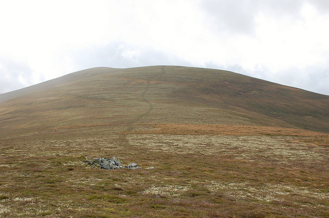
An Eilrig is a prominent hill located in Inverness-shire, Scotland. Standing at an elevation of approximately 900 meters (2,953 feet), it is considered a challenging yet rewarding mountain to climb. It is part of the Grampian Mountains range, which is renowned for its scenic beauty and rugged terrain.

The ascent of An Eilrig begins from the village of Aviemore, where a well-marked trail leads climbers through a picturesque landscape of heather moorlands and dense forests. As the path gradually steepens, hikers are treated to breathtaking views of the surrounding Cairngorms National Park, which is home to a rich variety of flora and fauna.

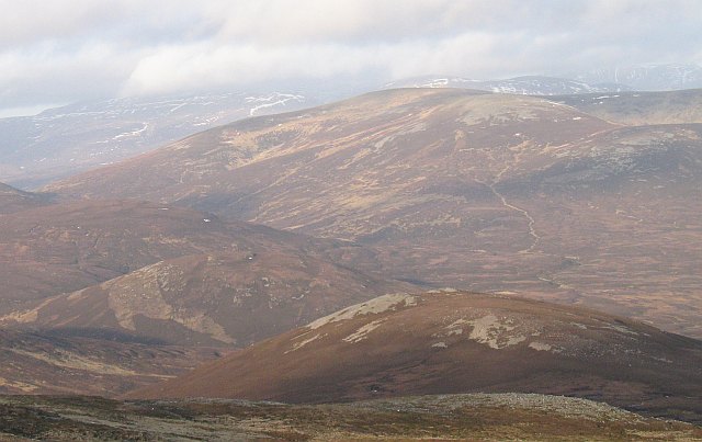
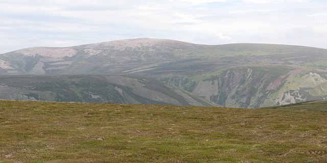
Reaching the summit of An Eilrig requires some mountaineering skills, as the final section of the climb becomes steeper and more challenging. However, the effort is well worth it, as those who conquer the peak are rewarded with panoramic vistas of the Cairngorms, the Spey Valley, and the shimmering waters of the nearby Loch Morlich.

An Eilrig is a popular destination for outdoor enthusiasts, attracting both experienced mountaineers and casual hikers. It offers opportunities for various outdoor activities, including hillwalking, rock climbing, and birdwatching. The hill's diverse ecosystem supports a wide range of wildlife, including red deer, golden eagles, and ptarmigans, making it a haven for nature lovers.

Overall, An Eilrig stands as a majestic and challenging mountain in Inverness-shire, offering a thrilling adventure and a chance to immerse oneself in the stunning natural beauty of the Scottish Highlands.

If you have any feedback on the listing, please let us know in the comments section below.

An Eilrig Images

Images are sourced within 2km of 56.951074/-3.8748855 or Grid Reference NN8685. Thanks to Geograph Open Source API. All images are credited.

Upper Glen Feshie Small lochan in Upper Glen Feshie with remnant Caledonian Forest tree stumps. The hills beyond are Carn an Fhidhleir Lorgaidh (left with long snow covered shoulder) & Sron na Ban-righ (right, lower, & with more brown heather visible but snowy top). The central hill between them is the Glen Feshie munro Mullach a Clach Bhlair.
Upper Glen Feshie
Small lochan in Upper Glen Feshie with remnant Caledonian Forest tree stumps. The hills beyond are Carn an Fhidhleir Lorgaidh (left with long snow covered shoulder) & Sron na Ban-righ (right, lower, & with more brown heather visible but snowy top). The central hill between them is the Glen Feshie munro Mullach a Clach Bhlair.
Carn Fhidhleir catches the sun from the headwaters of the Feshie Looking back to Meall Tionaill & Cnap a'Choire Chreagaich the western outliers of Carn Fhidhleir. This is gloriously wild & remote & empty country.
Carn Fhidhleir catches the sun from the headwaters of the Feshie
Looking back to Meall Tionaill & Cnap a'Choire Chreagaich the western outliers of Carn Fhidhleir. This is gloriously wild & remote & empty country.
The 'hut' near the head of Allt Lorgaidh south of Glen Feshie by Aviemore Not a place to spend a winter's evening then!
The 'hut' near the head of Allt Lorgaidh south of Glen Feshie by Aviemore
Not a place to spend a winter's evening then!
Rock outcrop on Carn an Fhidleir Lorgaidh's south ridge near Glen Feshie by Aviemore
Summit cairn on Carn an Fhidleir Lorgaidh near Glen Feshie by Aviemore
Meall Tionail Lorgaidh above Glen Feshie, Aviemore
Looking back down Slochd Beag path from near its final destination
The source of Allt Lorgaidh near Glen Feshie, Aviemore
Re-entrant above Slochd Beag path's final few metres near Glen Feshie, Aviemore
Gully of minor feeder of Allt Lorgaidh above Glen Feshie, Aviemore
Slochd Beag path near its final destination above Glen Feshie, Aviemore
Allt Lorgaidh near its source above Glen Feshie, Aviemore
Tiny waterfall near the head of Allt Lorgaidh above Glen Feshie, Aviemore
Slopes behind ruined hut near the head of Allt Lorgaidh above Glen Feshie, Aviemore
Looking east from path end above Glen Feshie, Aviemore
Boggy ground at the head of Allt Lorgaidh above Glen Feshie, Aviemore
Peaty pool at the head of Allt Lorgaidh above Glen Feshie, Aviemore
Peaty pool in headwaters of River Feshie near Aviemore
Show me another place!

An Eilrig is located at Grid Ref: NN8685 (Lat: 56.951074, Lng: -3.8748855)

Unitary Authority: Highland

Police Authority: Highlands and Islands

What 3 Words

///growth.crystals.brief. Near Kingussie, Highland

Nearby Locations

An Eilrig

Related Wikis

Battle of Craig Cailloch

The Battle of Craig Cailloch was a Scottish clan battle fought in 1441 between the Clan Cameron and Clan Mackintosh (who were part of the Chattan Confederation...

Carn an Fhidhleir

Carn an Fhidhleir (994 m) is a mountain in the Grampian Mountains of Scotland. It lies on the border of Inverness-shire, Perthshire and Aberdeenshire,...

Càrn Dearg Mòr

Carn Dearg Mor (857 m) is a mountain in the Grampian Mountains of Scotland. It lies in the Badenoch and Strathspey area of Inverness-shire, east of the...

Mullach Clach a' Bhlàir

Mullach Clach a' Bhlàir or Meall Tional is a Munro in the Cairngorm mountain range of Scotland. == Sources ==

An Sgarsoch

An Sgarsoch (1,006.5m) is a mountain in the Grampian Mountains of Scotland. It lies north of Blair Atholl in a very remote part of the Highlands, on the...

Beinn Dearg (Blair Atholl)

Beinn Dearg (1,009 m) is a mountain in the Grampian Mountains of Scotland. It lies north of the Perth and Kinross village of Blair Atholl, in the Forest...

Grampian Mountains

The Grampian Mountains (Scottish Gaelic: Am Monadh) is one of the three major mountain ranges in Scotland, that together occupy about half of Scotland...

Kingdom of Scotland

The Kingdom of Scotland (Scottish Gaelic: Rìoghachd na h-Alba; Scots: Kinrick o Scotland, Norn: Kongungdum Skotland) was a sovereign state in northwest...

Have you been to An Eilrig?

Leave your review of An Eilrig below (or comments, questions and feedback).