Barclosh Hill

Hill, Mountain in Kirkcudbrightshire

Scotland

Barclosh Hill

B793 near Dalbeattie
B793 near Dalbeattie Credit: Steven Brown

Barclosh Hill is a prominent natural landmark located in the historical county of Kirkcudbrightshire in southwest Scotland. Rising to an elevation of approximately 402 meters (1,319 feet), it is classified as a hill rather than a mountain. The hill is positioned in the Galloway Forest Park, which is renowned for its stunning landscapes and diverse wildlife.

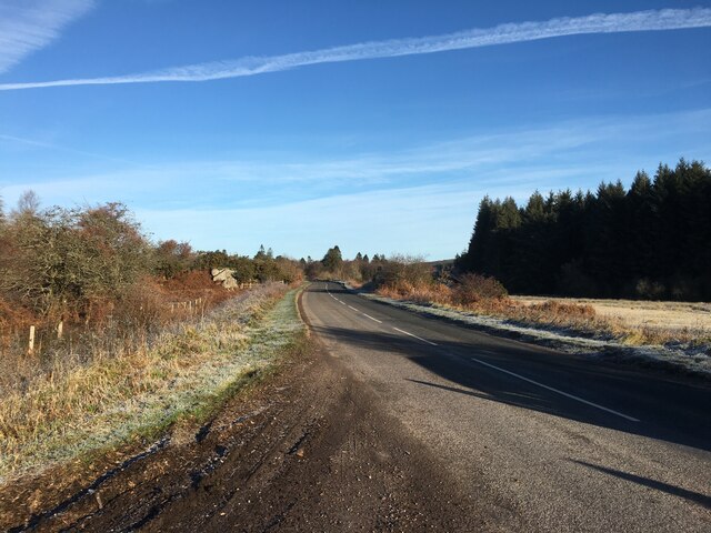
Barclosh Hill is characterized by its distinctive rounded shape and gentle slopes, making it a popular destination for hikers and outdoor enthusiasts. The hill offers panoramic views of the surrounding countryside, including the picturesque Galloway Hills and the rolling farmland that stretches towards the Solway Firth.

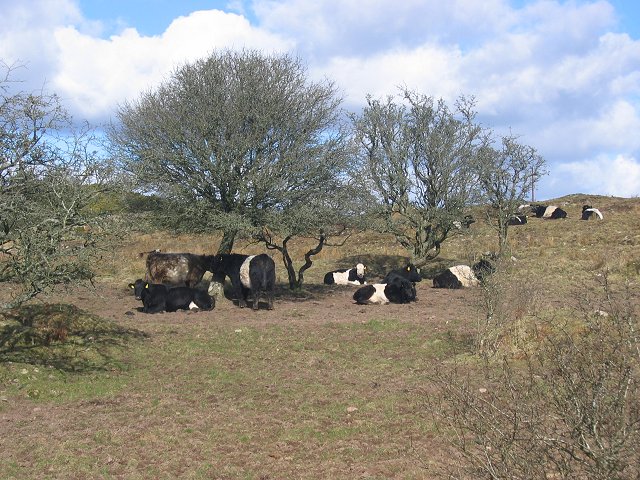
The vegetation on Barclosh Hill is dominated by heather, with patches of grass and scattered birch and rowan trees. This diverse ecosystem provides habitat for a variety of wildlife, including red deer, mountain hares, and various bird species such as red grouse and peregrine falcons.

The hill is easily accessible from the nearby town of Kirkcudbright, with several walking trails leading to its summit. These trails cater to different skill levels, allowing both experienced hikers and beginners to enjoy the scenic beauty of Barclosh Hill. Additionally, there are designated parking areas and information boards to help visitors navigate the area.

Overall, Barclosh Hill offers a tranquil escape into nature, with its breathtaking views, diverse flora and fauna, and an opportunity to engage in outdoor activities amidst the serene surroundings of Kirkcudbrightshire.

If you have any feedback on the listing, please let us know in the comments section below.

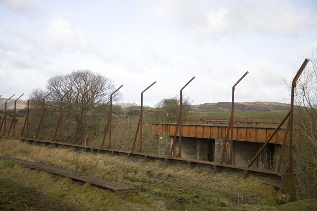
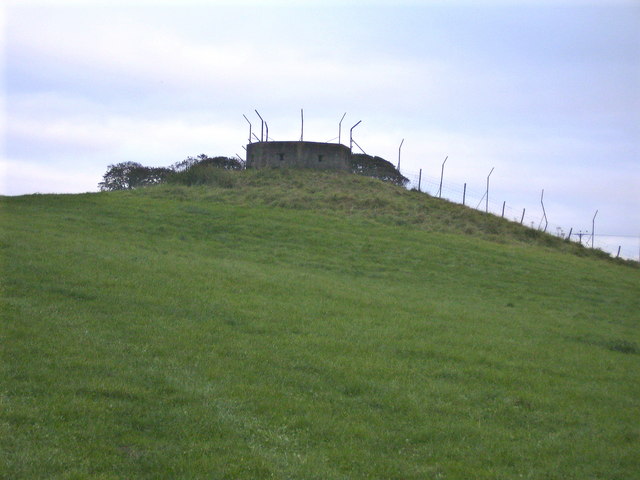
Barclosh Hill Images

Images are sourced within 2km of 54.946267/-3.784025 or Grid Reference NX8562. Thanks to Geograph Open Source API. All images are credited.

B793 near Dalbeattie
Aucheninnes Moss. Another corner of the moss used as a landfill. View SE from the square's corner.
Aucheninnes Moss.
Another corner of the moss used as a landfill. View SE from the square's corner.
Sawmill, Barclosh. Big sawmill, ideally placed to deal with big forests.
Sawmill, Barclosh.
Big sawmill, ideally placed to deal with big forests.
Sawmill, Barclosh. Big sawmill, as you might expect to find with all the commercial forestry in Galloway.
Sawmill, Barclosh.
Big sawmill, as you might expect to find with all the commercial forestry in Galloway.
Nether Hill Granite revealed by felling a Forestry Commission plantation.
Nether Hill
Granite revealed by felling a Forestry Commission plantation.
Belties Local breed on Barclosh Hill.
Belties
Local breed on Barclosh Hill.
Barclosh Hill Some of this rough hill has avoided the munching belties and is covered in hazel wood.
Barclosh Hill
Some of this rough hill has avoided the munching belties and is covered in hazel wood.
Loch Fern View east over a small reservoir towards Long Fern, one of the incredibly rough Solway granite hills.
Loch Fern
View east over a small reservoir towards Long Fern, one of the incredibly rough Solway granite hills.
Isles Farmland near Isles  with Clawbelly Hill in the distance.
Isles
Farmland near Isles with Clawbelly Hill in the distance.
Falgunzeon. Farm amongst the sour soils of the Solway granite. NE view.
Falgunzeon.
Farm amongst the sour soils of the Solway granite. NE view.
Woodland, Clawbelly Hill. A pocket of deciduous woodland in the pine forest on Clawbelly. Sadly it's another noxious introduced weed, sycamore.
Woodland, Clawbelly Hill.
A pocket of deciduous woodland in the pine forest on Clawbelly. Sadly it's another noxious introduced weed, sycamore.
Forest edge, Isles. Taken from just inside the eastern line, the granite dyke marks the edge of the forest. View west,
Forest edge, Isles.
Taken from just inside the eastern line, the granite dyke marks the edge of the forest. View west,
Culdrain View NW across wet farmland
Culdrain
View NW across wet farmland
Edingham Moss WWII cordite works One of several disused cordite drying buildings on the extensive World War II depot site north west of Dalbeatie. Opened in 1939 it finally closed in 1960. The site is dangerous and must not be visited without the owners permission. More information here <span class="nowrap"><a title="http://www.dalbeattie.com/ministryofsupplyfactorydalbeattie/index.html" rel="nofollow ugc noopener" href="http://www.dalbeattie.com/ministryofsupplyfactorydalbeattie/index.html">Link</a><img style="margin-left:2px;" alt="External link" title="External link - shift click to open in new window" src="https://s1.geograph.org.uk/img/external.png" width="10" height="10"/></span>
Edingham Moss WWII cordite works
One of several disused cordite drying buildings on the extensive World War II depot site north west of Dalbeatie. Opened in 1939 it finally closed in 1960. The site is dangerous and must not be visited without the owners permission. More information here LinkExternal link
Edingham Moss WWII cordite works Railway loading bays, part of extensive World War II depot site north west of Dalbeattie. Opened in 1939 it finally closed in 1960. This site is dangerous and must not be visited without the owners permission. More information here <span class="nowrap"><a title="http://www.dalbeattie.com/ministryofsupplyfactorydalbeattie/index.html" rel="nofollow ugc noopener" href="http://www.dalbeattie.com/ministryofsupplyfactorydalbeattie/index.html">Link</a><img style="margin-left:2px;" alt="External link" title="External link - shift click to open in new window" src="https://s1.geograph.org.uk/img/external.png" width="10" height="10"/></span>
Edingham Moss WWII cordite works
Railway loading bays, part of extensive World War II depot site north west of Dalbeattie. Opened in 1939 it finally closed in 1960. This site is dangerous and must not be visited without the owners permission. More information here LinkExternal link
Edingham Moss WWII cordite works Looking from the trackbed of the disused "Port Road" Dumfries to Stranraer railway line across to a railway bridge inside the extensive World War II depot site. Opened in 1939 it finally closed in 1960. This site is dangerous and must not be visited without the owners permission. More information here <span class="nowrap"><a title="http://www.dalbeattie.com/ministryofsupplyfactorydalbeattie/index.html" rel="nofollow ugc noopener" href="http://www.dalbeattie.com/ministryofsupplyfactorydalbeattie/index.html">Link</a><img style="margin-left:2px;" alt="External link" title="External link - shift click to open in new window" src="https://s1.geograph.org.uk/img/external.png" width="10" height="10"/></span>
Edingham Moss WWII cordite works
Looking from the trackbed of the disused "Port Road" Dumfries to Stranraer railway line across to a railway bridge inside the extensive World War II depot site. Opened in 1939 it finally closed in 1960. This site is dangerous and must not be visited without the owners permission. More information here LinkExternal link
Pillbox - built to protect the WWII cordite factory here <span class="nowrap"><a title="http://www.dalbeattie.com/ministryofsupplyfactorydalbeattie/index.html" rel="nofollow ugc noopener" href="http://www.dalbeattie.com/ministryofsupplyfactorydalbeattie/index.html">Link</a><img style="margin-left:2px;" alt="External link" title="External link - shift click to open in new window" src="https://s1.geograph.org.uk/img/external.png" width="10" height="10"/></span>
Pillbox - built to protect the WWII cordite factory here
Edingham Industrial Estate Engineering company E-Teq's factory on Edingham Industrial Estate.
Edingham Industrial Estate
Engineering company E-Teq's factory on Edingham Industrial Estate.
Show me another place!

Barclosh Hill is located at Grid Ref: NX8562 (Lat: 54.946267, Lng: -3.784025)

Unitary Authority: Dumfries and Galloway

Police Authority: Dumfries and Galloway

What 3 Words

///armrests.factoring.roughest. Near Dalbeattie, Dumfries & Galloway

Related Wikis

Southwick railway station (Scotland)

Southwick (Dumfries & Galloway) railway station served the civil parish of Colvend and Southwick, Dumfries and Galloway, Scotland from 1859 to 1965 on...

Dalbeattie Star F.C.

Dalbeattie Star Football Club is a Scottish association football club based in Dalbeattie, Dumfries and Galloway. It currently competes in the South of...

Dalbeattie Town Hall

Dalbeattie Town Hall is a municipal building in the High Street in Dalbeattie, Dumfries and Galloway, Scotland. The structure, which is used as community...

Dalbeattie

Dalbeattie (, Scots: Dawbeattie, Scottish Gaelic: Dail Bheithe meaning 'haugh of the birch' or Dail bhàite 'drowned (i.e. liable to flood) haugh') is a...

Dalbeattie railway station

Dalbeattie railway station served the town of Dalbeattie, Dumfries and Galloway, Scotland from 1859 to 1965 on the Castle Douglas and Dumfries Railway...

Dalbeattie High School

Dalbeattie High School is a small rural secondary school on the edge of Dalbeattie in the historical county of Kirkcudbrightshire in the local council...

Kirkgunzeon railway station

Kirkgunzeon railway station served the village of Kirkgunzeon, Dumfries and Galloway, Scotland from 1859 to 1950 on the Castle Douglas and Dumfries Railway...

Buittle Castle

Buittle Castle, also known historically as Botle or Botel Castle, is a Motte and Bailey site in Galloway, south-west Scotland with significant early and...

Nearby Amenities

Located within 500m of 54.946267,-3.784025
Barclosh Hill
Natural: peak
Lat/Long: 54.9467052/-3.7841674
Power: pole
Lat/Long: 54.9426105/-3.7799706
Power: pole
Lat/Long: 54.9428627/-3.7811946
Power: pole
Lat/Long: 54.9430906/-3.7823296
Power: pole
Lat/Long: 54.9432539/-3.7831612
Power: pole
Lat/Long: 54.9434793/-3.7843111
Power: pole
Lat/Long: 54.9437401/-3.7855797
Power: pole
Lat/Long: 54.9439899/-3.7868398
Power: pole
Lat/Long: 54.9441373/-3.7875632
Power: pole
Lat/Long: 54.9442409/-3.7881169
Power: pole
Lat/Long: 54.9441605/-3.7886006
Power: pole
Lat/Long: 54.9432649/-3.7783837
Power: pole
Lat/Long: 54.9438632/-3.7782204
Power: pole
Lat/Long: 54.9443445/-3.7779234
Power: pole
Lat/Long: 54.9447648/-3.7776497
The data included in this document is from www.openstreetmap.org. The data is made available under ODbL.

Have you been to Barclosh Hill?

Leave your review of Barclosh Hill below (or comments, questions and feedback).