Brynllech
Hill, Mountain in Merionethshire
Wales
Brynllech

Brynllech is a prominent hill located in the rural county of Merionethshire, Wales. It forms part of the stunning Snowdonia National Park, a renowned area known for its breathtaking natural beauty. Standing at an elevation of approximately 400 meters (1,312 feet), Brynllech offers visitors and outdoor enthusiasts a captivating experience.
The hill is characterized by its distinct shape and rugged terrain. Its slopes are covered in lush green vegetation, dotted with heather and grasses, providing a picturesque backdrop. From its summit, breathtaking panoramic views of the surrounding countryside can be enjoyed, including the nearby Rhinog Mountains, which add to the hill's allure.
Brynllech is a popular destination for hiking and walking enthusiasts. Numerous trails crisscross the hill, catering to various levels of difficulty and offering a chance to explore the diverse flora and fauna in the area. The hill is also frequented by birdwatchers, as it is home to a variety of avian species, including red kites and peregrine falcons.
In addition to its natural beauty, Brynllech has historical significance. It is believed that the hill was once used as a lookout point during ancient times, providing strategic advantages for early settlers. Today, remnants of old stone structures and boundary markers can still be found, serving as a tangible link to the area's past.
Overall, Brynllech is a captivating hill that showcases the stunning landscapes and rich history of Merionethshire. Its accessibility and natural allure make it a must-visit destination for those seeking an authentic Welsh outdoor experience.
If you have any feedback on the listing, please let us know in the comments section below.
Brynllech Images
Images are sourced within 2km of 52.875263/-3.7032422 or Grid Reference SH8532. Thanks to Geograph Open Source API. All images are credited.


Brynllech is located at Grid Ref: SH8532 (Lat: 52.875263, Lng: -3.7032422)
Unitary Authority: Gwynedd
Police Authority: North Wales
What 3 Words
///charge.opposites.riders. Near Llanuwchllyn, Gwynedd
Nearby Locations
Related Wikis

Carndochan Castle
Carndochan Castle (Welsh: Castell Carndochan) is a ruined stone castle near Llanuwchllyn, Gwynedd, north Wales. It was probably built in the early thirteenth...
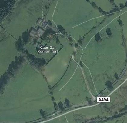
Caer Gai
Caer Gai (also Caer-gai) is a Grade II listed Roman fort in the district of Penllyn, Gwynedd, Wales, UK. It is located about 1 mile or 1.6 km north of...

Llanuwchllyn
Llanuwchllyn (Welsh: [ɬaˈnɨ̞u̯χɬɨn] ) is a village and community in Gwynedd, Wales, near the southern end of Bala Lake (Llyn Tegid). It is one of the most...

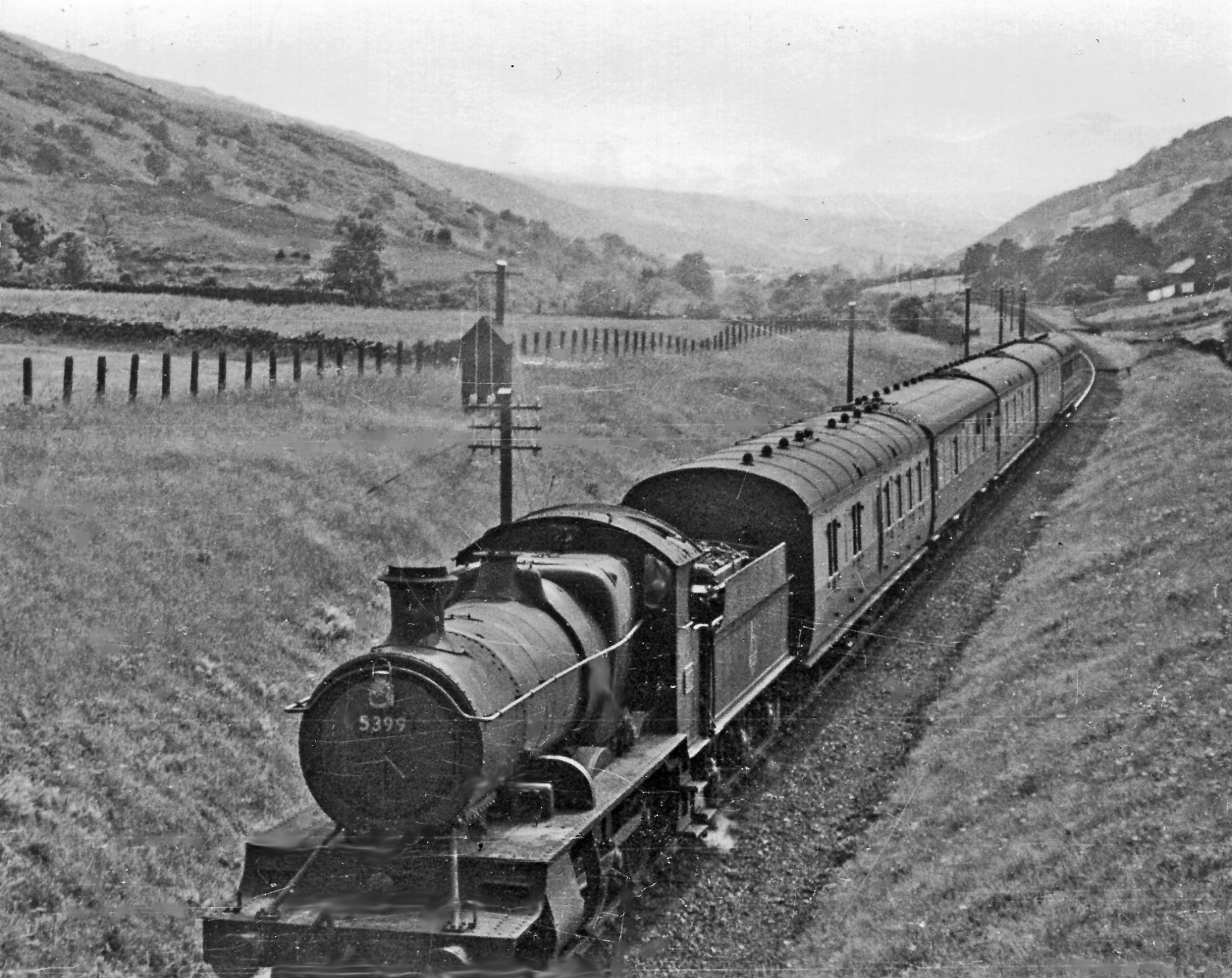
Llanuwchllyn railway station
Llanuwchllyn railway station (Welsh: [ɬaˈnɨuχɬɨn] (listen)) in the village of Llanuwchllyn, Gwynedd, Wales, was formerly a station on the Ruabon to Barmouth...
Llys Halt railway station
Llys Halt in Gwynedd, Wales, was on the Ruabon to Barmouth line. There was no passing place or freight activity here. There was a single platform on the...

Afon Llafar (Dee)
For the river which flows into the River Ogwen see Afon Llafar.The Afon Llafar is a small river in North Wales which, rising on the eastern slopes of Arenig...

Afon Mawddach
The Afon Mawddach (English: River Mawddach) is a river in Gwynedd, Wales, which has its source in a wide area SH820300 north of Dduallt in Snowdonia. It...
Pentrepiod Halt railway station (Gwynedd)
Pentrepiod ([pɛntrəˈpiːɔd] - 'Magpie Village') railway station is a small unstaffed railway halt on the Bala Lake Railway alongside the B4403. Trains will...
Nearby Amenities
Located within 500m of 52.875263,-3.7032422Have you been to Brynllech?
Leave your review of Brynllech below (or comments, questions and feedback).