Holyrood
Settlement in Midlothian
Scotland
Holyrood

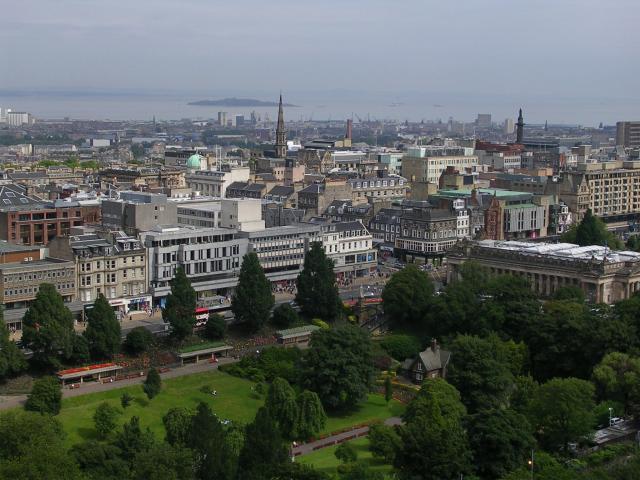
Holyrood is a small village located in the county of Midlothian, Scotland. Situated approximately 8 miles southeast of the capital city of Edinburgh, Holyrood is nestled in a picturesque setting surrounded by rolling hills and lush green landscapes. The village is known for its tranquility and natural beauty, making it an attractive destination for nature lovers and those seeking a peaceful retreat.
Holyrood is perhaps most famous for being home to the historic Holyrood Palace, an iconic royal residence that is closely associated with the British monarchy. Originally built as an Augustinian abbey in the 12th century, it was later transformed into a palace by King James IV in the early 16th century. Holyrood Palace is now the official residence of the British monarch in Scotland and remains an important symbol of Scottish history and heritage.
Aside from its royal connections, Holyrood offers a range of amenities and attractions for both locals and visitors. The village has a small but charming town center with a selection of shops, cafes, and restaurants, providing a welcoming atmosphere for residents and tourists alike. The surrounding countryside offers ample opportunities for outdoor activities such as hiking, cycling, and horseback riding, with several scenic trails and paths to explore.
Overall, Holyrood is a captivating village that seamlessly blends history, natural beauty, and modern amenities. Whether exploring the grandeur of Holyrood Palace or enjoying the tranquility of its surroundings, visitors to Holyrood are sure to be enchanted by its unique charm.
If you have any feedback on the listing, please let us know in the comments section below.
Holyrood Images
Images are sourced within 2km of 55.944475/-3.1703723 or Grid Reference NT2773. Thanks to Geograph Open Source API. All images are credited.


Holyrood is located at Grid Ref: NT2773 (Lat: 55.944475, Lng: -3.1703723)
Unitary Authority: City of Edinburgh
Police Authority: Edinburgh
What 3 Words
///finger.pirate.waddled. Near Edinburgh
Nearby Locations
Related Wikis
St Leonards railway station (Scotland)
St. Leonards railway station is a closed railway station in St Leonard's, Edinburgh, on the Edinburgh and Dalkeith Railway. It was Edinburgh's first railway...
St Leonard's Hospital, Edinburgh
The Hospital of St Leonard was a mediaeval hospital in the St Leonard's area of Edinburgh, Scotland, to which it gave its name. Founded by David I, it...
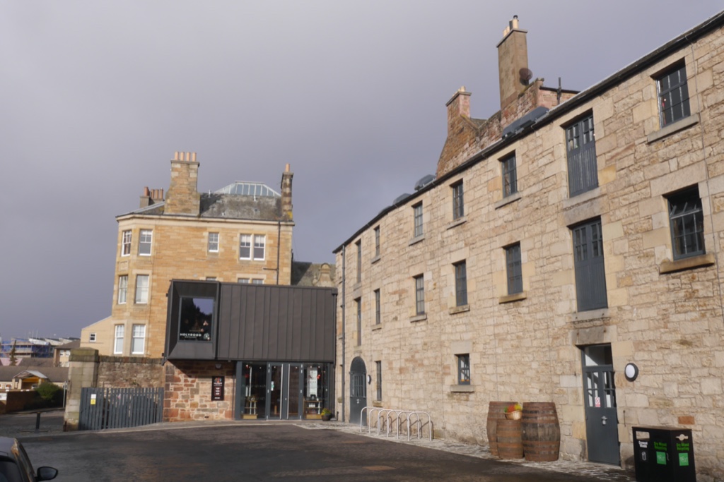
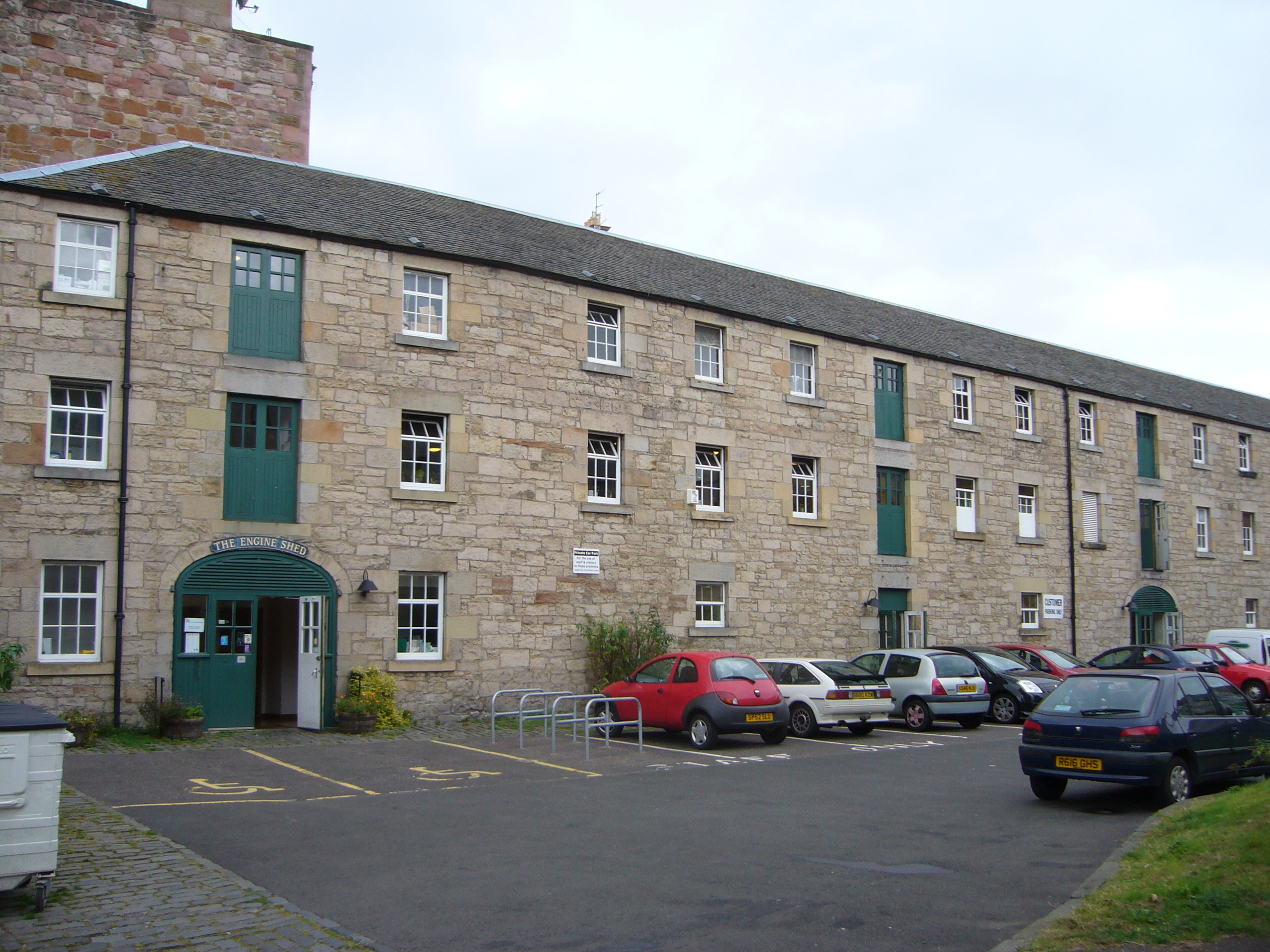
Holyrood Distillery
Holyrood Distillery is a distillery in Edinburgh, Scotland. It opened in 2019 as the first new distillery in the city in nearly one hundred years. The...
St Trinnean's School
St Trinnean's was a progressive girls' school in Edinburgh.It was founded in 1922 by its headmistress, Catherine Fraser Lee, who followed the Dalton Plan...
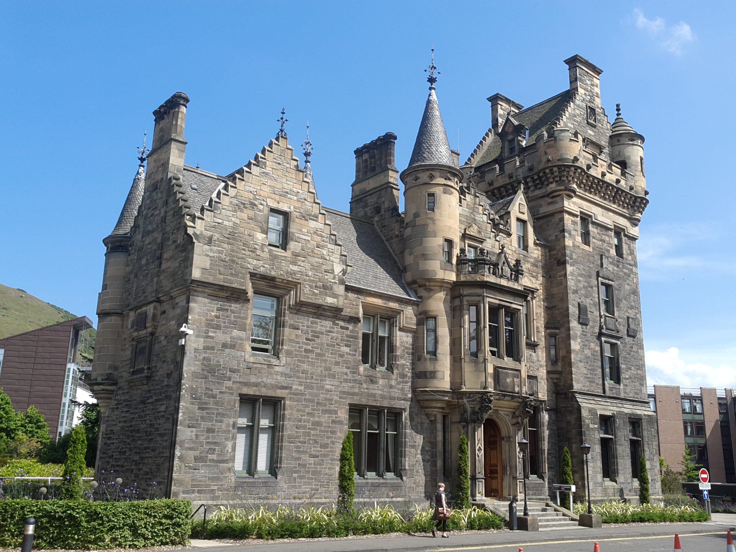
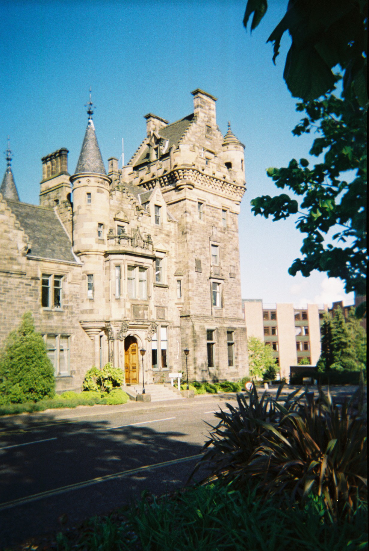
St Leonard's Hall
St Leonard's Hall is a mid-nineteenth century baronial style building within the Pollock Halls of Residence site of the University of Edinburgh.The hall...
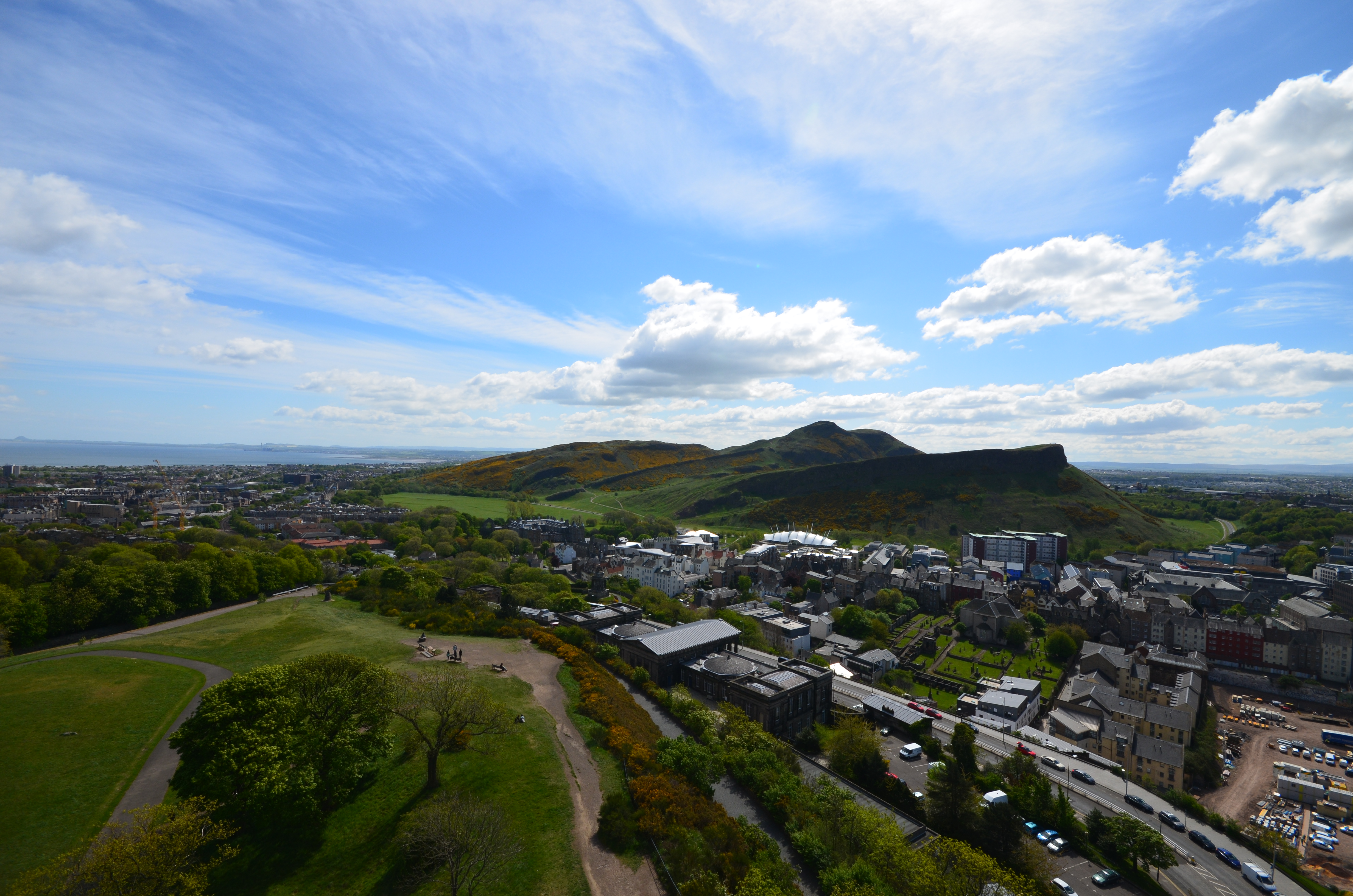
Arthur's Seat
Arthur's Seat (Scottish Gaelic: Suidhe Artair, pronounced [ˈs̪ɯi.əˈaɾt̪ʰəɾʲ]) is an ancient volcano which is the main peak of the group of hills in Edinburgh...
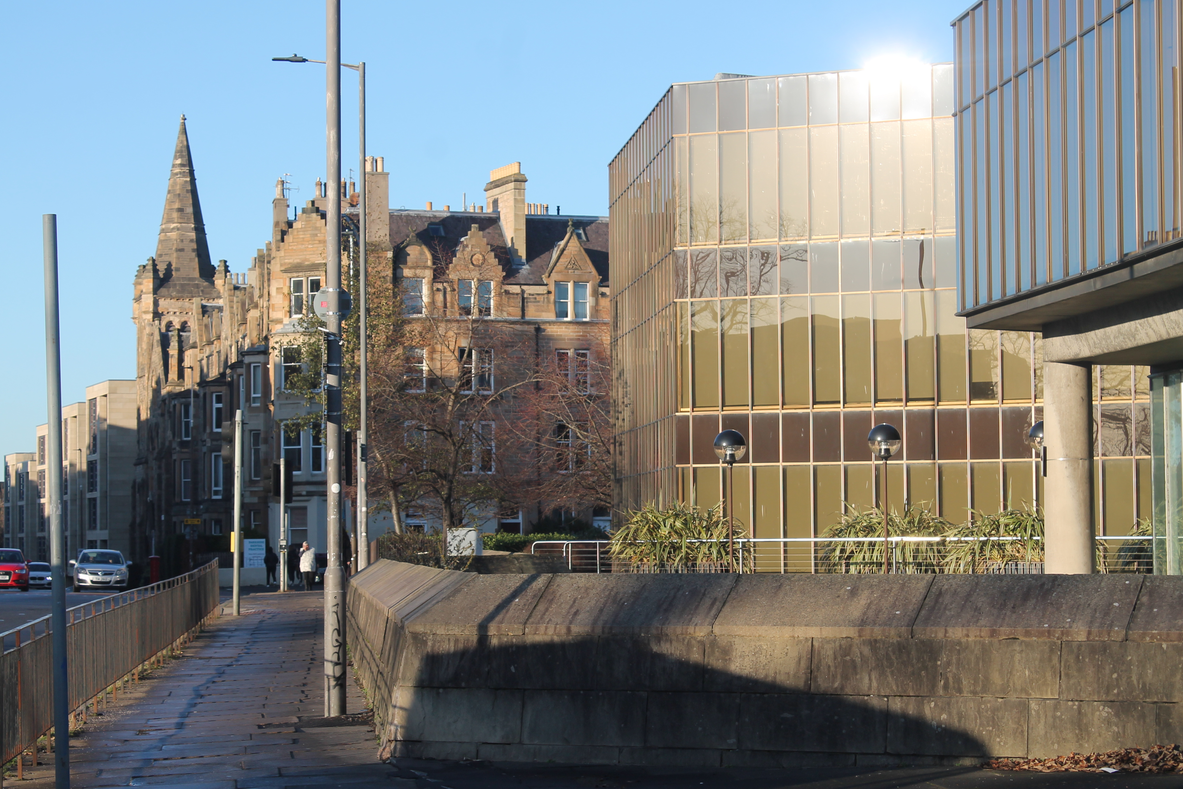
St Leonard's, Edinburgh
St Leonard's is a neighbourhood of south-central Edinburgh, Scotland, United Kingdom. Once notable as a centre of industry, it is now primarily residential...

Dumbie House
Dumbie House, also known as Craigside House, was an 18th-century building (now demolished) in Edinburgh, Scotland, which was home to Braidwood Academy...
Nearby Amenities
Located within 500m of 55.944475,-3.1703723Have you been to Holyrood?
Leave your review of Holyrood below (or comments, questions and feedback).