Little Hunt Hill

Hill, Mountain in Perthshire

Scotland

Little Hunt Hill

Wallace Stone, Sheriffmuir Part of a row of standing stones, now mostly recumbent on moorland at Sheriffmuir. The 'Wallace Stone' is said to derive its name from this location being where William Wallace and Andrew de Moray rallied their troops prior to the Battle of Stirling Bridge (1297).
Wallace Stone, Sheriffmuir Credit: Alan O'Dowd

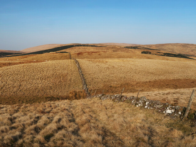
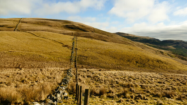
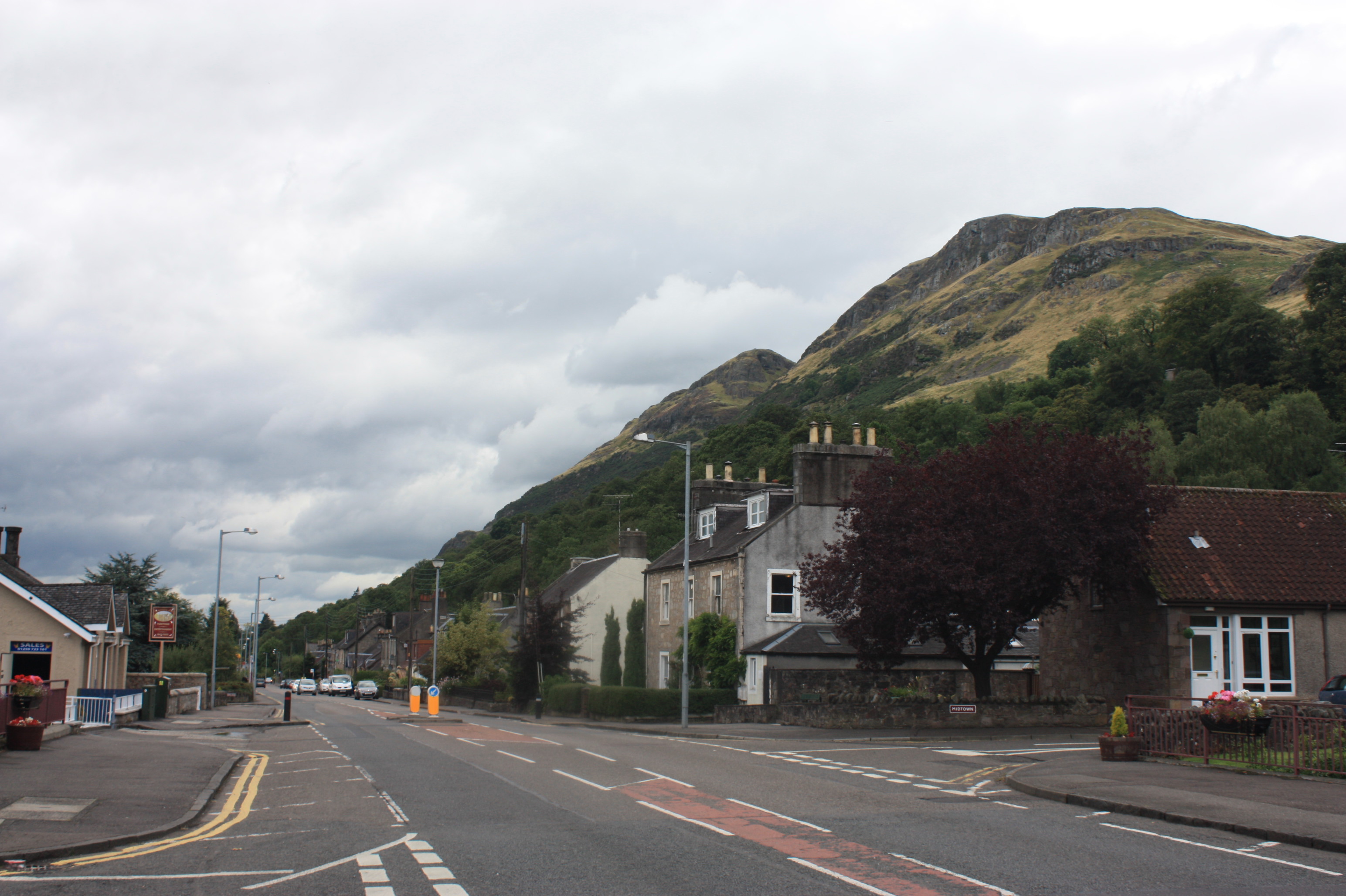
Little Hunt Hill is a prominent and picturesque mountain located in Perthshire, Scotland. It is situated within the stunning landscape of the Scottish Highlands, offering breathtaking views and a diverse range of natural features. Standing at an impressive height of approximately 700 meters (2,297 feet), Little Hunt Hill is a popular destination for hikers, mountaineers, and nature enthusiasts.

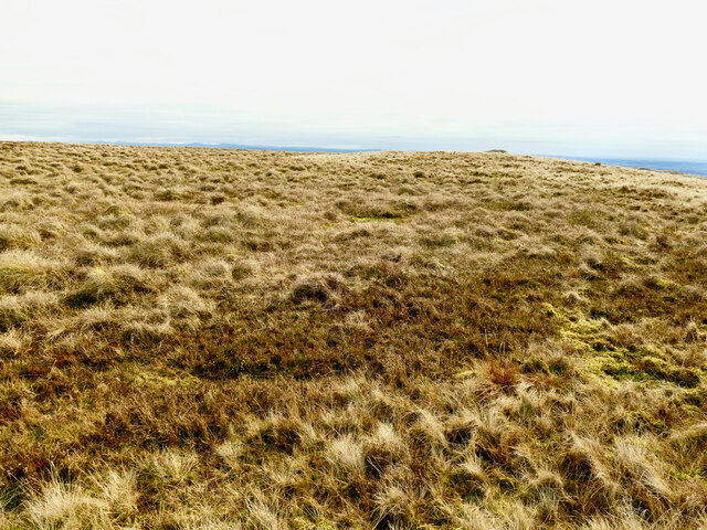
The mountain is characterized by its rugged terrain, covered with heather and grasses, creating a vibrant and colorful landscape. Its slopes are dotted with scattered rocks and boulders, adding to its wild and untamed allure. The summit of Little Hunt Hill provides an exceptional panoramic view of the surrounding area, including the nearby mountains and the vast expanse of the Scottish countryside.

Little Hunt Hill is also known for its rich biodiversity, with various species of flora and fauna inhabiting its slopes. The mountain is home to a diverse range of plant life, including heather, mosses, and wildflowers. It is also a habitat for several bird species, such as golden eagles and peregrine falcons, as well as smaller mammals like deer and rabbits.

The mountain offers a range of hiking trails, catering to different levels of difficulty and experience. These trails provide opportunities for outdoor enthusiasts to explore the natural beauty of the area while enjoying the challenges of ascending the mountain's slopes. Little Hunt Hill is a place of natural beauty and tranquility, offering visitors a chance to immerse themselves in the awe-inspiring landscape of Scotland's Perthshire region.

If you have any feedback on the listing, please let us know in the comments section below.

Little Hunt Hill Images

Images are sourced within 2km of 56.191792/-3.8681365 or Grid Reference NN8401. Thanks to Geograph Open Source API. All images are credited.

Wallace Stone, Sheriffmuir Part of a row of standing stones, now mostly recumbent on moorland at Sheriffmuir. The 'Wallace Stone' is said to derive its name from this location being where William Wallace and Andrew de Moray rallied their troops prior to the Battle of Stirling Bridge (1297).
Wallace Stone, Sheriffmuir
Part of a row of standing stones, now mostly recumbent on moorland at Sheriffmuir. The 'Wallace Stone' is said to derive its name from this location being where William Wallace and Andrew de Moray rallied their troops prior to the Battle of Stirling Bridge (1297).
Wallace Stone, Sheriffmuir Part of a row of standing stones, now mostly recumbent, on moorland at Sheriffmuir. The 'Wallace Stone' is said to derive its name from this location being where William Wallace and Andrew de Moray rallied their troops prior to the Battle of Stirling Bridge (1297).

The furthest north-east of the stones (recumbent) can be seen in the middle distance.
Wallace Stone, Sheriffmuir
Part of a row of standing stones, now mostly recumbent, on moorland at Sheriffmuir. The 'Wallace Stone' is said to derive its name from this location being where William Wallace and Andrew de Moray rallied their troops prior to the Battle of Stirling Bridge (1297). The furthest north-east of the stones (recumbent) can be seen in the middle distance.
Recumbent stone, Sheriffmuir This is the furthest north-east of the row of stones marked on the map, which run diagonally from south-west to north-east. It is likely that it once stood on its end, like the Wallace Stone, which stands nearby.
Recumbent stone, Sheriffmuir
This is the furthest north-east of the row of stones marked on the map, which run diagonally from south-west to north-east. It is likely that it once stood on its end, like the Wallace Stone, which stands nearby.
Old Wharry Burn A small outcrop on the banks of this burn, which flows down from the Ochil Hills into the Allan Water.
Old Wharry Burn
A small outcrop on the banks of this burn, which flows down from the Ochil Hills into the Allan Water.
New deer fencing under construction below Glentye Hill Fencing contractors were on-site, building this new deer fence next to the old collapsed drystane dyke. Presumably it is intended to keep deer off the new tree plantings on Glentye Hill, but will also create a new barrier for hillwalkers.
New deer fencing under construction below Glentye Hill
Fencing contractors were on-site, building this new deer fence next to the old collapsed drystane dyke. Presumably it is intended to keep deer off the new tree plantings on Glentye Hill, but will also create a new barrier for hillwalkers.
Edge of forestry plantation, Glen Tye Large swathes of hillside in this area have been planted with new trees (both conifers and deciduous trees), and an established forestry plantation can be seen in the middle ground.

The white building in the distance is the former Sheriffmuir Inn, now a private house.
Edge of forestry plantation, Glen Tye
Large swathes of hillside in this area have been planted with new trees (both conifers and deciduous trees), and an established forestry plantation can be seen in the middle ground. The white building in the distance is the former Sheriffmuir Inn, now a private house.
Fenceline on Big Hunt Hill The extent of new forestry plantations in this area are not yet shown on the OS map (with the exception of the large-scale plan). Extensive new plantations can be seen on the rounded rise of Little Hunt Hill below.

The small white speck in the distance (on the left) is the former Sheriffmuir Inn, now a private house.
Fenceline on Big Hunt Hill
The extent of new forestry plantations in this area are not yet shown on the OS map (with the exception of the large-scale plan). Extensive new plantations can be seen on the rounded rise of Little Hunt Hill below. The small white speck in the distance (on the left) is the former Sheriffmuir Inn, now a private house.
New tree plantings in the Ochil Hills The new trees can be seen on the flank of Kidlaw Hill, with Meikle Corum and Glenforet Hill rising behind.
New tree plantings in the Ochil Hills
The new trees can be seen on the flank of Kidlaw Hill, with Meikle Corum and Glenforet Hill rising behind.
Near the summit of Kidlaw Hill Looking across to Glentye Hill.
Near the summit of Kidlaw Hill
Looking across to Glentye Hill.
Glen Tye viewed from Kidlaw Hill A new track can be seen winding round Glentye Hill, where deer fencing is being erected to protect new tree plantings.
Glen Tye viewed from Kidlaw Hill
A new track can be seen winding round Glentye Hill, where deer fencing is being erected to protect new tree plantings.
Young conifer trees on Kidlaw Hill The lower slopes of this hill have been extensively planted with conifer trees.
Young conifer trees on Kidlaw Hill
The lower slopes of this hill have been extensively planted with conifer trees.
New deer fencing in Glen Tye The new fencing on the left protects new tree plantings on Glentye Hill. 

An extensive area of new conifer trees can be seen on Kidlaw Hill, on the opposite side of the Old Wharry Burn.
New deer fencing in Glen Tye
The new fencing on the left protects new tree plantings on Glentye Hill. An extensive area of new conifer trees can be seen on Kidlaw Hill, on the opposite side of the Old Wharry Burn.
Rough moorland by the Wharry Burn Uneven, thickly vegetated terrain near the entrance to Glen Tye.
Rough moorland by the Wharry Burn
Uneven, thickly vegetated terrain near the entrance to Glen Tye.
Moorland on Ashentrool with cattle and sheep
Drystane Dyke on Loss Hill Heading towards Brown Hill.
Drystane Dyke on Loss Hill
Heading towards Brown Hill.
View north east from Loss Hill in the Ochils Overhead conditions were perfect for a stravaig in the hills. Conditions underfoot were less so. Despite a spell of dry weather much of the ground, including the top of Loss Hill, was very wet. A very recent deer fence has been installed along the line of the old dyke. Fresh sawdust and tractor tracks could be seen on the inside, east, of the fence. Fencing was still in progress beside the hill track to Menstrie by the Lossburn reservoir.
View north east from Loss Hill in the Ochils
Overhead conditions were perfect for a stravaig in the hills. Conditions underfoot were less so. Despite a spell of dry weather much of the ground, including the top of Loss Hill, was very wet. A very recent deer fence has been installed along the line of the old dyke. Fresh sawdust and tractor tracks could be seen on the inside, east, of the fence. Fencing was still in progress beside the hill track to Menstrie by the Lossburn reservoir.
Loss Hill top in the Ochils Taken through the deer fence, this shows the wet top of Loss Hill <a href="https://www.geograph.org.uk/photo/7424078">NN8300 : View north east from Loss Hill in the Ochils</a>. The brighter green patches in the foreground are areas of waterlogged sphagnum moss. The small dark feature on the near skyline right of centre is the summit of Dunyat.
Loss Hill top in the Ochils
Taken through the deer fence, this shows the wet top of Loss Hill NN8300 : View north east from Loss Hill in the Ochils. The brighter green patches in the foreground are areas of waterlogged sphagnum moss. The small dark feature on the near skyline right of centre is the summit of Dunyat.
Stand of Trees A delightful old stand of pines by the road and close to Wallace's Stone..
Stand of Trees
A delightful old stand of pines by the road and close to Wallace's Stone..
Show me another place!

Little Hunt Hill is located at Grid Ref: NN8401 (Lat: 56.191792, Lng: -3.8681365)

Unitary Authority: Stirling

Police Authority: Forth Valley

What 3 Words

///rather.smudges.dummy. Near Menstrie, Clackmannanshire

Related Wikis

Battle of Sheriffmuir

The Battle of Sheriffmuir (Scottish Gaelic: Blàr Sliabh an t-Siorraim, [pl̪ˠaɾ ˈʃʎiəv əɲ ˈtʲʰirˠəm]) was an engagement in 1715 at the height of the Jacobite...

Myreton Hill

Myreton Hill is a peak near the village of Menstrie in the Ochil Hills of Scotland. == Location == The hill is located immediately to the north-east of...

Menstrie Glen

Menstrie Glen is the glen which separates Dumyat from Myreton Hill and the main body of the Ochil Hills in Scotland. Once farmed but no longer inhabited...

Dumyat

Dumyat or Dunmyat (Scottish Gaelic: Dùn Mhèad) is a hill at the western extremity of the Ochil Hills in central Scotland. The name is thought to originate...

Broomhall Castle

Broomhall Castle is a mansion house originally called Broom Hall and was built in 1874 by John Foukes and Frances Mackison for James Johnstone. It is situated...

Menstrie

Menstrie (Scottish Gaelic: Meanstraidh) is a village in the county of Clackmannanshire in Scotland. It is about five miles (eight kilometres) east-northeast...

Menstrie Castle

Menstrie Castle is a three-storey manor house in the town of Menstrie, Clackmannanshire, near Stirling, central Scotland. From the early 17th century,...

Menstrie and Glenochil railway station

Menstrie and Glenochil railway station served the village of Menstrie, Clackmannanshire, Scotland, from 1863 to 1954 on the Alva Railway. == History... ==

Nearby Amenities

Located within 500m of 56.191792,-3.8681365
Little Hunt Hill
Natural: peak
Lat/Long: 56.1922834/-3.8690329
The data included in this document is from www.openstreetmap.org. The data is made available under ODbL.

Have you been to Little Hunt Hill?

Leave your review of Little Hunt Hill below (or comments, questions and feedback).