Bryn y Fedwen

Hill, Mountain in Montgomeryshire

Wales

Bryn y Fedwen

The Machynlleth - Llanidloes road, above Rhiw Fawr Still climbing, at about 440 metres above sea level.
The Machynlleth - Llanidloes road, above Rhiw Fawr Credit: Christine Johnstone

Bryn y Fedwen is a prominent hill located in Montgomeryshire, a historic county in Wales, United Kingdom. It is situated near the village of Llanymynech, on the border between Wales and England. The name Bryn y Fedwen translates to "Hill of the Birch Trees" in English.

This hill is part of the larger Offa's Dyke Path, a long-distance footpath that follows the ancient earthwork built by King Offa in the 8th century. The path offers stunning views of the surrounding countryside, including the picturesque countryside of the Welsh Marches.

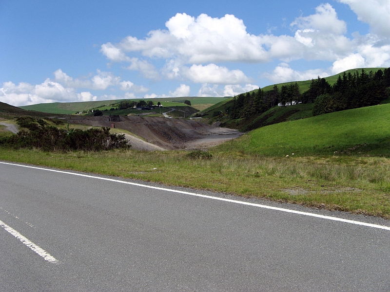
Bryn y Fedwen stands at an elevation of approximately 210 meters (690 feet) above sea level, making it a notable landmark in the area. Its distinct shape and position make it a popular destination for hikers, nature enthusiasts, and photographers.

The hill is covered in a variety of vegetation, including heather, grasses, and scattered trees. It is also home to a diverse range of wildlife, including birds, small mammals, and insects. The area surrounding Bryn y Fedwen is known for its rich biodiversity and is often visited by birdwatchers and nature lovers.

Overall, Bryn y Fedwen is a beautiful and significant hill in Montgomeryshire, offering not only natural beauty but also historical and cultural significance due to its connection to Offa's Dyke and its location on the Wales-England border.

If you have any feedback on the listing, please let us know in the comments section below.

Bryn y Fedwen Images

Images are sourced within 2km of 52.543523/-3.7109101 or Grid Reference SN8495. Thanks to Geograph Open Source API. All images are credited.

The Machynlleth - Llanidloes road, above Rhiw Fawr Still climbing, at about 440 metres above sea level.
The Machynlleth - Llanidloes road, above Rhiw Fawr
Still climbing, at about 440 metres above sea level.
Roadside fence above Rhiw Fawr There is about a 35 metre drop into the valley bottom.
Roadside fence above Rhiw Fawr
There is about a 35 metre drop into the valley bottom.
Track dropping down Banc y Cwm Forming the eastern [far] boundary of the open access land.
Track dropping down Banc y Cwm
Forming the eastern [far] boundary of the open access land.
Steep-sided valley at Rhiw Fawr The Welsh name 'Rhiw Fawr' could be translated as 'great slope', which is surely accurate.
Steep-sided valley at Rhiw Fawr
The Welsh name 'Rhiw Fawr' could be translated as 'great slope', which is surely accurate.
The Llanidloes - Machynlleth road, above Rhiw Fawr Dropping down from a 435 metre spot height.
The Llanidloes - Machynlleth road, above Rhiw Fawr
Dropping down from a 435 metre spot height.
Sheep grazing above Rhiw Fawr On the west side of the road, east of Esgair Graflwyn.
Sheep grazing above Rhiw Fawr
On the west side of the road, east of Esgair Graflwyn.
Rough grazing above Rhiw Fawr Rushes and thistles as well as grass at 440 metres above sea level.
Rough grazing above Rhiw Fawr
Rushes and thistles as well as grass at 440 metres above sea level.
Viewpoint at the 'best view in Wales' Memorial to Wynford Vaughan-Thomas, whose opinion this was.
Viewpoint at the 'best view in Wales'
Memorial to Wynford Vaughan-Thomas, whose opinion this was.
Upland farmland, north-east of Foel Fadian Once there were pits here, now there are sheep. This area is not open access.
Upland farmland, north-east of Foel Fadian
Once there were pits here, now there are sheep. This area is not open access.
Moorland fence, heading north to Bryn y Fedwen Also the boundary between open access land in Cadfarch civil parish [left / west] and  restricted access land in Trefeglwys [right / east].
Moorland fence, heading north to Bryn y Fedwen
Also the boundary between open access land in Cadfarch civil parish [left / west] and restricted access land in Trefeglwys [right / east].
Open access moorland, south of Bryn y Fedwen The lake about a mile away is called Glaslyn.
Open access moorland, south of Bryn y Fedwen
The lake about a mile away is called Glaslyn.
The mountain road from Machynlleth to Llanidloes Heading south-east to Lluest Dropyns.
The mountain road from Machynlleth to Llanidloes
Heading south-east to Lluest Dropyns.
Conifer plantation at Lluest Dropyns Looking east to the top [west end] of the hillside plantation.
Conifer plantation at Lluest Dropyns
Looking east to the top [west end] of the hillside plantation.
Rough grazing at 500 metres above sea level Between Lluen Dropyns and Waun Goch, with the lake Glaslyn in the distance.
Rough grazing at 500 metres above sea level
Between Lluen Dropyns and Waun Goch, with the lake Glaslyn in the distance.
Moorland sheep under grey skies, near Lluest Dropyns West of the Machynlleth - Llanidloes road, about 510 metres above sea level.
Moorland sheep under grey skies, near Lluest Dropyns
West of the Machynlleth - Llanidloes road, about 510 metres above sea level.
Triangulation Pillar + Cofiwch Dryweryn
Mountain road past the Wynford Vaughan Thomas memorial View from higher up the road.  Cader Idris in the background.
Mountain road past the Wynford Vaughan Thomas memorial
View from higher up the road. Cader Idris in the background.
Bacheiddon Mine open cut A very rich lead lode was discovered by a working miner in about 1851, close to the turnpike road to Dylife. This became the focus of considerable interest with the lode running to 8 tons of lead ore per cubic fathom. Deep mining was instigated by driving adits from both sides of the ridge, including a deep adit from the Rhoswydol Valley to the north east. Dividends of £1500 were paid out to shareholders in 1857-8 but this was not to last very long and by 1863 the mine had closed.The open cut is still an impressive feature close to the road, although, as with many such historical sites, this has become the dumping ground for agricultural rubbish and old car bodies.
Bacheiddon Mine open cut
A very rich lead lode was discovered by a working miner in about 1851, close to the turnpike road to Dylife. This became the focus of considerable interest with the lode running to 8 tons of lead ore per cubic fathom. Deep mining was instigated by driving adits from both sides of the ridge, including a deep adit from the Rhoswydol Valley to the north east. Dividends of £1500 were paid out to shareholders in 1857-8 but this was not to last very long and by 1863 the mine had closed.The open cut is still an impressive feature close to the road, although, as with many such historical sites, this has become the dumping ground for agricultural rubbish and old car bodies.
Show me another place!

Bryn y Fedwen is located at Grid Ref: SN8495 (Lat: 52.543523, Lng: -3.7109101)

Unitary Authority: Powys

Police Authority: Dyfed Powys

What 3 Words

///currently.truckload.matrons. Near Staylittle, Powys

Nearby Locations

Bryn y Fedwen

Related Wikis

Dylife

Dylife is a former mining settlement in Powys, Wales, located at the head of Afon Twymyn in the Cambrian Mountains, one mile west of the road between Llanidloes...

Bryn yr Ŵyn

Bryn yr Ŵyn (Welsh for 'hill of the lambs') is a former Dewey in the foothills of Plynlimon between Aberystwyth and Welshpool in Wales. The summit height...

Banc Bugeilyn

Banc Bugeilyn is a hill found in Plynlimon between Aberystwyth and Welshpool in the United Kingdom; grid reference SN826925.The summit is class as a Dewey...

Dylife Gorge

The Dylife Gorge, located near Dylife, Powys, Mid Wales, was carved by the action (and aftermath) of the last Ice age. It is headed by the Ffrwd Fawr Waterfall...

Ffrwd Fawr Waterfall

Ffrwd Fawr is a waterfall in Powys, Wales. == Location == The River Twymyn flows from the 40-metre-high (130 ft) Ffrwd Fawr Waterfall at the head of the...

Aberhosan

Aberhosan () is a village in the Welsh principal area of Powys, located between the town of Machynlleth and village of Dylife. It is in the historic county...

Siambr Trawsfynydd

Siambr Trawsfynydd is a mountain in Ceredigion, Wales, located to the north of Pumlumon. It is 582 m (1,910 ft) above sea level and one of the higher summits...

Pennant, Powys

Pennant is a small village in Powys, mid Wales located on the B4518 road between Llanbrynmair and Llanidloes.

Nearby Amenities

Located within 500m of 52.543523,-3.7109101
Bryn-y-Fedwen
Created By: POI Editor
Natural: peak
Source: npe
Lat/Long: 52.5434165/-3.7105823
Ncn Milepost: mccoll
Sustrans Ref: MP174
Lat/Long: 52.5425604/-3.7161372
The data included in this document is from www.openstreetmap.org. The data is made available under ODbL.

Have you been to Bryn y Fedwen?

Leave your review of Bryn y Fedwen below (or comments, questions and feedback).