Bryn yr Ŵyn

Hill, Mountain in Montgomeryshire

Wales

Bryn yr Ŵyn

Glyndwr's Way near Dylife
Glyndwr's Way near Dylife Credit: Dave Kelly

Bryn yr Ŵyn, located in Montgomeryshire, Wales, is a prominent hill or mountain that offers stunning natural beauty and a range of outdoor activities. Standing at an elevation of approximately 400 meters (1,300 feet), it provides breathtaking panoramic views of the surrounding countryside.

The hill/mountain is characterized by its distinct peak, adorned with lush greenery and dotted with gorse bushes and heather. It is a popular destination for hikers and nature enthusiasts, who can enjoy the diverse wildlife and flora that inhabit the area.

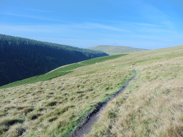
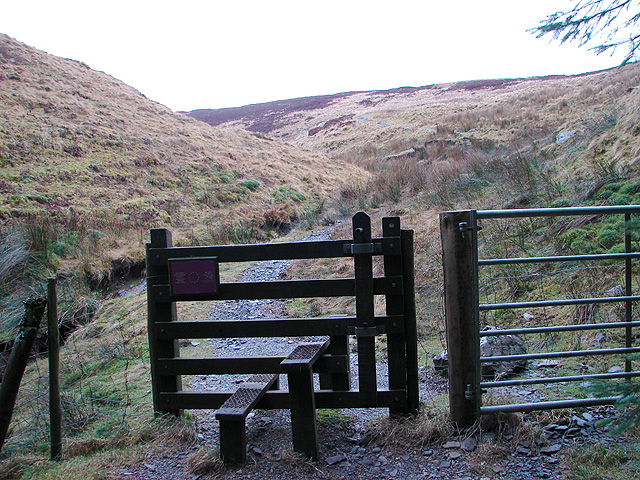
Bryn yr Ŵyn boasts a well-maintained network of trails, making it accessible and suitable for walkers of all abilities. One of the most popular routes is the circular walk that begins in the nearby village of Llangyniew and takes visitors on a scenic journey up the hill, passing through ancient woodlands and open moorland.

At the summit, visitors are rewarded with breathtaking views of the rolling hills and valleys of Montgomeryshire, as well as distant glimpses of Snowdonia National Park on clear days. The summit also provides an ideal spot for picnics or simply taking in the serene surroundings.

The hill/mountain is situated within a designated Site of Special Scientific Interest (SSSI), due to its ecological importance. It is home to a variety of plant species, including bilberry, heath bedstraw, and tormentil. Additionally, birdwatchers can spot a range of avian species, such as red kites, buzzards, and skylarks.

Overall, Bryn yr Ŵyn offers a captivating and diverse natural landscape, making it a must-visit destination for those seeking tranquility and outdoor adventures in Montgomeryshire.

If you have any feedback on the listing, please let us know in the comments section below.

Bryn yr Ŵyn Images

Images are sourced within 2km of 52.51867/-3.7123317 or Grid Reference SN8392. Thanks to Geograph Open Source API. All images are credited.
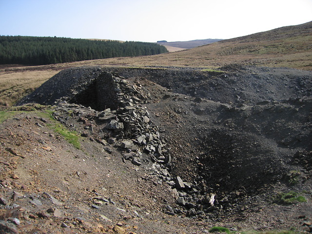
Glyndwr's Way near Dylife
Glyndwr's Way near the Roman Fortlet
Glyndwr's Way near Y Grug
Glyndwr's Way near Glaslyn
Glaslyn, wedi i'w rhewi A frozen Glaslyn in late winter.
Glaslyn, wedi i'w rhewi
A frozen Glaslyn in late winter.
Glaslyn The lake lies in a shallow depression in a moorland plateau.  It is separated from the craggy head of Cwm Dulas <a title="https://www.geograph.org.uk/photo/669937" href="https://www.geograph.org.uk/photo/669937">Link</a> only by a 200m wide and less than 10m high strip of slightly higher ground, seen on the right at the back in this image.
Glaslyn
The lake lies in a shallow depression in a moorland plateau. It is separated from the craggy head of Cwm Dulas Link only by a 200m wide and less than 10m high strip of slightly higher ground, seen on the right at the back in this image.
Waen Oer The valley of the Nant Goch cuts deep into the moorland, forming a scree slope on the hillside opposite.
Waen Oer
The valley of the Nant Goch cuts deep into the moorland, forming a scree slope on the hillside opposite.
Glaslyn and Cadair Idris The view from Mynydd Esgairfochnant takes in Glaslyn in the foreground and the Cadair Idris ridge around <a href="https://www.geograph.org.uk/gridref/SH7113">SH7113</a> at the back.  In between, yet out of sight, is Machynlleth in Dyffryn Dyfi.
Glaslyn and Cadair Idris
The view from Mynydd Esgairfochnant takes in Glaslyn in the foreground and the Cadair Idris ridge around SH7113 at the back. In between, yet out of sight, is Machynlleth in Dyffryn Dyfi.
Cyfartha lead mine - shaft and engine house The crater in the foreground is one of the engine shafts, which has been backfilled after operations ceased.  To the left are the remnants of the engine house, which had a gap <a title="https://www.geograph.org.uk/photo/2373243" href="https://www.geograph.org.uk/photo/2373243">Link</a> on the side facing the shaft for the rope to pass through.  The Nant Ddu passes through the gap between the engine house and the spoil tip at the back.  The shaft <span class="nowrap"><a title="http://www.coflein.gov.uk/en/site/289540/details" rel="nofollow ugc noopener" href="http://www.coflein.gov.uk/en/site/289540/details">Link</a><img style="margin-left:2px;" alt="External link" title="External link - shift click to open in new window" src="https://s1.geograph.org.uk/img/external.png" width="10" height="10"/></span> , engine house <span class="nowrap"><a title="http://www.coflein.gov.uk/en/site/289539/details" rel="nofollow ugc noopener" href="http://www.coflein.gov.uk/en/site/289539/details">Link</a><img style="margin-left:2px;" alt="External link" title="External link - shift click to open in new window" src="https://s1.geograph.org.uk/img/external.png" width="10" height="10"/></span> and spoil tip <span class="nowrap"><a title="http://www.coflein.gov.uk/en/site/289525/details" rel="nofollow ugc noopener" href="http://www.coflein.gov.uk/en/site/289525/details">Link</a><img style="margin-left:2px;" alt="External link" title="External link - shift click to open in new window" src="https://s1.geograph.org.uk/img/external.png" width="10" height="10"/></span> all have individual entries in the Coflein database.

Cyfartha mine is also known as Nantddu mine since most of its buildings are located in the valley of the Nant Ddu.  Mine operations at Cyfartha lasted from 1842 to 1881.  The ore was mined mostly for its lead and copper content.  Cyfartha was an underground mine, with access to the levels through a number of shafts.  Power was generated using two water wheels and a horse-powered whim.  The water feeding the wheels came mainly from the Nant Ddu, supplemented by a long leat abstracting water from the Nant Goch about a kilometre to the north.  Since the water wheels are located lower than the openings of the engine shafts, power was transmitted using a flatrod system, i.e. a series of linked iron rods moving backwards and forwards as the wheel turns (see Wikipedia article on Eylesbarrow mine in Devon <span class="nowrap"><a title="http://en.wikipedia.org/wiki/Eylesbarrow_mine#The_flatrod_system" rel="nofollow ugc noopener" href="http://en.wikipedia.org/wiki/Eylesbarrow_mine#The_flatrod_system">Link</a><img style="margin-left:2px;" alt="External link" title="External link - shift click to open in new window" src="https://s1.geograph.org.uk/img/external.png" width="10" height="10"/></span> for details of the mechanism).  For a detailed description of the mine, see Clwyd-Powys Archaeological Trust <span class="nowrap"><a title="http://www.cpat.org.uk/projects/longer/mines/8497.htm" rel="nofollow ugc noopener" href="http://www.cpat.org.uk/projects/longer/mines/8497.htm">Link</a><img style="margin-left:2px;" alt="External link" title="External link - shift click to open in new window" src="https://s1.geograph.org.uk/img/external.png" width="10" height="10"/></span> .  Cyfartha mine as a whole is listed in the Coflein database <span class="nowrap"><a title="http://www.coflein.gov.uk/en/site/306327/details" rel="nofollow ugc noopener" href="http://www.coflein.gov.uk/en/site/306327/details">Link</a><img style="margin-left:2px;" alt="External link" title="External link - shift click to open in new window" src="https://s1.geograph.org.uk/img/external.png" width="10" height="10"/></span> .
Cyfartha lead mine - shaft and engine house
The crater in the foreground is one of the engine shafts, which has been backfilled after operations ceased. To the left are the remnants of the engine house, which had a gap Link on the side facing the shaft for the rope to pass through. The Nant Ddu passes through the gap between the engine house and the spoil tip at the back. The shaft LinkExternal link , engine house LinkExternal link and spoil tip LinkExternal link all have individual entries in the Coflein database. Cyfartha mine is also known as Nantddu mine since most of its buildings are located in the valley of the Nant Ddu. Mine operations at Cyfartha lasted from 1842 to 1881. The ore was mined mostly for its lead and copper content. Cyfartha was an underground mine, with access to the levels through a number of shafts. Power was generated using two water wheels and a horse-powered whim. The water feeding the wheels came mainly from the Nant Ddu, supplemented by a long leat abstracting water from the Nant Goch about a kilometre to the north. Since the water wheels are located lower than the openings of the engine shafts, power was transmitted using a flatrod system, i.e. a series of linked iron rods moving backwards and forwards as the wheel turns (see Wikipedia article on Eylesbarrow mine in Devon LinkExternal link for details of the mechanism). For a detailed description of the mine, see Clwyd-Powys Archaeological Trust LinkExternal link . Cyfartha mine as a whole is listed in the Coflein database LinkExternal link .
Cyfartha lead mine - shaft and engine house This image shows the gap in the side of the engine house <a title="https://www.geograph.org.uk/photo/2373240" href="https://www.geograph.org.uk/photo/2373240">Link</a> through which the rope would have passed down into the shaft (now backfilled) in the foreground.  The engine house <span class="nowrap"><a title="http://www.coflein.gov.uk/en/site/289539/details" rel="nofollow ugc noopener" href="http://www.coflein.gov.uk/en/site/289539/details">Link</a><img style="margin-left:2px;" alt="External link" title="External link - shift click to open in new window" src="https://s1.geograph.org.uk/img/external.png" width="10" height="10"/></span> and shaft <span class="nowrap"><a title="http://www.coflein.gov.uk/en/site/289540/details" rel="nofollow ugc noopener" href="http://www.coflein.gov.uk/en/site/289540/details">Link</a><img style="margin-left:2px;" alt="External link" title="External link - shift click to open in new window" src="https://s1.geograph.org.uk/img/external.png" width="10" height="10"/></span> are listed on the Coflein database.

Cyfartha mine is also known as Nantddu mine since most of its buildings are located in the valley of the Nant Ddu.  Mine operations at Cyfartha lasted from 1842 to 1881.  The ore was mined mostly for its lead and copper content.  Cyfartha was an underground mine, with access to the levels through a number of shafts.  Power was generated using two water wheels and a horse-powered whim.  The water feeding the wheels came mainly from the Nant Ddu, supplemented by a long leat abstracting water from the Nant Goch about a kilometre to the north.  Since the water wheels are located lower than the openings of the engine shafts, power was transmitted using a flatrod system, i.e. a series of linked iron rods moving backwards and forwards as the wheel turns (see Wikipedia article on Eylesbarrow mine in Devon <span class="nowrap"><a title="http://en.wikipedia.org/wiki/Eylesbarrow_mine#The_flatrod_system" rel="nofollow ugc noopener" href="http://en.wikipedia.org/wiki/Eylesbarrow_mine#The_flatrod_system">Link</a><img style="margin-left:2px;" alt="External link" title="External link - shift click to open in new window" src="https://s1.geograph.org.uk/img/external.png" width="10" height="10"/></span> for details of the mechanism).  For a detailed description of the mine, see Clwyd-Powys Archaeological Trust <span class="nowrap"><a title="http://www.cpat.org.uk/projects/longer/mines/8497.htm" rel="nofollow ugc noopener" href="http://www.cpat.org.uk/projects/longer/mines/8497.htm">Link</a><img style="margin-left:2px;" alt="External link" title="External link - shift click to open in new window" src="https://s1.geograph.org.uk/img/external.png" width="10" height="10"/></span> .  Cyfartha mine as a whole is listed in the Coflein database <span class="nowrap"><a title="http://www.coflein.gov.uk/en/site/306327/details" rel="nofollow ugc noopener" href="http://www.coflein.gov.uk/en/site/306327/details">Link</a><img style="margin-left:2px;" alt="External link" title="External link - shift click to open in new window" src="https://s1.geograph.org.uk/img/external.png" width="10" height="10"/></span> .
Cyfartha lead mine - shaft and engine house
This image shows the gap in the side of the engine house Link through which the rope would have passed down into the shaft (now backfilled) in the foreground. The engine house LinkExternal link and shaft LinkExternal link are listed on the Coflein database. Cyfartha mine is also known as Nantddu mine since most of its buildings are located in the valley of the Nant Ddu. Mine operations at Cyfartha lasted from 1842 to 1881. The ore was mined mostly for its lead and copper content. Cyfartha was an underground mine, with access to the levels through a number of shafts. Power was generated using two water wheels and a horse-powered whim. The water feeding the wheels came mainly from the Nant Ddu, supplemented by a long leat abstracting water from the Nant Goch about a kilometre to the north. Since the water wheels are located lower than the openings of the engine shafts, power was transmitted using a flatrod system, i.e. a series of linked iron rods moving backwards and forwards as the wheel turns (see Wikipedia article on Eylesbarrow mine in Devon LinkExternal link for details of the mechanism). For a detailed description of the mine, see Clwyd-Powys Archaeological Trust LinkExternal link . Cyfartha mine as a whole is listed in the Coflein database LinkExternal link .
Cyfartha lead mine The view follows the Nant Ddu as it runs through the surface structures of Cyfartha mine.  The photograph was taken from a spoil tip just west of one of the engine shafts.  Another spoil tip can be seen on the right, on the other side of the Nant Ddu.  The ruined building on the left is the engine house <a title="https://www.geograph.org.uk/photo/2373243" href="https://www.geograph.org.uk/photo/2373243">Link</a> , which would have housed a pulley system carrying a rope down the shaft <a title="https://www.geograph.org.uk/photo/2373243" href="https://www.geograph.org.uk/photo/2373243">Link</a> .  The shaft itself (now backfilled) is between the camera and the engine house, in the depression beyond the grassy patch on the left.  The building in the middle distance is a wheel pit <a title="https://www.geograph.org.uk/photo/2373259" href="https://www.geograph.org.uk/photo/2373259">Link</a> which once housed a water wheel driven by the Nant Ddu.  The engine house was supplied with mechanical power from this wheel pit using a flatrod system.  The engine house <span class="nowrap"><a title="http://www.coflein.gov.uk/en/site/289539/details" rel="nofollow ugc noopener" href="http://www.coflein.gov.uk/en/site/289539/details">Link</a><img style="margin-left:2px;" alt="External link" title="External link - shift click to open in new window" src="https://s1.geograph.org.uk/img/external.png" width="10" height="10"/></span> , shaft <span class="nowrap"><a title="http://www.coflein.gov.uk/en/site/289540/details" rel="nofollow ugc noopener" href="http://www.coflein.gov.uk/en/site/289540/details">Link</a><img style="margin-left:2px;" alt="External link" title="External link - shift click to open in new window" src="https://s1.geograph.org.uk/img/external.png" width="10" height="10"/></span> , spoil tip <span class="nowrap"><a title="http://www.coflein.gov.uk/en/site/289525/details" rel="nofollow ugc noopener" href="http://www.coflein.gov.uk/en/site/289525/details">Link</a><img style="margin-left:2px;" alt="External link" title="External link - shift click to open in new window" src="https://s1.geograph.org.uk/img/external.png" width="10" height="10"/></span> and wheel pit <span class="nowrap"><a title="http://www.coflein.gov.uk/en/site/289528/details" rel="nofollow ugc noopener" href="http://www.coflein.gov.uk/en/site/289528/details">Link</a><img style="margin-left:2px;" alt="External link" title="External link - shift click to open in new window" src="https://s1.geograph.org.uk/img/external.png" width="10" height="10"/></span> are all listed individually on the Coflein database.

Cyfartha mine is also known as Nantddu mine since most of its buildings are located in the valley of the Nant Ddu.  Mine operations at Cyfartha lasted from 1842 to 1881.  The ore was mined mostly for its lead and copper content.  Cyfartha was an underground mine, with access to the levels through a number of shafts.  Power was generated using two water wheels and a horse-powered whim.  The water feeding the wheels came mainly from the Nant Ddu, supplemented by a long leat abstracting water from the Nant Goch about a kilometre to the north.  Since the water wheels are located lower than the openings of the engine shafts, power was transmitted using a flatrod system, i.e. a series of linked iron rods moving backwards and forwards as the wheel turns (see Wikipedia article on Eylesbarrow mine in Devon <span class="nowrap"><a title="http://en.wikipedia.org/wiki/Eylesbarrow_mine#The_flatrod_system" rel="nofollow ugc noopener" href="http://en.wikipedia.org/wiki/Eylesbarrow_mine#The_flatrod_system">Link</a><img style="margin-left:2px;" alt="External link" title="External link - shift click to open in new window" src="https://s1.geograph.org.uk/img/external.png" width="10" height="10"/></span> for details of the mechanism).  For a detailed description of the mine, see Clwyd-Powys Archaeological Trust <span class="nowrap"><a title="http://www.cpat.org.uk/projects/longer/mines/8497.htm" rel="nofollow ugc noopener" href="http://www.cpat.org.uk/projects/longer/mines/8497.htm">Link</a><img style="margin-left:2px;" alt="External link" title="External link - shift click to open in new window" src="https://s1.geograph.org.uk/img/external.png" width="10" height="10"/></span> .  Cyfartha mine as a whole is listed in the Coflein database <span class="nowrap"><a title="http://www.coflein.gov.uk/en/site/306327/details" rel="nofollow ugc noopener" href="http://www.coflein.gov.uk/en/site/306327/details">Link</a><img style="margin-left:2px;" alt="External link" title="External link - shift click to open in new window" src="https://s1.geograph.org.uk/img/external.png" width="10" height="10"/></span> .
Cyfartha lead mine
The view follows the Nant Ddu as it runs through the surface structures of Cyfartha mine. The photograph was taken from a spoil tip just west of one of the engine shafts. Another spoil tip can be seen on the right, on the other side of the Nant Ddu. The ruined building on the left is the engine house Link , which would have housed a pulley system carrying a rope down the shaft Link . The shaft itself (now backfilled) is between the camera and the engine house, in the depression beyond the grassy patch on the left. The building in the middle distance is a wheel pit Link which once housed a water wheel driven by the Nant Ddu. The engine house was supplied with mechanical power from this wheel pit using a flatrod system. The engine house LinkExternal link , shaft LinkExternal link , spoil tip LinkExternal link and wheel pit LinkExternal link are all listed individually on the Coflein database. Cyfartha mine is also known as Nantddu mine since most of its buildings are located in the valley of the Nant Ddu. Mine operations at Cyfartha lasted from 1842 to 1881. The ore was mined mostly for its lead and copper content. Cyfartha was an underground mine, with access to the levels through a number of shafts. Power was generated using two water wheels and a horse-powered whim. The water feeding the wheels came mainly from the Nant Ddu, supplemented by a long leat abstracting water from the Nant Goch about a kilometre to the north. Since the water wheels are located lower than the openings of the engine shafts, power was transmitted using a flatrod system, i.e. a series of linked iron rods moving backwards and forwards as the wheel turns (see Wikipedia article on Eylesbarrow mine in Devon LinkExternal link for details of the mechanism). For a detailed description of the mine, see Clwyd-Powys Archaeological Trust LinkExternal link . Cyfartha mine as a whole is listed in the Coflein database LinkExternal link .
Cyfartha lead mine - wheel pit This structure once housed a water wheel, driven by water taken from the Nant Ddu (and supplemented by a leat carrying water from the Nant Goch).  The power generated here would have been transmitted mechanically to the engine house <a title="https://www.geograph.org.uk/photo/2373240" href="https://www.geograph.org.uk/photo/2373240">Link</a> next to the shaft <a title="https://www.geograph.org.uk/photo/2373243" href="https://www.geograph.org.uk/photo/2373243">Link</a> of the mine a short stretch upstream of the Nant Ddu.  The function of the structure attached to the side of the wheel pit <a title="https://www.geograph.org.uk/photo/2373261" href="https://www.geograph.org.uk/photo/2373261">Link</a> is not entirely clear to me at present. It would seem reasonable that the crank driving the flatrod system to transmit power to the engine house would have been housed in it, but I cannot see an opening for the mechanism to emerge from.  The wheel pit is listed on the Coflein[1] database <span class="nowrap"><a title="http://www.coflein.gov.uk/en/site/289528/details" rel="nofollow ugc noopener" href="http://www.coflein.gov.uk/en/site/289528/details">Link</a><img style="margin-left:2px;" alt="External link" title="External link - shift click to open in new window" src="https://s1.geograph.org.uk/img/external.png" width="10" height="10"/></span> .

Cyfartha mine is also known as Nantddu mine since most of its buildings are located in the valley of the Nant Ddu.  Mine operations at Cyfartha lasted from 1842 to 1881.  The ore was mined mostly for its lead and copper content.  Cyfartha was an underground mine, with access to the levels through a number of shafts.  Power was generated using two water wheels and a horse-powered whim.  The water feeding the wheels came mainly from the Nant Ddu, supplemented by a long leat abstracting water from the Nant Goch about a kilometre to the north.  Since the water wheels are located lower than the openings of the engine shafts, power was transmitted using a flatrod system, i.e. a series of linked iron rods moving backwards and forwards as the wheel turns (see Wikipedia article on Eylesbarrow mine in Devon <span class="nowrap"><a title="http://en.wikipedia.org/wiki/Eylesbarrow_mine#The_flatrod_system" rel="nofollow ugc noopener" href="http://en.wikipedia.org/wiki/Eylesbarrow_mine#The_flatrod_system">Link</a><img style="margin-left:2px;" alt="External link" title="External link - shift click to open in new window" src="https://s1.geograph.org.uk/img/external.png" width="10" height="10"/></span> for details of the mechanism).  For a detailed description of the mine, see Clwyd-Powys Archaeological Trust <span class="nowrap"><a title="http://www.cpat.org.uk/projects/longer/mines/8497.htm" rel="nofollow ugc noopener" href="http://www.cpat.org.uk/projects/longer/mines/8497.htm">Link</a><img style="margin-left:2px;" alt="External link" title="External link - shift click to open in new window" src="https://s1.geograph.org.uk/img/external.png" width="10" height="10"/></span> .  Cyfartha mine as whole is listed in the Coflein[1] database <span class="nowrap"><a title="http://www.coflein.gov.uk/en/site/306327/details" rel="nofollow ugc noopener" href="http://www.coflein.gov.uk/en/site/306327/details">Link</a><img style="margin-left:2px;" alt="External link" title="External link - shift click to open in new window" src="https://s1.geograph.org.uk/img/external.png" width="10" height="10"/></span> .
Cyfartha lead mine - wheel pit
This structure once housed a water wheel, driven by water taken from the Nant Ddu (and supplemented by a leat carrying water from the Nant Goch). The power generated here would have been transmitted mechanically to the engine house Link next to the shaft Link of the mine a short stretch upstream of the Nant Ddu. The function of the structure attached to the side of the wheel pit Link is not entirely clear to me at present. It would seem reasonable that the crank driving the flatrod system to transmit power to the engine house would have been housed in it, but I cannot see an opening for the mechanism to emerge from. The wheel pit is listed on the Coflein[1] database LinkExternal link . Cyfartha mine is also known as Nantddu mine since most of its buildings are located in the valley of the Nant Ddu. Mine operations at Cyfartha lasted from 1842 to 1881. The ore was mined mostly for its lead and copper content. Cyfartha was an underground mine, with access to the levels through a number of shafts. Power was generated using two water wheels and a horse-powered whim. The water feeding the wheels came mainly from the Nant Ddu, supplemented by a long leat abstracting water from the Nant Goch about a kilometre to the north. Since the water wheels are located lower than the openings of the engine shafts, power was transmitted using a flatrod system, i.e. a series of linked iron rods moving backwards and forwards as the wheel turns (see Wikipedia article on Eylesbarrow mine in Devon LinkExternal link for details of the mechanism). For a detailed description of the mine, see Clwyd-Powys Archaeological Trust LinkExternal link . Cyfartha mine as whole is listed in the Coflein[1] database LinkExternal link .
Cyfartha lead mine - wheel pit This picture shows the structure to the side of the wheel pit <a title="https://www.geograph.org.uk/photo/2373259" href="https://www.geograph.org.uk/photo/2373259">Link</a> in more detail.  It appears that there is a rectangular gap, now filled with loose rock, in the foreground, which may have housed the crank of the flatrod system. The wheel pit is listed on the Coflein database <span class="nowrap"><a title="http://www.coflein.gov.uk/en/site/289528/details" rel="nofollow ugc noopener" href="http://www.coflein.gov.uk/en/site/289528/details">Link</a><img style="margin-left:2px;" alt="External link" title="External link - shift click to open in new window" src="https://s1.geograph.org.uk/img/external.png" width="10" height="10"/></span> .

Cyfartha mine is also known as Nantddu mine since most of its buildings are located in the valley of the Nant Ddu.  Mine operations at Cyfartha lasted from 1842 to 1881.  The ore was mined mostly for its lead and copper content.  Cyfartha was an underground mine, with access to the levels through a number of shafts.  Power was generated using two water wheels and a horse-powered whim.  The water feeding the wheels came mainly from the Nant Ddu, supplemented by a long leat abstracting water from the Nant Goch about a kilometre to the north.  Since the water wheels are located lower than the openings of the engine shafts, power was transmitted using a flatrod system, i.e. a series of linked iron rods moving backwards and forwards as the wheel turns (see Wikipedia article on Eylesbarrow mine in Devon <span class="nowrap"><a title="http://en.wikipedia.org/wiki/Eylesbarrow_mine#The_flatrod_system" rel="nofollow ugc noopener" href="http://en.wikipedia.org/wiki/Eylesbarrow_mine#The_flatrod_system">Link</a><img style="margin-left:2px;" alt="External link" title="External link - shift click to open in new window" src="https://s1.geograph.org.uk/img/external.png" width="10" height="10"/></span> for details of the mechanism).  For a detailed description of the mine, see Clwyd-Powys Archaeological Trust <span class="nowrap"><a title="http://www.cpat.org.uk/projects/longer/mines/8497.htm" rel="nofollow ugc noopener" href="http://www.cpat.org.uk/projects/longer/mines/8497.htm">Link</a><img style="margin-left:2px;" alt="External link" title="External link - shift click to open in new window" src="https://s1.geograph.org.uk/img/external.png" width="10" height="10"/></span> .  Cyfartha mine as a whole is listed in the Coflein database <span class="nowrap"><a title="http://www.coflein.gov.uk/en/site/306327/details" rel="nofollow ugc noopener" href="http://www.coflein.gov.uk/en/site/306327/details">Link</a><img style="margin-left:2px;" alt="External link" title="External link - shift click to open in new window" src="https://s1.geograph.org.uk/img/external.png" width="10" height="10"/></span> .
Cyfartha lead mine - wheel pit
This picture shows the structure to the side of the wheel pit Link in more detail. It appears that there is a rectangular gap, now filled with loose rock, in the foreground, which may have housed the crank of the flatrod system. The wheel pit is listed on the Coflein database LinkExternal link . Cyfartha mine is also known as Nantddu mine since most of its buildings are located in the valley of the Nant Ddu. Mine operations at Cyfartha lasted from 1842 to 1881. The ore was mined mostly for its lead and copper content. Cyfartha was an underground mine, with access to the levels through a number of shafts. Power was generated using two water wheels and a horse-powered whim. The water feeding the wheels came mainly from the Nant Ddu, supplemented by a long leat abstracting water from the Nant Goch about a kilometre to the north. Since the water wheels are located lower than the openings of the engine shafts, power was transmitted using a flatrod system, i.e. a series of linked iron rods moving backwards and forwards as the wheel turns (see Wikipedia article on Eylesbarrow mine in Devon LinkExternal link for details of the mechanism). For a detailed description of the mine, see Clwyd-Powys Archaeological Trust LinkExternal link . Cyfartha mine as a whole is listed in the Coflein database LinkExternal link .
Cyfartha lead mine - wheel pit Looking inside the wheel pit <a title="https://www.geograph.org.uk/photo/2373259" href="https://www.geograph.org.uk/photo/2373259">Link</a> at Cyfartha mine from the downstream end.  The wheel pit is listed on the Coflein database <span class="nowrap"><a title="http://www.coflein.gov.uk/en/site/289528/details" rel="nofollow ugc noopener" href="http://www.coflein.gov.uk/en/site/289528/details">Link</a><img style="margin-left:2px;" alt="External link" title="External link - shift click to open in new window" src="https://s1.geograph.org.uk/img/external.png" width="10" height="10"/></span> .

Cyfartha mine is also known as Nantddu mine since most of its buildings are located in the valley of the Nant Ddu.  Mine operations at Cyfartha lasted from 1842 to 1881.  The ore was mined mostly for its lead and copper content.  Cyfartha was an underground mine, with access to the levels through a number of shafts.  Power was generated using two water wheels and a horse-powered whim.  The water feeding the wheels came mainly from the Nant Ddu, supplemented by a long leat abstracting water from the Nant Goch about a kilometre to the north.  Since the water wheels are located lower than the openings of the engine shafts, power was transmitted using a flatrod system, i.e. a series of linked iron rods moving backwards and forwards as the wheel turns (see Wikipedia article on Eylesbarrow mine in Devon <span class="nowrap"><a title="http://en.wikipedia.org/wiki/Eylesbarrow_mine#The_flatrod_system" rel="nofollow ugc noopener" href="http://en.wikipedia.org/wiki/Eylesbarrow_mine#The_flatrod_system">Link</a><img style="margin-left:2px;" alt="External link" title="External link - shift click to open in new window" src="https://s1.geograph.org.uk/img/external.png" width="10" height="10"/></span> for details of the mechanism).  For a detailed description of the mine, see Clwyd-Powys Archaeological Trust <span class="nowrap"><a title="http://www.cpat.org.uk/projects/longer/mines/8497.htm" rel="nofollow ugc noopener" href="http://www.cpat.org.uk/projects/longer/mines/8497.htm">Link</a><img style="margin-left:2px;" alt="External link" title="External link - shift click to open in new window" src="https://s1.geograph.org.uk/img/external.png" width="10" height="10"/></span> .  Cyfartha mine as a whole is listed in the Coflein database <span class="nowrap"><a title="http://www.coflein.gov.uk/en/site/306327/details" rel="nofollow ugc noopener" href="http://www.coflein.gov.uk/en/site/306327/details">Link</a><img style="margin-left:2px;" alt="External link" title="External link - shift click to open in new window" src="https://s1.geograph.org.uk/img/external.png" width="10" height="10"/></span> .
Cyfartha lead mine - wheel pit
Looking inside the wheel pit Link at Cyfartha mine from the downstream end. The wheel pit is listed on the Coflein database LinkExternal link . Cyfartha mine is also known as Nantddu mine since most of its buildings are located in the valley of the Nant Ddu. Mine operations at Cyfartha lasted from 1842 to 1881. The ore was mined mostly for its lead and copper content. Cyfartha was an underground mine, with access to the levels through a number of shafts. Power was generated using two water wheels and a horse-powered whim. The water feeding the wheels came mainly from the Nant Ddu, supplemented by a long leat abstracting water from the Nant Goch about a kilometre to the north. Since the water wheels are located lower than the openings of the engine shafts, power was transmitted using a flatrod system, i.e. a series of linked iron rods moving backwards and forwards as the wheel turns (see Wikipedia article on Eylesbarrow mine in Devon LinkExternal link for details of the mechanism). For a detailed description of the mine, see Clwyd-Powys Archaeological Trust LinkExternal link . Cyfartha mine as a whole is listed in the Coflein database LinkExternal link .
Cyfartha lead mine - wheel pit Here the location of the wheel pit <a title="https://www.geograph.org.uk/photo/2373259" href="https://www.geograph.org.uk/photo/2373259">Link</a> by the side of the Nant Ddu can be seen.  The stream runs in the trench beyond the structure.  The moorland in the background is Cors yr Ebolion.  The wheel pit is listed on the Coflein database <span class="nowrap"><a title="http://www.coflein.gov.uk/en/site/289528/details" rel="nofollow ugc noopener" href="http://www.coflein.gov.uk/en/site/289528/details">Link</a><img style="margin-left:2px;" alt="External link" title="External link - shift click to open in new window" src="https://s1.geograph.org.uk/img/external.png" width="10" height="10"/></span> .

Cyfartha mine is also known as Nantddu mine since most of its buildings are located in the valley of the Nant Ddu.  Mine operations at Cyfartha lasted from 1842 to 1881.  The ore was mined mostly for its lead and copper content.  Cyfartha was an underground mine, with access to the levels through a number of shafts.  Power was generated using two water wheels and a horse-powered whim.  The water feeding the wheels came mainly from the Nant Ddu, supplemented by a long leat abstracting water from the Nant Goch about a kilometre to the north.  Since the water wheels are located lower than the openings of the engine shafts, power was transmitted using a flatrod system, i.e. a series of linked iron rods moving backwards and forwards as the wheel turns (see Wikipedia article on Eylesbarrow mine in Devon <span class="nowrap"><a title="http://en.wikipedia.org/wiki/Eylesbarrow_mine#The_flatrod_system" rel="nofollow ugc noopener" href="http://en.wikipedia.org/wiki/Eylesbarrow_mine#The_flatrod_system">Link</a><img style="margin-left:2px;" alt="External link" title="External link - shift click to open in new window" src="https://s1.geograph.org.uk/img/external.png" width="10" height="10"/></span> for details of the mechanism).  For a detailed description of the mine, see Clwyd-Powys Archaeological Trust <span class="nowrap"><a title="http://www.cpat.org.uk/projects/longer/mines/8497.htm" rel="nofollow ugc noopener" href="http://www.cpat.org.uk/projects/longer/mines/8497.htm">Link</a><img style="margin-left:2px;" alt="External link" title="External link - shift click to open in new window" src="https://s1.geograph.org.uk/img/external.png" width="10" height="10"/></span> .  Cyfartha mine as a whole is listed in the Coflein database <span class="nowrap"><a title="http://www.coflein.gov.uk/en/site/306327/details" rel="nofollow ugc noopener" href="http://www.coflein.gov.uk/en/site/306327/details">Link</a><img style="margin-left:2px;" alt="External link" title="External link - shift click to open in new window" src="https://s1.geograph.org.uk/img/external.png" width="10" height="10"/></span> .
Cyfartha lead mine - wheel pit
Here the location of the wheel pit Link by the side of the Nant Ddu can be seen. The stream runs in the trench beyond the structure. The moorland in the background is Cors yr Ebolion. The wheel pit is listed on the Coflein database LinkExternal link . Cyfartha mine is also known as Nantddu mine since most of its buildings are located in the valley of the Nant Ddu. Mine operations at Cyfartha lasted from 1842 to 1881. The ore was mined mostly for its lead and copper content. Cyfartha was an underground mine, with access to the levels through a number of shafts. Power was generated using two water wheels and a horse-powered whim. The water feeding the wheels came mainly from the Nant Ddu, supplemented by a long leat abstracting water from the Nant Goch about a kilometre to the north. Since the water wheels are located lower than the openings of the engine shafts, power was transmitted using a flatrod system, i.e. a series of linked iron rods moving backwards and forwards as the wheel turns (see Wikipedia article on Eylesbarrow mine in Devon LinkExternal link for details of the mechanism). For a detailed description of the mine, see Clwyd-Powys Archaeological Trust LinkExternal link . Cyfartha mine as a whole is listed in the Coflein database LinkExternal link .
Farm buildings above the Nant Ddu Built on a large spoil tip originating from Cyfartha mine <a title="https://www.geograph.org.uk/photo/2373255" href="https://www.geograph.org.uk/photo/2373255">Link</a> and located at its eastern end, these modern farm buildings include a network of sheepfolds.  The Nant Ddu runs in a deep valley between the buildings and the forest beyond <a title="https://www.geograph.org.uk/photo/2373272" href="https://www.geograph.org.uk/photo/2373272">Link</a> .
Farm buildings above the Nant Ddu
Built on a large spoil tip originating from Cyfartha mine Link and located at its eastern end, these modern farm buildings include a network of sheepfolds. The Nant Ddu runs in a deep valley between the buildings and the forest beyond Link .
Nant Ddu at the entrance to the Clywedog gorge The Afon Clywedog is formed where the Nant Ddu and the Nant Goch merge <a title="https://www.geograph.org.uk/photo/2373279" href="https://www.geograph.org.uk/photo/2373279">Link</a> .  This picture shows the Nant Ddu just before the meeting point as it descends steeply over a large angled rock slab.  Note the trees atop the rock face for scale.
Nant Ddu at the entrance to the Clywedog gorge
The Afon Clywedog is formed where the Nant Ddu and the Nant Goch merge Link . This picture shows the Nant Ddu just before the meeting point as it descends steeply over a large angled rock slab. Note the trees atop the rock face for scale.
Show me another place!

Bryn yr Ŵyn is located at Grid Ref: SN8392 (Lat: 52.51867, Lng: -3.7123317)

Unitary Authority: Powys

Police Authority: Dyfed Powys

What 3 Words

///panics.popping.optimally. Near Staylittle, Powys

Nearby Locations

Bryn yr Ŵyn

Related Wikis

Bryn yr Ŵyn

Bryn yr Ŵyn (Welsh for 'hill of the lambs') is a former Dewey in the foothills of Plynlimon between Aberystwyth and Welshpool in Wales. The summit height...

Banc Bugeilyn

Banc Bugeilyn is a hill found in Plynlimon between Aberystwyth and Welshpool in the United Kingdom; grid reference SN826925.The summit is class as a Dewey...

Dylife

Dylife is a former mining settlement in Powys, Wales, located at the head of Afon Twymyn in the Cambrian Mountains, one mile west of the road between Llanidloes...

Pumlumon Cwmbiga

Pumlumon Cwmbiga is a summit of the Pumlumon mountain range in Ceredigion, Wales. It is 620 metres (2,034) feet above sea level and is a deleted Nuttall...

Nearby Amenities

Located within 500m of 52.51867,-3.7123317
The data included in this document is from www.openstreetmap.org. The data is made available under ODbL.

Have you been to Bryn yr Ŵyn?

Leave your review of Bryn yr Ŵyn below (or comments, questions and feedback).