Carn an Uillt Bhric

Hill, Mountain in Nairnshire

Scotland

Carn an Uillt Bhric

Carn nan Tri-tighearnan (trig point) The trig point on the summit of Carn nan Tri-tighearnan.
Carn nan Tri-tighearnan (trig point) Credit: Raibeart MacAoidh

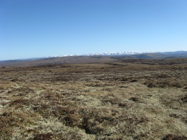
Carn an Uillt Bhric is a prominent hill located in Nairnshire, Scotland. Situated in the eastern part of the country, it is part of the stunning landscape of the Scottish Highlands. With an elevation of approximately 535 meters (1,755 feet), it is classified as a Corbett, which refers to a hill in Scotland with a height between 2,500 and 3,000 feet.

The hill is characterized by its distinctive shape and rugged terrain. It features a steep and rocky slope, covered in heather and grasses, which adds to its scenic beauty. The summit offers breathtaking panoramic views of the surrounding countryside, including the Moray Firth and the nearby hills and mountains.

Carn an Uillt Bhric is a popular attraction for outdoor enthusiasts and hikers. There are various routes to reach the summit, each providing a unique and rewarding experience. The hill is accessible year-round, although caution is advised during winter months due to potentially challenging weather conditions.

Wildlife enthusiasts will also find interest in Carn an Uillt Bhric. The hill is home to a variety of species, including red deer, mountain hares, and various bird species.

Overall, Carn an Uillt Bhric offers visitors a chance to immerse themselves in the natural beauty of the Scottish Highlands. Its stunning views, rugged landscape, and abundant wildlife make it a must-visit destination for nature lovers and outdoor adventurers alike.

If you have any feedback on the listing, please let us know in the comments section below.

Carn an Uillt Bhric Images

Images are sourced within 2km of 57.426975/-3.9369197 or Grid Reference NH8339. Thanks to Geograph Open Source API. All images are credited.

Carn nan Tri-tighearnan (trig point) The trig point on the summit of Carn nan Tri-tighearnan.
Carn nan Tri-tighearnan (trig point)
The trig point on the summit of Carn nan Tri-tighearnan.
Ford, Allt Breac On an estate track near Drynachan.
Ford, Allt Breac
On an estate track near Drynachan.
Landslip, Allt Breac On the north side of the burn below Carn an Uillt Bhric.
Landslip, Allt Breac
On the north side of the burn below Carn an Uillt Bhric.
Moorland east of Carn an Uillt Bhric On Cawdor Estate.
Moorland east of Carn an Uillt Bhric
On Cawdor Estate.
Slopes of Carn an Uillt Bhric The eastern side of the hill.
Slopes of Carn an Uillt Bhric
The eastern side of the hill.
A new estate track This track comes up from Drynachan Lodge to Carn an Uillt Bhric.
A new estate track
This track comes up from Drynachan Lodge to Carn an Uillt Bhric.
A new estate track above Daless Looking along the River Findhorn.
A new estate track above Daless
Looking along the River Findhorn.
Moorland east of Carn an Uillt Bhric A gradual slope of heather, moss and lichen.
Moorland east of Carn an Uillt Bhric
A gradual slope of heather, moss and lichen.
A new track below Carn an Uillt Bhric This track goes from Drynachan Lodge up the south side of the hill.
A new track below Carn an Uillt Bhric
This track goes from Drynachan Lodge up the south side of the hill.
Ruins of Ballaggan Remains of enclosures, a steading and a house west of the River Findhorn.
Ruins of Ballaggan
Remains of enclosures, a steading and a house west of the River Findhorn.
Moorland south of Cnoc a' Chinn Leith Looking across unnamed tributaries of Ballaggan Burn.
Moorland south of Cnoc a' Chinn Leith
Looking across unnamed tributaries of Ballaggan Burn.
Slopes south of Cnoc a' Chinn Leith Looking across an unnamed tributary of Ballaggan Burn towards An Seileach.
Slopes south of Cnoc a' Chinn Leith
Looking across an unnamed tributary of Ballaggan Burn towards An Seileach.
Tracks and fords, Ballaggan Burn Cawdor Estate tracks near the ruins of Ballaggan.
Tracks and fords, Ballaggan Burn
Cawdor Estate tracks near the ruins of Ballaggan.
Bell heather flowering above the River Findhorn Heather is starting to flower early this year, after some very dry weather.
Bell heather flowering above the River Findhorn
Heather is starting to flower early this year, after some very dry weather.
South side of Carn nan Tri-tighearnan A glorious Good Friday with extensive views in all directions and the feeling of a "big" sky. Looking south towards the snow covered Cairngorm Mountains.
South side of Carn nan Tri-tighearnan
A glorious Good Friday with extensive views in all directions and the feeling of a "big" sky. Looking south towards the snow covered Cairngorm Mountains.
Bogs, Carn Tri-tighearnan Near the summit of Carn Tri-tighearnan, a vast peaty plateau. Often the ground is dry with cladonia lichen, but other areas are tough going on dissected peat, a maze of mucky channels and steep banks.
Bogs, Carn Tri-tighearnan
Near the summit of Carn Tri-tighearnan, a vast peaty plateau. Often the ground is dry with cladonia lichen, but other areas are tough going on dissected peat, a maze of mucky channels and steep banks.
Carn an Uillt Bhric Carn Tri-tighearnan has two trig pillars close together. This one is on Carn an Uillt Bhric, a dry area of plateau covered in crisp reindeer moss.
Carn an Uillt Bhric
Carn Tri-tighearnan has two trig pillars close together. This one is on Carn an Uillt Bhric, a dry area of plateau covered in crisp reindeer moss.
Carn nan Tri-tighearnan trig
Show me another place!

Carn an Uillt Bhric is located at Grid Ref: NH8339 (Lat: 57.426975, Lng: -3.9369197)

Unitary Authority: Highland

Police Authority: Highlands and Islands

What 3 Words

///primed.florists.alienated. Near Balloch, Highland

Nearby Locations

Carn an Uillt Bhric

Related Wikis

Inverness, Nairn, Badenoch and Strathspey (UK Parliament constituency)

Inverness, Nairn, Badenoch and Strathspey is a constituency of the House of Commons of the UK Parliament. As with all seats since 1950 it elects one Member...
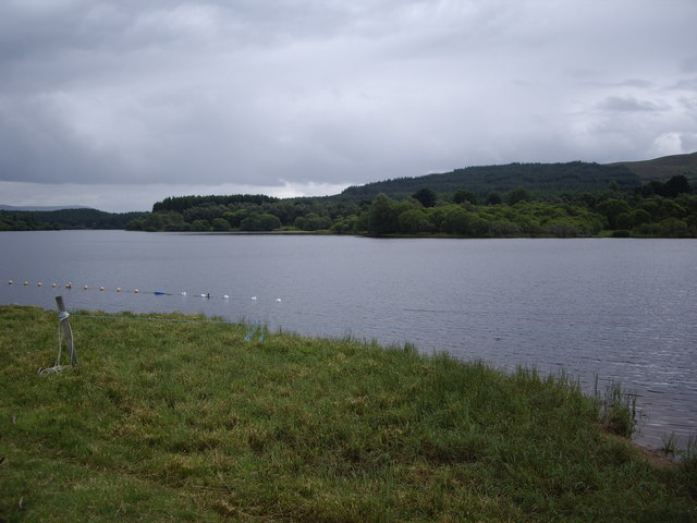
Loch Moy

Loch Moy (from the Scottish Gaelic Loch A'Mhoigh meaning the Loch of the Plain) is a freshwater loch beside the village of Moy near Inverness in the Scottish...

Balvraid

Balvraid (Scottish Gaelic: Baile a' Bhràghaid) is a small remote settlement, located 8 miles south east of Inverness in Inverness-shire, Scottish Highlands...

Moy Hall

Moy Hall near the village of Moy, south of Inverness, is the home of the chiefs of the Clan Mackintosh, a Highland Scottish clan. == History == The original...

Moy, Highland

The village of Moy (Scottish Gaelic: A' Mhòigh) is situated between the villages of Daviot and Tomatin, in the Highland region of Scotland. It sits beside...

Dun Evan

Dun Evan or the Doune of Cawdor is a hill fort located 2.5 kilometres (1.6 mi) south west of Cawdor in the Highland area of Scotland. It is situated on...

Moy railway station

Moy railway station served in the village of Moy, Highland, Scotland from 1897 to 1965 on the Inverness and Aviemore Direct Railway. == History == The...
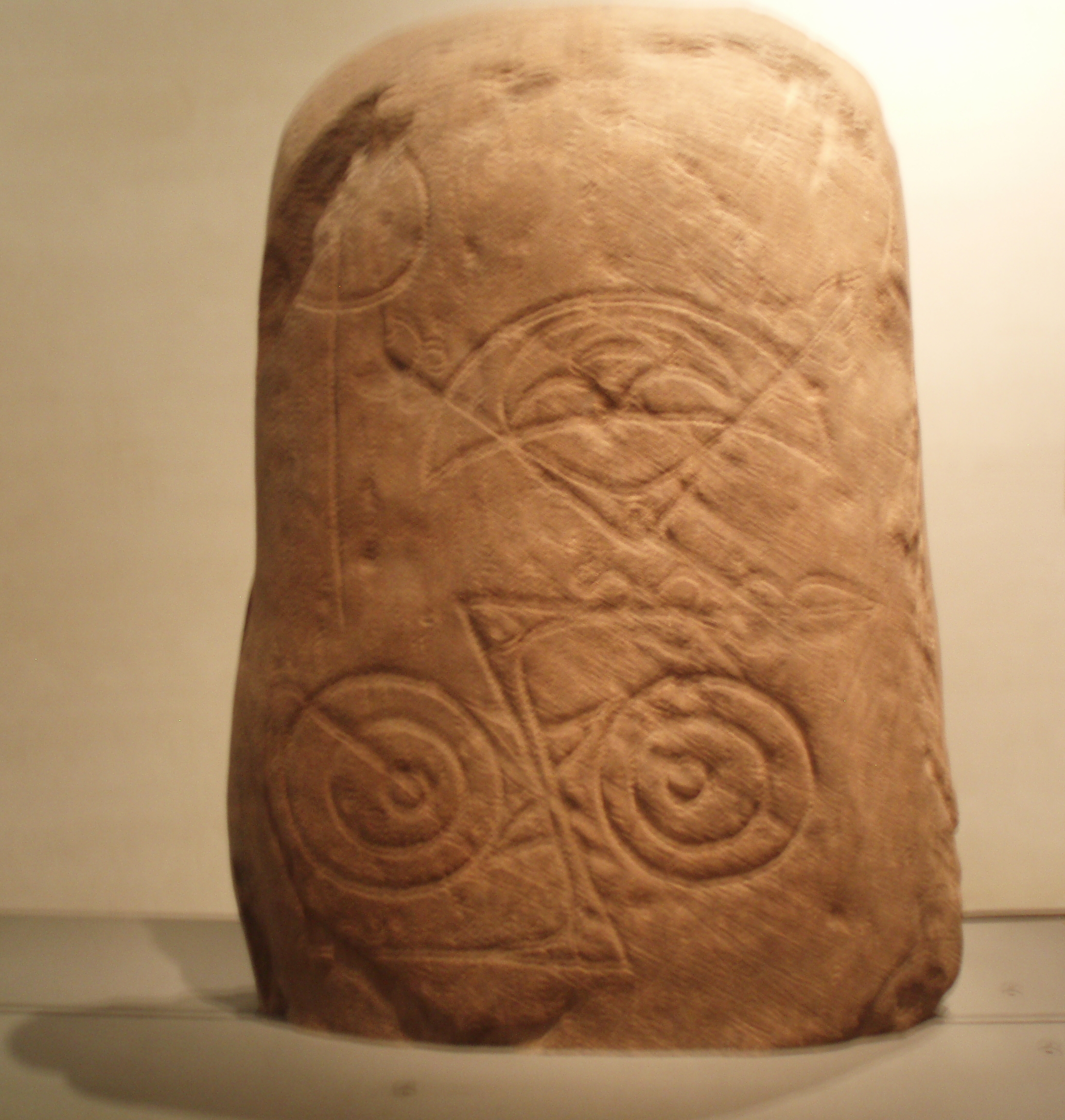
Invereen Stone

The Invereen Stone is a Class I incised Pictish stone that was unearthed near Invereen, Inverness in 1932. It is now on display at the National Museums...

Have you been to Carn an Uillt Bhric?

Leave your review of Carn an Uillt Bhric below (or comments, questions and feedback).