An Sguabach

Hill, Mountain in Inverness-shire

Scotland

An Sguabach

Geall-charn Mor The trig point and windshelter on the summit of Geall-charn Mor (NH 83637 12320)
Geall-charn Mor Credit: Raibeart MacAoidh

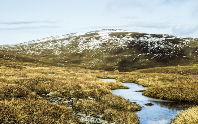
An Sguabach is a prominent hill located in Inverness-shire, Scotland. It lies approximately 5 miles north of the town of Newtonmore, within the Cairngorms National Park. The hill is part of a range called the Monadhliath Mountains, which is renowned for its rugged beauty and diverse wildlife.

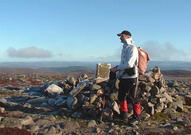
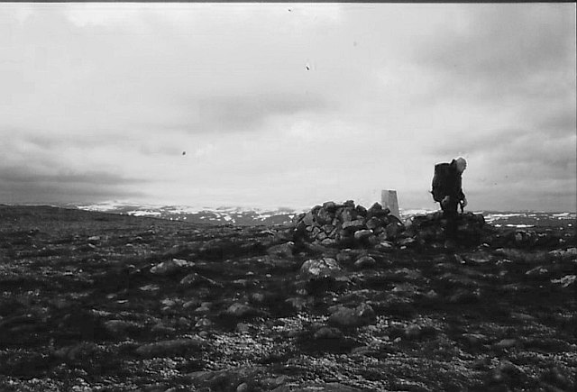
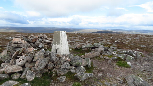
Standing at an elevation of 805 meters (2641 feet), An Sguabach offers stunning panoramic views of the surrounding landscape. On a clear day, visitors can enjoy breathtaking vistas of the Cairngorms, the Spey Valley, and the famous Loch Ness. The hill is a popular spot for hiking and hillwalking enthusiasts, with several well-marked trails leading to its summit.

An Sguabach is characterized by its steep slopes, rocky terrain, and heather-covered moorland. The hill is also home to a variety of plant and animal species, making it an important site for nature conservation. Rare birds such as the golden eagle and the ptarmigan can be spotted, along with various species of deer and mountain hares.

Due to its remote location, An Sguabach offers a peaceful and secluded environment for outdoor enthusiasts seeking solitude and tranquility. However, it is important to note that the terrain can be challenging, especially during inclement weather conditions. Visitors are advised to come well-prepared with appropriate clothing, maps, and navigation equipment.

In summary, An Sguabach is a magnificent hill in Inverness-shire, Scotland, offering breathtaking views, diverse wildlife, and an invigorating outdoor experience for those who venture to explore its slopes.

If you have any feedback on the listing, please let us know in the comments section below.
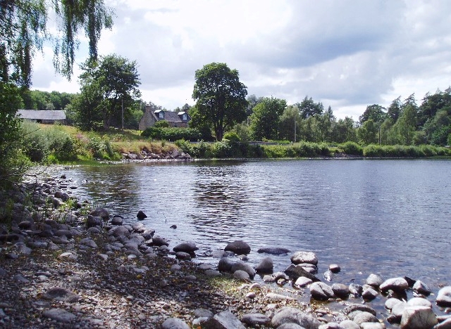
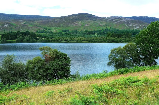
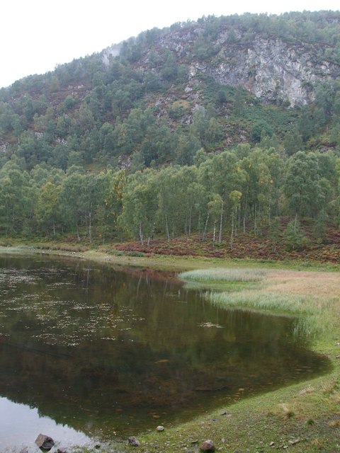
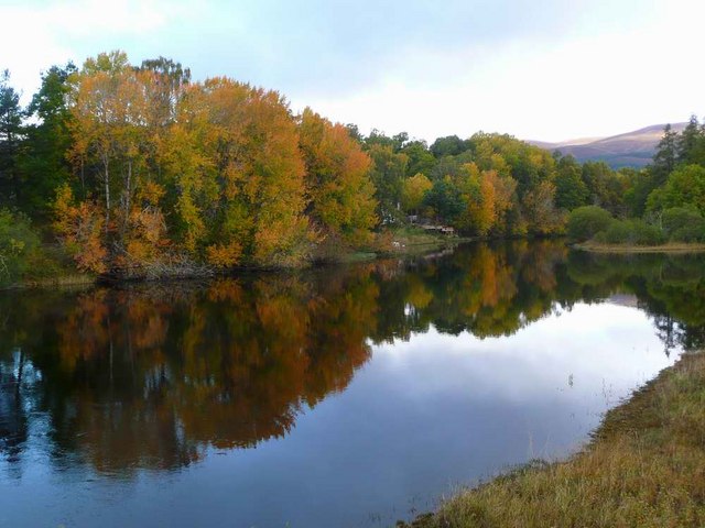
An Sguabach Images

Images are sourced within 2km of 57.173558/-3.9245168 or Grid Reference NH8310. Thanks to Geograph Open Source API. All images are credited.

Geall-charn Mor The trig point and windshelter on the summit of Geall-charn Mor (NH 83637 12320)
Geall-charn Mor
The trig point and windshelter on the summit of Geall-charn Mor (NH 83637 12320)
Geall-charn Mor The trig point and windshelter on the summit of Geall-charn Mor (NH 83637 12320)
Geall-charn Mor
The trig point and windshelter on the summit of Geall-charn Mor (NH 83637 12320)
Trig point, Geal-charn Mòr
Eastern slopes of Geal-charn Mòr Remnants of a temperature inversion fill Strath Spey with low cloud.
Eastern slopes of Geal-charn Mòr
Remnants of a temperature inversion fill Strath Spey with low cloud.
Boulders north of Carn nan Suilean Dubha Looking towards the NW ridge of Geal-charn Mor
Boulders north of Carn nan Suilean Dubha
Looking towards the NW ridge of Geal-charn Mor
Old gateposts on Carn nan Suilean Dubha On the line of an old fence at the top of the hill.
Old gateposts on Carn nan Suilean Dubha
On the line of an old fence at the top of the hill.
Track on Carn nan Suilean Dubha On the SE side of the hill.  The track goes further than shown on the map, ending on the north side of the hill.
Track on Carn nan Suilean Dubha
On the SE side of the hill. The track goes further than shown on the map, ending on the north side of the hill.
Summit, Geal-charn Mòr Ascent via the Burma Road.
Summit, Geal-charn Mòr
Ascent via the Burma Road.
Summit of Geal-charn Mòr under snow A mountain walker at the trig point of Geal-charn Mòr. There's a small tripod on the trig's top - obviously not used in the making of this image!
Sunlit Cairngorms are in the distance.
Summit of Geal-charn Mòr under snow
A mountain walker at the trig point of Geal-charn Mòr. There's a small tripod on the trig's top - obviously not used in the making of this image! Sunlit Cairngorms are in the distance.
Snow-clogged streak of water at col The pool is at the col between Geal-charn Mòr and Creag Ghleannain with Carn Dearg Mòr being the snow-capped hill.
Snow-clogged streak of water at col
The pool is at the col between Geal-charn Mòr and Creag Ghleannain with Carn Dearg Mòr being the snow-capped hill.
Trig Point on Geal-charn Mor The summit was so windy you could hardly stand up.
Trig Point on Geal-charn Mor
The summit was so windy you could hardly stand up.
Cyclists on path descending from Geal-charn Mor towards Ballinluig
Path leading down to Ballinluig & view to Loch Alvie
Geal-charn Mòr
Geal-charn Mòr
Rough ground south east of Geal-charn Mòr
Road, Carn nan Sùilean Dubha The infertile and exposed granite  ridge has little soil and the road is merely made of vehicle tracks on the bedrock.
Road, Carn nan Sùilean Dubha
The infertile and exposed granite ridge has little soil and the road is merely made of vehicle tracks on the bedrock.
Summit, Carn nan Sùilean Dubha Granite gravels and an Alvie Estate road.
Summit, Carn nan Sùilean Dubha
Granite gravels and an Alvie Estate road.
A long lost gate Gateposts survive, one a summit candidate for Carn nan Sùilean Dubha. The mapped fence has long since been demolished.
A long lost gate
Gateposts survive, one a summit candidate for Carn nan Sùilean Dubha. The mapped fence has long since been demolished.
Show me another place!

An Sguabach is located at Grid Ref: NH8310 (Lat: 57.173558, Lng: -3.9245168)

Unitary Authority: Highland

Police Authority: Highlands and Islands

What 3 Words

///cure.clash.afterglow. Near Aviemore, Highland

Nearby Locations

An Sguabach

Related Wikis

Alvie

Alvie (Scottish Gaelic: Albhaidh) is a small crofting hamlet, a working Scottish highland estate and civil parish, located on the south shore of Loch Alvie...

Loch Alvie

Loch Alvie is a loch located north of the River Spey, in the civil parish of Alvie, in the council area of Highland, Scotland. The loch is about two miles...

River Feshie

The River Feshie (Scottish Gaelic: Fèisidh / Abhainn Fhèisidh) is a major right bank tributary of the River Spey in north-east Scotland. It rises in the...

Monadhliath Mountains

The Monadhliath Mountains , or Monadh Liath, are a range of mountains in Scotland. Monadh Liath is Scottish Gaelic, and means "grey mountain range". Running...

Craigellachie National Nature Reserve

Craigellachie (Scottish Gaelic: Chreag Eileachaidh) is a hill lying to the west of the village of Aviemore in Strathspey, in the central Highlands of Scotland...

Kincraig

Kincraig (Scottish Gaelic: Ceann na Creige) is a village located north of Kingussie and south of Aviemore in Highland, Scotland. Its original name was...

Kincraig railway station

Kincraig railway station served the village of Kincraig, Highland, Scotland from 1863 to 1965 on the Inverness and Perth Junction Railway. == History... ==

Dalnavert, Highland

Dalnavert (Scottish Gaelic Dail nam Feart) is a small rural hamlet, that lies 4 miles northeast of Insh, and 8 miles northeast of Kingussie, in the...

Nearby Amenities

Located within 500m of 57.173558,-3.9245168
An Sguabach
Ele: 751
Natural: peak
Source: OS7
Lat/Long: 57.1724424/-3.9229672
The data included in this document is from www.openstreetmap.org. The data is made available under ODbL.

Have you been to An Sguabach?

Leave your review of An Sguabach below (or comments, questions and feedback).