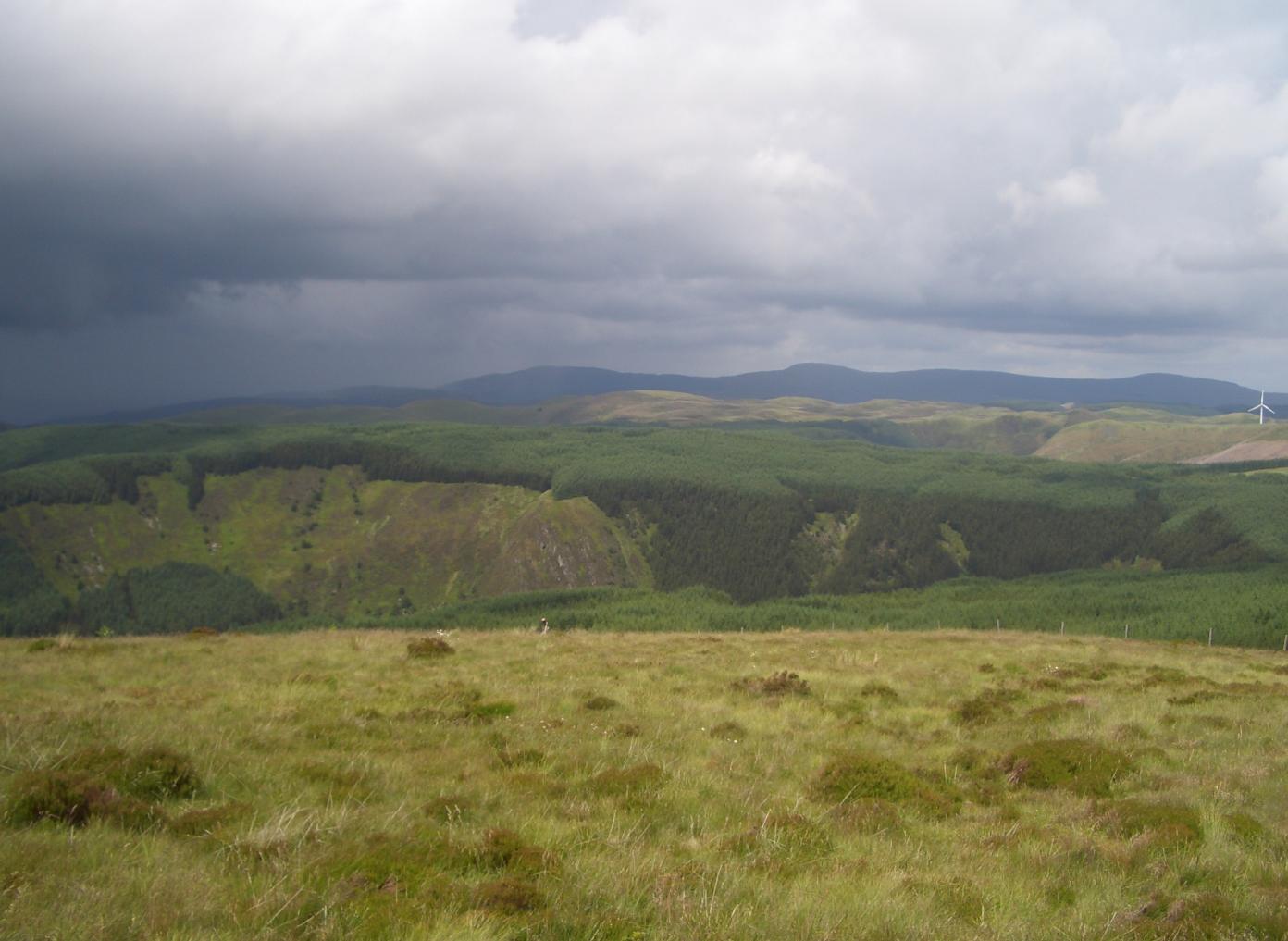
Bryn Rhudd

Hill, Mountain in Cardiganshire

Wales

Bryn Rhudd

Disused Quarry at Bryn-du
Disused Quarry at Bryn-du Credit: Jonathan Clitheroe

The requested URL returned error: 429 Too Many Requests

If you have any feedback on the listing, please let us know in the comments section below.

Bryn Rhudd Images

Images are sourced within 2km of 52.390178/-3.7204176 or Grid Reference SN8378. Thanks to Geograph Open Source API. All images are credited.

Disused Quarry at Bryn-du
Nant Rhys on a frosty morning A basic shelter maintained by volunteers of the Mountain Bothies Association with permission of the landowner. The blocked up window in this photograph has since been opened up again.
Nant Rhys on a frosty morning
A basic shelter maintained by volunteers of the Mountain Bothies Association with permission of the landowner. The blocked up window in this photograph has since been opened up again.
The mountain track by Nant Troed-y-rhiw
The grassy valley of Nant Troed-y-rhiw
Moorland on the slopes of Yr Allt
The edge of the Diliw forest
The track above Lluest-dolgwiail
The track down to the bridge across Afon Diliw
Looking west to the bridge over Afon Diliw
A line of turbines beyond the Nant y Gaseg
National Cycle Network Route 818 This section of NCN 818 is rather eroded and would suit a mountain bike much better than a road bike.
National Cycle Network Route 818
This section of NCN 818 is rather eroded and would suit a mountain bike much better than a road bike.
Wind Turbines and Service Road Pictured from the north east corner of the square.
Wind Turbines and Service Road
Pictured from the north east corner of the square.
Wind Turbine at Banc Nant-rhys This is the most southerly in a chain of six turbines high on the mid-Wales moors. Each strategically placed group of generators form part of the 39 mast-strong Cefn Croes Wind Farm.
Wind Turbine at Banc Nant-rhys
This is the most southerly in a chain of six turbines high on the mid-Wales moors. Each strategically placed group of generators form part of the 39 mast-strong Cefn Croes Wind Farm.
Forestry and Wind Turbines at Rhos Grafiaullwynog Upland scene pictured from a forestry track on a sunny July afternoon. A rapidly changing landscape of coniferous tree felling and regrowth characterises this grid square.
Forestry and Wind Turbines at Rhos Grafiaullwynog
Upland scene pictured from a forestry track on a sunny July afternoon. A rapidly changing landscape of coniferous tree felling and regrowth characterises this grid square.
Woodland Track at Nant Rhys
IMBA UK Trans Cambrian Way Wild camp on Ffos Gau above the Cwmystwyth valley
IMBA UK Trans Cambrian Way
Wild camp on Ffos Gau above the Cwmystwyth valley
Nant Rhys bothy Owned by Forest Enterprise and operated by the Mountain Bothies Association.
Nant Rhys bothy
Owned by Forest Enterprise and operated by the Mountain Bothies Association.
Signs on the door Nant Rhys bothy
Signs on the door
Nant Rhys bothy
Show me another place!

Bryn Rhudd is located at Grid Ref: SN8378 (Lat: 52.390178, Lng: -3.7204176)

Unitary Authority: Ceredigion

Police Authority: Dyfed Powys

What 3 Words

///gifted.clapper.stubborn. Near Cwmystwyth, Ceredigion

Nearby Locations

Bryn Rhudd

Related Wikis

Cefn Croes Wind Farm

Cefn Croes is a wind farm in Ceredigion, Wales. It is located in the Cambrian Mountains on Cefn Croes mountain, 573m (1,880 ft) south of the A44 road between...

Pen y Garn

Pen y Garn (head of the cairn) is a mountain in the Cambrian Mountains, Mid Wales standing at 611 metres above sea level. Pen y Garn tops a 500–600 m high...

Mwyngloddfa Cwmystwyth

Mwyngloddfa Cwmystwyth is a Site of Special Scientific Interest in Ceredigion, west Wales. It comprises old mine workings located in the upper Ystwyth...

Y Glog (mountain)

Y Glog or Draws Drum is a mountain situated in Ceredigion, Wales. It stands at an elevation of 574 metres (1883 feet) above sea level and is located a...

Nearby Amenities

Located within 500m of 52.390178,-3.7204176
Generator Method: wind_turbine
Generator Output Electricity: 1.5 MW
Generator Source: wind
Generator Type: horizontal_axis
Power: generator
Source: Bing
Lat/Long: 52.3927959/-3.7208781
Generator Method: wind_turbine
Generator Output Electricity: 1.5 MW
Generator Source: wind
Generator Type: horizontal_axis
Power: generator
Source: Bing
Lat/Long: 52.3909103/-3.7207493
Generator Output Electricity: 1.5 MW
Generator Source: wind
Generator Type: horizontal_axis
Power: generator
Source: Bing
Lat/Long: 52.3875513/-3.7156317
Generator Method: wind_turbine
Generator Output Electricity: 1.5 MW
Generator Source: wind
Generator Type: horizontal_axis
Power: generator
Source: Bing
Lat/Long: 52.3941053/-3.721951
Generator Method: wind_turbine
Generator Output Electricity: 1.5 MW
Generator Source: wind
Generator Type: horizontal_axis
Power: generator
Source: Bing
Lat/Long: 52.3892275/-3.7208995
The data included in this document is from www.openstreetmap.org. The data is made available under ODbL.

Have you been to Bryn Rhudd?

Leave your review of Bryn Rhudd below (or comments, questions and feedback).