Black Hill

Hill, Mountain in Stirlingshire

Scotland

Black Hill

Pitch n' put at Airthrey Castle
Pitch n' put at Airthrey Castle Credit: Alan Reid

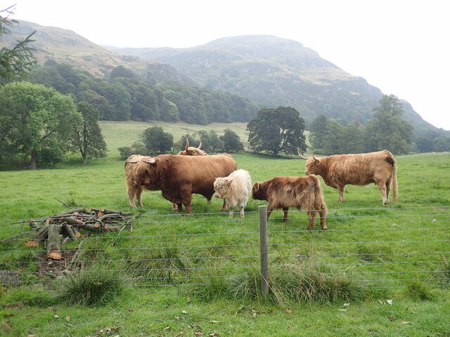
Black Hill is a prominent hill situated in the Stirlingshire region of Scotland. With its summit reaching an elevation of 729 meters (2,392 feet), it is widely recognized as one of the most notable hills in the area. As part of the Campsie Fells, a range of hills located between the cities of Glasgow and Stirling, Black Hill stands as a distinctive landmark within the picturesque Scottish countryside.

The hill's name, Black Hill, can be attributed to the dark-colored vegetation covering its slopes, which gives it a distinct appearance. Its distinctiveness is further enhanced by the presence of rocky outcrops and crags that dot its landscape. The hill offers stunning panoramic views of the surrounding countryside, including the Campsie Glen, the Carron Valley, and the Lowlands.

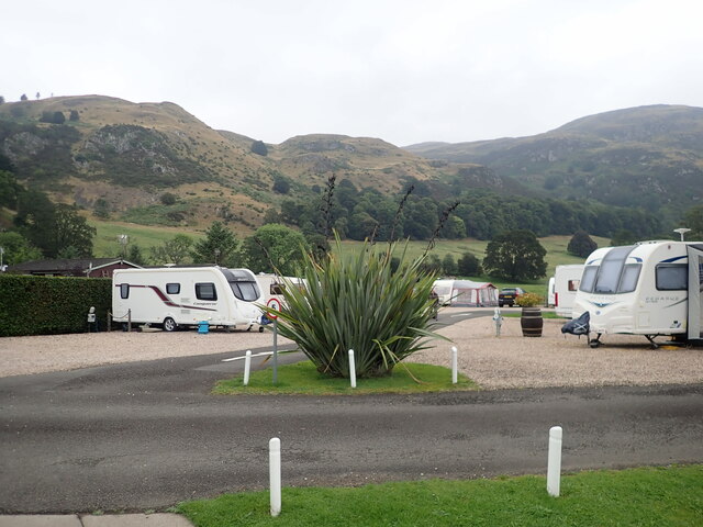
Black Hill is a popular destination for outdoor enthusiasts, hikers, and nature lovers. There are several well-marked trails and footpaths that lead to the summit, offering varying levels of difficulty and scenic routes for different skill levels. The hill's accessibility and proximity to nearby urban areas make it a favored spot for locals and tourists alike.

The diverse flora and fauna found on Black Hill provide a rich biodiversity to explore. The hill is home to a variety of bird species, including raptors such as buzzards and kestrels, making it a haven for birdwatchers. Additionally, the hill's heather-covered slopes attract a range of insects, butterflies, and wildflowers, adding to its natural beauty.

Overall, Black Hill in Stirlingshire is a captivating destination that combines breathtaking views, diverse wildlife, and a range of outdoor activities, making it an ideal spot for those seeking to immerse themselves in the natural wonders of Scotland.

If you have any feedback on the listing, please let us know in the comments section below.

Black Hill Images

Images are sourced within 2km of 56.159741/-3.9195435 or Grid Reference NS8098. Thanks to Geograph Open Source API. All images are credited.

Pitch n' put at Airthrey Castle
Path on Dumyat A steep path from the car park at Blairlogie through woodland to the open moorland.
Path on Dumyat
A steep path from the car park at Blairlogie through woodland to the open moorland.
Highland family Iconic highland cattle near the Witches Craig Caravan Site
Highland family
Iconic highland cattle near the Witches Craig Caravan Site
Witches Craig Caravan & Camping Park Just outside Stirling
Witches Craig Caravan & Camping Park
Just outside Stirling
Old milestone Just west of the traffic island on the A91 at Logie Kirk is a milestone.   Searched for in autumn 2021 but not found.  But there it is, just visible before the Spring growth in April 2022.   Logie Kirk is behind the trees bordering the field.
Old milestone
Just west of the traffic island on the A91 at Logie Kirk is a milestone. Searched for in autumn 2021 but not found. But there it is, just visible before the Spring growth in April 2022. Logie Kirk is behind the trees bordering the field.
Old milestone A closer view of the 'hidden' milestone near Logie Kirk roundabout.   Compare with the much older photo <a href="https://www.geograph.org.uk/photo/6047616">NS8196 : Old Milestone by the A91, Logie Kirk, Logie Parish</a>.   It is adjacent to a Telephone cover in the path.  For benchmark enthusiasts a pin and benchmark can just be made out at the top of the bevel.   It may once have had Dollar 9½ painted on the left-hand side and Stirling 3 on the right.
Old milestone
A closer view of the 'hidden' milestone near Logie Kirk roundabout. Compare with the much older photo NS8196 : Old Milestone by the A91, Logie Kirk, Logie Parish. It is adjacent to a Telephone cover in the path. For benchmark enthusiasts a pin and benchmark can just be made out at the top of the bevel. It may once have had Dollar 9½ painted on the left-hand side and Stirling 3 on the right.
Faint path on the southern side of Dumyat As an alternative to the short walk up Dumyat from the Sheriffmuir road, the hill can be climbed from close to sea level at the foot of its southern slopes. A path can be followed from the Blairlogie car park steeply through woods and then through this area, passing through an old gate, and eventually on to the main path on the crest of the hill.
Faint path on the southern side of Dumyat
As an alternative to the short walk up Dumyat from the Sheriffmuir road, the hill can be climbed from close to sea level at the foot of its southern slopes. A path can be followed from the Blairlogie car park steeply through woods and then through this area, passing through an old gate, and eventually on to the main path on the crest of the hill.
Path in University of Stirling
Boundary stones The triangle formed by these three stones marks the junction of the ancient Clackmannan, Perthshire, and Stirlingshire county boundaries. The stones are set upright edge to edge, each stone measuring 0.6m by 0.05m by 1.0m high and with each face pointing to the three counties.
Boundary stones
The triangle formed by these three stones marks the junction of the ancient Clackmannan, Perthshire, and Stirlingshire county boundaries. The stones are set upright edge to edge, each stone measuring 0.6m by 0.05m by 1.0m high and with each face pointing to the three counties.
A9 southbound
A9 southbound
Overhanging oak
Overhanging oak
View across the lake
Chalton Road, Bridge of Allan
Sheriffmuir Road
Sheriffmuir Road
No through road to Pendreich
Stirling University entrance Viewed on a bright but chilly November morning.
Stirling University entrance
Viewed on a bright but chilly November morning.
Grassland west of Blairlogie The land is used as pasture for sheep.
Grassland west of Blairlogie
The land is used as pasture for sheep.
Construction of the Beuly-Denny power line These pylons have been recently constructed and the power cables are in the process of being strung between them.  Temporary roads have been constructed to provide access to the pylons.  These are planned to be removed once construction is complete.
Construction of the Beuly-Denny power line
These pylons have been recently constructed and the power cables are in the process of being strung between them. Temporary roads have been constructed to provide access to the pylons. These are planned to be removed once construction is complete.
Show me another place!

Black Hill is located at Grid Ref: NS8098 (Lat: 56.159741, Lng: -3.9195435)

Unitary Authority: Stirling

Police Authority: Forth Valley

What 3 Words

///zinc.sensible.slid. Near Bridge of Allan, Stirling

Related Wikis

Scottish Political Archive

The Scottish Political Archive (SPA) is located within the University of Stirling and was founded in 2010. The archive is made up of several collections...
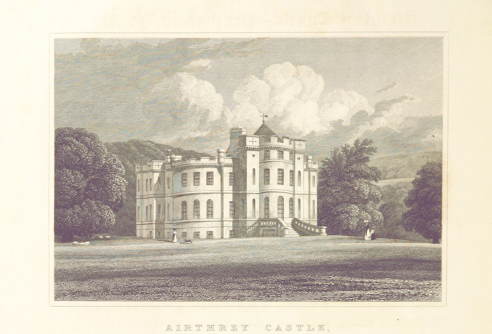
Airthrey Castle

Airthrey Castle is a historic building and estate which now forms part of the buildings and grounds of the University of Stirling in central Scotland....

Bridge of Allan

Bridge of Allan (Scots: Brig Allan, Scottish Gaelic: Drochaid Ailein), also known colloquially as Bofa, is a town in the Stirling council area in Scotland...

Stirling University W.F.C.

Stirling University Womens Football Club is a women's football club that play in the Scottish Women's Premier League, the top division of women's football...

Nearby Amenities

Located within 500m of 56.159741,-3.9195435
Barrier: kissing_gate
Lat/Long: 56.1621065/-3.9171905
Design: barrel
Power: tower
Lat/Long: 56.1587461/-3.9123935
Design: barrel
Power: tower
Lat/Long: 56.1605176/-3.9143354
The data included in this document is from www.openstreetmap.org. The data is made available under ODbL.

Have you been to Black Hill?

Leave your review of Black Hill below (or comments, questions and feedback).