Black Hill

Hill, Mountain in Somerset Somerset West and Taunton

England

Black Hill

Oareford Farm over the bridge
Oareford Farm over the bridge Credit: Peter Turner

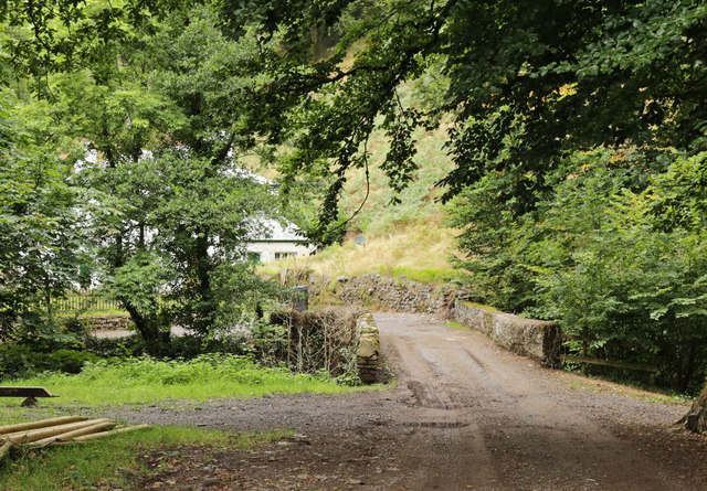
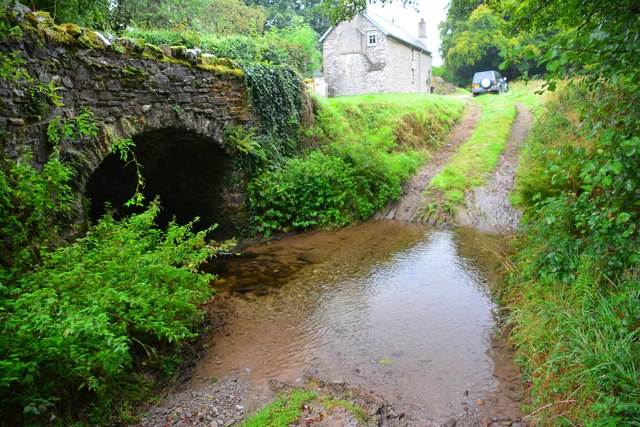
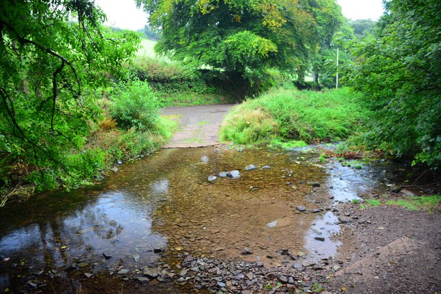
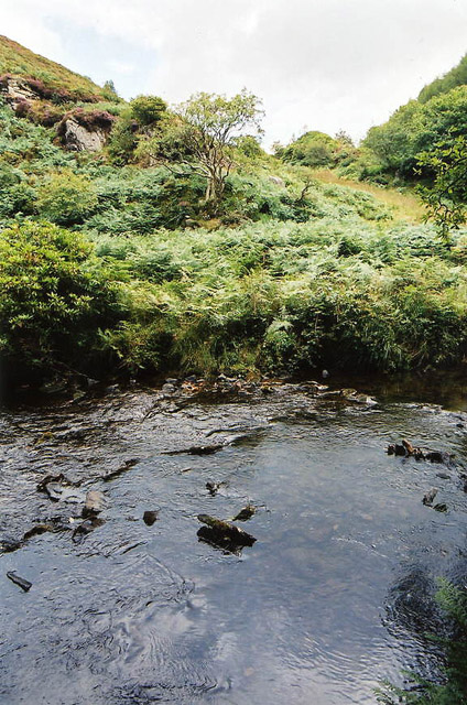
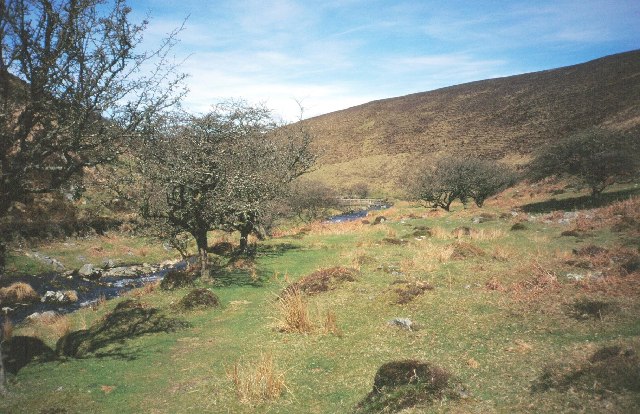
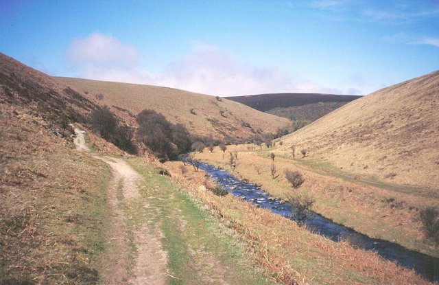
Black Hill is a prominent hill located in the county of Somerset, England. With an elevation of approximately 382 meters (1253 feet), it forms part of the Quantock Hills, a designated Area of Outstanding Natural Beauty. The hill is situated near the village of Holford, about 14 kilometers (8.7 miles) west of Bridgwater.

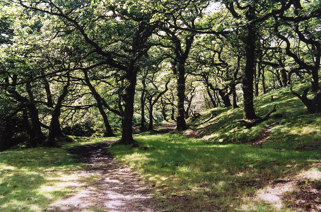
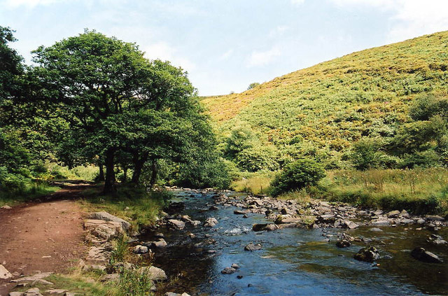
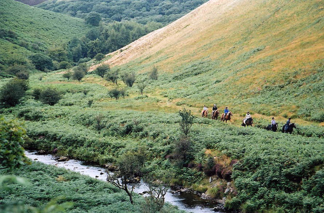
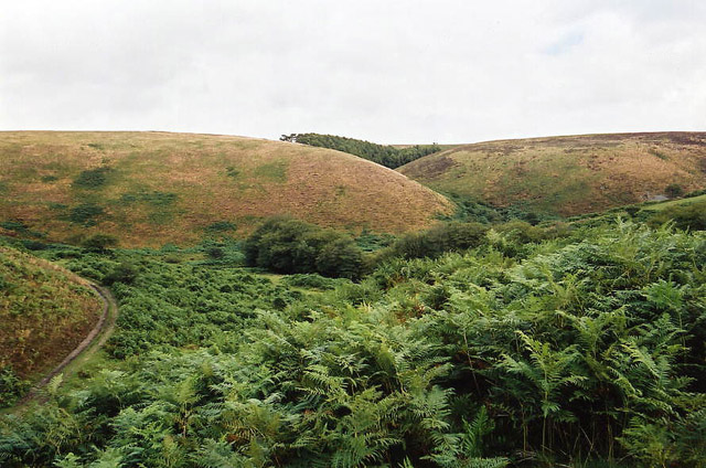
Black Hill offers breathtaking panoramic views of the surrounding countryside, making it a popular destination for hikers and nature enthusiasts. Its distinctive dark-colored soil, from which it derives its name, stands out against the lush greenery of the area. The hill is covered in a variety of vegetation, including heather, gorse, and bracken, adding to its scenic beauty.

The hill is home to a diverse range of wildlife, including birds such as buzzards, kestrels, and skylarks, as well as various small mammals like rabbits and foxes. Rare species of butterflies, such as the silver-spotted skipper, can also be spotted in the area.

Black Hill offers a network of footpaths and bridleways, allowing visitors to explore its stunning landscapes and discover its hidden gems. The hill is easily accessible, with car parks located nearby, and is well-connected to the wider Quantock Hills trail system.

In summary, Black Hill in Somerset is a picturesque hill within the Quantock Hills, featuring stunning views, diverse flora and fauna, and a range of walking trails for visitors to enjoy.

If you have any feedback on the listing, please let us know in the comments section below.

Black Hill Images

Images are sourced within 2km of 51.188081/-3.7073604 or Grid Reference SS8044. Thanks to Geograph Open Source API. All images are credited.

Oareford Farm over the bridge
Oareford Ford This ford is found at Oareford a short distance from Robber's Bridge Ford.
Oareford Ford
This ford is found at Oareford a short distance from Robber's Bridge Ford.
Oareford Ford This is a second ford at Oareford found beside Oareford Farm.
Oareford Ford
This is a second ford at Oareford found beside Oareford Farm.
Ordnance Survey Cut Mark This OS cut mark can be found on the north face of The Cottage. It marks a point 266.753m above mean sea level.
Ordnance Survey Cut Mark
This OS cut mark can be found on the north face of The Cottage. It marks a point 266.753m above mean sea level.
Footpath south of Oareford
The Withy Combe A valley from the south with a stream joining the Weir Water
The Withy Combe
A valley from the south with a stream joining the Weir Water
Long Combe
Long Combe
Moorland above Oareford
Footbridge, Oareford
Kittuck Hill prehistoric stone row A probable double prehistoric stone row measuring 16.7m long, including at least 8 small and medium-sized stones. The row is orientated NNE to SSW, leads from a small robbed cairn and has seen considerable damage since it was first identified in 1932. <span class="nowrap"><a title="https://stonerows.wordpress.com/gazetteer/region/exmoor/kittuck-hill/" rel="nofollow ugc noopener" href="https://stonerows.wordpress.com/gazetteer/region/exmoor/kittuck-hill/">Link</a><img style="margin-left:2px;" alt="External link" title="External link - shift click to open in new window" src="https://s1.geograph.org.uk/img/external.png" width="10" height="10"/></span>
Kittuck Hill prehistoric stone row
A probable double prehistoric stone row measuring 16.7m long, including at least 8 small and medium-sized stones. The row is orientated NNE to SSW, leads from a small robbed cairn and has seen considerable damage since it was first identified in 1932. LinkExternal link
Tom's Hill prehistoric stone row A wide double prehistoric stone row (or avenue) measuring 17.5m long, including 6 medium-sized stones. The row is orientated north to south. <span class="nowrap"><a title="https://stonerows.wordpress.com/gazetteer/region/exmoor/toms-hill/" rel="nofollow ugc noopener" href="https://stonerows.wordpress.com/gazetteer/region/exmoor/toms-hill/">Link</a><img style="margin-left:2px;" alt="External link" title="External link - shift click to open in new window" src="https://s1.geograph.org.uk/img/external.png" width="10" height="10"/></span>
Tom's Hill prehistoric stone row
A wide double prehistoric stone row (or avenue) measuring 17.5m long, including 6 medium-sized stones. The row is orientated north to south. LinkExternal link
Brendon: Badgworthy Wood Woodland on the walk south from Malmsmead to the 'Doone Country', beside Badgworthy Water
Brendon: Badgworthy Wood
Woodland on the walk south from Malmsmead to the 'Doone Country', beside Badgworthy Water
Brendon: Badgworthy Water With the Oare Water, Badgworthy Water combines to form the East Lyn, which meets the West Lyn at Lynmouth. By the path south from Malmsmead
Brendon: Badgworthy Water
With the Oare Water, Badgworthy Water combines to form the East Lyn, which meets the West Lyn at Lynmouth. By the path south from Malmsmead
Brendon: Badgworthy Water Badgworthy Water provides the border between west Somerset and north Devon. Riders on the Somerset bank in Oare parish
Brendon: Badgworthy Water
Badgworthy Water provides the border between west Somerset and north Devon. Riders on the Somerset bank in Oare parish
Brendon: site of medieval village Overlooking the site of a medieval village at the foot of Hoccombe Combe, in 'Doone Country', lost in the bracken
Brendon: site of medieval village
Overlooking the site of a medieval village at the foot of Hoccombe Combe, in 'Doone Country', lost in the bracken
Brendon: Badgworthy Water Looking east to the Somerset bank
Brendon: Badgworthy Water
Looking east to the Somerset bank
Badgworthy Water River, deep in the moor.  Heads north to join the East Lyn.
Badgworthy Water
River, deep in the moor. Heads north to join the East Lyn.
Badgworthy Water The river downstream and north of the medieval village.
Badgworthy Water
The river downstream and north of the medieval village.
Show me another place!

Black Hill is located at Grid Ref: SS8044 (Lat: 51.188081, Lng: -3.7073604)

Administrative County: Somerset

District: Somerset West and Taunton

Police Authority: Avon and Somerset

What 3 Words

///glitz.confusion.hotspots. Near Porlock, Somerset

Nearby Locations

South Common Black Hill

Related Wikis

Oare, Somerset

Oare is a village and civil parish on Oare Water on Exmoor in the Somerset West and Taunton district of Somerset, England. It is located 6 miles (10 km...

North Exmoor SSSI

North Exmoor (grid reference SS800430) is a 12,005.3-hectare (29,666-acre) biological Site of Special Scientific Interest (SSSI) in Devon and Somerset...

Robber's Bridge

Robber's Bridge, or Robbers Bridge, is an old masonry arch bridge in the royal forest of Exmoor near Doone Valley, carrying the minor road from Porlock...

Lanacombe

Lanacombe is an area of Exmoor in Somerset, South West England. It is the site of several standing stones and cairns which have been scheduled as ancient...

Church of St Mary, Oare

The Anglican Church of St Mary in Oare, Somerset, England, was built in the 15th century. It is a Grade II* listed building. == History == The nave and...

Malmsmead Bridge

Malmsmead Bridge is a 17th-century stone bridge which crosses Badgworthy Water in the hamlet of Malmsmead, on the road between Oare and Brendon. The Badgworthy...

Culbone Stone

The Culbone Stone, an early mediaeval standing stone, is close to Culbone in the English county of Somerset. The stone is made from Hangman grit, a local...

Oare Water

Oare Water passes through the village of Oare, on Exmoor in Somerset, England. It joins Badgworthy Water before flowing to Watersmeet and the Bristol Channel...

Nearby Amenities

Located within 500m of 51.188081,-3.7073604
Stowey Allotment
Ele: 406
Natural: peak
Lat/Long: 51.1880621/-3.7071506
The data included in this document is from www.openstreetmap.org. The data is made available under ODbL.

Have you been to Black Hill?

Leave your review of Black Hill below (or comments, questions and feedback).