Auchnafree Craig

Hill, Mountain in Perthshire

Scotland

Auchnafree Craig

Coire nam Fuaran ('corrie of the springs') A grassy corrie on the south-west side of Meall nam Fuaran, sloping down towards Glen Shervie.
Coire nam Fuaran ('corrie of the springs') Credit: Alan O'Dowd

Auchnafree Craig is a prominent hill located in Perthshire, Scotland. Standing at an elevation of 789 meters (2,589 feet), it is known for its picturesque landscapes and stunning views of the surrounding area. Situated in the eastern part of the Grampian Mountains, Auchnafree Craig offers a challenging yet rewarding hike for outdoor enthusiasts.

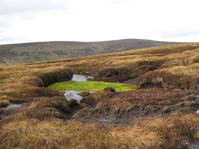
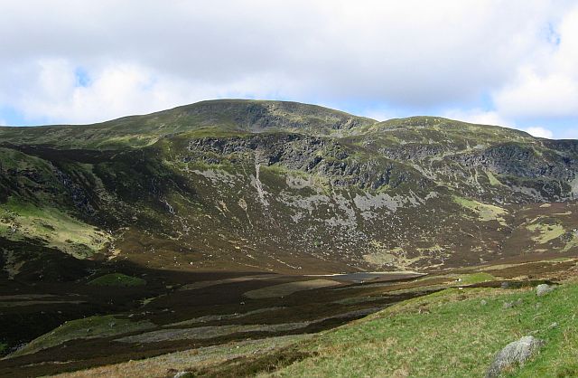
The hill is characterized by its rugged terrain, with steep slopes and rocky outcrops. Its distinctive shape and towering presence make it a notable landmark in the region. As hikers ascend the hill, they are treated to panoramic vistas of the surrounding countryside, including the nearby Loch Turret and the rolling hills of Perthshire.

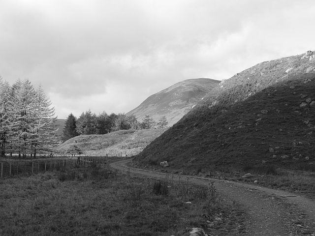
The ascent to Auchnafree Craig begins at the parking area near the town of Comrie, from where a well-marked trail leads up the hill. The hike is of moderate difficulty, requiring a good level of fitness and proper hiking equipment. The trail passes through a mix of heather-clad moorland, rocky sections, and grassy slopes. Along the way, hikers may encounter various species of wildlife, such as red deer, mountain hares, and a variety of bird species.

Reaching the summit of Auchnafree Craig offers a sense of accomplishment and a chance to take in the breathtaking views. On clear days, it is possible to see as far as the Cairngorms National Park to the north and the Trossachs National Park to the south. Whether it is for the challenge of the hike or the beauty of the surroundings, Auchnafree Craig is a must-visit destination for nature lovers and outdoor adventurers in Perthshire.

If you have any feedback on the listing, please let us know in the comments section below.

Auchnafree Craig Images

Images are sourced within 2km of 56.488308/-3.9405274 or Grid Reference NN8034. Thanks to Geograph Open Source API. All images are credited.

Coire nam Fuaran ('corrie of the springs') A grassy corrie on the south-west side of Meall nam Fuaran, sloping down towards Glen Shervie.
Coire nam Fuaran ('corrie of the springs')
A grassy corrie on the south-west side of Meall nam Fuaran, sloping down towards Glen Shervie.
Ascending Auchnafree Craig An image taken on an ascent of Auchnafree Craig from the east.
Ascending Auchnafree Craig
An image taken on an ascent of Auchnafree Craig from the east.
Auchnafree Craig The summit area of Auchnafree Craig - itself rather featureless, but offering outstanding views into Glen Almond, Glen Lochan, and Glen Shervie
Auchnafree Craig
The summit area of Auchnafree Craig - itself rather featureless, but offering outstanding views into Glen Almond, Glen Lochan, and Glen Shervie
View from Auchnafree Craig A view to the east from Auchnafree Craig towards Glen Lochan
View from Auchnafree Craig
A view to the east from Auchnafree Craig towards Glen Lochan
Track near Carn Bad an Fhraoich A track descending into Glen Shervie from Carn Bad an Fhraoich, with the glaciated flank of Auchnafree Craig visible towards the right of the image.
Track near Carn Bad an Fhraoich
A track descending into Glen Shervie from Carn Bad an Fhraoich, with the glaciated flank of Auchnafree Craig visible towards the right of the image.
Glen Shervie A track descending into Glen Shervie from the hills surrounding Meall nan Eanchainn
Glen Shervie
A track descending into Glen Shervie from the hills surrounding Meall nan Eanchainn
Rodent trap Increasing numbers of these appear to be used in grouse shooting areas. The trap is positioned on a plank offering a crossing over a burn - any rodent utilising this is forced to pass over the jaws of the trap. I am not sure which species are the target of these devices. The mesh cover is presumably to protect birds.
Rodent trap
Increasing numbers of these appear to be used in grouse shooting areas. The trap is positioned on a plank offering a crossing over a burn - any rodent utilising this is forced to pass over the jaws of the trap. I am not sure which species are the target of these devices. The mesh cover is presumably to protect birds.
River Almond The river by Larichlaura. The small larch wood was probably planted to supply the estate with timber.
River Almond
The river by Larichlaura. The small larch wood was probably planted to supply the estate with timber.
Larichlaura House in Glen Almond, with Ben Chonzie behind.
Larichlaura
House in Glen Almond, with Ben Chonzie behind.
Glen Almond road The road, now rougher continues up the glen, between the flood plain and some glacial deposits.
Glen Almond road
The road, now rougher continues up the glen, between the flood plain and some glacial deposits.
Burn on Stuck Chapel Craig A small meltwater channel on the plateau occupied by a burn.
Burn on Stuck Chapel Craig
A small meltwater channel on the plateau occupied by a burn.
A mossy burn A small channel on the plateau above Stuck Chapel Craig is occupied by a burn.
A mossy burn
A small channel on the plateau above Stuck Chapel Craig is occupied by a burn.
Plateau above Glen Almond The rolling bog country perched above Glen Almond. The road extends to Meall nan Eanchainn.
Plateau above Glen Almond
The rolling bog country perched above Glen Almond. The road extends to Meall nan Eanchainn.
Butts, Meall nam Broighleag The heathery hills are home to grouse as well as sheep.
Butts, Meall nam Broighleag
The heathery hills are home to grouse as well as sheep.
Meall nam Broighleag The road goes much further than shown on the 1:50 000 maps.
Meall nam Broighleag
The road goes much further than shown on the 1:50 000 maps.
Meall nam Broighleag An road not shown on the 1:50 000 map, but according to the 1:25 000 map runs along the top of Auchnafree Craig.
Meall nam Broighleag
An road not shown on the 1:50 000 map, but according to the 1:25 000 map runs along the top of Auchnafree Craig.
Grouse butt, Meall nam Broighleag A screen for grouse shooting set amongst peat hags. The gun need not fear exercise though, there is a road passing close by.
Grouse butt, Meall nam Broighleag
A screen for grouse shooting set amongst peat hags. The gun need not fear exercise though, there is a road passing close by.
Bog, Meall nam Broighleag Some well watered moss adds colour to a brown scene. The walking here is still very easy though.
Bog, Meall nam Broighleag
Some well watered moss adds colour to a brown scene. The walking here is still very easy though.
Show me another place!

Auchnafree Craig is located at Grid Ref: NN8034 (Lat: 56.488308, Lng: -3.9405274)

Unitary Authority: Perth and Kinross

Police Authority: Tayside

What 3 Words

///printer.squashes.punks. Near Comrie, Perth & Kinross

Nearby Locations

Auchnafree Craig

Related Wikis

Perthshire

Perthshire (locally: ; Scottish Gaelic: Siorrachd Pheairt), officially the County of Perth, is a historic county and registration county in central Scotland...

Stirling (council area)

The Stirling council area (Scots: Stirlin; Scottish Gaelic: Sruighlea) is one of the 32 council areas of Scotland, and has a population of about 93,470...

Ben Chonzie

Ben Chonzie or Ben-y-Hone (Scottish Gaelic: Beinn a' Chomhainn, 'mountain of the narrowness', or possibly from Beinn Chòinnich, 'mossy mountain') is a...

Glen Quaich

Glen Quaich is a glen in Perth and Kinross and is situated almost midway between Crieff and Aberfeldy. The upper reaches of the glen approach Loch Tay...

Nearby Amenities

Located within 500m of 56.488308,-3.9405274
Auchnafree Craig
Place: locality
Lat/Long: 56.4902616/-3.9474056
The data included in this document is from www.openstreetmap.org. The data is made available under ODbL.

Have you been to Auchnafree Craig?

Leave your review of Auchnafree Craig below (or comments, questions and feedback).