Banc Hir

Hill, Mountain in Cardiganshire

Wales

Banc Hir

Cwmystwyth metal mine, disused
Cwmystwyth metal mine, disused Credit: Steven Brown

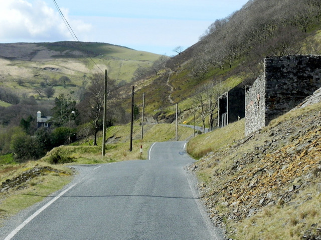
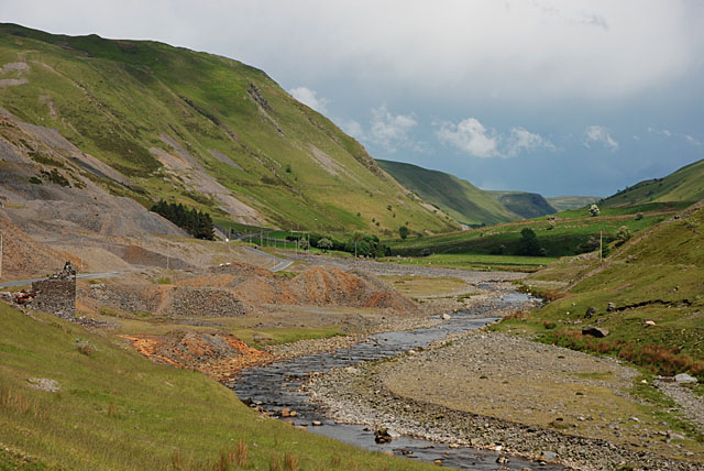
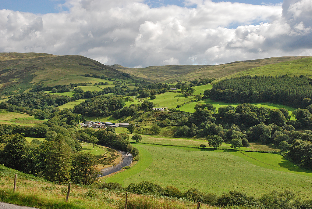
Banc Hir is a prominent hill located in Cardiganshire, Wales. It is situated near the village of Tregaron and is part of the Cambrian Mountains range. The hill stands at an elevation of approximately 1,309 feet (399 meters) above sea level, making it a notable landmark in the surrounding area.

Banc Hir is known for its stunning views of the Welsh countryside, with panoramic vistas stretching out over the rolling hills and valleys below. The hill is popular among hikers and nature enthusiasts, who come to explore its various walking trails and enjoy the peaceful surroundings.

The terrain of Banc Hir is characterized by grassy slopes and rocky outcrops, providing a challenging yet rewarding hiking experience for visitors. The hill is also home to a variety of wildlife, including birds of prey and rare plant species.

Overall, Banc Hir offers a picturesque and tranquil escape for those looking to immerse themselves in the natural beauty of Cardiganshire. Its rugged terrain and breathtaking views make it a must-visit destination for outdoor enthusiasts and nature lovers alike.

If you have any feedback on the listing, please let us know in the comments section below.

Banc Hir Images

Images are sourced within 2km of 52.341836/-3.7550634 or Grid Reference SN8072. Thanks to Geograph Open Source API. All images are credited.

Cwmystwyth metal mine, disused
Old mine workings by Afon Ystwyth
Sheep on flood plain of Afon Ystwyth Rough pasture above the edge of the flood plain, with stone walls as boundaries
Sheep on flood plain of Afon Ystwyth
Rough pasture above the edge of the flood plain, with stone walls as boundaries
A hillside covered with mine spoil, overlooking Afon Ystwyth
Advert for local pottery, valley of Afon Ystwyth
Scars from lead mining, valley of Afon Ystwyth
Bridge over tributary of Afon Ystwyth
Road towards Cwmystwyth
Snow-dusted Domen Milwyn Domen Milwyn is a small but distinctive hill which hardly stands out on the map, but nevertheless is instantly recognisable when seen from the Cwm Ystwyth side. Here it shows the first dusting of snow of the coming winter.
Snow-dusted Domen Milwyn
Domen Milwyn is a small but distinctive hill which hardly stands out on the map, but nevertheless is instantly recognisable when seen from the Cwm Ystwyth side. Here it shows the first dusting of snow of the coming winter.
Cwm Ystwyth, Road to the West of Ty-Mawr Below the upland farms, the steep-sided valley is dominated by disused lead mines. Evidence can be seen on the hillside ahead; pollution resulting from the mining activity results in very little vegetation growing in this area.
Cwm Ystwyth, Road to the West of Ty-Mawr
Below the upland farms, the steep-sided valley is dominated by disused lead mines. Evidence can be seen on the hillside ahead; pollution resulting from the mining activity results in very little vegetation growing in this area.
Road through Cwm Ystwyth
Bridge over Nant yr Onnen
Bridge over Nant y Gwaith Below the upland farms, the steep-sided valley is dominated by disused lead mines. Evidence can of former activity can be seen in the spoil heaps just beyond the bridge and further up the valley where there are also remains of former mine buildings. Pollution resulting from the mining activity results in very little vegetation growing in this area.
Bridge over Nant y Gwaith
Below the upland farms, the steep-sided valley is dominated by disused lead mines. Evidence can of former activity can be seen in the spoil heaps just beyond the bridge and further up the valley where there are also remains of former mine buildings. Pollution resulting from the mining activity results in very little vegetation growing in this area.
Old Mine Workings, Cwm Ystwyth Below the upland farms, the steep-sided valley is dominated by disused lead mines. Pollution resulting from the mining activity results in very little vegetation growing in this area.

Cwm Ystwyth is considered the most important non-ferrous metal mining site in Wales providing a premier example of mining heritage in Ceredigion from the Bronze Age, through the medieval period, to its revival in the 18th century and the peak of activity with a subsequent decline in the late 19th and the early 20th century  and the site is a scheduled ancient monument. 
<span class="nowrap"><a title="https://en.wikipedia.org/wiki/Cwmystwyth_Mines" rel="nofollow ugc noopener" href="https://en.wikipedia.org/wiki/Cwmystwyth_Mines">Link</a><img style="margin-left:2px;" alt="External link" title="External link - shift click to open in new window" src="https://s1.geograph.org.uk/img/external.png" width="10" height="10"/></span> Cwmystwyth Mines (Wikipedia).
Old Mine Workings, Cwm Ystwyth
Below the upland farms, the steep-sided valley is dominated by disused lead mines. Pollution resulting from the mining activity results in very little vegetation growing in this area. Cwm Ystwyth is considered the most important non-ferrous metal mining site in Wales providing a premier example of mining heritage in Ceredigion from the Bronze Age, through the medieval period, to its revival in the 18th century and the peak of activity with a subsequent decline in the late 19th and the early 20th century and the site is a scheduled ancient monument. LinkExternal link Cwmystwyth Mines (Wikipedia).
Derelict Buildings at former Cwmystwyth Lead Mines Below the upland farms, the steep-sided valley is dominated by disused lead mines. Pollution resulting from the mining activity results in very little vegetation growing in this area.

Cwm Ystwyth is considered the most important non-ferrous metal mining site in Wales providing a premier example of mining heritage in Ceredigion from the Bronze Age, through the medieval period, to its revival in the 18th century and the peak of activity with a subsequent decline in the late 19th and the early 20th century  and the site is a scheduled ancient monument. 
<span class="nowrap"><a title="https://en.wikipedia.org/wiki/Cwmystwyth_Mines" rel="nofollow ugc noopener" href="https://en.wikipedia.org/wiki/Cwmystwyth_Mines">Link</a><img style="margin-left:2px;" alt="External link" title="External link - shift click to open in new window" src="https://s1.geograph.org.uk/img/external.png" width="10" height="10"/></span> Cwmystwyth Mines (Wikipedia).
Derelict Buildings at former Cwmystwyth Lead Mines
Below the upland farms, the steep-sided valley is dominated by disused lead mines. Pollution resulting from the mining activity results in very little vegetation growing in this area. Cwm Ystwyth is considered the most important non-ferrous metal mining site in Wales providing a premier example of mining heritage in Ceredigion from the Bronze Age, through the medieval period, to its revival in the 18th century and the peak of activity with a subsequent decline in the late 19th and the early 20th century and the site is a scheduled ancient monument. LinkExternal link Cwmystwyth Mines (Wikipedia).
Former Barracks Building at Cwmystwyth Lead Mine Cwm Ystwyth is considered the most important non-ferrous metal mining site in Wales providing a premier example of mining heritage in Ceredigion from the Bronze Age, through the medieval period, to its revival in the 18th century and the peak of activity with a subsequent decline in the late 19th and the early 20th century  and the site is a scheduled ancient monument. 
<span class="nowrap"><a title="https://en.wikipedia.org/wiki/Cwmystwyth_Mines" rel="nofollow ugc noopener" href="https://en.wikipedia.org/wiki/Cwmystwyth_Mines">Link</a><img style="margin-left:2px;" alt="External link" title="External link - shift click to open in new window" src="https://s1.geograph.org.uk/img/external.png" width="10" height="10"/></span> Cwmystwyth Mines (Wikipedia).

The map on the Historic Wales website <span class="nowrap"><a title="http://historicwales.gov.uk/#zoom=7&lat=274318.40513&lon=280139.05984&layers=BFTTFTTFFTTT" rel="nofollow ugc noopener" href="http://historicwales.gov.uk/#zoom=7&lat=274318.40513&lon=280139.05984&layers=BFTTFTTFFTTT">Link</a><img style="margin-left:2px;" alt="External link" title="External link - shift click to open in new window" src="https://s1.geograph.org.uk/img/external.png" width="10" height="10"/></span>   lists the building nearest the camera as “old place Cwmystwyth
lead-mine barracks”.
Former Barracks Building at Cwmystwyth Lead Mine
Cwm Ystwyth is considered the most important non-ferrous metal mining site in Wales providing a premier example of mining heritage in Ceredigion from the Bronze Age, through the medieval period, to its revival in the 18th century and the peak of activity with a subsequent decline in the late 19th and the early 20th century and the site is a scheduled ancient monument. LinkExternal link Cwmystwyth Mines (Wikipedia). The map on the Historic Wales website LinkExternal link lists the building nearest the camera as “old place Cwmystwyth lead-mine barracks”.
Disused lead mine near Cwmystwyth
The scenic route from Aberystwyth to Rhayader Taken from the minor road East of Cwmystwyth by the old mine workings.
The scenic route from Aberystwyth to Rhayader
Taken from the minor road East of Cwmystwyth by the old mine workings.
Show me another place!

Banc Hir is located at Grid Ref: SN8072 (Lat: 52.341836, Lng: -3.7550634)

Unitary Authority: Ceredigion

Police Authority: Dyfed Powys

What 3 Words

///successor.officials.onwards. Near Cwmystwyth, Ceredigion

Nearby Locations

Esgair Milwyn Banc Hir

Related Wikis

Banc Tynddol sun-disc

The Banc Tynddol sun-disc (Welsh: Disc Haul Banc Tynddol) is a small, decorated, gold ornament discovered at Cwmystwyth, Ceredigion, Wales. It most likely...

Mwyngloddfa Cwmystwyth

Mwyngloddfa Cwmystwyth is a Site of Special Scientific Interest in Ceredigion, west Wales. It comprises old mine workings located in the upper Ystwyth...

Cwmystwyth Mines

Cwmystwyth mines are located in Cwmystwyth, Ceredigion, Wales and exploited a part of the Central Wales Orefield. Cwm Ystwyth is a scheduled monument,...

Cwmystwyth

Cwmystwyth (also Cwm Ystwyth, Welsh pronunciation: [kʊmˈəstʊɨθ]; English: "valley of the River Ystwyth") is a village in Ceredigion, Wales near Devil's...

Nearby Amenities

Located within 500m of 52.341836,-3.7550634
Banc-Hir
Natural: peak
Wikidata: Q106709627
Lat/Long: 52.3417856/-3.7553181
Ford: yes
Lat/Long: 52.3376289/-3.7528218
The data included in this document is from www.openstreetmap.org. The data is made available under ODbL.

Have you been to Banc Hir?

Leave your review of Banc Hir below (or comments, questions and feedback).