Carn a' Choire Odhair
Hill, Mountain in Nairnshire
Scotland
Carn a' Choire Odhair

The requested URL returned error: 429 Too Many Requests
If you have any feedback on the listing, please let us know in the comments section below.
Carn a' Choire Odhair Images
Images are sourced within 2km of 57.449211/-3.9985778 or Grid Reference NH8041. Thanks to Geograph Open Source API. All images are credited.


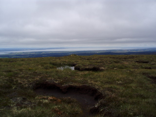


Carn a' Choire Odhair is located at Grid Ref: NH8041 (Lat: 57.449211, Lng: -3.9985778)
Unitary Authority: Highland
Police Authority: Highlands and Islands
What 3 Words
///mixers.another.entitles. Near Balloch, Highland
Nearby Locations
Related Wikis
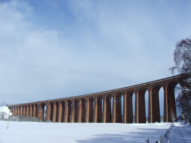
Culloden Viaduct
The Culloden Viaduct is a railway viaduct on the Highland Main Line, to the east of the city of Inverness, in the Highland council area of Scotland. It...

Clava cairn
The Clava cairn is a type of Bronze Age circular chamber tomb cairn, named after the group of three cairns at Balnuaran of Clava, to the east of Inverness...

Culloden Moor railway station
Culloden Moor railway station served the village of Culloden, Highland, Scotland from 1898 to 1965 on the Inverness and Aviemore Direct Railway. ��2�...

Battle of Culloden
The Battle of Culloden (; Scottish Gaelic: Blàr Chùil Lodair) was the final confrontation of the Jacobite rising of 1745. On 16 April 1746, the Jacobite...
Have you been to Carn a' Choire Odhair?
Leave your review of Carn a' Choire Odhair below (or comments, questions and feedback).