Banc Dolwen

Hill, Mountain in Cardiganshire

Wales

Banc Dolwen

Banc Rhiw-r-ordd Stood by a steep lip of the Myherin valley near Nant Rhiw-r-ordd which is one of the brooks feeding into Nant Myherin. Five of the Cefn Cross wind turbines are also visible here.
Banc Rhiw-r-ordd Credit: Jonathan Clitheroe

The requested URL returned error: 429 Too Many Requests

If you have any feedback on the listing, please let us know in the comments section below.
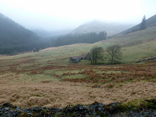
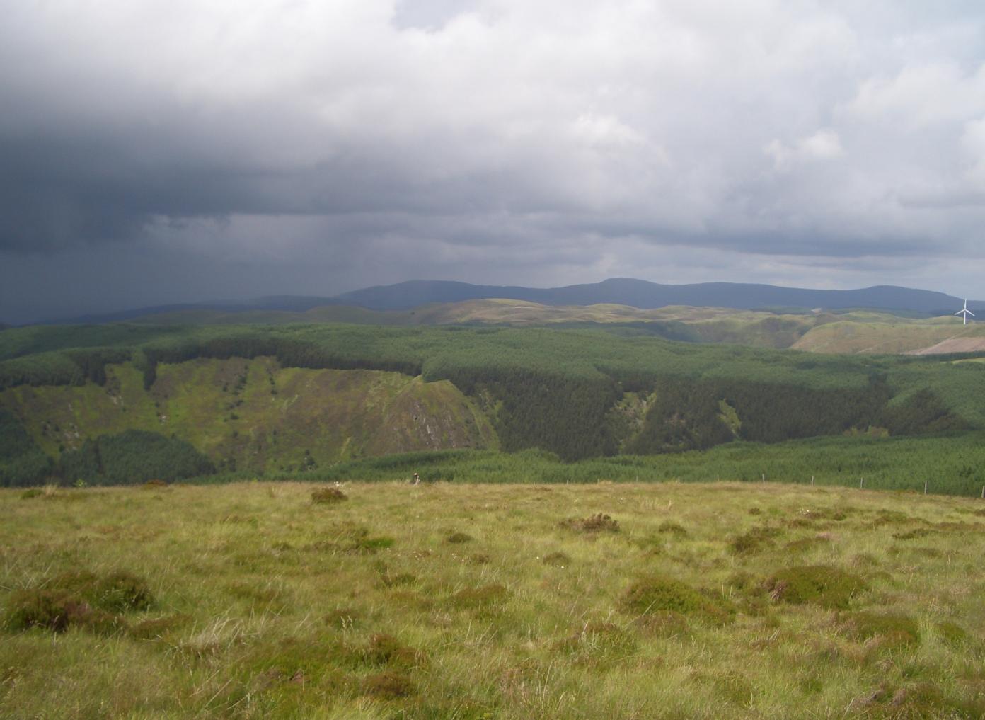
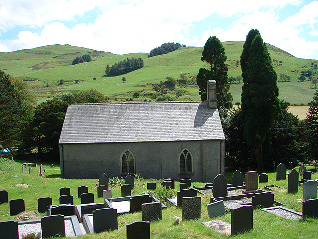
Banc Dolwen Images

Images are sourced within 2km of 52.393443/-3.7757025 or Grid Reference SN7978. Thanks to Geograph Open Source API. All images are credited.

Banc Rhiw-r-ordd Stood by a steep lip of the Myherin valley near Nant Rhiw-r-ordd which is one of the brooks feeding into Nant Myherin. Five of the Cefn Cross wind turbines are also visible here.
Banc Rhiw-r-ordd
Stood by a steep lip of the Myherin valley near Nant Rhiw-r-ordd which is one of the brooks feeding into Nant Myherin. Five of the Cefn Cross wind turbines are also visible here.
Turbines, Cefn Croes windfarm With the backbone of Plynlimon forming the horizon behind.
Turbines, Cefn Croes windfarm
With the backbone of Plynlimon forming the horizon behind.
Blaen Myherin Farm
Blaen Myherin Farm
Derelict Farm and Sheepfolds in the Myherin Valley Stood at the head of this valley is the former farmstead of Blaen-Myherin. Imagine during the farm's heyday perhaps 150 years ago, the tenants suddenly being confronted by an army of wind turbines like those that now populate the surrounding hills. Imagine the thrashing blades marching across the horizon and down into the valley. They would surely have thought that judgement day had arrived.
Derelict Farm and Sheepfolds in the Myherin Valley
Stood at the head of this valley is the former farmstead of Blaen-Myherin. Imagine during the farm's heyday perhaps 150 years ago, the tenants suddenly being confronted by an army of wind turbines like those that now populate the surrounding hills. Imagine the thrashing blades marching across the horizon and down into the valley. They would surely have thought that judgement day had arrived.
The Myherin Valley
The Myherin Valley
Wind turbine in the mist I've never approached wind turbines in mist before; you try to place the rhythymic whirring as accurately as you can and then one appears before you like a grey ghost, its great blades chopping the cold wet air like something from War of the Worlds.
Wind turbine in the mist
I've never approached wind turbines in mist before; you try to place the rhythymic whirring as accurately as you can and then one appears before you like a grey ghost, its great blades chopping the cold wet air like something from War of the Worlds.
Wind turbines beside the footpath Not much is happening up here today so even wind turbines become interesting.
Wind turbines beside the footpath
Not much is happening up here today so even wind turbines become interesting.
The rape of the landscape It's very difficult to find upland areas in the Cambrian Mountains which are not now corrupted by these things - and they want to build more!
The rape of the landscape
It's very difficult to find upland areas in the Cambrian Mountains which are not now corrupted by these things - and they want to build more!
Scrap metal? They certainly would be if it were not for the generous subsidies paid to the developers - extracted from you and me. Their true economic performance and efficiency has been proved to be abysmal.
Scrap metal?
They certainly would be if it were not for the generous subsidies paid to the developers - extracted from you and me. Their true economic performance and efficiency has been proved to be abysmal.
Track past Pen y Garn Taken ten years or so before the Cefn Croes wind farm was built, on a frosty, snowy February day, which gave superb views once the snow had ceased falling. The whitened backbone ridge of Plynlimon can be seen in the distance.
Track past Pen y Garn
Taken ten years or so before the Cefn Croes wind farm was built, on a frosty, snowy February day, which gave superb views once the snow had ceased falling. The whitened backbone ridge of Plynlimon can be seen in the distance.
Wind Farm on Cefn Croes In the foreground is the plaque commemorating the opening of this wind farm on 16 June 2005.
Wind Farm on Cefn Croes
In the foreground is the plaque commemorating the opening of this wind farm on 16 June 2005.
A view towards Banc Nant-Rhys and the Cefn Croes Wind-farm
A view towards Cefn Croes windfarm If this is a foretaste of the future that Greenpeace zealots, ageing hippies, clueless politicians and subsidy-sucking landowners wish to impose upon the uplands of mid-Wales then I am proud to be a 'denier' and 'flat-earther' in rejecting it, as do most of the inhabitants of the region.
A view towards Cefn Croes windfarm
If this is a foretaste of the future that Greenpeace zealots, ageing hippies, clueless politicians and subsidy-sucking landowners wish to impose upon the uplands of mid-Wales then I am proud to be a 'denier' and 'flat-earther' in rejecting it, as do most of the inhabitants of the region.
Cefn Croes Climbed after bagging Pen Y Garn, walking down and through the noisy wind turbines on a clear spring day.
Name: Cefn Croes
Hill number: 3479
Height: 573m / 1880ft
Area: 31C: South-West Wales
Class: 5
Grid ref: SN 80800 79954
Summit feature: no feature
Drop: 45m
Col: 528m  SN806811
Cefn Croes
Climbed after bagging Pen Y Garn, walking down and through the noisy wind turbines on a clear spring day. Name: Cefn Croes Hill number: 3479 Height: 573m / 1880ft Area: 31C: South-West Wales Class: 5 Grid ref: SN 80800 79954 Summit feature: no feature Drop: 45m Col: 528m SN806811
The ruined farmhouse at Blaen-Myherin
Above Blaen-Myherin The wind-turbines on the hill at Cefn-croes are hidden in the low cloud.
Above Blaen-Myherin
The wind-turbines on the hill at Cefn-croes are hidden in the low cloud.
Moorland from the side of Pen y Garn Taken during the construction of the Cefn Croes windfarm.  Here is a similar view after the power station was installed: <a href="https://www.geograph.org.uk/photo/519662">SN8077 : Southern end of Cefn Croes wind power station</a>.
Moorland from the side of Pen y Garn
Taken during the construction of the Cefn Croes windfarm. Here is a similar view after the power station was installed: SN8077 : Southern end of Cefn Croes wind power station.
Show me another place!

Banc Dolwen is located at Grid Ref: SN7978 (Lat: 52.393443, Lng: -3.7757025)

Unitary Authority: Ceredigion

Police Authority: Dyfed Powys

What 3 Words

///plugs.update.bordering. Near Cwmystwyth, Ceredigion

Nearby Locations

Banc Dolwen

Related Wikis

Pen y Garn

Pen y Garn (head of the cairn) is a mountain in the Cambrian Mountains, Mid Wales standing at 611 metres above sea level. Pen y Garn tops a 500–600 m high...

Y Glog (mountain)

Y Glog or Draws Drum is a mountain situated in Ceredigion, Wales. It stands at an elevation of 574 metres (1883 feet) above sea level and is located a...

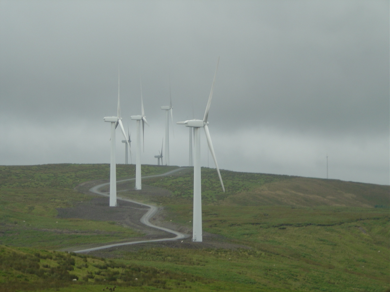
Cefn Croes Wind Farm

Cefn Croes is a wind farm in Ceredigion, Wales. It is located in the Cambrian Mountains on Cefn Croes mountain, 573m (1,880 ft) south of the A44 road between...

Ysbyty Cynfyn

Ysbyty Cynfyn is a hamlet in the community of Blaenrheidol, Ceredigion, Wales, which is 69.1 miles (111.3 km) from Cardiff and 169.3 miles (272.4 km)...

Have you been to Banc Dolwen?

Leave your review of Banc Dolwen below (or comments, questions and feedback).