Common Hill

Hill, Mountain in Lanarkshire

Scotland

Common Hill

Summit area of Common Hill A wind farm with many generators and a network of roads covers Common Hill and Broomerside Hill. The view beyond the trig point is eastwards where Tinto is the dominant hill.
Summit area of Common Hill Credit: Trevor Littlewood

Common Hill is a prominent natural landmark located in Lanarkshire, Scotland. It is situated in the southern part of the region, near the town of Biggar. This hill is part of the wider Southern Uplands, a range of hills and mountains that stretch across southern Scotland.

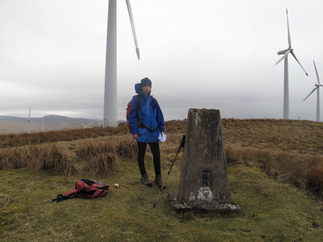
With an elevation of around 400 meters (1,312 feet), Common Hill offers stunning panoramic views of the surrounding countryside. Its distinctive shape and relatively easy access make it a popular destination for hikers and nature enthusiasts of all ages and abilities.

The hill is known for its diverse flora and fauna, boasting a range of plant species including heather, gorse, and various wildflowers, especially in the summer months. It is also home to a variety of bird species such as skylarks and meadow pipits, making it a haven for birdwatchers.

Common Hill is easily accessible from nearby towns and villages, with several walking routes leading to its summit. The most popular route starts from the village of Coulter, where a well-marked path takes visitors through fields and meadows before ascending the hill. The climb is relatively gentle, making it suitable for families and those new to hiking.

Once at the top, visitors are rewarded with breathtaking views of the surrounding Lanarkshire countryside, including the rolling hills, valleys, and farmland. On clear days, it is even possible to see as far as the Pentland Hills to the north and the Moffat Hills to the south.

Overall, Common Hill offers a wonderful opportunity to experience the beauty of the Lanarkshire landscape and enjoy a peaceful escape in nature.

If you have any feedback on the listing, please let us know in the comments section below.

Common Hill Images

Images are sourced within 2km of 55.555762/-3.9159525 or Grid Reference NS7930. Thanks to Geograph Open Source API. All images are credited.

Summit area of Common Hill A wind farm with many generators and a network of roads covers Common Hill and Broomerside Hill. The view beyond the trig point is eastwards where Tinto is the dominant hill.
Summit area of Common Hill
A wind farm with many generators and a network of roads covers Common Hill and Broomerside Hill. The view beyond the trig point is eastwards where Tinto is the dominant hill.
Common Hill Parked at Douglas West and use wind farm access road for most of way to summit on windy grey morning with Adam Auckland, doing some D of E training and celebrating my mother's 75 birthday.
Name: Common Hill
Hill number: 1682
Height: 488m / 1601ft
Area: 27A: Ayr to the River Clyde
Class: Ma
Grid ref: NS 79191 30781
Summit feature: no feature
Drop: 172m
Col: 316m  NS776317
Common Hill
Parked at Douglas West and use wind farm access road for most of way to summit on windy grey morning with Adam Auckland, doing some D of E training and celebrating my mother's 75 birthday. Name: Common Hill Hill number: 1682 Height: 488m / 1601ft Area: 27A: Ayr to the River Clyde Class: Ma Grid ref: NS 79191 30781 Summit feature: no feature Drop: 172m Col: 316m NS776317
Henry's Hill View dominated by wind turbines over on Common and Hagshaw Hill.
Henry's Hill
View dominated by wind turbines over on Common and Hagshaw Hill.
Common Hill Scotland's first windfarm (1994)
Common Hill
Scotland's first windfarm (1994)
Looking up Wedder Hill
Hagshaw Hill
Hagshaw Hill
Looking down from Wedder Hill
Trig point S6108 on Common Hill
Sheepfold below Windrow Hill
Hagshawhill wind farm from the air Opened with 20 turbines in 1995, 26 more were added in 2006.
Hagshawhill wind farm from the air
Opened with 20 turbines in 1995, 26 more were added in 2006.
Wind turbines on Common Hill and Burnt Rig A section of the Hagshaw Hill Wind Farm
Wind turbines on Common Hill and Burnt Rig
A section of the Hagshaw Hill Wind Farm
Trig pillar and wind turbines on Common Hill A plethora of wind turbines dominate the hillsides and moorland in this area.
Trig pillar and wind turbines on Common Hill
A plethora of wind turbines dominate the hillsides and moorland in this area.
Tributary of Windrow Burn between Broomerside and Common Hills
Windrow Burn
Windrow Burn
Windrow Burn below Windrow Hill
Hillside below Burnt Rig
Fence on Burnt Rig
Fence on Burnt Rig
Towards Burnt Rig top
Show me another place!

Common Hill is located at Grid Ref: NS7930 (Lat: 55.555762, Lng: -3.9159525)

Unitary Authority: South Lanarkshire

Police Authority: Lanarkshire

What 3 Words

///locate.flashing.passively. Near Douglas, South Lanarkshire

Related Wikis

Inches railway station

Inches railway station co-served the hamlet of Glespin, South Lanarkshire, Scotland, from 1874 to 1964 on the Muirkirk Branch. == History == The station...

Bankend railway station

Bankend railway station served Bankend, a village in South Lanarkshire, Scotland. It closed in 1926 and the area became an opencast coal mine. == References ==

Douglas West railway station

Douglas West railway station served the village of Douglas West, South Lanarkshire in Scotland between 1896 and 1964. == History == The railway line between...

Bankend, South Lanarkshire

Bankend is a village in South Lanarkshire, Scotland. It is located near the villages of Braehead, Coalburn and Cumberhead. == History == Sometime after...

Nearby Amenities

Located within 500m of 55.555762,-3.9159525
Broomerside Hill
Corbett: no
Ele: 463
Graham: no
Marilyn: no
Munro: no
Natural: peak
Lat/Long: 55.5518962/-3.9185211
Common Hill
Corbett: no
Ele: 488
Graham: no
Marilyn: yes
Munro: no
Natural: peak
Prominence: 172
Lat/Long: 55.5559742/-3.915517
Generator Method: wind_turbine
Generator Output Electricity: yes
Generator Source: wind
Generator Type: horizontal_axis
Power: generator
Lat/Long: 55.552695/-3.9205322
Generator Method: wind_turbine
Generator Output Electricity: yes
Generator Source: wind
Generator Type: horizontal_axis
Power: generator
Lat/Long: 55.557161/-3.9133438
Generator Method: wind_turbine
Generator Output Electricity: yes
Generator Source: wind
Generator Type: horizontal_axis
Power: generator
Lat/Long: 55.5527132/-3.9183006
Generator Method: wind_turbine
Generator Output Electricity: yes
Generator Source: wind
Generator Type: horizontal_axis
Power: generator
Lat/Long: 55.5512931/-3.9167234
Generator Method: wind_turbine
Generator Output Electricity: yes
Generator Source: wind
Generator Type: horizontal_axis
Power: generator
Lat/Long: 55.5561294/-3.9195129
Generator Method: wind_turbine
Generator Output Electricity: yes
Generator Source: wind
Generator Type: horizontal_axis
Power: generator
Lat/Long: 55.5558867/-3.9180109
Generator Method: wind_turbine
Generator Output Electricity: yes
Generator Source: wind
Generator Type: horizontal_axis
Power: generator
Lat/Long: 55.5557047/-3.9115414
Barrier: cattle_grid
Lat/Long: 55.5560944/-3.9187917
Generator Method: wind_turbine
Generator Output Electricity: yes
Generator Source: wind
Generator Type: horizontal_axis
Power: generator
Lat/Long: 55.5564938/-3.9123568
Generator Method: wind_turbine
Generator Output Electricity: yes
Generator Source: wind
Generator Type: horizontal_axis
Power: generator
Lat/Long: 55.5569911/-3.9220557
Generator Method: wind_turbine
Generator Output Electricity: yes
Generator Source: wind
Generator Type: horizontal_axis
Power: generator
Lat/Long: 55.5551224/-3.9105544
Generator Method: wind_turbine
Generator Output Electricity: yes
Generator Source: wind
Generator Type: horizontal_axis
Power: generator
Lat/Long: 55.554491/-3.9202532
Generator Method: wind_turbine
Generator Output Electricity: yes
Generator Source: wind
Generator Type: horizontal_axis
Power: generator
Lat/Long: 55.5520757/-3.9171311
Generator Method: wind_turbine
Generator Output Electricity: yes
Generator Source: wind
Generator Type: horizontal_axis
Power: generator
Lat/Long: 55.5555593/-3.9166054
Generator Method: wind_turbine
Generator Output Electricity: yes
Generator Source: wind
Generator Type: horizontal_axis
Power: generator
Lat/Long: 55.5548372/-3.9157149
Barrier: cattle_grid
Lat/Long: 55.5565408/-3.9216215
Generator Method: wind_turbine
Generator Output Electricity: yes
Generator Source: wind
Generator Type: horizontal_axis
Power: generator
Lat/Long: 55.5545034/-3.9232573
Generator Method: wind_turbine
Generator Output Electricity: yes
Generator Source: wind
Generator Type: horizontal_axis
Power: generator
Lat/Long: 55.5577314/-3.9149961
Generator Method: wind_turbine
Generator Output Electricity: yes
Generator Source: wind
Generator Type: horizontal_axis
Power: generator
Lat/Long: 55.5573673/-3.9230964
The data included in this document is from www.openstreetmap.org. The data is made available under ODbL.

Have you been to Common Hill?

Leave your review of Common Hill below (or comments, questions and feedback).