Beinn Bhuidhe Bheag
Hill, Mountain in Nairnshire
Scotland
Beinn Bhuidhe Bheag

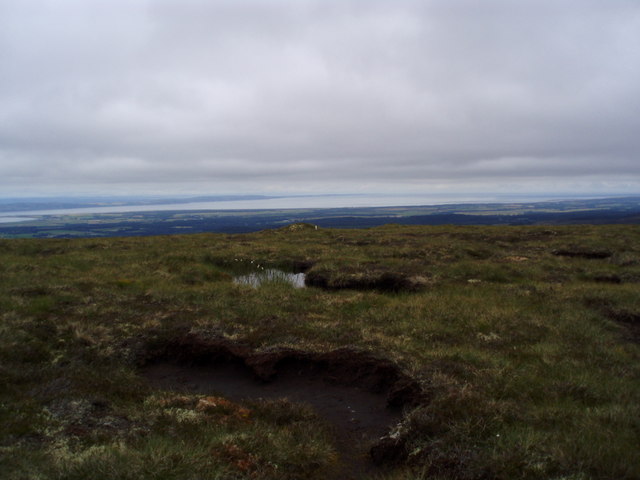
Beinn Bhuidhe Bheag, also known as Little Yellow Mountain, is a prominent hill located in Nairnshire, Scotland. It stands at an elevation of approximately 347 meters (1,138 feet) above sea level, making it a popular destination for hikers and outdoor enthusiasts.
This hill is situated in the northern part of Nairnshire, near the town of Nairn. It is surrounded by stunning natural beauty, with rolling green fields and picturesque landscapes. Beinn Bhuidhe Bheag offers breathtaking panoramic views of the surrounding area, including the nearby Moray Firth and the Scottish Highlands.
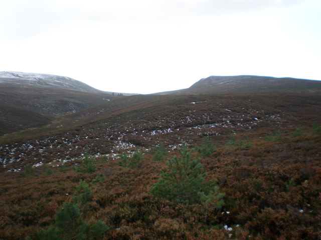
The hill itself is characterized by its distinctive yellowish hue, which gives it its name "Little Yellow Mountain." This unique coloration is caused by the presence of yellowish-colored rocks and vegetation that cover its slopes. The hill is mainly composed of sandstone and shale, which have eroded over time to create its distinctive shape.
Hiking to the summit of Beinn Bhuidhe Bheag is a rewarding experience, with well-marked trails and paths leading to the top. The ascent is relatively moderate, making it suitable for hikers of various skill levels. Once at the summit, visitors can enjoy stunning panoramic views of the surrounding countryside, including the coastline and distant mountains.
Overall, Beinn Bhuidhe Bheag is a captivating natural landmark in Nairnshire, offering visitors the opportunity to immerse themselves in Scotland's natural beauty and enjoy a memorable outdoor adventure.
If you have any feedback on the listing, please let us know in the comments section below.
Beinn Bhuidhe Bheag Images
Images are sourced within 2km of 57.455555/-4.0171771 or Grid Reference NH7942. Thanks to Geograph Open Source API. All images are credited.


Beinn Bhuidhe Bheag is located at Grid Ref: NH7942 (Lat: 57.455555, Lng: -4.0171771)
Unitary Authority: Highland
Police Authority: Highlands and Islands
What 3 Words
///forge.than.trouser. Near Balloch, Highland
Nearby Locations
Related Wikis
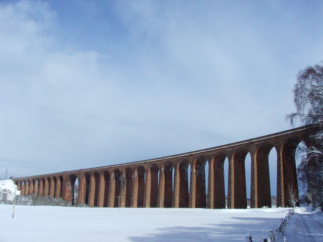
Culloden Viaduct
The Culloden Viaduct is a railway viaduct on the Highland Main Line, to the east of the city of Inverness, in the Highland council area of Scotland. It...

Clava cairn
The Clava cairn is a type of Bronze Age circular chamber tomb cairn, named after the group of three cairns at Balnuaran of Clava, to the east of Inverness...

Culloden Moor railway station
Culloden Moor railway station served the village of Culloden, Highland, Scotland from 1898 to 1965 on the Inverness and Aviemore Direct Railway. ��2�...

Battle of Culloden
The Battle of Culloden (; Scottish Gaelic: Blàr Chùil Lodair) was the final confrontation of the Jacobite rising of 1745. On 16 April 1746, the Jacobite...

Daviot railway station
Daviot railway station served the village of Daviot, Highland, Scotland, from 1897 to 1965 on the Inverness and Aviemore Direct Railway. == History... ==
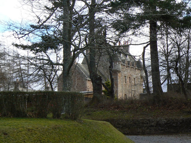
Dalcross Castle
Dalcross Castle is a restored 17th century tower house, about 1+1⁄2 miles (2.5 kilometres) southwest of Croy, Highland, Scotland, and about 7 miles (11...
Balloch, Highland
Balloch (; Scottish Gaelic: Baile an Locha, IPA:[ˈpaləˈanˈɫ̪ɔxə]) is a residential village four miles (6.4 km) east of the city of Inverness, Scotland...

Cawdor (Roman fort)
Cawdor (Roman Fort), located near the small village of Easter Galcantray (15 miles or 24 kilometres east of Inverness), is suspected of being one of the...
Nearby Amenities
Located within 500m of 57.455555,-4.0171771Have you been to Beinn Bhuidhe Bheag?
Leave your review of Beinn Bhuidhe Bheag below (or comments, questions and feedback).