Bryn Mawr

Hill, Mountain in Cardiganshire

Wales

Bryn Mawr

Low water levels As the water recedes in the upper levels of Llyn Briane after a relatively dry summer, an old foot bridge over the River Tywi, which is normally submerged is revealed once more.
Low water levels Credit: Hywel Williams

Bryn Mawr is a prominent hill located in Cardiganshire, Wales. Situated in the beautiful Welsh countryside, it stands at an elevation of approximately 500 meters (1,640 feet) above sea level. The name "Bryn Mawr" translates to "big hill" in the Welsh language, which accurately describes its imposing presence in the local landscape.

The hill offers breathtaking panoramic views of the surrounding area, including lush green valleys, rolling hills, and distant mountains. It is a popular destination for hikers and nature enthusiasts, who are drawn to its peaceful and serene ambiance. Several well-marked trails lead to the summit, allowing visitors to explore the hill's diverse flora and fauna along the way.

At the top of Bryn Mawr, visitors are rewarded with a stunning vista that stretches as far as the eye can see. On clear days, it is possible to see the shimmering waters of Cardigan Bay in the west, while the Cambrian Mountains dominate the eastern horizon. The hill's strategic location also offers a unique opportunity for stargazing, as the absence of light pollution enhances the visibility of the night sky.

Bryn Mawr holds cultural and historical significance as well. It is believed that the hill was once home to Iron Age settlements, and traces of ancient fortifications can still be seen today. The area is also dotted with remnants of old mining activities, which remind visitors of Cardiganshire's industrial past.

In summary, Bryn Mawr in Cardiganshire is a captivating natural landmark, offering unparalleled views and a rich tapestry of history. Its accessibility and breathtaking vistas make it a must-visit destination for nature lovers and those seeking a tranquil escape in the heart of Wales.

If you have any feedback on the listing, please let us know in the comments section below.
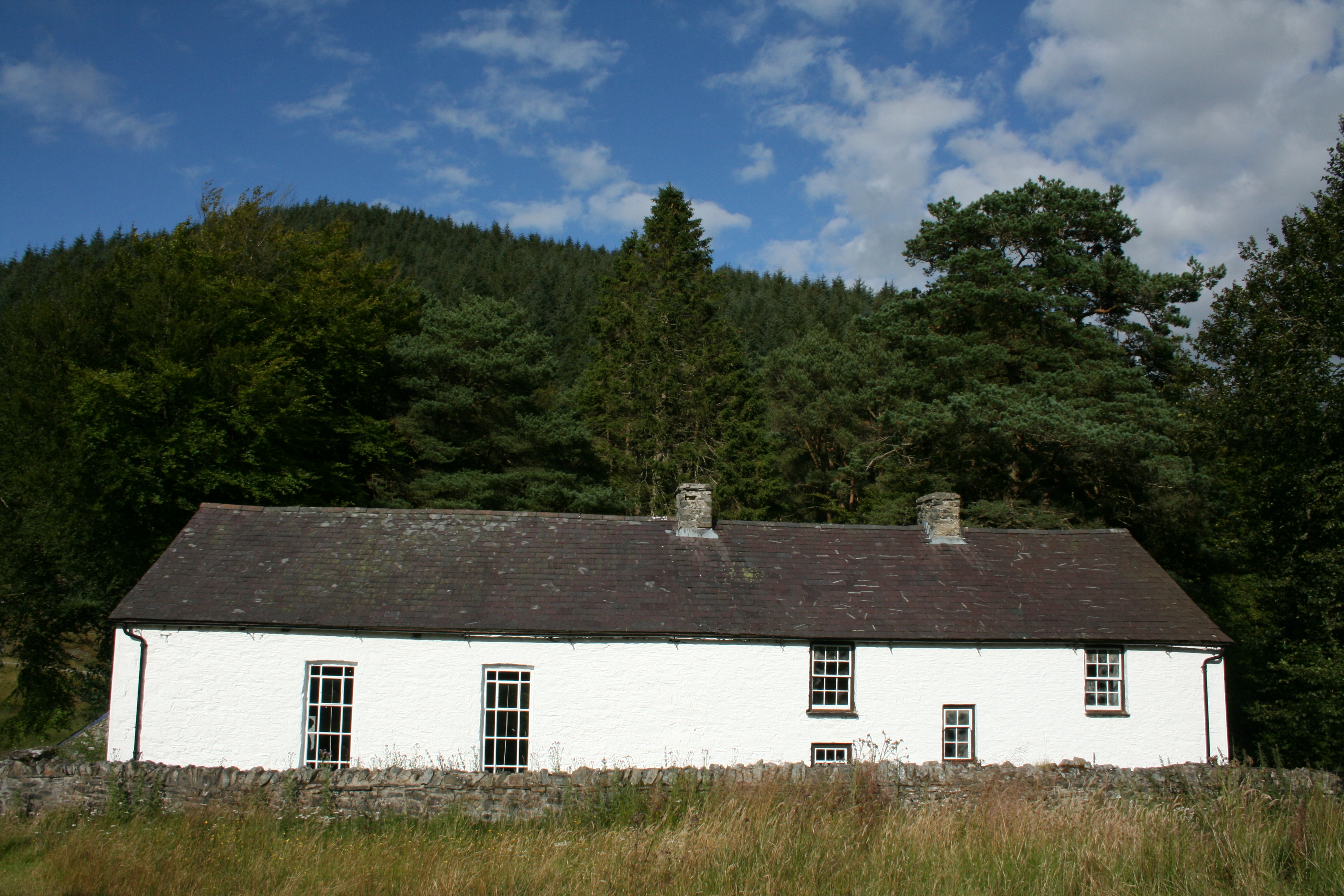
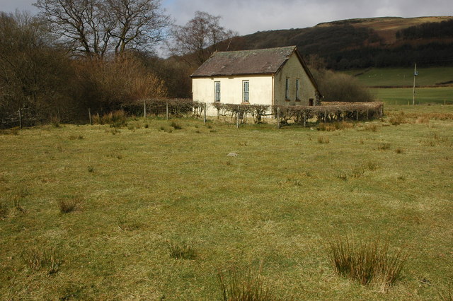
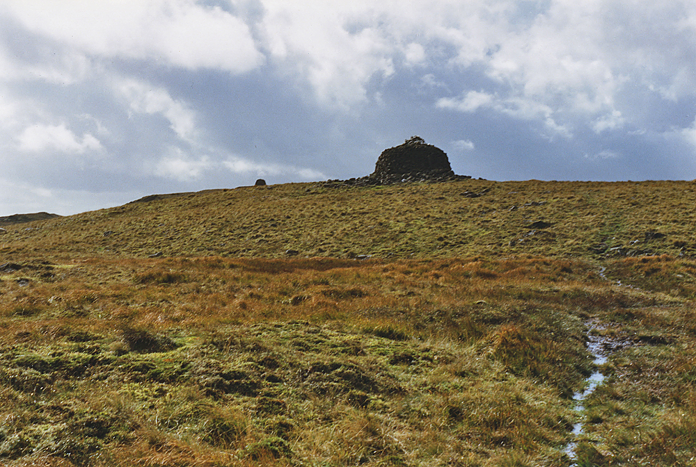
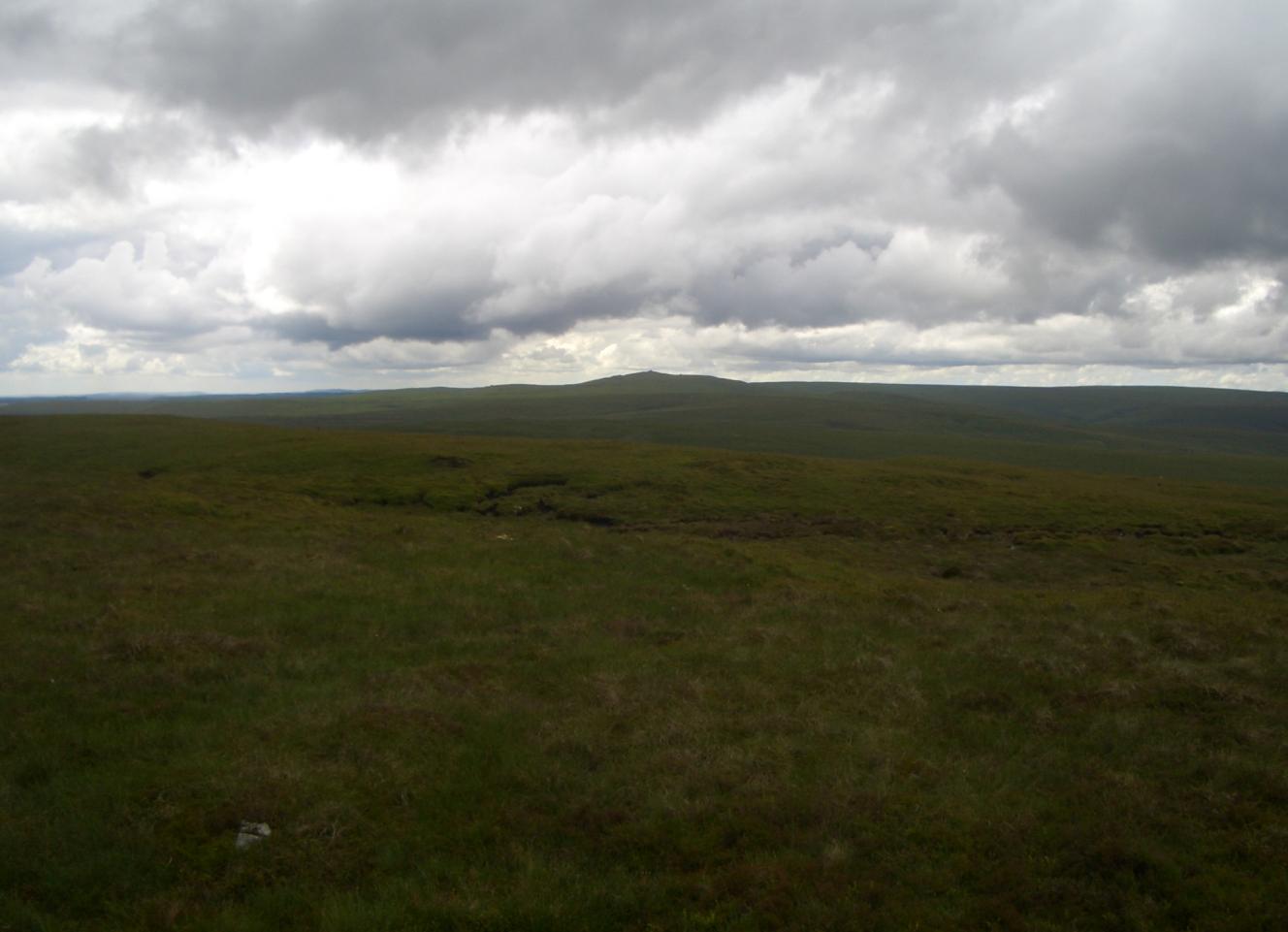
Bryn Mawr Images

Images are sourced within 2km of 52.167211/-3.7697204 or Grid Reference SN7953. Thanks to Geograph Open Source API. All images are credited.

Low water levels As the water recedes in the upper levels of Llyn Briane after a relatively dry summer, an old foot bridge over the River Tywi, which is normally submerged is revealed once more.
Low water levels
As the water recedes in the upper levels of Llyn Briane after a relatively dry summer, an old foot bridge over the River Tywi, which is normally submerged is revealed once more.
Derelict footbridge revealed by low waters When the waters in the upper reaches of Llyn Briane reservoir are low, a small footbridge is revealed that once crossed the river Towy.   Once the foot access route to a nearby farm (possibly Fanog Farm, also submerged by the reservoir).

The bridge also marks the county boundary between Carmarthenshire and Powys.
Derelict footbridge revealed by low waters
When the waters in the upper reaches of Llyn Briane reservoir are low, a small footbridge is revealed that once crossed the river Towy. Once the foot access route to a nearby farm (possibly Fanog Farm, also submerged by the reservoir). The bridge also marks the county boundary between Carmarthenshire and Powys.
Submerged bridge revealed once again Almost always now submerged in the upper reaches of the Llyn Brianne reservoir, this small footbridge and the underlying river bed's path have once again been revealed by very low drought levels of the reservoir.   Note that the iron hand rails are now in an advanced state of rust, but the concrete floor and pillars are still in good condition.
Submerged bridge revealed once again
Almost always now submerged in the upper reaches of the Llyn Brianne reservoir, this small footbridge and the underlying river bed's path have once again been revealed by very low drought levels of the reservoir. Note that the iron hand rails are now in an advanced state of rust, but the concrete floor and pillars are still in good condition.
Bridge and river structure revealed by drought Taken just over a year after <a href="https://www.geograph.org.uk/photo/7088196">SN8052 : Derelict footbridge revealed by low waters</a>, you can see how much the water level has dropped even further here in the upper reaches of the Llyn Brianne reservoir - indeed, back then the backwaters of the reservoir reached here and the bridge wasn't accessible by foot. However, it's now temporarily no longer a reservoir here with the original river being revealed for the first time in many years along with the small foot bridge seen in <a href="https://www.geograph.org.uk/photo/7293649">SN8052 : Submerged bridge revealed once again</a>, which can now be visited and crossed for the first time since 1984.
Bridge and river structure revealed by drought
Taken just over a year after SN8052 : Derelict footbridge revealed by low waters, you can see how much the water level has dropped even further here in the upper reaches of the Llyn Brianne reservoir - indeed, back then the backwaters of the reservoir reached here and the bridge wasn't accessible by foot. However, it's now temporarily no longer a reservoir here with the original river being revealed for the first time in many years along with the small foot bridge seen in SN8052 : Submerged bridge revealed once again, which can now be visited and crossed for the first time since 1984.
A small waterfall now visible for the first time in decades Taken off a small foot bridge that was submerged when Llyn Brianne reservoir was built in the early '70s - the river bed of the river Towy here has rarely been observed for many decades now (last seen in 1984) but this year's drought conditions have changed that - and for a small time period at least, this small waterfall and upper river's eroded rock structures can once more be observed (until rain once more submerges this tranquil water bed under at least 5 metres of water, as can be seen by the higher banks on each side).
A small waterfall now visible for the first time in decades
Taken off a small foot bridge that was submerged when Llyn Brianne reservoir was built in the early '70s - the river bed of the river Towy here has rarely been observed for many decades now (last seen in 1984) but this year's drought conditions have changed that - and for a small time period at least, this small waterfall and upper river's eroded rock structures can once more be observed (until rain once more submerges this tranquil water bed under at least 5 metres of water, as can be seen by the higher banks on each side).
Riverbed off forgotten bridge The bridge was submerged in the early '70s when the Llyn Brianne reservoir was created.

Now in 2022 you can see the course of the original Towy river and the sad state of the bridge's rusted out handrails (after about 4 decades of being under water)!
Riverbed off forgotten bridge
The bridge was submerged in the early '70s when the Llyn Brianne reservoir was created. Now in 2022 you can see the course of the original Towy river and the sad state of the bridge's rusted out handrails (after about 4 decades of being under water)!
Old bridge over Afon Tywi The bridge is usually submerged by the reservoir but is here exposed during the drought of 2022.
Old bridge over Afon Tywi
The bridge is usually submerged by the reservoir but is here exposed during the drought of 2022.
Water flow monitoring station
Much needed rain approaching Llyn Brianne
Esgair Ganol and Esgair Gors View up and across the upper Tywi valley.
Esgair Ganol and Esgair Gors
View up and across the upper Tywi valley.
Cwm Camddwr Cerddwyr yn dilyn heol fach wledig yng Nghwm Camddwr.

Walkers following a minor country road in Cwm Camddwr (trans. winding river valley).
Cwm Camddwr
Cerddwyr yn dilyn heol fach wledig yng Nghwm Camddwr. Walkers following a minor country road in Cwm Camddwr (trans. winding river valley).
Meinihirion Pen Pontbren / Pen Pontbren Standing Stones Meinihirion wedi eu lleoli ar lethr uwhben Afon Camddwr.  Mae 'na amheuon a yw'r un ar y dde yn garreg naturiol neu'n faenhir go iawn.  

Standing stones on a slope above Afon Camddwr (trans. winding river). There are doubts whether the one on  the right is a natural boulder or a genuine standing stone.
Meinihirion Pen Pontbren / Pen Pontbren Standing Stones
Meinihirion wedi eu lleoli ar lethr uwhben Afon Camddwr. Mae 'na amheuon a yw'r un ar y dde yn garreg naturiol neu'n faenhir go iawn. Standing stones on a slope above Afon Camddwr (trans. winding river). There are doubts whether the one on the right is a natural boulder or a genuine standing stone.
Llwybr ceffyl Nant Llwyd / Nant Llwyd bridleway Llwybr ceffyl yn mynd i gyfeiriad Capel Soar y Mynydd.

A bridleway heading towards Capel Soar y Mynydd (trans. Soar Chapel of the mountain).
Llwybr ceffyl Nant Llwyd / Nant Llwyd bridleway
Llwybr ceffyl yn mynd i gyfeiriad Capel Soar y Mynydd. A bridleway heading towards Capel Soar y Mynydd (trans. Soar Chapel of the mountain).
Heol i Soar y Mynydd / Road to Soar y Mynydd Hen heol ddiwyneb yn mynd i lawr y waered i gyfeiriad Capel Soar y Mynydd.

An old unsurfaced road descending the hill towards Capel Soar y Mynydd (trans. Soar Chapel of the mountain).
Heol i Soar y Mynydd / Road to Soar y Mynydd
Hen heol ddiwyneb yn mynd i lawr y waered i gyfeiriad Capel Soar y Mynydd. An old unsurfaced road descending the hill towards Capel Soar y Mynydd (trans. Soar Chapel of the mountain).
Meinihirion Pen Pontbren / Pen Pontbren Standing Stones Meinihirion wedi eu lleoli ar lethr uwhben Afon Camddwr.  Mae 'na amheuon a yw'r un ar y dde yn garreg naturiol neu'n faenhir go iawn.  

Standing stones on a slope above Afon Camddwr (trans. winding river). There are doubts whether the stone on  the right is a natural boulder or a genuine monolith.
Meinihirion Pen Pontbren / Pen Pontbren Standing Stones
Meinihirion wedi eu lleoli ar lethr uwhben Afon Camddwr. Mae 'na amheuon a yw'r un ar y dde yn garreg naturiol neu'n faenhir go iawn. Standing stones on a slope above Afon Camddwr (trans. winding river). There are doubts whether the stone on the right is a natural boulder or a genuine monolith.
Llwybr ceffyl ger Noddfa / Bridleway near Noddfa Dyma'r lleoliad lle y bu llwybr ceffyl yn rhydio Afon Camddwr ond nid yw hyn yn bosibl bellach oherwydd Cronfa Ddwr Llyn Brianne.

This is the location where a bridleway crossed Afon Camddwr (trans. winding river) but this is not possible today due to Llyn Brianne Reservoir.
Llwybr ceffyl ger Noddfa / Bridleway near Noddfa
Dyma'r lleoliad lle y bu llwybr ceffyl yn rhydio Afon Camddwr ond nid yw hyn yn bosibl bellach oherwydd Cronfa Ddwr Llyn Brianne. This is the location where a bridleway crossed Afon Camddwr (trans. winding river) but this is not possible today due to Llyn Brianne Reservoir.
Mwynglawdd Plwm Rhydtalog / Rhydtalog Lead Mine Gweddillion adeilad a fu'n rhan o Fwynglawdd Plwm Rhydtalog.  Bu cloddio am blwm yma ar adegau yn ystod yr 18g a'r 19g.  Mae'r dwr yn y cefndir yn rhan uchaf Cronfa Ddwr Llyn Brianne. 

The remains of a building associated with Rhydtalog Lead Mine. The mine was worked at intervals during the 18th and 19th centuries. The water in the background is the upper reaches of Llyn Brianne Reservoir.
Mwynglawdd Plwm Rhydtalog / Rhydtalog Lead Mine
Gweddillion adeilad a fu'n rhan o Fwynglawdd Plwm Rhydtalog. Bu cloddio am blwm yma ar adegau yn ystod yr 18g a'r 19g. Mae'r dwr yn y cefndir yn rhan uchaf Cronfa Ddwr Llyn Brianne. The remains of a building associated with Rhydtalog Lead Mine. The mine was worked at intervals during the 18th and 19th centuries. The water in the background is the upper reaches of Llyn Brianne Reservoir.
Ffarm Rhydtalog / Rhydtalog Farm Gweddillion Farm Rhydtalog, un o nifer  o anhedd-dai adfeilieidig sydd yn yr ardal bryniog angyhsbell hon.  Yn sgil gaeaf caled hirffaith 1947 penderfynnodd nifer i adael a gwerthu eu heiddo i'r Comisiwn Coedwigoedd. 

The remains of Rhydtalog Farm, one of many ruined properties in this remote hilly region. Life was hard but the final straw was the prolonged harsh winter of 1947 and many decided to leave and sell their properties to the Forestry Commission.
Ffarm Rhydtalog / Rhydtalog Farm
Gweddillion Farm Rhydtalog, un o nifer o anhedd-dai adfeilieidig sydd yn yr ardal bryniog angyhsbell hon. Yn sgil gaeaf caled hirffaith 1947 penderfynnodd nifer i adael a gwerthu eu heiddo i'r Comisiwn Coedwigoedd. The remains of Rhydtalog Farm, one of many ruined properties in this remote hilly region. Life was hard but the final straw was the prolonged harsh winter of 1947 and many decided to leave and sell their properties to the Forestry Commission.
Show me another place!

Bryn Mawr is located at Grid Ref: SN7953 (Lat: 52.167211, Lng: -3.7697204)

Unitary Authority: Ceredigion

Police Authority: Dyfed Powys

What 3 Words

///risen.buck.elections. Near Abergwesyn, Powys

Nearby Locations

Bryn Mawr

Related Wikis

Soar y mynydd

Soar-y-mynydd or Soar y mynydd is a Calvinist Methodist chapel near the eastern extremity of the large parish of Llanddewi Brefi, Ceredigion. It is claimed...

Camddwr

For the tributary of the River Wye, see Camddwr, Wye and for the tributary of the River Teifi, see Camddwr, Teifi.The Camddwr is a significant right-bank...

Llyn Brianne

Llyn Brianne is a man-made lake or reservoir in the headwaters of the River Towy in Wales. == Construction == The reservoir was constructed by Wimpey Construction...

Nant Irfon National Nature Reserve

Nant Irfon National Nature Reserve is a national nature reserve located high in the hills above the Afon Irfon valley near the village of Abergwesyn in...

Vicarage Meadows

Vicarage Meadows is a Site of Special Scientific Interest near Abergwesyn, Powys, Wales. The 3.6 hectares (8.9 acres) site, located close to the Nant Irfon...

Abergwesyn

Abergwesyn is a village in the Welsh county of Powys, in mid-Wales, at the start of the Abergwesyn valley and at the confluence of the Afon Irfon and the...

Drygarn Fawr

Drygarn Fawr is a mountain in the county of Powys, Wales. It is one of the highest summits in Mid Wales at 645 metres (2,116 ft) above sea level. It lies...

Gorllwyn

Gorllwyn is a subsidiary summit of Drygarn Fawr, located on a remote moorland plateau of the Cambrian Mountains. The summit is grassy and is surrounded...

Have you been to Bryn Mawr?

Leave your review of Bryn Mawr below (or comments, questions and feedback).