Beinn Bhuidhe Mhòr

Hill, Mountain in Nairnshire

Scotland

Beinn Bhuidhe Mhòr

Looking NW from above An Riasgach
Looking NW from above An Riasgach Credit: Sarah McGuire

Beinn Bhuidhe Mhòr is a prominent hill located in Nairnshire, Scotland. It is part of the broader range of the Scottish Highlands, which is known for its stunning natural beauty and rugged landscapes. Standing at an elevation of approximately 666 meters (2,185 feet), the hill offers breathtaking panoramic views of the surrounding area.

Beinn Bhuidhe Mhòr is characterized by its distinctive cone-shaped peak and steep slopes. It is composed mainly of sandstone and conglomerate rock formations, adding to its unique geological features. The hill is covered in a mix of heather, grasses, and scattered shrubs, providing a diverse habitat for a variety of plant and animal species.

Hiking and hillwalking enthusiasts are drawn to Beinn Bhuidhe Mhòr due to its challenging yet rewarding trails. There are several routes available for visitors to explore, each offering a different level of difficulty and duration. The ascent to the summit can be quite demanding, requiring a good level of fitness and appropriate gear.

Reaching the top of Beinn Bhuidhe Mhòr rewards climbers with breathtaking views of the surrounding countryside, including the nearby Moray Firth and the Cairngorms National Park in the distance. On clear days, it is even possible to catch a glimpse of the North Sea coastline.

Overall, Beinn Bhuidhe Mhòr is a must-visit destination for nature lovers and outdoor enthusiasts looking to experience the beauty and tranquility of the Scottish Highlands.

If you have any feedback on the listing, please let us know in the comments section below.

Beinn Bhuidhe Mhòr Images

Images are sourced within 2km of 57.43994/-4.0226991 or Grid Reference NH7840. Thanks to Geograph Open Source API. All images are credited.

Looking NW from above An Riasgach
Hill track above Finglack
Looking down on start of Allt na h-Athais from Carn a' Choire Odhair
Inverness in the distance from Carn a' Choire Odhair
Beinn Bhuidhe Mhor trig Looking NW to Inverness
Beinn Bhuidhe Mhor trig
Looking NW to Inverness
Beinn Bhuidhe Bheag Looking N from position
Beinn Bhuidhe Bheag
Looking N from position
Moorland track Looking N towards Beinn Bhuidhe Bheag
Moorland track
Looking N towards Beinn Bhuidhe Bheag
Track splits Left for Beinn Bhuidhe Bheag, right for Beinn Bhuidhe Mhor
Track splits
Left for Beinn Bhuidhe Bheag, right for Beinn Bhuidhe Mhor
Source of Dalriach Burn
Carn Dubh Mhor Summit
Cairn on Beinn Bhuidhe Bheag
Looking to Carn a' Choire Odhair
Approaching Clava Estate Bounbry Fence All the gates on moor were open.  The grouse moor has had no deer for 50 years as had adjoining estate Cawdor.
Approaching Clava Estate Bounbry Fence
All the gates on moor were open. The grouse moor has had no deer for 50 years as had adjoining estate Cawdor.
Looking East Across Moor from Track
Track Beside Burn SW The track is crossing Clava Grouse Moor coming down from Beinn Bhuidhe Bheag near Carn a' Ghranndaich. The track follows the burn to where both meet the track coming from Clava Forest.
Track Beside Burn SW
The track is crossing Clava Grouse Moor coming down from Beinn Bhuidhe Bheag near Carn a' Ghranndaich. The track follows the burn to where both meet the track coming from Clava Forest.
Looking Across to Track Junction Looking across Clava Grouse Moor near Carn a' Ghranndaich you can see the track coming up from Clava Forest and Finglack. Both tracks follow the burn and meet where the burn goes under the track.
Looking Across to Track Junction
Looking across Clava Grouse Moor near Carn a' Ghranndaich you can see the track coming up from Clava Forest and Finglack. Both tracks follow the burn and meet where the burn goes under the track.
Track Going to Beinn Bhuidhe Mhor
Digger Track Crossing Grouse Moor
Show me another place!

Beinn Bhuidhe Mhòr is located at Grid Ref: NH7840 (Lat: 57.43994, Lng: -4.0226991)

Unitary Authority: Highland

Police Authority: Highlands and Islands

What 3 Words

///buckets.gained.performed. Near Balloch, Highland

Nearby Locations

Beinn Bhuidhe Mhòr

Related Wikis

Clava cairn

The Clava cairn is a type of Bronze Age circular chamber tomb cairn, named after the group of three cairns at Balnuaran of Clava, to the east of Inverness...
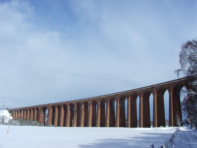
Culloden Viaduct

The Culloden Viaduct is a railway viaduct on the Highland Main Line, to the east of the city of Inverness, in the Highland council area of Scotland. It...

Daviot railway station

Daviot railway station served the village of Daviot, Highland, Scotland, from 1897 to 1965 on the Inverness and Aviemore Direct Railway. == History... ==

Culloden Moor railway station

Culloden Moor railway station served the village of Culloden, Highland, Scotland from 1898 to 1965 on the Inverness and Aviemore Direct Railway. ��2�...

Nearby Amenities

Located within 500m of 57.43994,-4.0226991
Beinn Bhuidhe Mhor
Ele: 548
Natural: peak
Lat/Long: 57.439783/-4.0219753
Hunting Stand
Hunting Stand: grouse_butt
Lat/Long: 57.4442726/-4.023709
Hunting Stand
Hunting Stand: grouse_butt
Lat/Long: 57.4439762/-4.0235993
Hunting Stand
Hunting Stand: grouse_butt
Lat/Long: 57.4436371/-4.0234692
Hunting Stand
Hunting Stand: grouse_butt
Lat/Long: 57.4433046/-4.0233391
Hunting Stand
Hunting Stand: grouse_butt
Lat/Long: 57.4429709/-4.0232029
Hunting Stand
Hunting Stand: grouse_butt
Lat/Long: 57.4426351/-4.0230829
Hunting Stand
Hunting Stand: grouse_butt
Lat/Long: 57.4423113/-4.0229711
Hunting Stand
Hunting Stand: grouse_butt
Lat/Long: 57.4419602/-4.0228268
Hunting Stand
Hunting Stand: grouse_butt
Lat/Long: 57.4423572/-4.022156
Hunting Stand
Hunting Stand: grouse_butt
Lat/Long: 57.4427073/-4.0221072
Hunting Stand
Hunting Stand: grouse_butt
Lat/Long: 57.4433964/-4.0219832
Hunting Stand
Hunting Stand: grouse_butt
Lat/Long: 57.4437782/-4.0219243
Hunting Stand
Hunting Stand: grouse_butt
Lat/Long: 57.4441545/-4.0218592
The data included in this document is from www.openstreetmap.org. The data is made available under ODbL.

Have you been to Beinn Bhuidhe Mhòr?

Leave your review of Beinn Bhuidhe Mhòr below (or comments, questions and feedback).