Bac na Creige

Hill, Mountain in Perthshire

Scotland

Bac na Creige

Snow covered burn The Feith Ghorm Ailleag is somewhere under the snow visible in the foreground of this image. Elsewhere, the burn has a crevasse-like appearance, visible where the snow has collapsed. Crossing to access ground to the north is portentially hazardous, a fall through the snow into the fast-flowing burn could easily result in injury.
Snow covered burn Credit: William Starkey

Bac na Creige is a prominent hill located in Perthshire, Scotland. With an elevation of approximately 703 meters (2,306 feet), it is classified as a Corbett, a term used for Scottish hills between 2,500 and 3,000 feet in height.

Situated in the southern part of the Grampian Mountains, Bac na Creige offers breathtaking panoramic views of the surrounding landscape. Its location within the Loch Tay and Glen Lyon National Scenic Area enhances its natural beauty, making it a popular destination for hikers, mountaineers, and nature enthusiasts.

The ascent to Bac na Creige is moderate, making it accessible to individuals with varying levels of hiking experience. The climb is predominantly over grassy terrain, with some rocky patches towards the summit. On a clear day, the summit rewards visitors with stunning vistas over Loch Tay, the Tay Forest Park, and the surrounding peaks, including the famous Ben Lawers.

The hill is home to a variety of flora and fauna, such as heather, grasses, and mountain hares. Birdwatchers may have the opportunity to spot golden eagles soaring above the hill's craggy slopes.

Located approximately 20 miles west of the town of Aberfeldy, Bac na Creige offers a tranquil escape from the urban bustle. Its natural beauty, diverse wildlife, and captivating views make it a must-visit destination for those seeking an outdoor adventure in the heart of Scotland.

If you have any feedback on the listing, please let us know in the comments section below.

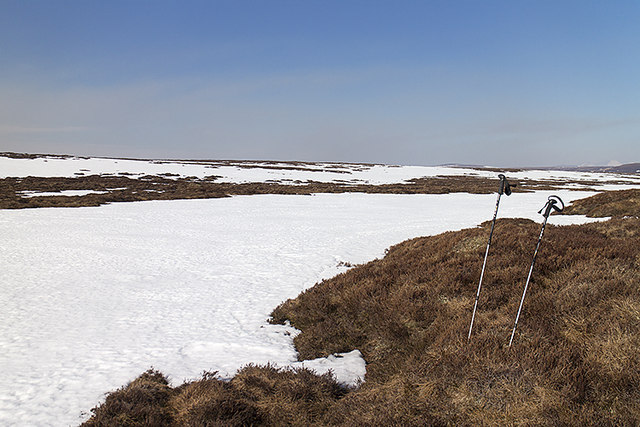
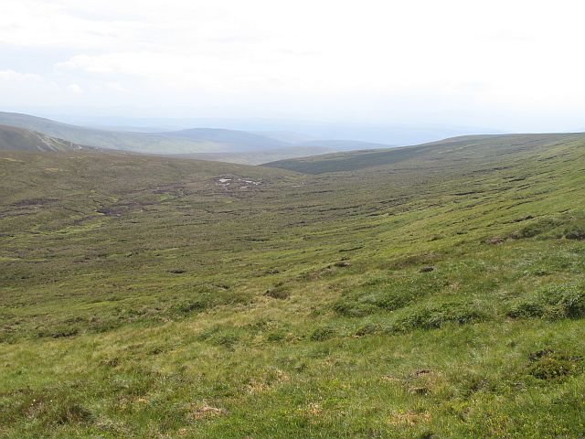
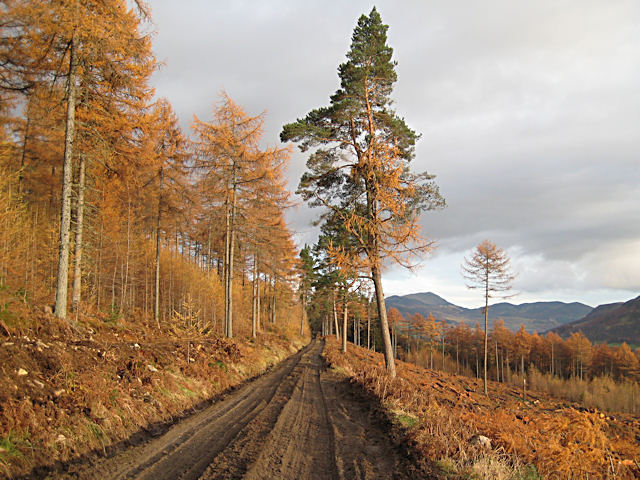
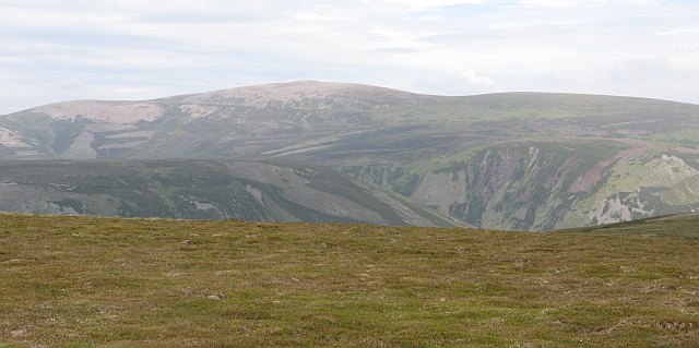
Bac na Creige Images

Images are sourced within 2km of 56.894639/-4.0122371 or Grid Reference NN7779. Thanks to Geograph Open Source API. All images are credited.

Snow covered burn The Feith Ghorm Ailleag is somewhere under the snow visible in the foreground of this image. Elsewhere, the burn has a crevasse-like appearance, visible where the snow has collapsed. Crossing to access ground to the north is portentially hazardous, a fall through the snow into the fast-flowing burn could easily result in injury.
Snow covered burn
The Feith Ghorm Ailleag is somewhere under the snow visible in the foreground of this image. Elsewhere, the burn has a crevasse-like appearance, visible where the snow has collapsed. Crossing to access ground to the north is portentially hazardous, a fall through the snow into the fast-flowing burn could easily result in injury.
Beside the Feith Ghorm Ailleag Late lying snow on the banks of the Feith Ghorm Ailleag.
Beside the Feith Ghorm Ailleag
Late lying snow on the banks of the Feith Ghorm Ailleag.
Moorland north of Meall Odhar a' Choire Snow covered moorland beside the Feith Ghorm Ailleag, north of Meall Odhar a' Choire.
Moorland north of Meall Odhar a' Choire
Snow covered moorland beside the Feith Ghorm Ailleag, north of Meall Odhar a' Choire.
Beside the Feith Ghorm Ailleag Lingering snow on the course of the Feith Ghorm Ailleag - a remote area accessed today via Gleann a' Chrombaidh.
Beside the Feith Ghorm Ailleag
Lingering snow on the course of the Feith Ghorm Ailleag - a remote area accessed today via Gleann a' Chrombaidh.
Allt nan Caoirnich The awkward descent to the Garbh Gaick by Comyn's Road uses the east side of this gorge.
Allt nan Caoirnich
The awkward descent to the Garbh Gaick by Comyn's Road uses the east side of this gorge.
Comyn's road descends to the Gharbh Ghaig Another name for Comyn's Road or Rathad nan Cuimeinach is the Garbh Gaick or rough Gaick, named after the deep glen and burn in the picture.
Since Glen Garry, the road has crossed gently sloping moorland, here the ground drops away and the road begins its descent to the Gaick.  The line of the route, little used since the sixteenth century can clearly be seen as a terrace in the hillside. Further downhill, landslides and rock fall have all but obliterated the route.
Comyn's road descends to the Gharbh Ghaig
Another name for Comyn's Road or Rathad nan Cuimeinach is the Garbh Gaick or rough Gaick, named after the deep glen and burn in the picture. Since Glen Garry, the road has crossed gently sloping moorland, here the ground drops away and the road begins its descent to the Gaick. The line of the route, little used since the sixteenth century can clearly be seen as a terrace in the hillside. Further downhill, landslides and rock fall have all but obliterated the route.
Allt a'  Chaoirnich - Leum nam Fiann Taken from the hazardous descent of Comyn's Road from the Mounth Plateau. The gorge cuts deep into the high ground and has very unstable slopes. Rockfall, avalanche and landslide are all hazards here, and have all but obliterated the ancient road. 
The map names a Leum nam Fiann.  Why the warriors jumped is a mystery, but the Gaick is rich in Gaelic legend and folklore - there is a story here.
Allt a' Chaoirnich - Leum nam Fiann
Taken from the hazardous descent of Comyn's Road from the Mounth Plateau. The gorge cuts deep into the high ground and has very unstable slopes. Rockfall, avalanche and landslide are all hazards here, and have all but obliterated the ancient road. The map names a Leum nam Fiann. Why the warriors jumped is a mystery, but the Gaick is rich in Gaelic legend and folklore - there is a story here.
Head of the Allt an Dubh-easain A bog on a low point of the plateau is slowly drained by the Allt an Dubh-easain, which later plunges off the edge into the Garbh Ghaig glen. <a href="https://www.geograph.org.uk/photo/817588">NN7681 : An Dubh-easain</a>
Head of the Allt an Dubh-easain
A bog on a low point of the plateau is slowly drained by the Allt an Dubh-easain, which later plunges off the edge into the Garbh Ghaig glen. NN7681 : An Dubh-easain
Carr na Moine View down to a boggy col on the Inverness-shire/Perthshire march. While the higher parts of the plateau are dry underfoot, sheltered areas are deep in peat.
Carr na Moine
View down to a boggy col on the Inverness-shire/Perthshire march. While the higher parts of the plateau are dry underfoot, sheltered areas are deep in peat.
Gorge of the Allt Gharbh Ghaig
Carr na Moine A low point in the plateau between Gaick and Dalnamein Forest.
Carr na Moine
A low point in the plateau between Gaick and Dalnamein Forest.
Allt a' Chapirnich Steep sided glen off the Garbh Ghaig. Taken from Comyn's Road as it begins a rather awkward descent off the plateau.
Allt a' Chapirnich
Steep sided glen off the Garbh Ghaig. Taken from Comyn's Road as it begins a rather awkward descent off the plateau.
Allt a' Chapirnich A waterfall deep in the gorge of the Allt a' Chapirnich.
Allt a' Chapirnich
A waterfall deep in the gorge of the Allt a' Chapirnich.
Allt a' Chapirnich meets Garbh Ghaig The stony bed of the Allt a' Chapirnich where it meets the Garbh Ghaig after a steep descent from the plateau.
Allt a' Chapirnich meets Garbh Ghaig
The stony bed of the Allt a' Chapirnich where it meets the Garbh Ghaig after a steep descent from the plateau.
The Mounth : Carr Na Moine The high heathery plateau between Badenoch and Atholl. View through the gap of Carr na Moine towards Leathad an Taobhain.
The Mounth : Carr Na Moine
The high heathery plateau between Badenoch and Atholl. View through the gap of Carr na Moine towards Leathad an Taobhain.
Stac an Dubh-easain A steep spur above the Garbh Ghaig. A large area of heathery plateau beyond.
Stac an Dubh-easain
A steep spur above the Garbh Ghaig. A large area of heathery plateau beyond.
Fèith na Mad Looking up the Fèith na Mad, a burn draining moorland on the Atholl (Perthshire)/Badenoch (Invernessshire) march. The pile of stones is interesting, there are few such piles on these hills and I wonder if it was left there by the builders or maintainers of Comyn's Road which descends to cross the Fèith na Mad near here.
Eagle eyed viewers may spot an eagle exiting stage left. I was trying to compose a shot of the stones, when it took off from a few metres away.
Fèith na Mad
Looking up the Fèith na Mad, a burn draining moorland on the Atholl (Perthshire)/Badenoch (Invernessshire) march. The pile of stones is interesting, there are few such piles on these hills and I wonder if it was left there by the builders or maintainers of Comyn's Road which descends to cross the Fèith na Mad near here. Eagle eyed viewers may spot an eagle exiting stage left. I was trying to compose a shot of the stones, when it took off from a few metres away.
Rathad nan Cuimeinach, Comyn's road The fourteenth century road over the Mounth has been neglected for many years. A lot of the route is now invisible, but traces remain on the higher ground. It can be seen clearly here climbing the steep hillside of Bac na Creige.
Rathad nan Cuimeinach, Comyn's road
The fourteenth century road over the Mounth has been neglected for many years. A lot of the route is now invisible, but traces remain on the higher ground. It can be seen clearly here climbing the steep hillside of Bac na Creige.
Show me another place!

Bac na Creige is located at Grid Ref: NN7779 (Lat: 56.894639, Lng: -4.0122371)

Unitary Authority: Perth and Kinross

Police Authority: Tayside

What 3 Words

///gifts.tricky.shackles. Near Blair Atholl, Perth & Kinross

Nearby Locations

Bac na Creige

Related Wikis

Grampian Mountains

The Grampian Mountains (Scottish Gaelic: Am Monadh) is one of the three major mountain ranges in Scotland, that together occupy about half of Scotland...

Forest of Atholl

The Forest of Atholl (also known as Atholl Forest) is a deer forest near the Scottish village of Blair Atholl, Perth and Kinross, first recorded in the...

Beinn Dearg (Blair Atholl)

Beinn Dearg (1,009 m) is a mountain in the Grampian Mountains of Scotland. It lies north of the Perth and Kinross village of Blair Atholl, in the Forest...

Meall Chuaich

Meall Chuaich (951 m) is a mountain in the Grampian Mountains of Scotland, located east of the village of Dalwhinnie. Although the mountain lacks any distinctive...

Nearby Amenities

Located within 500m of 56.894639,-4.0122371
Bac na Creige
Ele: 770
Natural: peak
Source: OS7
Lat/Long: 56.8940638/-4.0123952
The data included in this document is from www.openstreetmap.org. The data is made available under ODbL.

Have you been to Bac na Creige?

Leave your review of Bac na Creige below (or comments, questions and feedback).