Holmcroft

Settlement in Staffordshire Stafford

England

Holmcroft

Wind turbines near Doxey, Staffordshire
Wind turbines near Doxey, Staffordshire Credit: Roy Hughes

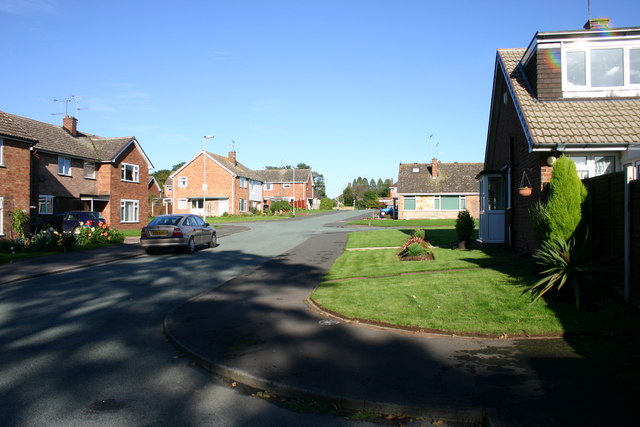
Holmcroft is a small suburb located in the county of Staffordshire, England. Situated approximately 1.5 miles north of the town center of Stafford, it forms part of the wider Stafford urban area. Holmcroft is primarily a residential area, characterized by a mix of housing styles ranging from detached houses to semi-detached and terraced properties.

The suburb benefits from its close proximity to Stafford, offering residents easy access to the town's amenities and services. Within walking distance, there are several local shops, including convenience stores, a post office, and a bakery, providing everyday essentials to the community. Additionally, a larger supermarket can be found nearby, catering to a wider range of shopping needs.

Holmcroft is well-served by public transportation, with regular bus services connecting the suburb to Stafford town center and surrounding areas. The local road network also provides convenient access to major routes, making it easily accessible for commuters and those traveling by car.

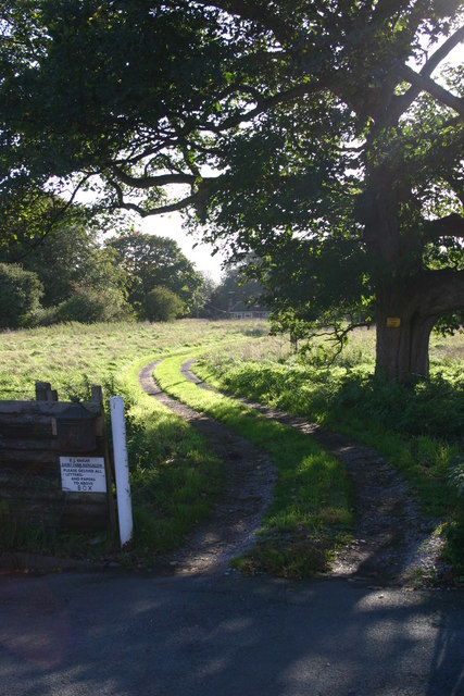
The area is home to several schools, including primary and secondary institutions, ensuring that families have access to quality education for their children. In terms of recreational facilities, Holmcroft benefits from several green spaces, providing opportunities for outdoor activities and leisure pursuits.

Overall, Holmcroft offers a pleasant residential environment with convenient access to amenities, making it an attractive place to live for families and individuals seeking a suburban lifestyle within easy reach of a town center.

If you have any feedback on the listing, please let us know in the comments section below.
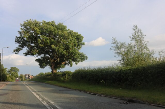
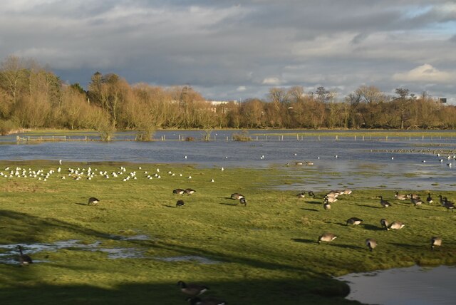
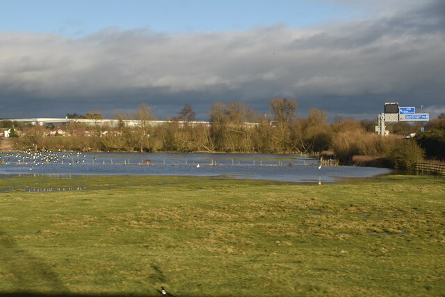
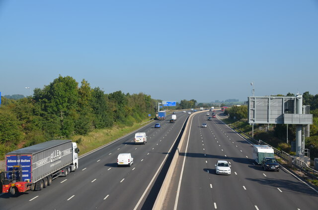
Holmcroft Images

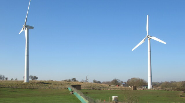
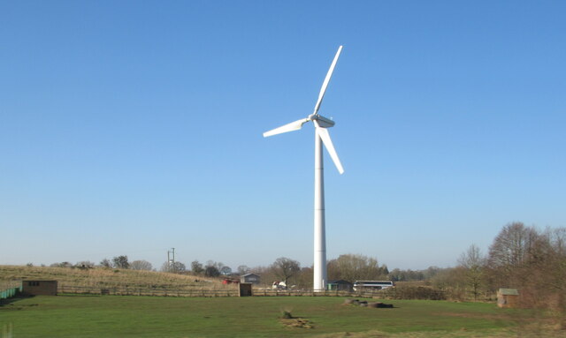
Images are sourced within 2km of 52.822447/-2.130885 or Grid Reference SJ9125. Thanks to Geograph Open Source API. All images are credited.

Wind turbines near Doxey, Staffordshire
A wind turbine near Doxey, Staffordshire
Railway passing underneath the M6 Motorway south of Junction 14
Localised flooding by River Sow
Creswell Grove heading for Stafford
Wildfowl and localised flooding
Localised flooding
Localised flooding
M6 looking north to J14 from Aston Bank bridge The M6 between junctions 13 and 15 was converted to a managed motorway which was opened in August 2022
M6 looking north to J14 from Aston Bank bridge
The M6 between junctions 13 and 15 was converted to a managed motorway which was opened in August 2022
Gantry, M6 The M6 motorway runs from junction 19 of the M1 at the Catthorpe Interchange, near Rugby to the Gretna junction (J45). Here it becomes the A74(M) and M74 which continues to Glasgow.

The M6 is the longest motorway in the United Kingdom (232 miles) and one of the busiest. It incorporates the first length of motorway opened in the UK (the Preston bypass in 1958) and forms part of a motorway "Backbone of Britain", running north-south between London and Glasgow via the industrial north of England. It is also part of the east-west route between the Midlands and the east coast ports.
Gantry, M6
The M6 motorway runs from junction 19 of the M1 at the Catthorpe Interchange, near Rugby to the Gretna junction (J45). Here it becomes the A74(M) and M74 which continues to Glasgow. The M6 is the longest motorway in the United Kingdom (232 miles) and one of the busiest. It incorporates the first length of motorway opened in the UK (the Preston bypass in 1958) and forms part of a motorway "Backbone of Britain", running north-south between London and Glasgow via the industrial north of England. It is also part of the east-west route between the Midlands and the east coast ports.
Wind turbine
Wind turbine
Wilkes Wood, Stafford This is Wilkes Wood, a housing estate on the very fringes of north Stafford.
Wilkes Wood, Stafford
This is Wilkes Wood, a housing estate on the very fringes of north Stafford.
Farm Track to Wilkes Wood This track leads from the housing estate of Wilkes Wood to the small woodland called Wilkes Wood.  This is private land so I was not able to get to photograph the woodland.
Farm Track to Wilkes Wood
This track leads from the housing estate of Wilkes Wood to the small woodland called Wilkes Wood. This is private land so I was not able to get to photograph the woodland.
Chapel Ruins Creswell Chapel on the A5013 near Stafford. The story (I was told today) is that this chapel dates back about 1000yrs. A ruin for many years, this C of E chapel had an annual service held here until about 5 years ago.
Chapel Ruins
Creswell Chapel on the A5013 near Stafford. The story (I was told today) is that this chapel dates back about 1000yrs. A ruin for many years, this C of E chapel had an annual service held here until about 5 years ago.
Derelict Chapel Creswell Chapel. I was forced to use a 200mm lens for this view because the ruin is on private ground. The view is from a public footpath. More info and another view has been submitted.
Derelict Chapel
Creswell Chapel. I was forced to use a 200mm lens for this view because the ruin is on private ground. The view is from a public footpath. More info and another view has been submitted.
Farmland near Creswell Looking from the railway bridge towards the Mount at Cresswell and Primepoint 14.
Farmland near Creswell
Looking from the railway bridge towards the Mount at Cresswell and Primepoint 14.
2008 : The M6 from the overbridge at Aston Bank Looking north near Stafford.
The 'no entry' sign guards an exit for emergency and motorway maintenance vehicles.
2008 : The M6 from the overbridge at Aston Bank
Looking north near Stafford. The 'no entry' sign guards an exit for emergency and motorway maintenance vehicles.
M6 North crosses the railway Northwest of Stafford, approaching junction 14. The railway is the West Coast main line between Stafford and the junction for Stoke and Manchester.
M6 North crosses the railway
Northwest of Stafford, approaching junction 14. The railway is the West Coast main line between Stafford and the junction for Stoke and Manchester.
M6 Motorway - half-mile to junction 14, northbound
Show me another place!

Holmcroft is located at Grid Ref: SJ9125 (Lat: 52.822447, Lng: -2.130885)

Administrative County: Staffordshire

District: Stafford

Police Authority: Staffordshire

What 3 Words

///wing.stamp.best. Near Stafford, Staffordshire

Related Wikis

Holmcroft

Holmcroft is the name of a Stafford, Staffordshire, England, residential estate approximately 1½ miles north of Stafford town centre, situated in a geographic...

Tillington, Staffordshire

Tillington is an area of Stafford, in Staffordshire, England. The area lies about 1½ miles north of the town centre. Essentially, the district lies within...

Sir Graham Balfour School

Sir Graham Balfour School is a coeducational secondary school and sixth form located in Stafford, England. It is named after Graham Balfour, son of the...
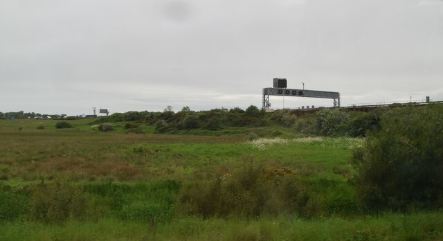
Doxey Marshes

Doxey Marshes is a 150 hectares (370 acres) nature reserve located within two miles of Stafford town centre, and is managed by Staffordshire Wildlife Trust...

Nearby Amenities

Located within 500m of 52.822447,-2.130885
Traffic Signals
Lat/Long: 52.8233384/-2.1279043
Turning Circle
Lat/Long: 52.8209647/-2.1323548
Post Box
Brand: Royal Mail
Brand Wikidata: Q638098
Brand Wikipedia: en:Royal Mail
Collection Times: Mo-Fr 16:15; Sa 09:00
Operator: Royal Mail
Operator Wikidata: Q638098
Post Box Type: lamp
Ref: ST16 47
Royal Cypher: EIIR
Royal Cypher Wikidata: Q33102113
Lat/Long: 52.8192546/-2.1320534
Speed Camera
Enforcement: maxspeed
Maxspeed: 30 mph
Note: Max speed confirmed
Lat/Long: 52.8251978/-2.1287798
Crossing
Lat/Long: 52.8217273/-2.1324609
The Co-operative Food
Addr Housenumber: 52-56
Addr Postcode: ST16 1JB
Addr Street: Holmcroft Road
Fhrs Id: 1196047
Opening Hours: Mo-Su 07:00-22:00
Operator: Central England Co-operative
Operator Wikidata: Q16986583
Shop: supermarket
Source Addr: FHRS Open Data
Website: https://stores.centralengland.coop/staffordshire/stafford/52-56-holmcroft-road
Lat/Long: 52.8212531/-2.1326065
Atm
Lat/Long: 52.8213029/-2.132575
Noexit: yes
Lat/Long: 52.8213367/-2.1361229
Noexit: yes
Lat/Long: 52.8206239/-2.1349829
Post Box
Brand: Royal Mail
Brand Wikidata: Q638098
Brand Wikipedia: en:Royal Mail
Operator: Royal Mail
Operator Wikidata: Q638098
Post Box Type: pillar
Postal Code: ST16
Ref: ST16 44
Royal Cypher: GR
Royal Cypher Wikidata: Q33102273
Lat/Long: 52.8216706/-2.1267031
Bench
Lat/Long: 52.8216133/-2.1338502
Best-One
Opening Hours: Mo-Sa 06:00-23:00; Su 08:00-22:30
Lat/Long: 52.821957/-2.1265908
Turning Circle
Lat/Long: 52.8257287/-2.1305139
Addr City: Stafford
Addr Postcode: ST16 1JG
Addr Street: Holmcroft Road
Dispensing: yes
Opening Hours: Mo-Fr 08:45-20:00; Sa 09:00-13:00
Operator: Cornwell's Chemists
Phone: +44 1785 250151
Lat/Long: 52.8221196/-2.1327182
Bus Stop
Crispins PH
Bus: yes
Naptan AtcoCode: 3800C735201
Naptan Bearing: N
Naptan CommonName: Crispins PH
Naptan Indicator: Adj
Naptan Landmark: Crispins PH
Naptan PlusbusZoneRef: STAFFRD
Naptan Street: Stone Road
Naptan Verified: no
Public Transport: platform
Source: naptan_import
Lat/Long: 52.8268604/-2.1294476
Bus Stop
Brooklands School
Bus: yes
Naptan AtcoCode: 3800C736501
Naptan Bearing: SE
Naptan CommonName: Brooklands School
Naptan Indicator: Opp
Naptan Landmark: Brooklands School
Naptan PlusbusZoneRef: STAFFRD
Naptan Street: Eccleshall Road
Naptan Verified: no
Public Transport: platform
Source: naptan_import
Lat/Long: 52.8194317/-2.1323934
Bus Stop
Brooklands School
Bus: yes
Naptan AtcoCode: 3800C736502
Naptan Bearing: NW
Naptan CommonName: Brooklands School
Naptan Indicator: Adj
Naptan Landmark: Brooklands School
Naptan PlusbusZoneRef: STAFFRD
Naptan Street: Eccleshall Road
Naptan Verified: no
Public Transport: platform
Source: naptan_import
Lat/Long: 52.8186958/-2.1313079
Bus Stop
Holmcroft Road
Bus: yes
Naptan AtcoCode: 3800C736701
Naptan Bearing: N
Naptan CommonName: Holmcroft Road
Naptan Indicator: Opp
Naptan Landmark: Croft Road
Naptan PlusbusZoneRef: STAFFRD
Naptan Street: Eccleshall Road
Naptan Verified: no
Public Transport: platform
Source: naptan_import
Lat/Long: 52.8203911/-2.1345925
Bus Stop
Tillington Hall Hotel
Bus: yes
Naptan AtcoCode: 3800C736702
Naptan Bearing: SE
Naptan CommonName: Tillington Hall Hotel
Naptan Indicator: Adj
Naptan Landmark: Tillington Hall Hotel
Naptan PlusbusZoneRef: STAFFRD
Naptan Street: Eccleshall Rd
Naptan Verified: no
Public Transport: platform
Source: naptan_import
Lat/Long: 52.8216123/-2.1358428
Bus Stop
Woodlands Road
Bus: yes
Naptan AtcoCode: 3800C737001
Naptan Bearing: SE
Naptan CommonName: Woodlands Road
Naptan Indicator: Adj
Naptan Landmark: Woodlands Road
Naptan PlusbusZoneRef: STAFFRD
Naptan Street: Eccleshall Road
Naptan Verified: no
Public Transport: platform
Source: naptan_import
Lat/Long: 52.8226527/-2.1379533
Bus Stop
Meakin Grove
Bus: yes
Naptan AtcoCode: 3800C737002
Naptan Bearing: NW
Naptan CommonName: Meakin Grove
Naptan Indicator: Opp
Naptan Landmark: Meakin Grove
Naptan PlusbusZoneRef: STAFFRD
Naptan Street: Eccleshall Road
Naptan Verified: no
Public Transport: platform
Source: naptan_import
Lat/Long: 52.8222756/-2.1375366
Bus Stop
First Avenue
Bus: yes
Naptan AtcoCode: 3800C738101
Naptan Bearing: SW
Naptan CommonName: First Avenue
Naptan Indicator: Adj
Naptan Landmark: First Avenue (S)
Naptan PlusbusZoneRef: STAFFRD
Naptan Street: Woodlands Road
Naptan Verified: no
Public Transport: platform
Source: naptan_import
Lat/Long: 52.8260927/-2.1327104
Bus Stop
First Avenue
Bus: yes
Naptan AtcoCode: 3800C738102
Naptan Bearing: NE
Naptan CommonName: First Avenue
Naptan Indicator: Adj
Naptan Landmark: First Avenue (N)
Naptan PlusbusZoneRef: STAFFRD
Naptan Street: Woodlands Road
Naptan Verified: no
Public Transport: platform
Source: naptan_import
Lat/Long: 52.8261464/-2.1329035
Bus Stop
Second Avenue
Bus: yes
Naptan AtcoCode: 3800C738201
Naptan Bearing: SW
Naptan CommonName: Second Avenue
Naptan Indicator: Adj
Naptan Landmark: Second Avenue
Naptan PlusbusZoneRef: STAFFRD
Naptan Street: Woodlands Road
Naptan Verified: no
Public Transport: platform
Source: naptan_import
Lat/Long: 52.8255783/-2.1344898
Bus Stop
Hurlingham Road
Bus: yes
Naptan AtcoCode: 3800C738202
Naptan Bearing: NE
Naptan CommonName: Hurlingham Road
Naptan Indicator: Adj
Naptan Landmark: Hurlingham Rd
Naptan PlusbusZoneRef: STAFFRD
Naptan Street: Woodlands Road
Naptan Verified: no
Public Transport: platform
Source: naptan_import
Lat/Long: 52.8256411/-2.1346384
Bus Stop
Craddock Road
Bus: yes
Naptan AtcoCode: 3800C738301
Naptan Bearing: NW
Naptan CommonName: Craddock Road
Naptan Indicator: Opp
Naptan Landmark: raddock Rd
Naptan PlusbusZoneRef: STAFFRD
Naptan Street: Second Avenue
Naptan Verified: no
Public Transport: platform
Source: naptan_import
Lat/Long: 52.8239882/-2.1335796
Bus Stop
Hawke Road
Bus: yes
Naptan AtcoCode: 3800C738302
Naptan Bearing: SE
Naptan CommonName: Hawke Road
Naptan Indicator: Adj
Naptan Landmark: Hawke Road
Naptan PlusbusZoneRef: STAFFRD
Naptan Street: Second Avenue
Naptan Verified: no
Public Transport: platform
Source: naptan_import
Lat/Long: 52.8238628/-2.1331043
Bus Stop
Holmcroft Road
Bus: yes
Naptan AtcoCode: 3800C738401
Naptan Bearing: SE
Naptan CommonName: Holmcroft Road
Naptan Indicator: Adj
Naptan Landmark: Holmcroft Road
Naptan PlusbusZoneRef: STAFFRD
Naptan Street: Second Avenue
Naptan Verified: no
Public Transport: platform
Source: naptan_import
Lat/Long: 52.8226964/-2.1310973
Bus Stop
Clare Avenue
Bus: yes
Naptan AtcoCode: 3800C738402
Naptan Bearing: NW
Naptan CommonName: Clare Avenue
Naptan Indicator: Opp
Naptan Landmark: Clare Avenue
Naptan PlusbusZoneRef: STAFFRD
Naptan Street: Second Avenue
Naptan Verified: no
Public Transport: platform
Source: naptan_import
Lat/Long: 52.8228577/-2.1315727
Bus Stop
First Avenue
Bus: yes
Naptan AtcoCode: 3800C738601
Naptan Bearing: SW
Naptan CommonName: First Avenue
Naptan Indicator: Adj
Naptan Landmark: First Avenue
Naptan PlusbusZoneRef: STAFFRD
Naptan Street: Holmcroft Road
Naptan Verified: no
Public Transport: platform
Source: naptan_import
Lat/Long: 52.8230406/-2.1287685
Bus Stop
Second Avenue
Bus: yes
Naptan AtcoCode: 3800C738602
Naptan Bearing: NE
Naptan CommonName: Second Avenue
Naptan Indicator: Adj
Naptan Landmark: Second Avenue
Naptan PlusbusZoneRef: STAFFRD
Naptan Street: Holmcroft Road
Naptan Verified: no
Public Transport: platform
Source: naptan_import
Lat/Long: 52.8227604/-2.1301626
Bus Stop
The Common
Bus: yes
Naptan AtcoCode: 3800C739001
Naptan Bearing: N
Naptan CommonName: The Common
Naptan Indicator: Opp
Naptan Landmark: The Common
Naptan PlusbusZoneRef: STAFFRD
Naptan Street: Stone Road
Naptan Verified: no
Public Transport: platform
Source: naptan_import
Lat/Long: 52.8202211/-2.1257181
Bus Stop
The Common
Bus: yes
Naptan AtcoCode: 3800C739002
Naptan Bearing: S
Naptan CommonName: The Common
Naptan Indicator: Adj
Naptan Landmark: The Common
Naptan PlusbusZoneRef: STAFFRD
Naptan Street: Stone Road
Naptan Verified: no
Public Transport: platform
Source: naptan_import
Lat/Long: 52.8199249/-2.1253017
Bus Stop
Gordon Avenue
Bus: yes
Naptan AtcoCode: 3800C750401
Naptan Bearing: S
Naptan CommonName: Gordon Avenue
Naptan Indicator: Opp
Naptan Landmark: Gordon Avenue
Naptan PlusbusZoneRef: STAFFRD
Naptan Street: Stone Road
Naptan Verified: no
Public Transport: platform
Source: naptan_import
Lat/Long: 52.8255846/-2.1287908
Bus Stop
North Avenue
Bus: yes
Naptan AtcoCode: 3800C791500
Naptan Bearing: SE
Naptan CommonName: North Avenue
Naptan Indicator: Adj
Naptan Landmark: North Avenue
Naptan PlusbusZoneRef: STAFFRD
Naptan Street: Stone Road
Naptan Verified: no
Public Transport: platform
Source: naptan_import
Lat/Long: 52.8227635/-2.1272836
Bus Stop
Holmcroft Road
Bus: yes
Naptan AtcoCode: 3800C791501
Naptan Bearing: N
Naptan CommonName: Holmcroft Road
Naptan Indicator: Adj
Naptan Landmark: Holmcroft Road
Naptan PlusbusZoneRef: STAFFRD
Naptan Street: Stone Road
Naptan Verified: no
Public Transport: platform
Source: naptan_import
Lat/Long: 52.8236164/-2.128325
Traffic Signals
Crossing: traffic_signals
Lat/Long: 52.8215453/-2.1264823
Speed Camera
Maxspeed: 30 mph
Lat/Long: 52.8255804/-2.1289149
Bicycle Parking
Capacity: 6
Fee: no
Lat/Long: 52.82145/-2.1266463
Post Office
Bargain Booze Plus
Addr Housenumber: 245
Addr Postcode: ST16 1LA
Addr Street: Stone Road
Fhrs Id: 1195607
Opening Hours: Mo-Sa 06:00-22:00; Su 07:00-19:00
Shop: convenience
Source Addr: FHRS Open Data
Lat/Long: 52.8217204/-2.1266948
Dentist
PURE Dental Solutions
Healthcare: dentist
Lat/Long: 52.8219129/-2.1374316
Clean Express
Shop: laundry
Lat/Long: 52.8213721/-2.1324764
Shop: hairdresser
Lat/Long: 52.8213993/-2.1324285
Kindergarten
Holmcroft Pre-school Playgroup
Lat/Long: 52.8224268/-2.1320795
Coral
Brand: Coral
Brand Wikidata: Q54621344
Brand Wikipedia: en:Coral (bookmaker)
Shop: bookmaker
Lat/Long: 52.8214248/-2.1324117
Newlands Avenue
Power: substation
Ref: 861054
Lat/Long: 52.8257935/-2.1264102
Post Box
Brand: Royal Mail
Brand Wikidata: Q638098
Brand Wikipedia: en:Royal Mail
Collection Times: Mo-Fr 16:30; Sa 09:00
Operator: Royal Mail
Operator Wikidata: Q638098
Post Box Type: lamp
Ref: ST16 445
Royal Cypher: EIIR
Royal Cypher Wikidata: Q33102113
Lat/Long: 52.825261/-2.1351468
Mark James Hair Design
Shop: hairdresser
Lat/Long: 52.8221457/-2.1267334
Plumbing Point Ltd
Shop: doityourself
Lat/Long: 52.8255223/-2.1293859
Woodlands Road
Power: substation
Ref: 961787
Lat/Long: 52.8265848/-2.1300266
Recycling
Recycling Clothes: yes
Lat/Long: 52.8211461/-2.1267536
Post Box
Post Box Type: wall
Ref: ST16 45
Royal Cypher: EIIR
Royal Cypher Wikidata: Q33102113
Lat/Long: 52.8251885/-2.1290447
Atm
Co Op
Fee: no
Operator: Co-Operative Bank
Lat/Long: 52.8215035/-2.126683
Holmcroft Youth and Community Centre
Building: yes
Lat/Long: 52.8250844/-2.1254484
Bench
Lat/Long: 52.8247682/-2.1358446
Entrance: main
Lat/Long: 52.8184204/-2.1281934
Post Box
Brand: Royal Mail
Brand Wikidata: Q638098
Brand Wikipedia: en:Royal Mail
Operator: Royal Mail
Operator Wikidata: Q638098
Post Box Type: pillar
Postal Code: ST16
Royal Cypher: GR
Royal Cypher Wikidata: Q33102273
Lat/Long: 52.8220075/-2.1370185
Generator Method: photovoltaic
Generator Output Electricity: yes
Generator Source: solar
Generator Type: solar_photovoltaic_panel
Location: roof
Power: generator
Lat/Long: 52.8264816/-2.1308351
Generator Method: photovoltaic
Generator Output Electricity: yes
Generator Source: solar
Generator Type: solar_photovoltaic_panel
Location: roof
Power: generator
Lat/Long: 52.8204733/-2.1370983
Generator Method: photovoltaic
Generator Output Electricity: yes
Generator Source: solar
Generator Type: solar_photovoltaic_panel
Location: roof
Power: generator
Lat/Long: 52.8201362/-2.136822
Generator Method: photovoltaic
Generator Output Electricity: yes
Generator Source: solar
Generator Type: solar_photovoltaic_panel
Location: roof
Power: generator
Lat/Long: 52.8201378/-2.1366343
Generator Method: photovoltaic
Generator Output Electricity: yes
Generator Source: solar
Generator Type: solar_photovoltaic_panel
Location: roof
Power: generator
Lat/Long: 52.8201021/-2.1365297
Generator Method: photovoltaic
Generator Output Electricity: yes
Generator Source: solar
Generator Type: solar_photovoltaic_panel
Location: roof
Power: generator
Lat/Long: 52.8201897/-2.1348479
Generator Method: photovoltaic
Generator Output Electricity: yes
Generator Source: solar
Generator Type: solar_photovoltaic_panel
Location: roof
Power: generator
Lat/Long: 52.8198412/-2.1343973
Generator Method: photovoltaic
Generator Output Electricity: yes
Generator Source: solar
Generator Type: solar_photovoltaic_panel
Location: roof
Power: generator
Lat/Long: 52.8194181/-2.1333995
Generator Method: photovoltaic
Generator Output Electricity: yes
Generator Source: solar
Generator Type: solar_photovoltaic_panel
Location: roof
Power: generator
Lat/Long: 52.8193792/-2.1333191
Generator Method: photovoltaic
Generator Output Electricity: yes
Generator Source: solar
Generator Type: solar_photovoltaic_panel
Location: roof
Power: generator
Lat/Long: 52.818311/-2.1322703
Generator Method: photovoltaic
Generator Output Electricity: yes
Generator Source: solar
Generator Type: solar_photovoltaic_panel
Location: roof
Power: generator
Lat/Long: 52.8183872/-2.1324232
Generator Method: photovoltaic
Generator Output Electricity: yes
Generator Source: solar
Generator Type: solar_photovoltaic_panel
Location: roof
Power: generator
Lat/Long: 52.8184245/-2.1325493
Generator Method: photovoltaic
Generator Output Electricity: yes
Generator Source: solar
Generator Type: solar_photovoltaic_panel
Location: roof
Power: generator
Lat/Long: 52.8185023/-2.1327156
Generator Method: photovoltaic
Generator Output Electricity: yes
Generator Source: solar
Generator Type: solar_photovoltaic_panel
Location: roof
Power: generator
Lat/Long: 52.8249095/-2.1303177
Generator Method: photovoltaic
Generator Orientation: 245
Generator Output Electricity: yes
Generator Place: roof
Generator Solar Modules: 12
Generator Source: solar
Generator Type: solar_photovoltaic_panel
Location: roof
Power: generator
Lat/Long: 52.8222271/-2.1273378
Generator Method: photovoltaic
Generator Orientation: 245
Generator Output Electricity: yes
Generator Place: roof
Generator Solar Modules: 6
Generator Source: solar
Generator Type: solar_photovoltaic_panel
Location: roof
Power: generator
Lat/Long: 52.8210212/-2.1265465
Generator Method: photovoltaic
Generator Orientation: 155
Generator Output Electricity: yes
Generator Place: roof
Generator Solar Modules: 6
Generator Source: solar
Generator Type: solar_photovoltaic_panel
Location: roof
Power: generator
Lat/Long: 52.8211087/-2.1265599
Generator Method: photovoltaic
Generator Orientation: 245
Generator Output Electricity: yes
Generator Place: roof
Generator Solar Modules: 12
Generator Source: solar
Generator Type: solar_photovoltaic_panel
Location: roof
Power: generator
Lat/Long: 52.8210763/-2.1264821
Generator Method: photovoltaic
Generator Orientation: 155
Generator Output Electricity: yes
Generator Place: roof
Generator Solar Modules: 12
Generator Source: solar
Generator Type: solar_photovoltaic_panel
Location: roof
Power: generator
Lat/Long: 52.8210082/-2.1264553
Generator Method: photovoltaic
Generator Output Electricity: yes
Generator Source: solar
Generator Type: solar_photovoltaic_panel
Location: roof
Power: generator
Lat/Long: 52.8246129/-2.1373504
Generator Method: photovoltaic
Generator Output Electricity: yes
Generator Source: solar
Generator Type: solar_photovoltaic_panel
Location: roof
Power: generator
Lat/Long: 52.824715/-2.1371385
Generator Method: photovoltaic
Generator Output Electricity: yes
Generator Source: solar
Generator Type: solar_photovoltaic_panel
Location: roof
Power: generator
Lat/Long: 52.8247442/-2.1370715
Generator Method: photovoltaic
Generator Output Electricity: yes
Generator Source: solar
Generator Type: solar_photovoltaic_panel
Location: roof
Power: generator
Lat/Long: 52.8245351/-2.1366558
Generator Method: photovoltaic
Generator Output Electricity: yes
Generator Source: solar
Generator Type: solar_photovoltaic_panel
Location: roof
Power: generator
Lat/Long: 52.8243017/-2.1371707
Generator Method: photovoltaic
Generator Output Electricity: yes
Generator Source: solar
Generator Type: solar_photovoltaic_panel
Location: roof
Power: generator
Lat/Long: 52.823749/-2.1376321
Generator Method: photovoltaic
Generator Output Electricity: yes
Generator Source: solar
Generator Type: solar_photovoltaic_panel
Location: roof
Power: generator
Lat/Long: 52.8241591/-2.1375623
Generator Method: photovoltaic
Generator Output Electricity: yes
Generator Source: solar
Generator Type: solar_photovoltaic_panel
Location: roof
Power: generator
Lat/Long: 52.8222482/-2.1379834
Generator Method: photovoltaic
Generator Output Electricity: yes
Generator Source: solar
Generator Type: solar_photovoltaic_panel
Location: roof
Power: generator
Lat/Long: 52.8226258/-2.1374041
Generator Method: photovoltaic
Generator Output Electricity: yes
Generator Source: solar
Generator Type: solar_photovoltaic_panel
Location: roof
Power: generator
Lat/Long: 52.8232466/-2.1361622
Generator Method: photovoltaic
Generator Output Electricity: yes
Generator Source: solar
Generator Type: solar_photovoltaic_panel
Location: roof
Power: generator
Lat/Long: 52.8234703/-2.1358725
Defibrillator
Defibrillator Location: outside Co-op, Stone Road, Stafford - facing car park
Emergency: defibrillator
Indoor: no
Lat/Long: 52.8214645/-2.1266877
Entrance: main
Lat/Long: 52.8217593/-2.1329337
The data included in this document is from www.openstreetmap.org. The data is made available under ODbL.

Have you been to Holmcroft?

Leave your review of Holmcroft below (or comments, questions and feedback).