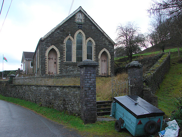
Bryn Mawr
Hill, Mountain in Montgomeryshire
Wales
Bryn Mawr

Bryn Mawr, a small hill located in Montgomeryshire, is a prominent landmark in the region. Situated in the heart of Wales, this mountainous area is known for its stunning natural beauty and rich history.
Bryn Mawr stands at an elevation of approximately 1,380 feet (420 meters) above sea level, offering breathtaking panoramic views of the surrounding countryside. Covered in lush greenery, the hill is home to a diverse range of flora and fauna, making it a popular spot for nature enthusiasts and hikers.
The name "Bryn Mawr" translates to "big hill" in Welsh, accurately reflecting its imposing presence in the landscape. The hill's strategic location has played a significant role throughout history, serving as a vantage point and defensive position during various conflicts.
For visitors, Bryn Mawr provides an opportunity to explore the area's heritage and enjoy outdoor activities. Several walking trails and footpaths crisscross the hill, allowing visitors to appreciate its natural beauty up close. Additionally, the surrounding area offers attractions such as historical sites, traditional Welsh villages, and charming countryside pubs.
Bryn Mawr is easily accessible, with roads leading to its base and ample parking facilities available for visitors. Local amenities, including cafes and visitor centers, provide information and services to enhance the experience of exploring the hill and its surroundings.
In summary, Bryn Mawr is a picturesque hill in Montgomeryshire, Wales, offering stunning views, a rich history, and a range of outdoor activities for visitors to enjoy.
If you have any feedback on the listing, please let us know in the comments section below.
Bryn Mawr Images
Images are sourced within 2km of 52.552247/-3.8245155 or Grid Reference SN7696. Thanks to Geograph Open Source API. All images are credited.

Bryn Mawr is located at Grid Ref: SN7696 (Lat: 52.552247, Lng: -3.8245155)
Unitary Authority: Powys
Police Authority: Dyfed Powys
What 3 Words
///goggle.yacht.hides. Near Machynlleth, Powys
Nearby Locations
Related Wikis
Pistyll y Llyn
Pistyll y Llyn is one of the tallest waterfalls in Wales and the United Kingdom. It is a horsetail style set of falls which are located in the Cambrian...
Forge, Powys
Forge (Welsh: "Y Bontfaen") is a village in the county of Powys, Wales near to Machynlleth. It lies on the southern Afon Dulas on the mountain road to...
Machynlleth F.C.
Machynlleth Football Club (Welsh: Clwb Pêl Droed Machynlleth) is a Welsh football team based in Machynlleth, Powys, Wales. They played in the Ardal Leagues...
Plas Machynlleth
Plas Machynlleth is the former Welsh residence of the Marquesses of Londonderry. It is situated in the market town of Machynlleth in Powys (formerly Montgomeryshire...
Nearby Amenities
Located within 500m of 52.552247,-3.8245155Have you been to Bryn Mawr?
Leave your review of Bryn Mawr below (or comments, questions and feedback).


