Bag Tor

Hill, Mountain in Devon Teignbridge

England

Bag Tor

Haytor - Car Park Several car parks line the road below Haytor where grass and bracken are prominent on the moorland.
Haytor - Car Park Credit: Colin Smith

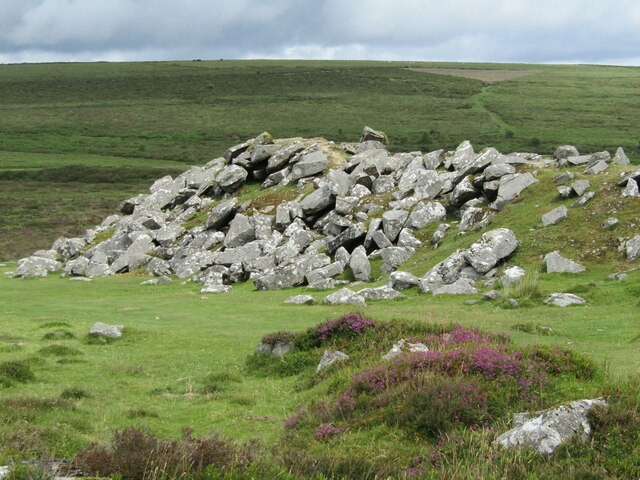
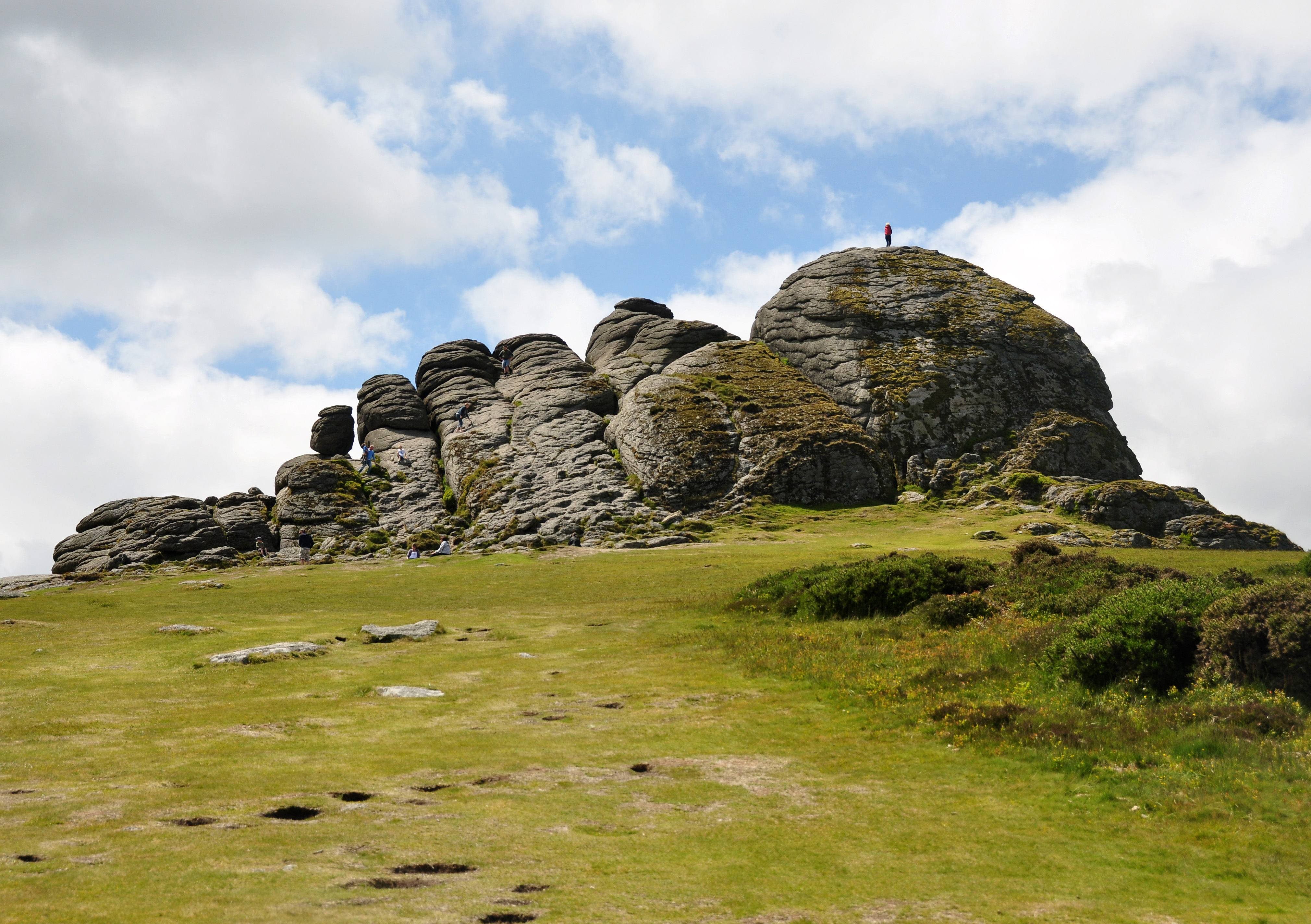
Bag Tor is a prominent hill located in Devon, England. Standing at an elevation of 309 meters (1,014 feet), it is known for its stunning views and unique geological features. Situated on the eastern edge of Dartmoor National Park, Bag Tor offers visitors a picturesque and tranquil escape from the bustling city life.

The hill is composed mainly of granite, which has been weathered over time, resulting in fascinating rock formations and tors. Bag Tor itself is a tor, a large outcrop of exposed bedrock, which adds to its distinctive character. The tor is easily accessible, with footpaths leading to its summit, making it a popular destination for hikers and nature enthusiasts.

From the top of Bag Tor, visitors are rewarded with breathtaking panoramic views of the surrounding countryside. On a clear day, one can see the rolling hills of Dartmoor, the picturesque villages nestled in the valleys, and even glimpses of the distant coastline. The hill is particularly renowned for its stunning sunsets, attracting photographers and artists alike.

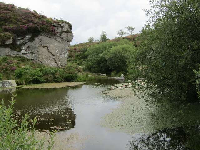
Bag Tor is also home to a diverse range of flora and fauna. The hillside is covered in heather and gorse, providing a habitat for various bird species, including skylarks and stonechats. Rare plants such as the yellow-wort and the white rock-rose can also be found here, adding to the area's ecological significance.

Overall, Bag Tor is a natural gem within the Devon landscape. Its combination of geological wonders, breathtaking views, and abundant wildlife make it a must-visit destination for anyone seeking a peaceful and awe-inspiring experience in the heart of nature.

If you have any feedback on the listing, please let us know in the comments section below.
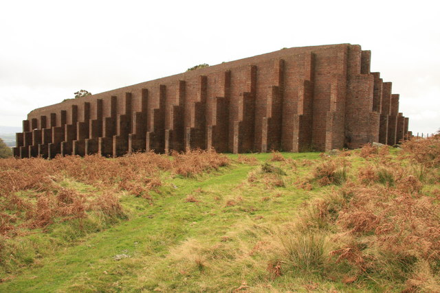
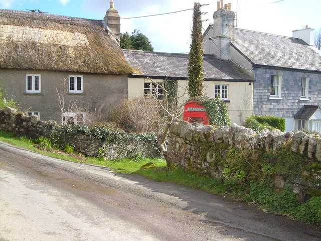
Bag Tor Images

Images are sourced within 2km of 50.568618/-3.7497655 or Grid Reference SX7675. Thanks to Geograph Open Source API. All images are credited.

Haytor - Car Park Several car parks line the road below Haytor where grass and bracken are prominent on the moorland.
Haytor - Car Park
Several car parks line the road below Haytor where grass and bracken are prominent on the moorland.
Haytor Rocks Popular and prominent granite outcrop (457m amsl) only a few minutes walk from the road below. The jointed and weathered rocks rise up to 50 feet above the grassy, moorland surroundings.
<span class="nowrap"><a title="www.dartmoor.gov.uk" rel="nofollow ugc noopener" href="http://www.dartmoor.gov.uk">Link</a><img style="margin-left:2px;" alt="External link" title="External link - shift click to open in new window" src="https://s1.geograph.org.uk/img/external.png" width="10" height="10"/></span>
Haytor Rocks
Popular and prominent granite outcrop (457m amsl) only a few minutes walk from the road below. The jointed and weathered rocks rise up to 50 feet above the grassy, moorland surroundings. LinkExternal link
Haytor - Moorland Blooming heather on the moorland slope north of Haytor Rocks. Granite outcrops abound.
<span class="nowrap"><a title="www.dartmoor.gov.uk" rel="nofollow ugc noopener" href="http://www.dartmoor.gov.uk">Link</a><img style="margin-left:2px;" alt="External link" title="External link - shift click to open in new window" src="https://s1.geograph.org.uk/img/external.png" width="10" height="10"/></span>
Haytor - Moorland
Blooming heather on the moorland slope north of Haytor Rocks. Granite outcrops abound. LinkExternal link
Haytor - Disused Quarry Former granite quarry on the moorland north of Haytor Rocks.
Haytor - Disused Quarry
Former granite quarry on the moorland north of Haytor Rocks.
Haytor - Disused Quarry Former granite quarry on the moorland north of Haytor Rocks. Blooming heather in profusion.
<span class="nowrap"><a title="www.dartmoor.gov.uk" rel="nofollow ugc noopener" href="http://www.dartmoor.gov.uk">Link</a><img style="margin-left:2px;" alt="External link" title="External link - shift click to open in new window" src="https://s1.geograph.org.uk/img/external.png" width="10" height="10"/></span>
Haytor - Disused Quarry
Former granite quarry on the moorland north of Haytor Rocks. Blooming heather in profusion. LinkExternal link
Haytor - Disused Granite Tramway The historic Haytor Granite Tramway was built ca 1820 for transporting granite from Haytor Down to the Stover Canal, some 10 miles away. Note that the trackbed has been made of flanged granite, to guide the wheels of horse-drawn wagons.
<span class="nowrap"><a title="www.dartmoor.gov.uk" rel="nofollow ugc noopener" href="http://www.dartmoor.gov.uk">Link</a><img style="margin-left:2px;" alt="External link" title="External link - shift click to open in new window" src="https://s1.geograph.org.uk/img/external.png" width="10" height="10"/></span>
Haytor - Disused Granite Tramway
The historic Haytor Granite Tramway was built ca 1820 for transporting granite from Haytor Down to the Stover Canal, some 10 miles away. Note that the trackbed has been made of flanged granite, to guide the wheels of horse-drawn wagons. LinkExternal link
Haytor Rocks Popular and prominent granite outcrop (457m amsl) only a few minutes walk from the road below. The jointed and weathered rocks rise up to 50 feet above the grassy, moorland surroundings. A party of rock climbers has arrived there.
<span class="nowrap"><a title="www.dartmoor.gov.uk" rel="nofollow ugc noopener" href="http://www.dartmoor.gov.uk">Link</a><img style="margin-left:2px;" alt="External link" title="External link - shift click to open in new window" src="https://s1.geograph.org.uk/img/external.png" width="10" height="10"/></span>
Haytor Rocks
Popular and prominent granite outcrop (457m amsl) only a few minutes walk from the road below. The jointed and weathered rocks rise up to 50 feet above the grassy, moorland surroundings. A party of rock climbers has arrived there. LinkExternal link
Haytor - Disused Granite Tramway The historic Haytor Granite Tramway was built ca 1820 for transporting granite from Haytor Down to the Stover Canal, some 10 miles away. Note that the trackbed has been made of flanged granite, to guide the wheels of horse-drawn wagons.
<span class="nowrap"><a title="www.dartmoor.gov.uk" rel="nofollow ugc noopener" href="http://www.dartmoor.gov.uk">Link</a><img style="margin-left:2px;" alt="External link" title="External link - shift click to open in new window" src="https://s1.geograph.org.uk/img/external.png" width="10" height="10"/></span>
Haytor - Disused Granite Tramway
The historic Haytor Granite Tramway was built ca 1820 for transporting granite from Haytor Down to the Stover Canal, some 10 miles away. Note that the trackbed has been made of flanged granite, to guide the wheels of horse-drawn wagons. LinkExternal link
Haytor Down - Dartmoor Ponies Quintessential Dartmoor - ponies, moorland and historic granite tramway.
<span class="nowrap"><a title="www.dartmoor.gov.uk" rel="nofollow ugc noopener" href="http://www.dartmoor.gov.uk">Link</a><img style="margin-left:2px;" alt="External link" title="External link - shift click to open in new window" src="https://s1.geograph.org.uk/img/external.png" width="10" height="10"/></span>
Haytor Down - Dartmoor Ponies
Quintessential Dartmoor - ponies, moorland and historic granite tramway. LinkExternal link
Haytor Quarry A spoil heap of granite blocks lies by a disused quarry on the northern slopes of Haytor Rocks.
<span class="nowrap"><a title="www.dartmoor.gov.uk" rel="nofollow ugc noopener" href="http://www.dartmoor.gov.uk">Link</a><img style="margin-left:2px;" alt="External link" title="External link - shift click to open in new window" src="https://s1.geograph.org.uk/img/external.png" width="10" height="10"/></span>
Haytor Quarry
A spoil heap of granite blocks lies by a disused quarry on the northern slopes of Haytor Rocks. LinkExternal link
Haytor - Disused Quarry Haytor Quarry (now flooded) was opened in the late 18th century and worked sporadically throughout the 19th century until the 1860s. Granite from here was used in the old London Bridge and the British Museum.
<span class="nowrap"><a title="www.dartmoor.gov.uk" rel="nofollow ugc noopener" href="http://www.dartmoor.gov.uk">Link</a><img style="margin-left:2px;" alt="External link" title="External link - shift click to open in new window" src="https://s1.geograph.org.uk/img/external.png" width="10" height="10"/></span>
Haytor - Disused Quarry
Haytor Quarry (now flooded) was opened in the late 18th century and worked sporadically throughout the 19th century until the 1860s. Granite from here was used in the old London Bridge and the British Museum. LinkExternal link
Show me another place!

Bag Tor is located at Grid Ref: SX7675 (Lat: 50.568618, Lng: -3.7497655)

Administrative County: Devon

District: Teignbridge

Police Authority: Devon and Cornwall

What 3 Words

///surveyors.clashing.thick. Near Bovey Tracey, Devon

Nearby Locations

Bag Tor Mill Wood

Related Wikis

Ilsington

Ilsington is a village and civil parish situated on the eastern edge of Dartmoor, Devon, England. It is one of the largest parishes in the county, and...

Haytor

Haytor, also known as Haytor Rocks, Hay Tor, or occasionally Hey Tor, is a granite tor on the eastern edge of Dartmoor in the English county of Devon....

Rippon Tor

Rippon Tor is a striking tor on eastern Dartmoor, in England, that stands at 473 metres (1,552 ft) above sea level. It has three cairns, of which are some...

River Lemon

The River Lemon is a 9.9 miles (15.9 kilometres) river in the county of Devon in southwest England. It is a tributary of the River Teign, starting on Dartmoor...

Rippon Tor Rifle Range

Rippon Tor Rifle Range is a disused rifle range from World War II on Dartmoor, Devon, England. The range is situated southeast of the 473 m high Rippon...

Haytor Granite Tramway

The Haytor Granite Tramway (also called Heytor) was a tramway built to convey granite from Haytor Down, Dartmoor, Devon to the Stover Canal. It was very...

Sigford

Sigford is a small hamlet in the Parish of Ilsington, on the eastern edge of Dartmoor, Devon, England. It is situated at the confluence of three rivers...

Pil Tor

Pil Tor is a granite tor on the eastern edge of Dartmoor, England. It sits at a height of around 420 metres (1,380 ft). == References ==

Nearby Amenities

Located within 500m of 50.568618,-3.7497655
Bag Tor
Natural: peak
Source: npe
Lat/Long: 50.5686581/-3.7498143
Bag Tor Mine
Historic: ruins
Historic Civilization: Victorian
Lat/Long: 50.5706183/-3.7449606
Ford: yes
Lat/Long: 50.5672581/-3.7519933
The data included in this document is from www.openstreetmap.org. The data is made available under ODbL.

Have you been to Bag Tor?

Leave your review of Bag Tor below (or comments, questions and feedback).