Cerniau

Hill, Mountain in Merionethshire

Wales

Cerniau

'To The Quarry' A landscape image of part of the former Gorseddau Slate Quarry, at Cwmsystradllyn.
Taken from part of the former tramway, that linked it to Ynys-Y-Pandy Slate Mill.
The former tramway path this side of the gate, local stone built retaining wall. Providing a lead in to the image, and view of the remaining slate waste beyond.
'To The Quarry' Credit: D M Wilmot

The requested URL returned error: 429 Too Many Requests

If you have any feedback on the listing, please let us know in the comments section below.

Cerniau Images

Images are sourced within 2km of 52.800721/-3.8452562 or Grid Reference SH7524. Thanks to Geograph Open Source API. All images are credited.

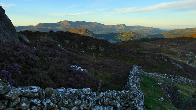
'To The Quarry' A landscape image of part of the former Gorseddau Slate Quarry, at Cwmsystradllyn.
Taken from part of the former tramway, that linked it to Ynys-Y-Pandy Slate Mill.
The former tramway path this side of the gate, local stone built retaining wall. Providing a lead in to the image, and view of the remaining slate waste beyond.
'To The Quarry'
A landscape image of part of the former Gorseddau Slate Quarry, at Cwmsystradllyn. Taken from part of the former tramway, that linked it to Ynys-Y-Pandy Slate Mill. The former tramway path this side of the gate, local stone built retaining wall. Providing a lead in to the image, and view of the remaining slate waste beyond.
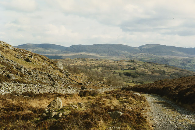
Wall defining the south-west ridge of Rhobell Fawr The path down the south-west ridge of Rhobell Fawr follows this wall to Bwlch Goriwared.
Here on the lower slopes, the wall divides the hillside into the colourful heather on the eastern side and coarse grasses to the west. The Cadair ridge is in the background.
Wall defining the south-west ridge of Rhobell Fawr
The path down the south-west ridge of Rhobell Fawr follows this wall to Bwlch Goriwared. Here on the lower slopes, the wall divides the hillside into the colourful heather on the eastern side and coarse grasses to the west. The Cadair ridge is in the background.
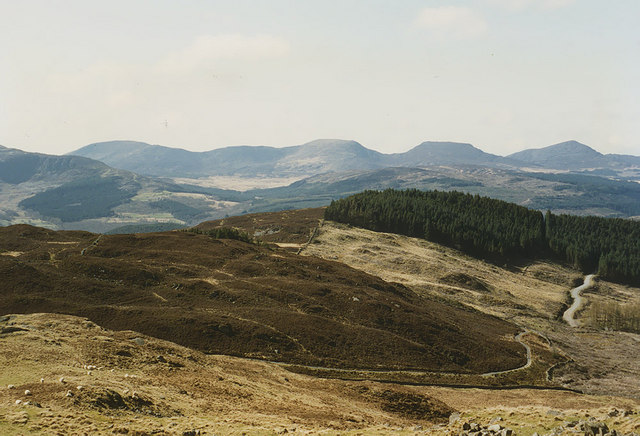
Southern approach to Bwlch Goriwared The old drove road climbs up to the pass. Waun Oer is the highest of the hills on the horizon.
Southern approach to Bwlch Goriwared
The old drove road climbs up to the pass. Waun Oer is the highest of the hills on the horizon.
The north side of Bwlch Goriwared A mixture of heather-covered hillside and better grazing, through which the old drove road to Bwlch Goriwared climbs.
The north side of Bwlch Goriwared
A mixture of heather-covered hillside and better grazing, through which the old drove road to Bwlch Goriwared climbs.
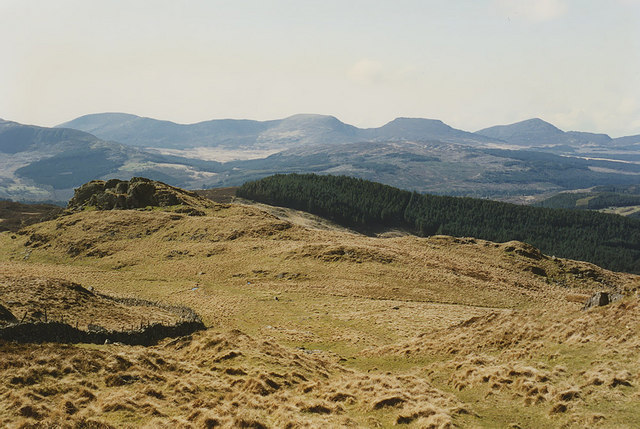
View west from near Ffynnon Shôn Looking down the lower part of the long western approach to Rhobell Fawr in the direction of Bwlch Goriwared. The distinctive rocky knoll on the left can be seen from below in <a href="https://www.geograph.org.uk/photo/671999">SH7624 : Hillside east of Bwlch Goriwared</a>. The Rhinogydd form the horizon.
View west from near Ffynnon Shôn
Looking down the lower part of the long western approach to Rhobell Fawr in the direction of Bwlch Goriwared. The distinctive rocky knoll on the left can be seen from below in SH7624 : Hillside east of Bwlch Goriwared. The Rhinogydd form the horizon.
Near Dolfrwynog
Near Dolfrwynog
Coed Cae-cocyn from Dolydd
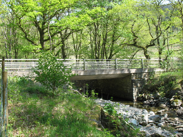
Road bridge over Afon Wen at Dolydd The road downstream along the east side of the Afon Wen, heading for Dolgellau, is one of many narrow lanes in this part of Wales
Road bridge over Afon Wen at Dolydd
The road downstream along the east side of the Afon Wen, heading for Dolgellau, is one of many narrow lanes in this part of Wales
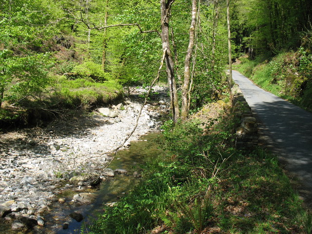
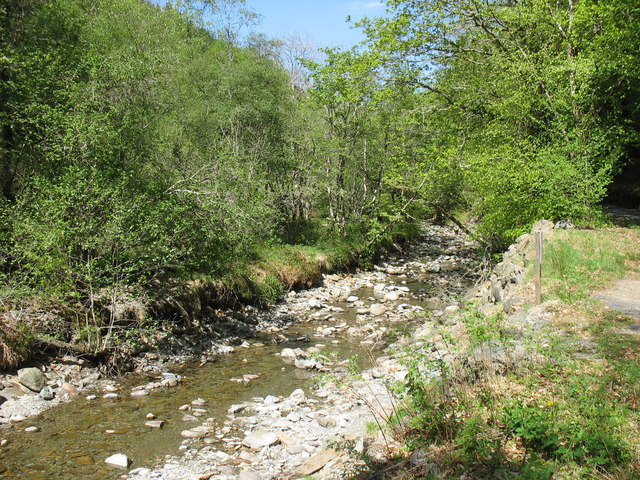
The Afon Wen valley Rivers were pretty dry in the spring of 2011.
The Afon Wen valley
Rivers were pretty dry in the spring of 2011.
The Afon Wen Rivers in this part of Wales were pretty low in the spring of 2011.
The Afon Wen
Rivers in this part of Wales were pretty low in the spring of 2011.
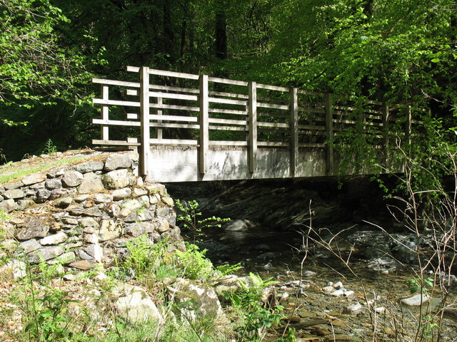
Footbridge across the Afon Wen
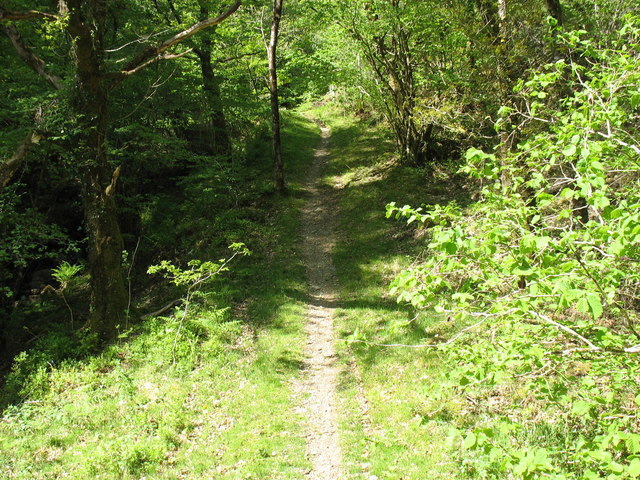
Footpath in Coed-y-Brenin forest This path climbs gently away from the Afon Wen.
Footpath in Coed-y-Brenin forest
This path climbs gently away from the Afon Wen.
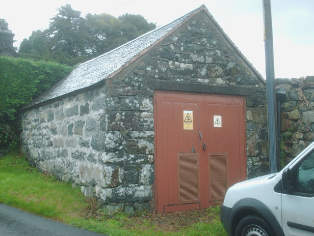
Ty Hers Set against the churchyard wall is this 11kV electricity substation where in time past the hearse was kept. The plate on the door has the legend 'Ty Hers 10 7522 013'. 10 represents the district according to the old MANWEB  designation, 7522 tells you that you are in that grid square and 013 is the substation number.
Ty Hers
Set against the churchyard wall is this 11kV electricity substation where in time past the hearse was kept. The plate on the door has the legend 'Ty Hers 10 7522 013'. 10 represents the district according to the old MANWEB designation, 7522 tells you that you are in that grid square and 013 is the substation number.
Coed-y-Brenin Porphyry Cu-Mo Deposit - Ore Body Part of the poorly exposed orebody. This is sited in the highly altered host volcanics and sediments. There are some overlap into the stock. 

Green copper supergene minerals stain the rock, molybdenite (MoS2) can be seen in hand samples. 

Magmatic fluid pressures created hairline cracks, when the pressure dropped suddenly metals were deposited. This is often in a stockwork tenture. The sudden pressure drop causes phenocryst formation in the stock. 

This resource is 200Mt of Cu at 0.3% with 1ppm of Au and some Mo. However, opencasting would be required so it is only a curiosity.
Coed-y-Brenin Porphyry Cu-Mo Deposit - Ore Body
Part of the poorly exposed orebody. This is sited in the highly altered host volcanics and sediments. There are some overlap into the stock. Green copper supergene minerals stain the rock, molybdenite (MoS2) can be seen in hand samples. Magmatic fluid pressures created hairline cracks, when the pressure dropped suddenly metals were deposited. This is often in a stockwork tenture. The sudden pressure drop causes phenocryst formation in the stock. This resource is 200Mt of Cu at 0.3% with 1ppm of Au and some Mo. However, opencasting would be required so it is only a curiosity.
Coed-y-Brenin Porphyry Cu-Mo Deposit - Ore Body Part of the poorly exposed orebody. This is sited in the highly altered host volcanics and sediments. There is some overlap into the stock.

Green copper supergene minerals stain the rock, molybdenite (MoS2) can be seen in hand samples.

Magmatic fluid pressures created hairline cracks, when the pressure dropped suddenly metals were deposited. This is often in a stockwork tenture. The sudden pressure drop causes phenocryst formation in the stock.

This resource is 200Mt of Cu at 0.3% with 1ppm of Au and some Mo. However, opencasting would be required so it is only a curiosity.
Coed-y-Brenin Porphyry Cu-Mo Deposit - Ore Body
Part of the poorly exposed orebody. This is sited in the highly altered host volcanics and sediments. There is some overlap into the stock. Green copper supergene minerals stain the rock, molybdenite (MoS2) can be seen in hand samples. Magmatic fluid pressures created hairline cracks, when the pressure dropped suddenly metals were deposited. This is often in a stockwork tenture. The sudden pressure drop causes phenocryst formation in the stock. This resource is 200Mt of Cu at 0.3% with 1ppm of Au and some Mo. However, opencasting would be required so it is only a curiosity.
Coed-y-Brenin Porphyry Cu-Mo Deposit - Ore Body Part of the poorly exposed orebody. This is sited in the highly altered host volcanics and sediments. There is some overlap into the stock.

Green copper supergene minerals stain the rock, molybdenite (MoS2) can be seen in hand samples.

Magmatic fluid pressures created hairline cracks, when the pressure dropped suddenly metals were deposited. This is often in a stockwork tenture. The sudden pressure drop causes phenocryst formation in the stock.

This resource is 200Mt of Cu at 0.3% with 1ppm of Au and some Mo. However. opencasting would be required so it is only a curiosity.
Coed-y-Brenin Porphyry Cu-Mo Deposit - Ore Body
Part of the poorly exposed orebody. This is sited in the highly altered host volcanics and sediments. There is some overlap into the stock. Green copper supergene minerals stain the rock, molybdenite (MoS2) can be seen in hand samples. Magmatic fluid pressures created hairline cracks, when the pressure dropped suddenly metals were deposited. This is often in a stockwork tenture. The sudden pressure drop causes phenocryst formation in the stock. This resource is 200Mt of Cu at 0.3% with 1ppm of Au and some Mo. However. opencasting would be required so it is only a curiosity.
Coed-y-Brenin Porphyry Cu-Mo Deposit - Phyllic Zone Porphyry copper deposits are of a major economic importance due to the high tonnage (but often low grades) of copper, molybdenum and gold. This deposit contains 200Mt of ore at 0.3% Cu with some Mo and Au. It would be economic only through opencasting, which I can't see happening any time soon!

A process that made PCDs economic was developed in the area, at Glasdir copper mine SE of here. <a href="https://www.geograph.org.uk/photo/3392787">SH7422 : Glasdir Copper Mine</a> <span class="nowrap"><a title="http://en.wikipedia.org/wiki/Bingham_Canyon_Mine" rel="nofollow ugc noopener" href="http://en.wikipedia.org/wiki/Bingham_Canyon_Mine">Link</a><img style="margin-left:2px;" alt="External link" title="External link - shift click to open in new window" src="https://s1.geograph.org.uk/img/external.png" width="10" height="10"/></span>

Hydrothermal and magmatic fluids circulate to create alteration zones. The ore is usually hosted in the outer edge of the stock. 

Potassic zone, usually an igneous stock (volcanic magma chamber). 
Can be rich in secondary orthoclase, quartz, biotite and chlorite/sericite. 

Phyllic zone, altered host rocks. In this case volcanics and sediments.
Pyrite rich (10-15%), quartz, sericite, chlorite and illite. 

+/- Argillic zone. Varies in size, clay alteration. 

Propylitic zone, always present. Lightly altered with pyrite, chlorite, quartz, carbonates and epidote. 

This shows the phyllic zone. The pyrite has oxidised to produce the red stained colour.
Coed-y-Brenin Porphyry Cu-Mo Deposit - Phyllic Zone
Porphyry copper deposits are of a major economic importance due to the high tonnage (but often low grades) of copper, molybdenum and gold. This deposit contains 200Mt of ore at 0.3% Cu with some Mo and Au. It would be economic only through opencasting, which I can't see happening any time soon! A process that made PCDs economic was developed in the area, at Glasdir copper mine SE of here. SH7422 : Glasdir Copper Mine LinkExternal link Hydrothermal and magmatic fluids circulate to create alteration zones. The ore is usually hosted in the outer edge of the stock. Potassic zone, usually an igneous stock (volcanic magma chamber). Can be rich in secondary orthoclase, quartz, biotite and chlorite/sericite. Phyllic zone, altered host rocks. In this case volcanics and sediments. Pyrite rich (10-15%), quartz, sericite, chlorite and illite. +/- Argillic zone. Varies in size, clay alteration. Propylitic zone, always present. Lightly altered with pyrite, chlorite, quartz, carbonates and epidote. This shows the phyllic zone. The pyrite has oxidised to produce the red stained colour.
Coed-y-Brenin Forest
Show me another place!

Cerniau is located at Grid Ref: SH7524 (Lat: 52.800721, Lng: -3.8452562)

Unitary Authority: Gwynedd

Police Authority: North Wales

What 3 Words

///weekends.scrambles.mock. Near Dolgellau, Gwynedd

Nearby Locations

Cerniau

Related Wikis

Llanfachreth

Llanfachreth is a settlement approximately three miles north-east of Dolgellau, Gwynedd, in the community of Brithdir and Llanfachreth within the historic...

Ganllwyd

Ganllwyd is a small village and community in southern Gwynedd, Wales. It lies in the Snowdonia National Park to the north of Dolgellau. A470 passes through...

Dolmelynllyn Estate

Dolmelynllyn Estate is an area of farmland, woodland and parkland near the village of Ganllwyd in southern Gwynedd, Wales. It is owned by the National...

Rhobell Fawr

Rhobell Fawr is the site of an ancient volcano that was active during the Early Ordovician period in the Arenig range within the Snowdonia National Park...

Nearby Amenities

Located within 500m of 52.800721,-3.8452562
Cerniau
Ele: 409
Natural: peak
Wikidata: Q106709814
Lat/Long: 52.8006531/-3.84513
Moel y Llan
Ele: 400
Natural: peak
Wikidata: Q106709846
Lat/Long: 52.7999136/-3.8506875
Bwlch Gwyn
Natural: saddle
Lat/Long: 52.800828/-3.847714
The data included in this document is from www.openstreetmap.org. The data is made available under ODbL.

Have you been to Cerniau?

Leave your review of Cerniau below (or comments, questions and feedback).