Am Buachaille

Hill, Mountain in Inverness-shire

Scotland

Am Buachaille

View down the Milton Burn From near Lynmore with a good view of the kame and kettle terrain and marshes.
View down the Milton Burn Credit: Richard Webb

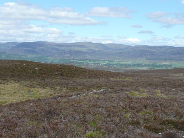
Am Buachaille, located in Inverness-shire, Scotland, is a prominent hill that stands tall with a commanding presence. It is part of the breathtakingly beautiful Torridon range, which is renowned for its rugged landscapes and stunning vistas. Standing at an impressive height of 863 meters (2,831 feet), Am Buachaille is a popular destination for hikers, mountaineers, and nature enthusiasts.

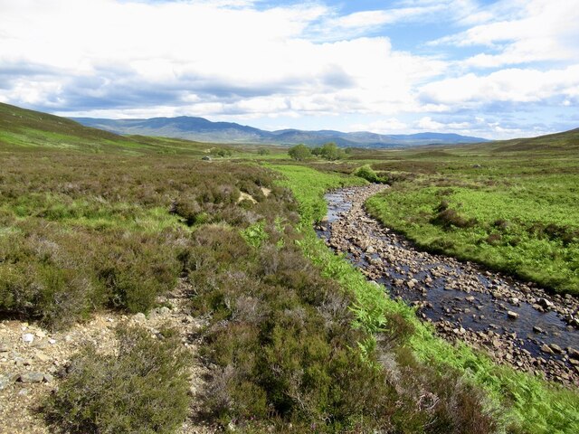
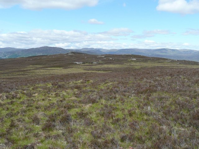
The hill is characterized by its distinctive pyramid shape, with its rocky slopes and craggy ridges adding to its allure. It boasts a challenging but rewarding climb, attracting experienced climbers who seek to conquer its steep inclines and enjoy panoramic views from its summit. On a clear day, the vistas from Am Buachaille extend across the surrounding glens, lochs, and mountains, providing a truly awe-inspiring experience.

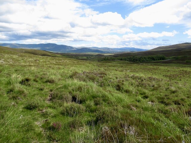
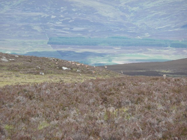
The terrain of Am Buachaille is diverse, featuring heather-covered slopes, scattered boulders, and occasional patches of scree. The hill is also home to a variety of flora and fauna, including mountain hares, red deer, and numerous bird species. Its remote location adds to the sense of adventure and tranquility that visitors can expect to find.

Access to Am Buachaille is typically gained through the village of Torridon, where a well-defined path guides climbers through the ascent. Visitors are advised to come prepared with appropriate clothing, sturdy footwear, and a good level of fitness. As with any mountainous region, weather conditions can change rapidly, so it is essential to check forecasts and be cautious during the climb.

Am Buachaille offers a remarkable opportunity to immerse oneself in the untamed beauty of the Scottish Highlands, providing a challenging yet rewarding experience for those who seek to explore its majestic slopes.

If you have any feedback on the listing, please let us know in the comments section below.

Am Buachaille Images

Images are sourced within 2km of 57.025277/-4.074061 or Grid Reference NN7494. Thanks to Geograph Open Source API. All images are credited.

View down the Milton Burn From near Lynmore with a good view of the kame and kettle terrain and marshes.
View down the Milton Burn
From near Lynmore with a good view of the kame and kettle terrain and marshes.
Moorland, Allt Ghiubhais
Allt Ghiubhais Downstream view.
Allt Ghiubhais
Downstream view.
Haugh beside the Allt Ghiubhais Land near here has been bought for carbon offset tree planting.
Haugh beside the Allt Ghiubhais
Land near here has been bought for carbon offset tree planting.
Roadside tree, Lynmore
Garbh-meall Mòr and Allt Ghiubhais
Red deer on Am Buachaille Plenty of deer here for 'herding'.  Note the three near the summit cairn.
Red deer on Am Buachaille
Plenty of deer here for 'herding'. Note the three near the summit cairn.
Carn Pheigith A cairn a few feet high and about 12ft. in diameter, supposed to have been erected in memory of a person called Margaret or Peggy. 
The Gaick (cleft in Gaelic) in the distance, leading through to Atholl.
Carn Pheigith
A cairn a few feet high and about 12ft. in diameter, supposed to have been erected in memory of a person called Margaret or Peggy. The Gaick (cleft in Gaelic) in the distance, leading through to Atholl.
Golden Plover and Am Buachaille The plover serenaded me with its plaintive call as I headed to Am Buachaille, the dark hill with a summit cairn on the left.
Golden Plover and Am Buachaille
The plover serenaded me with its plaintive call as I headed to Am Buachaille, the dark hill with a summit cairn on the left.
Golden Plover Amongst burnt heather on Sròn na Gaoithe.
Golden Plover
Amongst burnt heather on Sròn na Gaoithe.
Red deer on Sròn na Gaoithe The forest in the background is north west of Kingussie.  The A9 is unseen and unheard in the glen.
Red deer on Sròn na Gaoithe
The forest in the background is north west of Kingussie. The A9 is unseen and unheard in the glen.
On Sròn na Gaoithe Looking across to Am Buachaille.
On Sròn na Gaoithe
Looking across to Am Buachaille.
Deer on Sròn na Gaoithe Across the boulders and heather of the flat bealach from Am Buachaille.
Deer on Sròn na Gaoithe
Across the boulders and heather of the flat bealach from Am Buachaille.
Newtonmore from Am Buachaille col The Monadh Liath hills on the horizon.
Newtonmore from Am Buachaille col
The Monadh Liath hills on the horizon.
View from Am Buachaille Looking across the Allt Ghiubhais.
The dark hill in the middle distance is Cruban Beag.  The notch in the skyline to the right of it is 'The Window' between Creag Meagaidh and Stob Poite Coire Ardair.
View from Am Buachaille
Looking across the Allt Ghiubhais. The dark hill in the middle distance is Cruban Beag. The notch in the skyline to the right of it is 'The Window' between Creag Meagaidh and Stob Poite Coire Ardair.
Three trees on Blàr an Liana Mhòir The flat boggy area between Glen Tromie and Glen Truim. The absence of trees probably has something to do with the many red deer in the vicinity.
Garbh-mheall Mòr is prominent on the skyline.
Three trees on Blàr an Liana Mhòir
The flat boggy area between Glen Tromie and Glen Truim. The absence of trees probably has something to do with the many red deer in the vicinity. Garbh-mheall Mòr is prominent on the skyline.
Looking across the southern slopes of Am Buachaille Towards a small bothy near the Allt Ghiubhais.
Looking across the southern slopes of Am Buachaille
Towards a small bothy near the Allt Ghiubhais.
Upper Glen Tromie Looking across the heather towards the Gaick.
Upper Glen Tromie
Looking across the heather towards the Gaick.
Show me another place!

Am Buachaille is located at Grid Ref: NN7494 (Lat: 57.025277, Lng: -4.074061)

Unitary Authority: Highland

Police Authority: Highlands and Islands

What 3 Words

///mindset.shun.stupidly. Near Newtonmore, Highland

Nearby Locations

Am Buachaille

Related Wikis

Newtonmore railway station

Newtonmore railway station serves the village of Newtonmore, Highland, Scotland. The station is managed by ScotRail and is on the Highland Main Line. The...

Etteridge

Etteridge (Scottish Gaelic: Eadrais) is a small remote hamlet, situated close to Loch Etteridge in Inverness-shire, Scottish Highlands and is in the Scottish...

The Eilan

The Eilan (Scottish Gaelic: Eilean Bheannchair) is a shinty stadium in the town of Newtonmore, Scotland. It is the home of Newtonmore Camanachd and has...

Ruthven, Badenoch

Ruthven (Scottish Gaelic: Ruadhainn) is a former settlement in Badenoch, in the Highland council area, Scotland. It lies 0.5 miles (0.80 km) south of Kingussie...

Nearby Amenities

Located within 500m of 57.025277,-4.074061
Am Buachaille
Ele: 480
Natural: peak
Source: OS7
Lat/Long: 57.025047/-4.0740777
The data included in this document is from www.openstreetmap.org. The data is made available under ODbL.

Have you been to Am Buachaille?

Leave your review of Am Buachaille below (or comments, questions and feedback).