Cefn Maen Amor

Hill, Mountain in Caernarfonshire

Wales

Cefn Maen Amor

Tuag at yr hen eglwys Llangelynin The C14 church of Llangelynin in a landscape of rock and stone.
Tuag at yr hen eglwys Llangelynin Credit: Mike Parker

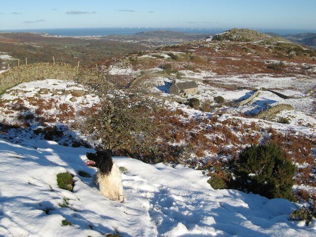
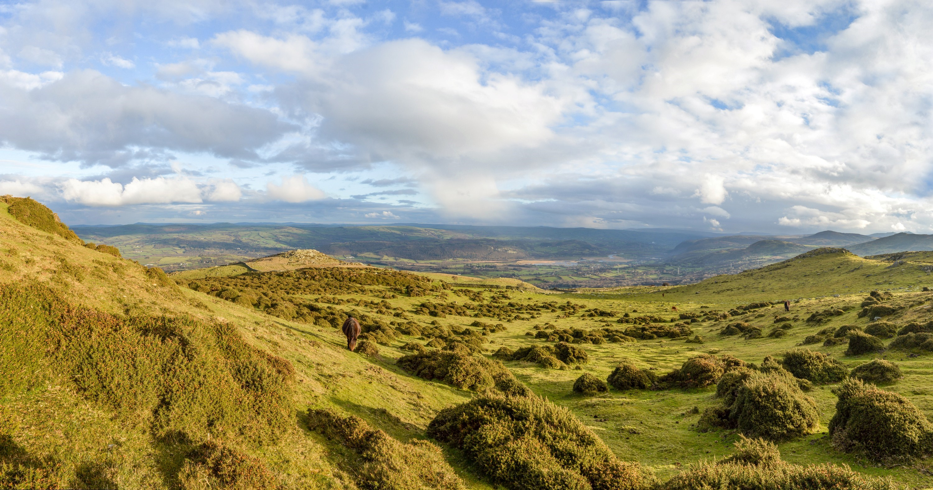
Cefn Maen Amor is a prominent hill located in the county of Caernarfonshire, Wales. With an elevation of approximately 462 meters (1,516 feet), it stands as an impressive landmark in the surrounding landscape. Situated near the village of Llanllyfni, Cefn Maen Amor offers stunning panoramic views of the Snowdonia National Park and the nearby coastline.

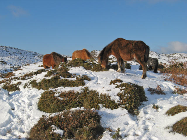
The hill is primarily composed of rugged and rocky terrain, typical of the Welsh countryside. Its slopes are covered in a mixture of grasses, heather, and scattered shrubs, providing a diverse habitat for various plant and animal species. The hill is also intersected by several streams, adding to its natural charm.

Cefn Maen Amor is a popular destination for outdoor enthusiasts and hikers due to its accessible location and breathtaking scenery. Numerous well-marked trails and footpaths crisscross the hill, allowing visitors to explore its beauty on foot. The hill's summit offers a rewarding experience, with panoramic views that stretch as far as the eye can see.

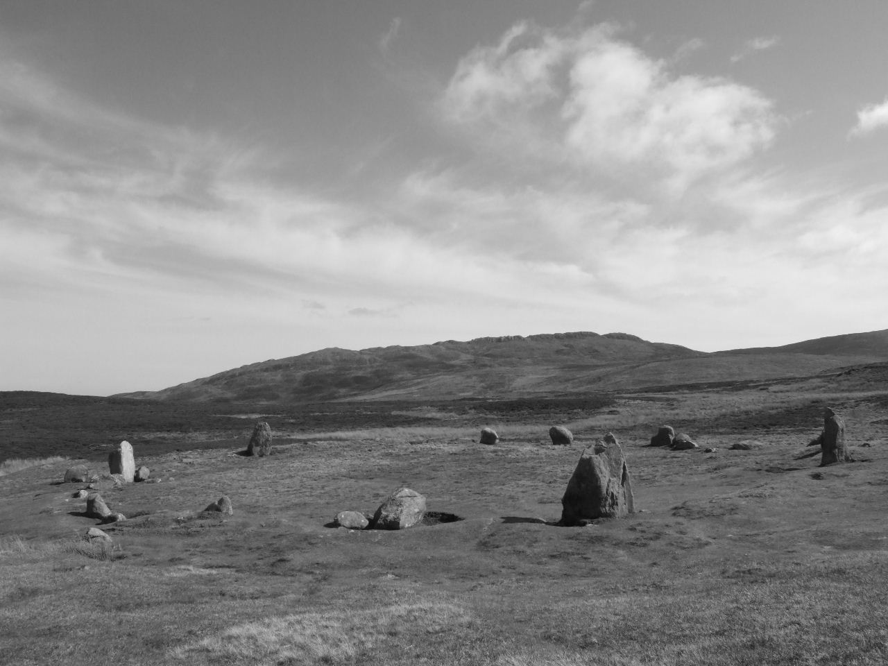
In addition to its natural beauty, Cefn Maen Amor has historical significance. The hill is home to an ancient burial chamber known as Maen y Bardd, or the "Stone of the Bard." This Neolithic tomb is believed to date back to around 3000 BC and is a testament to the early human settlement in the area.

Overall, Cefn Maen Amor is a picturesque and historically significant hill that offers visitors an opportunity to immerse themselves in the natural beauty of Caernarfonshire. It is a must-visit destination for nature lovers, hikers, and history enthusiasts alike.

If you have any feedback on the listing, please let us know in the comments section below.

Cefn Maen Amor Images

Images are sourced within 2km of 53.25122/-3.8878406 or Grid Reference SH7474. Thanks to Geograph Open Source API. All images are credited.

Tuag at yr hen eglwys Llangelynin The C14 church of Llangelynin in a landscape of rock and stone.
Tuag at yr hen eglwys Llangelynin
The C14 church of Llangelynin in a landscape of rock and stone.
Coed ffawydd / Beech trees
Maen Amor
Maen Amor
Standing Stone Near Tyddyn-grasod
Maen Penddu Conwy valley beyond.
Maen Penddu
Conwy valley beyond.
Access To Upper Pit, Tal-y-fan Quarry
Disused Reservoir Below Cefn Maen Amor
Pillars On The Jubilee Path Below Foel Lus
Maen Crwn, Bryn Derwydd
Druid's Circle, Cefn Coch
Midsummer sunset Sunset over Penmaenmawr and Conwy Bay. While the sky was perfectly clear, the horizon was obscured by low cloud and sea fog, with sea frets clinging to nearby hillsides.
Midsummer sunset
Sunset over Penmaenmawr and Conwy Bay. While the sky was perfectly clear, the horizon was obscured by low cloud and sea fog, with sea frets clinging to nearby hillsides.
Eastern slopes of Tal y Fan The public footpath curves below this slope heading towards the fortifications of Caer Bach. or, at a junction, heading up the hill.
Eastern slopes of Tal y Fan
The public footpath curves below this slope heading towards the fortifications of Caer Bach. or, at a junction, heading up the hill.
The Eastern flank of Tal y Fan This footpath ascends from Frith-y-Ddwyffrwd, crossing the path we had used, from Cae Coch. Its destination, behind the photographer, is a junction with the North Wales Path, in the direction of Penmaenmawr, passing, at its summit, some old quarry workings from where an ascent of Tal y Fan can be made via a path not shown on the map.
The Eastern flank of Tal y Fan
This footpath ascends from Frith-y-Ddwyffrwd, crossing the path we had used, from Cae Coch. Its destination, behind the photographer, is a junction with the North Wales Path, in the direction of Penmaenmawr, passing, at its summit, some old quarry workings from where an ascent of Tal y Fan can be made via a path not shown on the map.
Quarry track, Cefn Maen Amor The lone fell runner, having overtaken us earlier, has taken a longer way round to climb towards Tal y Fan quarry on this track, which has not been made a public right of way and ends abruptly at the workings behind the photographer on the quarry waste tip. It does, however, form a convenient route of ascent for Tal y Fan, as a rather fainter footpath continues above the quarry.
Quarry track, Cefn Maen Amor
The lone fell runner, having overtaken us earlier, has taken a longer way round to climb towards Tal y Fan quarry on this track, which has not been made a public right of way and ends abruptly at the workings behind the photographer on the quarry waste tip. It does, however, form a convenient route of ascent for Tal y Fan, as a rather fainter footpath continues above the quarry.
The way in and out of Tal y Fan quarry The quarrymen who worked here must have had something very specific to extract and didn't wish to remove any more rock than was strictly necessary to obtain it. The entrance is very narrow, and the waste tip very substantial for a quarry this small, as though only a tiny fraction of what was removed was of any value. It is just about possible, with care, to enter and leave dryshod, though one or two of the stones are a bit wobbly and all are rather slick.
The way in and out of Tal y Fan quarry
The quarrymen who worked here must have had something very specific to extract and didn't wish to remove any more rock than was strictly necessary to obtain it. The entrance is very narrow, and the waste tip very substantial for a quarry this small, as though only a tiny fraction of what was removed was of any value. It is just about possible, with care, to enter and leave dryshod, though one or two of the stones are a bit wobbly and all are rather slick.
On the eastern approach to Tal y Fan From the quarry on the east north east ridge of Tal y Fan, a path starts faintly but becomes fairly well defined higher up as the ridge gets rockier. This point is just below the 600m contour, so there's not much further to climb to the top. Although it remains dreich here, there are signs of the weather clearing up nearer the coast and patches of sun illuminate Moelfre, with the northeast end of the Menai strait beyond. Faintly visible in the distance is Puffin Island.
On the eastern approach to Tal y Fan
From the quarry on the east north east ridge of Tal y Fan, a path starts faintly but becomes fairly well defined higher up as the ridge gets rockier. This point is just below the 600m contour, so there's not much further to climb to the top. Although it remains dreich here, there are signs of the weather clearing up nearer the coast and patches of sun illuminate Moelfre, with the northeast end of the Menai strait beyond. Faintly visible in the distance is Puffin Island.
Church in snow Seeming on this wintry day to spring from the very rock, a view of Llangelynin Old Church in all its fabulous and restrained beauty.
Church in snow
Seeming on this wintry day to spring from the very rock, a view of Llangelynin Old Church in all its fabulous and restrained beauty.
Church and Cerig-y-ddinas Reverence for the antiquity of this landscape knows few bounds when an ancient church sits in a hollow near to an Iron-age hill fort.
Church and Cerig-y-ddinas
Reverence for the antiquity of this landscape knows few bounds when an ancient church sits in a hollow near to an Iron-age hill fort.
Show me another place!

Cefn Maen Amor is located at Grid Ref: SH7474 (Lat: 53.25122, Lng: -3.8878406)

Unitary Authority: Conwy

Police Authority: North Wales

What 3 Words

///pink.bolsters.sleep. Near Penmaenmawr, Conwy

Nearby Locations

Cefn Maen Amor

Related Wikis

Llangelynnin, Conwy

Llangelynnin (; Welsh for The church of Celynnin) is a former parish in the Conwy valley, in Conwy county borough, north Wales. Today the name exists...

Caer Bach

Caer Bach is a Welsh hillfort of indeterminate age, on a rounded hillock situated near the village of Rowen; in Conwy County, North Wales. Its name in...

Tal y Fan

Tal y Fan is an outlying peak of the Carneddau mountains in North Wales. It is one of the four Marilyns that make up the Carneddau, the others being Carnedd...

Sychnant Pass

Sychnant Pass (Welsh: Bwlch Sychnant, "Dry-stream Pass") in Conwy County Borough, Wales, links Conwy to Penmaenmawr via Dwygyfylchi. Much of the pass is...

Rowen, Conwy

Rowen is a village on the western slopes of the Conwy valley in the parish of Caerhun and the former County of Caernarfonshire in Wales. It lies off the...

Henryd

Henryd () is a village and community on the western slopes of the Conwy valley in Conwy county borough, north Wales. It lies about 2 miles (3.2 km) south...

Dwygyfylchi

Dwygyfylchi (Welsh: [dʊɨɡəˈvəlχi]) is a village in Conwy County Borough, Wales. It is part of the community of Penmaenmawr which has a population of 4...

Penmaenmawr railway station

Penmaenmawr railway station serves the town of Penmaenmawr, Wales, and is located on the North Wales Coast Line travelling from Crewe to Holyhead, 49+1...

Nearby Amenities

Located within 500m of 53.25122,-3.8878406
Barrier: stile
Lat/Long: 53.2514357/-3.8806792
Barrier: stile
Lat/Long: 53.2535765/-3.8830374
Maen Amor
Ele: 392
Natural: peak
Lat/Long: 53.2512261/-3.8878393
The data included in this document is from www.openstreetmap.org. The data is made available under ODbL.

Have you been to Cefn Maen Amor?

Leave your review of Cefn Maen Amor below (or comments, questions and feedback).