Stac Dearg

Hill, Mountain in Inverness-shire

Scotland

Stac Dearg

Rainbow over Loch Bhrodainn On our Lands End to John O´Groats walk in 2013
Rainbow over Loch Bhrodainn Credit: Jan Refsing

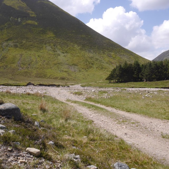
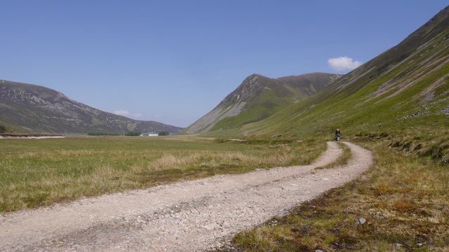
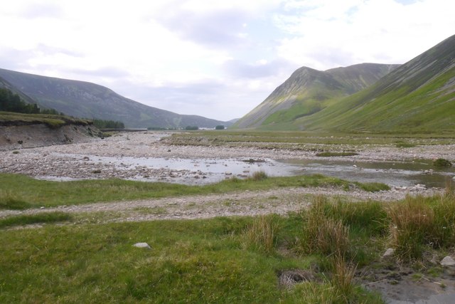
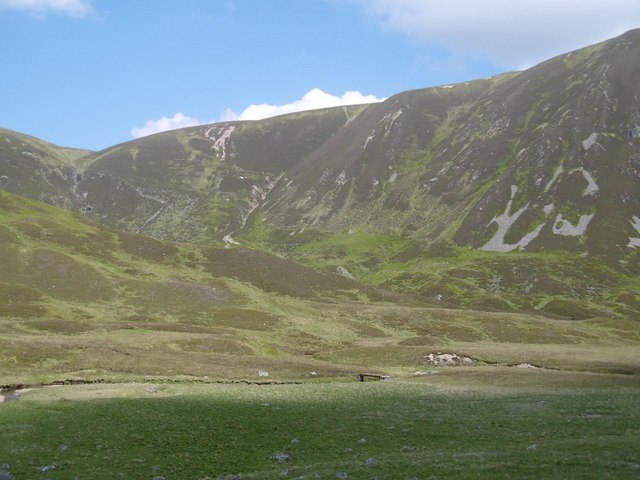
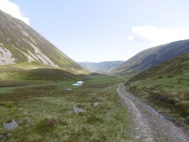
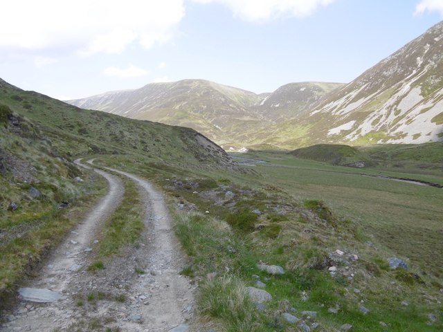
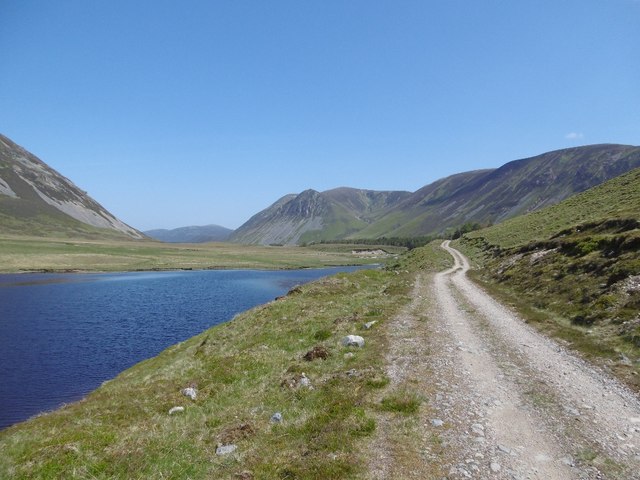
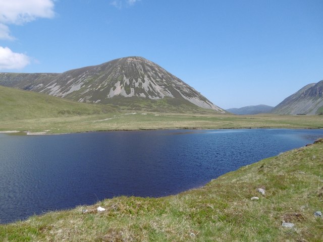
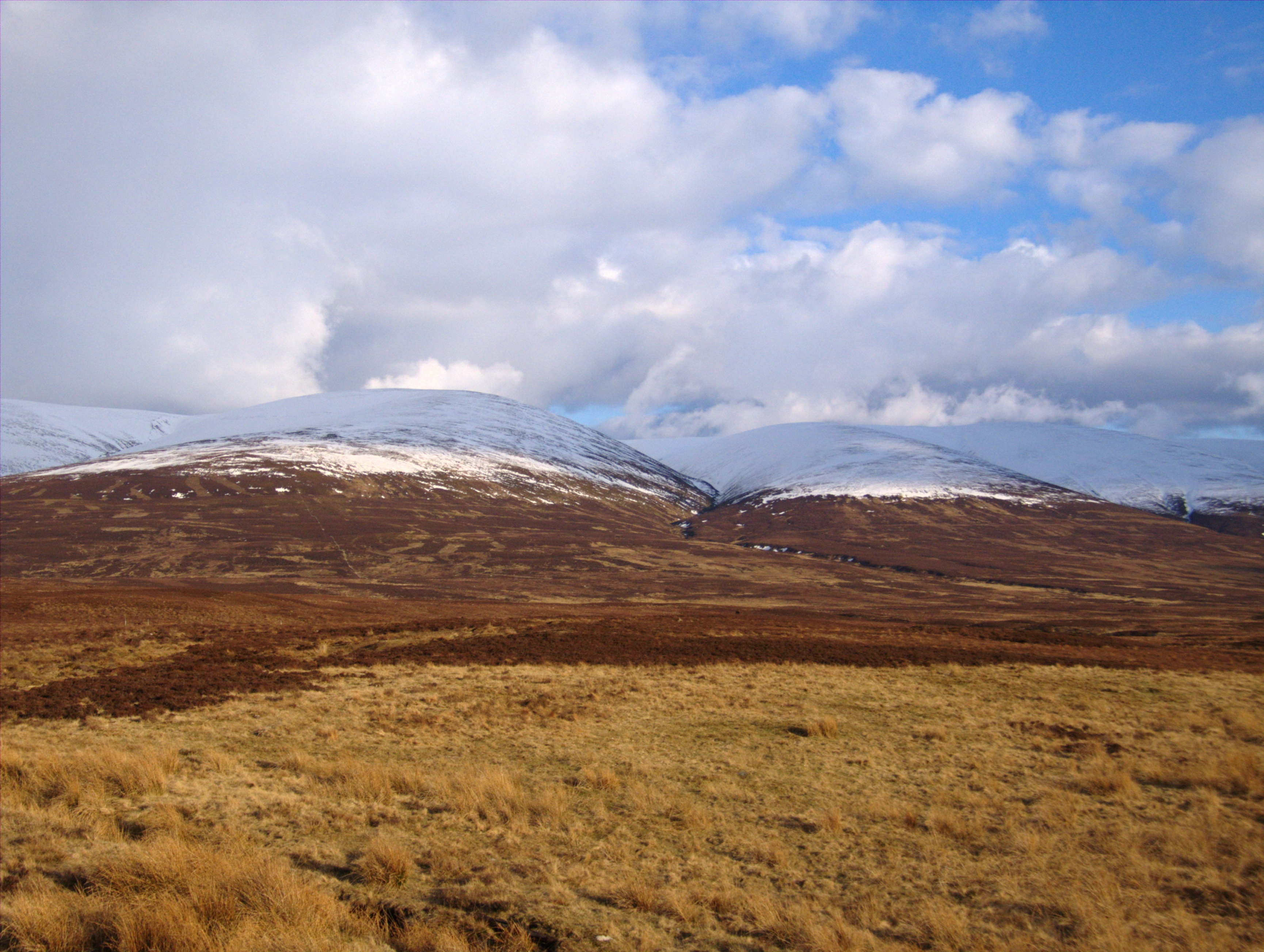
Stac Dearg is a prominent hill located in the Inverness-shire region of Scotland. It is part of the Torridon Hills range and stands at an impressive height of 575 meters (1,886 feet) above sea level. The hill is known for its distinctive red sandstone rock formations, which give it its name "Stac Dearg" meaning "red stack" in Gaelic.

Stac Dearg is a popular destination for hikers and climbers, offering stunning panoramic views of the surrounding landscape, including Loch Torridon and the Isle of Skye. The hill is relatively challenging to climb, with steep and rugged terrain, making it a suitable option for experienced outdoor enthusiasts seeking a more adventurous ascent.

The area surrounding Stac Dearg is rich in biodiversity, with a variety of plant and animal species thriving in the rugged mountainous terrain. The hill is also steeped in history, with evidence of ancient settlements and archaeological sites scattered throughout the landscape.

Overall, Stac Dearg is a captivating natural landmark that offers a challenging yet rewarding outdoor experience for those willing to explore its rugged slopes and take in its breathtaking views.

If you have any feedback on the listing, please let us know in the comments section below.

Stac Dearg Images

Images are sourced within 2km of 56.927159/-4.0710603 or Grid Reference NN7483. Thanks to Geograph Open Source API. All images are credited.

Rainbow over Loch Bhrodainn On our Lands End to John O´Groats walk in 2013
Rainbow over Loch Bhrodainn
On our Lands End to John O´Groats walk in 2013
Loch Bhrodainn Walking beside the loch on our Lands End to John O´Groats walk in 2013. Sgòr Dearg in the background.
Loch Bhrodainn
Walking beside the loch on our Lands End to John O´Groats walk in 2013. Sgòr Dearg in the background.
Ford, Allt Gharbh Ghaig A wide but in these conditions, easy ford on the Gaick Pass.
Ford, Allt Gharbh Ghaig
A wide but in these conditions, easy ford on the Gaick Pass.
Bike packing through the Gaick Quite a few bikes cross the Gaick which has a road for all but 2km of its length. The main problem is river crossings but not during a prolonged warm and dry spell like this.

Three folk crossed on horseback today as well, however there are gates between Dalnacardoch and Sronphadruig and these were open today.
Bike packing through the Gaick
Quite a few bikes cross the Gaick which has a road for all but 2km of its length. The main problem is river crossings but not during a prolonged warm and dry spell like this. Three folk crossed on horseback today as well, however there are gates between Dalnacardoch and Sronphadruig and these were open today.
Ford, An Gharbh Ghaig Once bridged, this is a potentially awkward river crossing on the Gaick Pass.  View towards Gaick Lodge.
Ford, An Gharbh Ghaig
Once bridged, this is a potentially awkward river crossing on the Gaick Pass. View towards Gaick Lodge.
Bridge, Allt Loch an Dùin The northern side of the Gaick Pass under the usual steep slopes and flat topped hills.
Bridge, Allt Loch an Dùin
The northern side of the Gaick Pass under the usual steep slopes and flat topped hills.
Road, Gaick Pass The road passes a vegetated lochan.
Road, Gaick Pass
The road passes a vegetated lochan.
Gaick Road Approaching the pass from the north.
Gaick Road
Approaching the pass from the north.
Alluvial Fan, Gaick Outwash from Allt a' Chaoinich which has been refreshed by new material washed down from A' Chaoinich.
Alluvial Fan, Gaick
Outwash from Allt a' Chaoinich which has been refreshed by new material washed down from A' Chaoinich.
Allt a'  Chaoirnich The burn has washed out the road, probably during the flooding of December 2015 although there were severe flash floods in the two preceding summers.
Allt a' Chaoirnich
The burn has washed out the road, probably during the flooding of December 2015 although there were severe flash floods in the two preceding summers.
Alluvial Fan, Gaick The Allt a' Chaoirnich has delivered a lot of stone to the glen floor.
Alluvial Fan, Gaick
The Allt a' Chaoirnich has delivered a lot of stone to the glen floor.
Gaick: Allt a' Chaoinich View downstream along an empty channel in the alluvial fan towards An Sgòr above Gaick Lodge.
Gaick: Allt a' Chaoinich
View downstream along an empty channel in the alluvial fan towards An Sgòr above Gaick Lodge.
Gaick: Allt a' Chaoinich's alluvial fan The road crosses a refreshed alluvial fan in the Gaick. There has been a lot of movement in the watercourses after flash flooding in August 2014, July 2015 and sustained heavy rainfall in December 2015. Roads have been washed out or buried in fresh stone and burns have changed course.
Gaick: Allt a' Chaoinich's alluvial fan
The road crosses a refreshed alluvial fan in the Gaick. There has been a lot of movement in the watercourses after flash flooding in August 2014, July 2015 and sustained heavy rainfall in December 2015. Roads have been washed out or buried in fresh stone and burns have changed course.
Loch Bhrodainn Simply gorgeous - one of the three Gaick lochans.
Loch Bhrodainn
Simply gorgeous - one of the three Gaick lochans.
Allt Coire Liath Beag A fine example of an alluvial fan at the base of a steep watercourse in the Gaick.
Allt Coire Liath Beag
A fine example of an alluvial fan at the base of a steep watercourse in the Gaick.
Gaick Road Passing Loch Bhrodainn.
Gaick Road
Passing Loch Bhrodainn.
Road, Gaick Pass Passing Loch Bhrodainn, just south of the junction with the Garbh Ghaig/Comyn's Road.
Road, Gaick Pass
Passing Loch Bhrodainn, just south of the junction with the Garbh Ghaig/Comyn's Road.
Loch Bhrodainn The middle of the three Gaick lochs with a background of scree covered An Sgòr.
Loch Bhrodainn
The middle of the three Gaick lochs with a background of scree covered An Sgòr.
Show me another place!

Stac Dearg is located at Grid Ref: NN7483 (Lat: 56.927159, Lng: -4.0710603)

Unitary Authority: Highland

Police Authority: Highlands and Islands

What 3 Words

///hangs.discussed.dealings. Near Newtonmore, Highland

Nearby Locations

Loch Bhrodainn Stac Dearg

Related Wikis

Grampian Mountains

The Grampian Mountains (Scottish Gaelic: Am Monadh) is one of the three major mountain ranges in Scotland, that together occupy about half of Scotland...

Meall Chuaich

Meall Chuaich (951 m) is a mountain in the Grampian Mountains of Scotland, located east of the village of Dalwhinnie. Although the mountain lacks any distinctive...

Càrn na Caim

Carn na Caim (941 m) is a mountain in the Grampian Mountains of Scotland. It lies on the border of Highland and Perth and Kinross, east of the Pass of...

Kingdom of Scotland

The Kingdom of Scotland (Scottish Gaelic: Rìoghachd na h-Alba; Scots: Kinrick o Scotland, Norn: Kongungdum Skotland) was a sovereign state in northwest...

Have you been to Stac Dearg?

Leave your review of Stac Dearg below (or comments, questions and feedback).