Carn nan Seabhag
Hill, Mountain in Perthshire
Scotland
Carn nan Seabhag

The requested URL returned error: 500 Internal Server Error
If you have any feedback on the listing, please let us know in the comments section below.
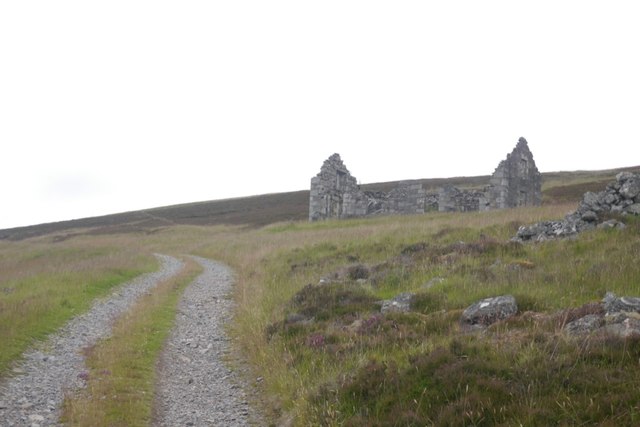
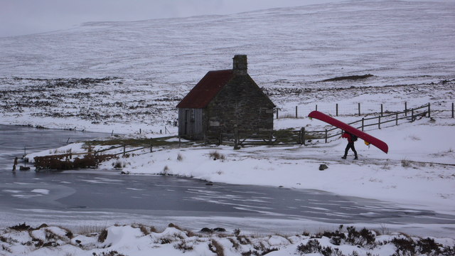
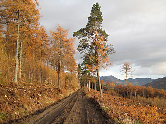
Carn nan Seabhag Images
Images are sourced within 2km of 56.822896/-4.0656778 or Grid Reference NN7472. Thanks to Geograph Open Source API. All images are credited.


Carn nan Seabhag is located at Grid Ref: NN7472 (Lat: 56.822896, Lng: -4.0656778)
Unitary Authority: Perth and Kinross
Police Authority: Tayside
What 3 Words
///cheaper.darts.districts. Near Blair Atholl, Perth & Kinross
Nearby Locations
Related Wikis
Loch Con
Loch Con is a small, remote, shallow, irregular shaped freshwater loch that is located in Glen Errochty in the Perth and Kinross council area, at the...

Geographical centre of Scotland
There is some debate as to the location of the geographical centre of Scotland. This is due to different methods of calculating the centre, and whether...

River Garry, Perthshire
The River Garry (Scottish Gaelic: Gar / Abhainn Ghar) is a major tributary of the River Tummel, itself a tributary of the River Tay, in the traditional...

Trinafour
Trinafour (; Scottish Gaelic: Trian a' Phùir) is a village in Perth and Kinross, Scotland, approximately 17 miles (27 km) north-west of Pitlochry, its...

Loch Errochty
Loch Errochty is a man made freshwater loch situated within the Perth and Kinross council area at the edge of the Scottish Highlands near the Highland...

Struan railway station
Struan railway station served the village of Struan, Perthshire, Scotland from 1863 to 1965 on the Inverness and Perth Junction Railway. == History... ==
Forest of Atholl
The Forest of Atholl (also known as Atholl Forest) is a deer forest near the Scottish village of Blair Atholl, Perth and Kinross, first recorded in the...

Calvine
Calvine is a hamlet in Perth and Kinross, Scotland.It is sandwiched between the A9 road, to its north, and the Highland mainline railway and River Garry...
Have you been to Carn nan Seabhag?
Leave your review of Carn nan Seabhag below (or comments, questions and feedback).