Dundaff Hill

Hill, Mountain in Stirlingshire

Scotland

Dundaff Hill

Old fingerpost A photo taken in poor light showing the unique fingerpost at the crossroads just north of Carron Bridge which is the southernmost boundary of Stirlingshire with North Lanarkshire and Falkirk.  The only other recorded post of this style was, in 1983, at the junction of the A836 and B838 north of Lairg.  Now lost.
Old fingerpost Credit: John Riddell

Dundaff Hill is a prominent hill located in Stirlingshire, Scotland. Situated in the southern part of the region, it forms part of the Campsie Fells, a range of hills that stretches from Stirling to Glasgow. Dundaff Hill rises to an elevation of approximately 447 meters (1,467 feet) and offers stunning panoramic views of the surrounding countryside.

The hill is accessible by foot through various trails and paths, making it a popular destination for hikers and nature enthusiasts. The ascent to the summit is relatively moderate, making it suitable for individuals of various fitness levels. Along the way, visitors can enjoy the diverse flora and fauna that inhabit the hillside, including heather, gorse, and a variety of bird species.

At the summit, visitors are rewarded with breathtaking vistas of the surrounding landscape. On clear days, it is possible to see as far as Loch Lomond and the Trossachs National Park to the west, and the city of Glasgow to the south. To the east, the Campsie Glen and Carron Valley provide a picturesque backdrop.

Dundaff Hill is steeped in history, with evidence of prehistoric settlements and ancient burial sites in the vicinity. The hill has also played a role in local folklore, with tales of mythical creatures and hidden treasures associated with its slopes.

Overall, Dundaff Hill offers a delightful outdoor experience, providing both natural beauty and historical intrigue to visitors who venture to its summit.

If you have any feedback on the listing, please let us know in the comments section below.
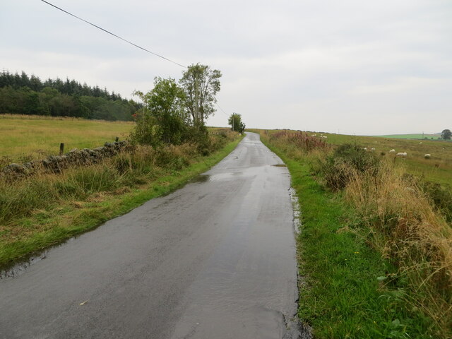
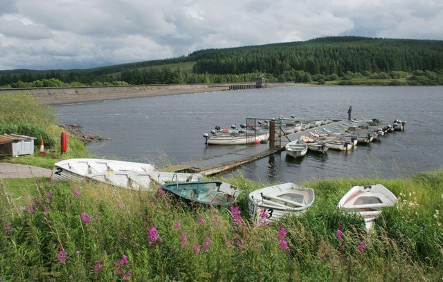
Dundaff Hill Images

Images are sourced within 2km of 56.036284/-4.0318083 or Grid Reference NS7384. Thanks to Geograph Open Source API. All images are credited.

Old fingerpost A photo taken in poor light showing the unique fingerpost at the crossroads just north of Carron Bridge which is the southernmost boundary of Stirlingshire with North Lanarkshire and Falkirk.  The only other recorded post of this style was, in 1983, at the junction of the A836 and B838 north of Lairg.  Now lost.
Old fingerpost
A photo taken in poor light showing the unique fingerpost at the crossroads just north of Carron Bridge which is the southernmost boundary of Stirlingshire with North Lanarkshire and Falkirk. The only other recorded post of this style was, in 1983, at the junction of the A836 and B838 north of Lairg. Now lost.
Old fingerpost A clearer view of the unique fingerpost at the crossroads on the B818 near Carron Bridge.  It was cast at the Smith and Wellstead Foundry in Bonnybridge and is the only known survivor in Scotland of this style of fingerpost with a 6" diameter ball finial and arrowhead ends to the fingers.
Old fingerpost
A clearer view of the unique fingerpost at the crossroads on the B818 near Carron Bridge. It was cast at the Smith and Wellstead Foundry in Bonnybridge and is the only known survivor in Scotland of this style of fingerpost with a 6" diameter ball finial and arrowhead ends to the fingers.
Old fingerpost This photograph shows the zigzag pattern of 4 inverted Vs cast around the post beneath the fingers of the unique fingerpost on the B818 near Carron Bridge.  The two lost fingers may have indicated the routes to Denny and Stirling.
Old fingerpost
This photograph shows the zigzag pattern of 4 inverted Vs cast around the post beneath the fingers of the unique fingerpost on the B818 near Carron Bridge. The two lost fingers may have indicated the routes to Denny and Stirling.
Minor road heading in the direction of Buckieburn Looking north-eastward.
Minor road heading in the direction of Buckieburn
Looking north-eastward.
Minor road leaving the B818 at Carron Bridge Looking north-eastward. Signage suggests that this road leads to Stirling.
Minor road leaving the B818 at Carron Bridge
Looking north-eastward. Signage suggests that this road leads to Stirling.
Forestry track restricted to foot, hoof and cycle usage Looking south-westward.
Forestry track restricted to foot, hoof and cycle usage
Looking south-westward.
A somewhat overgrown and disused forestry track Looking eastward.
A somewhat overgrown and disused forestry track
Looking eastward.
Earl's Burn View from the A818
Earl's Burn
View from the A818
River Carron Downstream of the dam and Forestry car park.
River Carron
Downstream of the dam and Forestry car park.
Forest road, Carron Valley Another spin of the roulette wheel - the mountain bike tracks were closed, but I wanted to use the road network to get to Little Bin. Would I get through?
No problems!
Forest road, Carron Valley
Another spin of the roulette wheel - the mountain bike tracks were closed, but I wanted to use the road network to get to Little Bin. Would I get through? No problems!
B818 Passing houses by the Carron Valley dam.
B818
Passing houses by the Carron Valley dam.
Dam, Carron Valley Reservoir Built between 1935 and 1938.
Dam, Carron Valley Reservoir
Built between 1935 and 1938.
About to cross Carron Bridge Approaching from the south.
About to cross Carron Bridge
Approaching from the south.
Bridge, River Carron
Carron Valley Reservoir
Fishing boats, Carron Valley Reservoir The reservoir holds both native brown trout and introduced rainbow trout, making it a popular fishing destination. The boats are rented out by Carron Valley Fishery.
The East Dam is in the background.
Fishing boats, Carron Valley Reservoir
The reservoir holds both native brown trout and introduced rainbow trout, making it a popular fishing destination. The boats are rented out by Carron Valley Fishery. The East Dam is in the background.
Entering Carron Valley The East Dam of the Carron Valley Reservoir is just to the right.
Entering Carron Valley
The East Dam of the Carron Valley Reservoir is just to the right.
East Dam, Carron Valley Reservoir
Show me another place!

Dundaff Hill is located at Grid Ref: NS7384 (Lat: 56.036284, Lng: -4.0318083)

Unitary Authority: Stirling

Police Authority: Forth Valley

What 3 Words

///feast.stoppage.space. Near Kilsyth, North Lanarkshire

Nearby Locations

Dundaff Hill

Related Wikis

Duncarron

Duncarron is a modern reproduction of a fortified village from the early Middle Ages of Scotland. It is the reconstruction of a typical residence of a...

Stirling Transmitting Station

Stirling Transmitting Station is a transmission facility on Earl's Hill southwest of Stirling, Scotland. It was built at the end of the 1950s for the radio...

Central 103.1 FM

Central 103.1 FM is an Independent Local Radio station serving Falkirk, Stirling, Clackmannanshire and the Forth Valley. It is owned and operated by businessman...

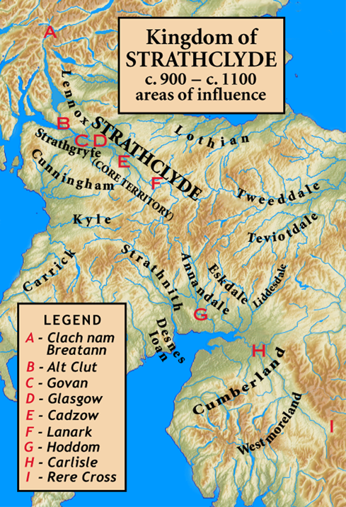
Kingdom of Strathclyde

Strathclyde (lit. "broad valley of the Clyde", Welsh: Ystrad Clud, Latin: Cumbria) was a Brittonic kingdom in northern Britain during the Middle Ages....

Nearby Amenities

Located within 500m of 56.036284,-4.0318083
Dundaff Hill
Corbett: no
Ele: 352
Ele Ft: 1156
Munro: no
Natural: peak
Lat/Long: 56.0366629/-4.0307814
The data included in this document is from www.openstreetmap.org. The data is made available under ODbL.

Have you been to Dundaff Hill?

Leave your review of Dundaff Hill below (or comments, questions and feedback).