Chains Barrow

Heritage SIte in Somerset Somerset West and Taunton

England

Chains Barrow

Farm access bridge on River Barle
Farm access bridge on River Barle Credit: Roger Cornfoot

Chains Barrow, located in Somerset, England, is a prominent heritage site with deep historical significance. Situated on a hilltop near the village of Priddy, Chains Barrow is an ancient burial mound dating back to the Neolithic period, around 4000-2500 BC.

The barrow itself is a large circular mound, approximately 35 meters in diameter and 3 meters high. It is constructed from earth and stone, creating a distinctive landmark in the surrounding landscape. The name "Chains" is derived from the Old English word "cēap," meaning market, suggesting that the site might have had economic or social importance in the past.

Excavations carried out in the early 20th century revealed the presence of a burial chamber within the barrow. Unfortunately, these excavations were not conducted with modern archaeological methods, resulting in limited information about the site's contents. However, it is believed that Chains Barrow was used as a communal burial site, possibly for a local elite or important individuals within the community.

Today, Chains Barrow is a protected heritage site under the care of the National Trust. It attracts visitors interested in the region's ancient history and offers breathtaking views of the surrounding countryside. The site is easily accessible via footpaths, and interpretation panels provide information about its historical significance.

Chains Barrow is not only a remarkable archaeological site but also a testament to the rich cultural heritage of Somerset. Its ancient origins and enduring presence make it a captivating destination for history enthusiasts and nature lovers alike.

If you have any feedback on the listing, please let us know in the comments section below.

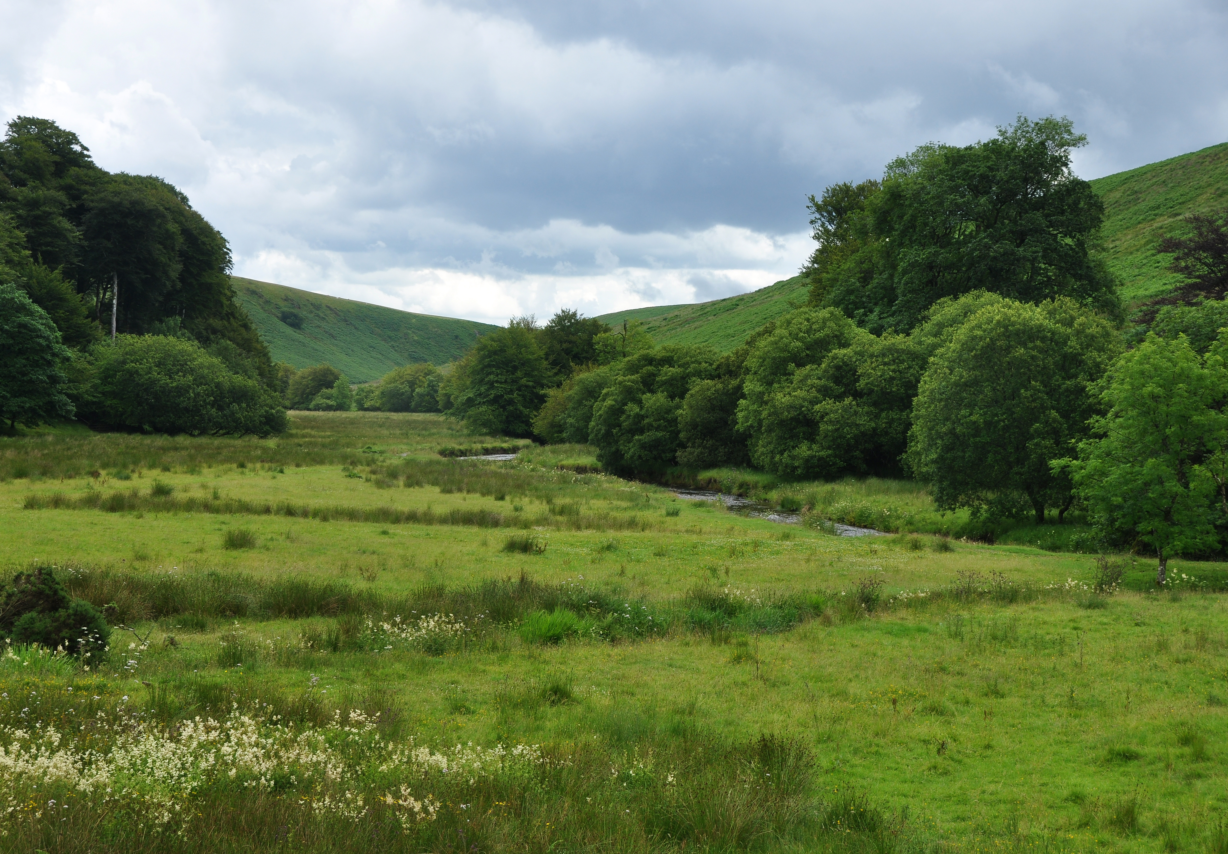
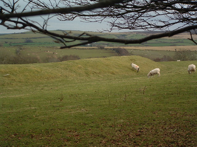
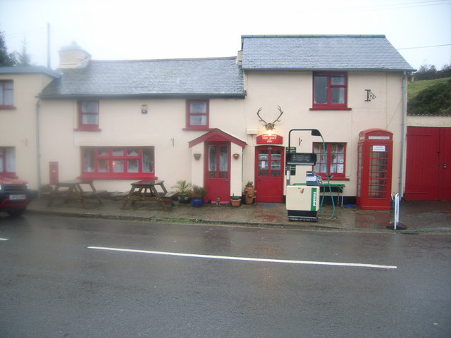
Chains Barrow Images

Images are sourced within 2km of 51.162347/-3.8111017 or Grid Reference SS7341. Thanks to Geograph Open Source API. All images are credited.

Farm access bridge on River Barle
Exmoor: bridleway to Mole’s Chamber The bridleway joins the B3358 road to Simonsbath near the former's crossing of the River Barle
Exmoor: bridleway to Mole’s Chamber
The bridleway joins the B3358 road to Simonsbath near the former's crossing of the River Barle
Exmoor: Woodbarrow Gate Seen from the top of the Bronze Age Wood Barrow. Here the Tarka Trail comes up from the south – to the right – and turns sharply east, heading for Pinkworthy Pond and Exe Head, where it turns north again. The paths on this part of the moor are not always well defined and tend to be a bit boggy in places. Looking east towards The Chains, where a cloudburst in 1952 created the Lynmouth disaster
Exmoor: Woodbarrow Gate
Seen from the top of the Bronze Age Wood Barrow. Here the Tarka Trail comes up from the south – to the right – and turns sharply east, heading for Pinkworthy Pond and Exe Head, where it turns north again. The paths on this part of the moor are not always well defined and tend to be a bit boggy in places. Looking east towards The Chains, where a cloudburst in 1952 created the Lynmouth disaster
Exmoor: Wood Barrow A Bronze Age barrow standing 480m above sea level at a point where the Tarka Trail turns east, having run north from the B3358. Bog asphodel grows nearby the barrow
Exmoor: Wood Barrow
A Bronze Age barrow standing 480m above sea level at a point where the Tarka Trail turns east, having run north from the B3358. Bog asphodel grows nearby the barrow
Exmoor: Pinkworthy Pond Known locally as Pinkery Pond, it was created for landowner John Knight in about 1830, by damming the headwaters of the river Barle. Knight, an ironmaster from Worcestershire, bought the mineral rights to the Forest of Exmoor from the Crown in 1818. It is thought the pond formed part of an aborted engineering project in which it would supply a canal or leat to power a large waterwheel planned for a site nearer Simonsbath. The wheel was to assist the operation of an inclined railway carrying iron ore from Exmoor to Porlock Weir. Neither the canal nor the railway were ever built. John Knight retired to Rome and Frederick, his son, continued to build farms on the moor and improve the land
Exmoor: Pinkworthy Pond
Known locally as Pinkery Pond, it was created for landowner John Knight in about 1830, by damming the headwaters of the river Barle. Knight, an ironmaster from Worcestershire, bought the mineral rights to the Forest of Exmoor from the Crown in 1818. It is thought the pond formed part of an aborted engineering project in which it would supply a canal or leat to power a large waterwheel planned for a site nearer Simonsbath. The wheel was to assist the operation of an inclined railway carrying iron ore from Exmoor to Porlock Weir. Neither the canal nor the railway were ever built. John Knight retired to Rome and Frederick, his son, continued to build farms on the moor and improve the land
Exmoor: near Pinkery Farm Pinkery Farm – out of shot, left – is now an exploration centre. Ahead is Goat Hill; looking south down the Barle valley
Exmoor: near Pinkery Farm
Pinkery Farm – out of shot, left – is now an exploration centre. Ahead is Goat Hill; looking south down the Barle valley
Hoar Oak Tree The first recorded Hoar Oak Tree died 'of great age and rottenness'in the seventeenth century. Ever since then, a new tree has been planted at the death of the old.
Hoar Oak Tree
The first recorded Hoar Oak Tree died 'of great age and rottenness'in the seventeenth century. Ever since then, a new tree has been planted at the death of the old.
The Tarka Trail fords Hoaroak Water The Tarka Trail continues over the ford and up the Chains Valley towards Exe Head. Hoaroak Water turns right along Long Chains Combe.
The Tarka Trail fords Hoaroak Water
The Tarka Trail continues over the ford and up the Chains Valley towards Exe Head. Hoaroak Water turns right along Long Chains Combe.
The Gate at Exe Head A meeting of footpaths. The view is from the North where the Tarka Trail and Two Moors Way arrive from Lynmouth. The Macmillan Way West arrives from the left (East) and heads right, following the route of the Tarka Trail for a mile and a half.
The Gate at Exe Head
A meeting of footpaths. The view is from the North where the Tarka Trail and Two Moors Way arrive from Lynmouth. The Macmillan Way West arrives from the left (East) and heads right, following the route of the Tarka Trail for a mile and a half.
Chains Barrow At 487m, the Chains is one of the highest points in this part of Exmoor
Chains Barrow
At 487m, the Chains is one of the highest points in this part of Exmoor
Pinkery Farm
Pinkery Farm
Short Combe Combe Looking down the Barle valley, here called Short Combe Combe, from the private road to Pinkery Farm.
Short Combe Combe
Looking down the Barle valley, here called Short Combe Combe, from the private road to Pinkery Farm.
River Barle Looking upstream from Goat Hill Bridge
River Barle
Looking upstream from Goat Hill Bridge
Barle Valley looking up the Barle valley from the path to Pinkery Pond.
Barle Valley
looking up the Barle valley from the path to Pinkery Pond.
Wind Turbine, Pinkery Farm
Exe Head This is the source of one of the South West's great Rivers, The Exe. Standing by the gate in Grant Shermans' picture the trickle starts in the gulley on the left. Tarka Trail- Two Moors Way on the right. This water enters the English Channel at Exeter/Exmouth some 42 miles as the crow flies or 58 meandering.
Exe Head
This is the source of one of the South West's great Rivers, The Exe. Standing by the gate in Grant Shermans' picture the trickle starts in the gulley on the left. Tarka Trail- Two Moors Way on the right. This water enters the English Channel at Exeter/Exmouth some 42 miles as the crow flies or 58 meandering.
Tarka Trail Exmoor National Park, Tarka Trail heading north - a well trodden path!
Tarka Trail
Exmoor National Park, Tarka Trail heading north - a well trodden path!
Tarka Trail Exmoor National Park; heading North on the Tarka Trail
Tarka Trail
Exmoor National Park; heading North on the Tarka Trail
Show me another place!

Chains Barrow is located at Grid Ref: SS7341 (Lat: 51.162347, Lng: -3.8111017)

Administrative County: Somerset

District: Somerset West and Taunton

Police Authority: Avon and Somerset

What 3 Words

///success.blush.dislikes. Near Lynton, Devon

Nearby Locations

Chains Barrow

Related Wikis

Chains (geological site)

The Chains is the name given to the north-west plateau of Exmoor, Somerset, England. This plateau lies above the 1,500 feet (457 m) contour line, and includes...

Barle Valley

Barle Valley is a 1,540 acres (620 ha) Site of Special Scientific Interest within Exmoor National Park, situated in the counties of Devon and Somerset...
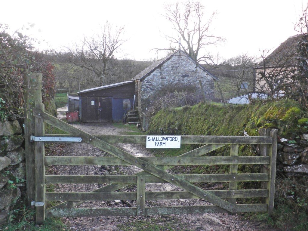
Shallowford, Devon

Shallowford is a hamlet in the civil parish of Lynton and Lynmouth in the North Devon district of Devon, England. Its nearest town is Lynton, which lies...

Shoulsbury castle

Shoulsbury Castle is an Iron Age hill fort close to Challacombe in Devon, England. It takes the form of a multi-ditch and rampart enclosure close to the...

Roborough Castle

Roborough Castle is an Iron Age enclosure or hill fort situated close to Lynton in Devon, England. The fort is situated on the North East edge of a Hillside...

Challacombe

Challacombe is a small village on the edge of the Exmoor National Park, in Devon, England. The village has a small general shop/Post Office and a single...

Furzehill, Devon

Furzehill is a hamlet in the North Devon district of Devon, England. Its nearest town is Lynton, which lies approximately 4 miles (6.4 km) north from the...

Simonsbath House

Simonsbath House is a historic house in Simonsbath on Exmoor in Somerset, England. The Grade II listed building is now the Simonsbath House Hotel, and...

Nearby Amenities

Located within 500m of 51.162347,-3.8111017
Chains Barrow
Ele: 487
Natural: peak
Lat/Long: 51.1623489/-3.8111003
The data included in this document is from www.openstreetmap.org. The data is made available under ODbL.

Have you been to Chains Barrow?

Leave your review of Chains Barrow below (or comments, questions and feedback).