Hollinsclough

Settlement in Staffordshire Staffordshire Moorlands

England

Hollinsclough

Parkhouse Hill as seen from Axe Edge Trig Point One of the few hills visible during this cold air inversion. Chrome Hill is on the right.
Parkhouse Hill as seen from Axe Edge Trig Point Credit: Colin Park

Hollinsclough is a small picturesque village located in the Staffordshire Moorlands district of Staffordshire, England. Situated in the heart of the Peak District National Park, it is surrounded by stunning natural beauty and rolling hills, making it a popular destination for outdoor enthusiasts and nature lovers.

The village itself is characterized by its charming stone-built houses, some of which date back to the 17th century. The local community is tight-knit and friendly, with a population of around 200 people. Despite its small size, Hollinsclough boasts a vibrant community spirit, with various events and activities organized throughout the year.

One of the notable features of Hollinsclough is its beautiful parish church, St. Mary's. Dating back to the 12th century, the church is an architectural gem and a testament to the village's rich history. It serves as a focal point for the community and holds regular services and events.

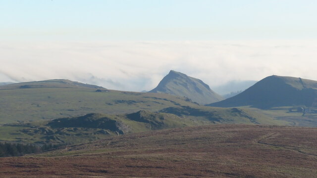
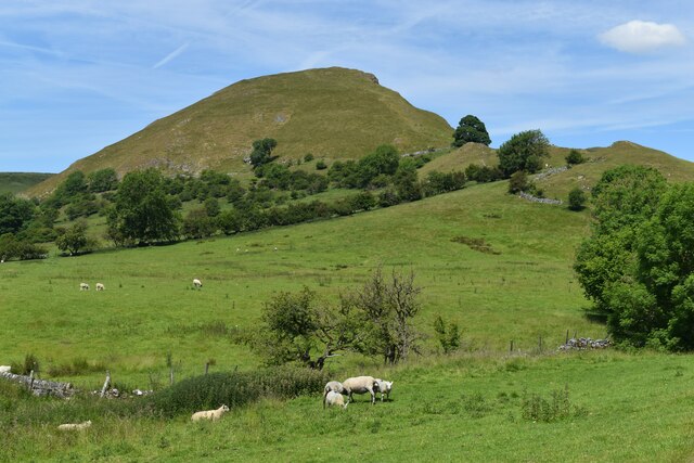
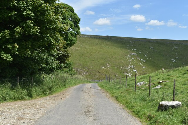
Hollinsclough is also known for its scenic walks and hiking trails, which offer breathtaking views of the surrounding countryside. The nearby River Dove, renowned for its trout fishing, is a popular spot for anglers. Additionally, the village is within close proximity to several attractions, including the historic market town of Leek and the stunning Dovedale Valley.

In summary, Hollinsclough is a charming and idyllic village nestled in the Staffordshire countryside. With its beautiful scenery, friendly community, and rich history, it is a hidden gem worth exploring for nature enthusiasts and those seeking a tranquil retreat.

If you have any feedback on the listing, please let us know in the comments section below.

Hollinsclough Images

Images are sourced within 2km of 53.195871/-1.904139 or Grid Reference SK0666. Thanks to Geograph Open Source API. All images are credited.

Parkhouse Hill as seen from Axe Edge Trig Point One of the few hills visible during this cold air inversion. Chrome Hill is on the right.
Parkhouse Hill as seen from Axe Edge Trig Point
One of the few hills visible during this cold air inversion. Chrome Hill is on the right.
Parkhouse and Chrome Hills Looking southwest through the Parkhouse and Chrome Hills, near Earl Sterndale in the Derbyshire Peak District.

- image by Phil Brandon Hunter - philbhu.com - P1060685A
Parkhouse and Chrome Hills
Looking southwest through the Parkhouse and Chrome Hills, near Earl Sterndale in the Derbyshire Peak District. - image by Phil Brandon Hunter - philbhu.com - P1060685A
Hollinsclough Derbyshire Peaks The view northeast from south of Hollinsclough village, Derbyshire Peak District

- image by Phil Brandon Hunter - philbhu.com - P7230099A
Hollinsclough Derbyshire Peaks
The view northeast from south of Hollinsclough village, Derbyshire Peak District - image by Phil Brandon Hunter - philbhu.com - P7230099A
Hollinsclough Derbyshire Peaks Chrome Hill and Parkhouse Hill from the southwest, viewed from  southeast of Hollinsclough village

- image by Phil Brandon Hunter - philbhu.com - P7230106A
Hollinsclough Derbyshire Peaks
Chrome Hill and Parkhouse Hill from the southwest, viewed from southeast of Hollinsclough village - image by Phil Brandon Hunter - philbhu.com - P7230106A
Parkhouse Hill, seen from Glutton Bridge The tree and building are beside the track from Crowdicote.
Parkhouse Hill, seen from Glutton Bridge
The tree and building are beside the track from Crowdicote.
Parkhouse Hill
Parkhouse Hill
Chrome Hill
Chrome Hill
Cattle grid south of Dowall Hall In the pass between Chrome Hill and Parkhouse Hill.
Cattle grid south of Dowall Hall
In the pass between Chrome Hill and Parkhouse Hill.
Parkhouse Hill
Parkhouse Hill
Dowall Hall
Dowall Hall
View along the ridge of Chrome Hill to Parkhouse Hill Along the “dragon’s back” of these two limestone reef knolls.
View along the ridge of Chrome Hill to Parkhouse Hill
Along the “dragon’s back” of these two limestone reef knolls.
The Dove Valley from the summit of Chrome Hill Parkhouse Hill on the left.
The Dove Valley from the summit of Chrome Hill
Parkhouse Hill on the left.
Dowel Dale, shortly above Dowell Hall Both spellings as per Ordnance Survey. This section of the valley is a miniature limestone gorge.
Dowel Dale, shortly above Dowell Hall
Both spellings as per Ordnance Survey. This section of the valley is a miniature limestone gorge.
Dowel Dale Limestone valley complete with crags and caves.
Dowel Dale
Limestone valley complete with crags and caves.
Looking down Dowel Dale
Greensides
Greensides
Lane into Dowel Dale at Owl Hole The lane descends from this point to Dowall Hall through a miniature limestone valley, with crags and caves and a short gorge section at the lower end.
Lane into Dowel Dale at Owl Hole
The lane descends from this point to Dowall Hall through a miniature limestone valley, with crags and caves and a short gorge section at the lower end.
Chocolate lid signs I was expecting something agricultural but these signs are made from popular chocolate box lids!
Chocolate lid signs
I was expecting something agricultural but these signs are made from popular chocolate box lids!
Show me another place!

Hollinsclough is located at Grid Ref: SK0666 (Lat: 53.195871, Lng: -1.904139)

Administrative County: Staffordshire

District: Staffordshire Moorlands

Police Authority: Staffordshire

What 3 Words

///from.puzzled.sprinkler. Near Buxton, Derbyshire

Nearby Locations

Hollinsclough

Related Wikis

Hollinsclough

Hollinsclough is a small rural village in the county of Staffordshire in the English Midlands. It is within the Peak District National Park. == Location... ==

Chrome Hill

Chrome Hill is a limestone reef knoll in Derbyshire, England, in the upper Dove valley beside the border with Staffordshire, within the civil parish...

Hollins Hill

Hollins Hill is a gritstone hill in the Derbyshire Peak District near the village of Hollinsclough. The summit is 450 metres (1,480 ft) above sea level...

Parkhouse Hill

Parkhouse Hill is a small but distinctive hill in the Peak District National Park of the Hartington Middle Quarter civil parish, in the English county...

High Edge

High Edge is a limestone hill overlooking Harpur Hill, Buxton in Derbyshire, in the Peak District. The summit is 472 metres (1,549 ft) above sea level...

Earl Sterndale

Earl Sterndale is a village in the Upper Dove Valley in the Peak District, Derbyshire, England, situated near the River Dove, 5 miles south of Buxton,...

St Bartholomew's Church, Longnor

The Church of St Bartholomew is a Grade II* listed Anglican church in the village of Longnor in north-east Staffordshire. It was built in the late 18th...

Longnor, Staffordshire

Longnor is a village in the Staffordshire Peak District, England. The settlement dates from early times, the first recorded church building being in the...

Nearby Amenities

Located within 500m of 53.195871,-1.904139
Hollinsclough
Is In: Staffordshire, United Kingdom
Place: village
Wikidata: Q2686430
Wikipedia: en:Hollinsclough
Lat/Long: 53.1970446/-1.9048387
Bus Stop
Vicarage Farm
Bus: yes
Naptan AtcoCode: 3800C808000
Naptan Bearing: SE
Naptan CommonName: Vicarage Farm
Naptan Indicator: Adj
Naptan Landmark: Vicarage Farm
Naptan Street: Main Rd
Naptan Verified: no
Public Transport: platform
Source: naptan_import
Lat/Long: 53.1955727/-1.9037204
Bus Stop
Vicarage Farm
Bus: yes
Naptan AtcoCode: 3800C808001
Naptan Bearing: NW
Naptan CommonName: Vicarage Farm
Naptan Indicator: Opp
Naptan Landmark: Vicarage Farm
Naptan Street: Main Rd
Naptan Verified: no
Public Transport: platform
Source: naptan_import
Lat/Long: 53.195548/-1.9038348
Barrier: cattle_grid
Lat/Long: 53.1968362/-1.8988111
Bench
Ele: 292.0000000
Lat/Long: 53.1955201/-1.9036704
Ele: 291.0000000
Information: board
Tourism: information
Lat/Long: 53.1955346/-1.9036919
Bench
Ele: 291.0000000
Lat/Long: 53.1955523/-1.9037053
Telephone
Booth: K6
Covered: booth
Ele: 291
Man Made: telephone_box
Old Phone: +44 1298 83386
Lat/Long: 53.1956439/-1.903826
Ele: 296.0000000
Lat/Long: 53.1955114/-1.9049482
Ele: 292.0000000
Lat/Long: 53.1955887/-1.9046742
Post Box
Collection Times: Mo-Fr 11:30; Sa 09:30
Post Box Type: wall
Ref: SK17 30
Royal Cypher: VR
Royal Cypher Wikidata: Q33102356
Lat/Long: 53.1961641/-1.9045225
Entrance: yes
Lat/Long: 53.1959916/-1.9041551
Ford: yes
Lat/Long: 53.1987937/-1.9076017
Barrier: entrance
Lat/Long: 53.1959729/-1.9041569
Barrier: stile
Stile: squeezer
Lat/Long: 53.1958825/-1.9004401
Barrier: stile
Material: wood
Source: survey
Stile: ladder
Lat/Long: 53.1919522/-1.9074454
Barrier: stile
Material: wood
Source: survey
Stile: ladder
Lat/Long: 53.192362/-1.9065859
Barrier: cattle_grid
Bicycle: yes
Foot: yes
Motorcar: yes
Lat/Long: 53.1927177/-1.9069833
Barrier: block
Lat/Long: 53.1954736/-1.9051132
Barrier: cattle_grid
Bicycle: yes
Foot: yes
Motorcar: yes
Motorcycle: yes
Lat/Long: 53.1967145/-1.9104992
Information: guidepost
Operator: Peak & Northern Footpaths Society
Ref: 581
Source: survey;gps
Tourism: information
Lat/Long: 53.1973253/-1.9063197
Parking
Access: yes
Capacity: 5
Fee: no
Parking: surface
Lat/Long: 53.1954895/-1.9036737
Bench
Source: survey;gps
Lat/Long: 53.1955749/-1.9037401
Cafe
Hollinsclough Chapel Hall
Opening Hours: May-Aug Su 11:00-16:00
Lat/Long: 53.195862/-1.9042927
Man Made: utility_pole
Lat/Long: 53.1938628/-1.9043803
Man Made: utility_pole
Lat/Long: 53.1949184/-1.9051795
Barrier: block
Lat/Long: 53.1935636/-1.9081142
Man Made: utility_pole
Lat/Long: 53.1935009/-1.9086603
Power: pole
Lat/Long: 53.1930069/-1.9085878
Man Made: utility_pole
Lat/Long: 53.1927026/-1.9089328
Man Made: utility_pole
Lat/Long: 53.1934923/-1.9023431
The data included in this document is from www.openstreetmap.org. The data is made available under ODbL.

Have you been to Hollinsclough?

Leave your review of Hollinsclough below (or comments, questions and feedback).