Beinn Odhar

Hill, Mountain in Perthshire

Scotland

Beinn Odhar

Rough Ground on Beinn nan Eun On the rough slopes north west of the summit of Beinn nan Eun. No path to be seen and this is before the notorious peat hags on the summit.  Good view of Stùc a' Chroin and Ben Vorlich.
Rough Ground on Beinn nan Eun Credit: Adam Ward

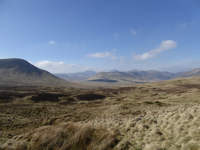
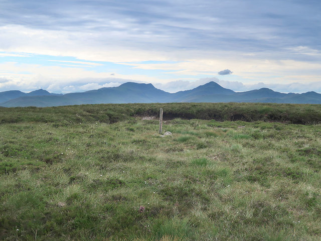
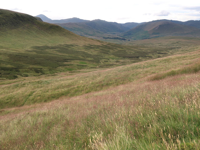
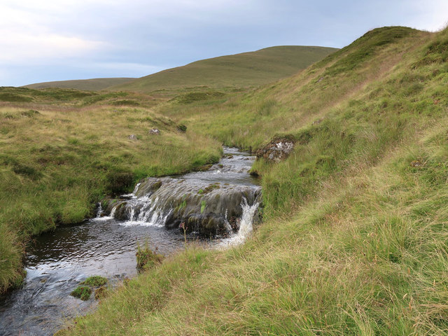
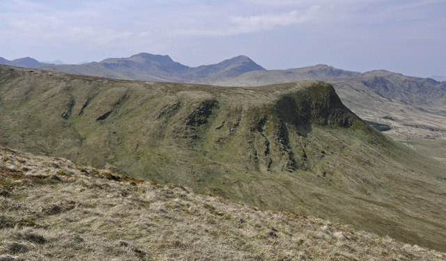
Beinn Odhar is a prominent hill located in Perthshire, Scotland. It is part of the Ben Lawers range and stands at a height of 901 meters (2,956 feet) above sea level. The name "Beinn Odhar" translates to "dun-colored hill" in Gaelic, which is a fitting description of its appearance.

The hill is a popular destination for hikers and outdoor enthusiasts due to its stunning views of the surrounding landscape. The ascent to the summit can be challenging, but the reward is well worth it as the panoramic views from the top are breathtaking. On a clear day, it is possible to see as far as Loch Tay and the surrounding mountains.

Beinn Odhar is also home to a diverse range of flora and fauna, including heather, mosses, and various species of birds. The hill is designated as a Site of Special Scientific Interest (SSSI) due to its important ecological and geological features.

Overall, Beinn Odhar is a must-visit for anyone looking to experience the natural beauty and rugged landscape of Perthshire.

If you have any feedback on the listing, please let us know in the comments section below.

Beinn Odhar Images

Images are sourced within 2km of 56.289883/-4.0785175 or Grid Reference NN7112. Thanks to Geograph Open Source API. All images are credited.

Rough Ground on Beinn nan Eun On the rough slopes north west of the summit of Beinn nan Eun. No path to be seen and this is before the notorious peat hags on the summit.  Good view of Stùc a' Chroin and Ben Vorlich.
Rough Ground on Beinn nan Eun
On the rough slopes north west of the summit of Beinn nan Eun. No path to be seen and this is before the notorious peat hags on the summit. Good view of Stùc a' Chroin and Ben Vorlich.
Summit of Beinn nan Eun On the summit of Donald Beinn nan Eun looking across to Stùc a' Chroin and Ben Vorlich. Lovely autumn day but hard going underfoot.
Summit of Beinn nan Eun
On the summit of Donald Beinn nan Eun looking across to Stùc a' Chroin and Ben Vorlich. Lovely autumn day but hard going underfoot.
Vorlich View Looking from the lower south western slopes of the Donald top of Beinn Odhar over Am Beannan to Stùc a' Chroin and Ben Vorlich. Snow covered Stob Binnean and Ben More can just be seen in the far distance.
Vorlich View
Looking from the lower south western slopes of the Donald top of Beinn Odhar over Am Beannan to Stùc a' Chroin and Ben Vorlich. Snow covered Stob Binnean and Ben More can just be seen in the far distance.
Braes of Doune Windfarm From just above the peat hagged coll between Beinn Odhar and Uamh Bheag is this view of Braes of Doune Windfarm, not producing much energy on a relatively windless day.
Braes of Doune Windfarm
From just above the peat hagged coll between Beinn Odhar and Uamh Bheag is this view of Braes of Doune Windfarm, not producing much energy on a relatively windless day.
Beinn Odhar (summit) Looking towards Ben Vorlich and Stuc a' Chroin from the summit of Beinn Odhar.
Beinn Odhar (summit)
Looking towards Ben Vorlich and Stuc a' Chroin from the summit of Beinn Odhar.
Beinn nan Eun (summit) Looking towards Ben Vorlich and Stuc a' Chroin from the summit of Beinn nan Eun.
Beinn nan Eun (summit)
Looking towards Ben Vorlich and Stuc a' Chroin from the summit of Beinn nan Eun.
Cairn on boulder, Uamh Beag The Braes of Doune windfarm dominates the view.
Cairn on boulder, Uamh Beag
The Braes of Doune windfarm dominates the view.
Allt Ollach The name of this burn in this corrie translates as the 'stream of the wool or fleece.'
Allt Ollach
The name of this burn in this corrie translates as the 'stream of the wool or fleece.'
Allt na Stainge in Findhu Glen The stream is almost hidden in places by the bracken and long grass. It is a tributary of the Findhuglen Water
Allt na Stainge in Findhu Glen
The stream is almost hidden in places by the bracken and long grass. It is a tributary of the Findhuglen Water
Source of the Allt Mor In the peat haggs and moorland between Beinn nan Eun and Beinn Odhar
Source of the Allt Mor
In the peat haggs and moorland between Beinn nan Eun and Beinn Odhar
Summit post on Beinn nan Eun Hidden in the peat hags of the flat summit. Looking towards Ben Vorlich on the right and Stuc a' Chroin on the left.
Summit post on Beinn nan Eun
Hidden in the peat hags of the flat summit. Looking towards Ben Vorlich on the right and Stuc a' Chroin on the left.
Peat hags on Beinn nan Eun Looking south towards the Braes o' Doune windfarm
Peat hags on Beinn nan Eun
Looking south towards the Braes o' Doune windfarm
Peat hags on Beinn Odhar Looking towards more peat hags on Beinn nan Eun
Peat hags on Beinn Odhar
Looking towards more peat hags on Beinn nan Eun
Moorland west of Beinn Odhar A mixture of rough grass and heather moorland
Moorland west of Beinn Odhar
A mixture of rough grass and heather moorland
Fence across the source of the Garvald Burn The fence goes to the trig point on Uamh Bheag
Fence across the source of the Garvald Burn
The fence goes to the trig point on Uamh Bheag
Allt Ollach A tributary of the Water of Ruchill
Allt Ollach
A tributary of the Water of Ruchill
From the NE ridge of Uamh Bheag The two northern ridges of Uamh Bheag enclose Coire nan Fiannarachd; the western wall, Am Beannan, is precipitous.   Stuc a'Chroin and Ben Vorlich form the backdrop.
From the NE ridge of Uamh Bheag
The two northern ridges of Uamh Bheag enclose Coire nan Fiannarachd; the western wall, Am Beannan, is precipitous. Stuc a'Chroin and Ben Vorlich form the backdrop.
North-east spur of Uamh Bheag A view across Coire na Fionnarachd ('the corrie of the chill or the cool breeze') towards the spur running off Uamh Beag ('small cave'), a hill named after a cave on its south-west side.
North-east spur of Uamh Bheag
A view across Coire na Fionnarachd ('the corrie of the chill or the cool breeze') towards the spur running off Uamh Beag ('small cave'), a hill named after a cave on its south-west side.
Show me another place!

Beinn Odhar is located at Grid Ref: NN7112 (Lat: 56.289883, Lng: -4.0785175)

Unitary Authority: Stirling

Police Authority: Forth Valley

What 3 Words

///loafer.joggers.novelists. Near Callander, Stirling

Nearby Locations

Beinn Odhar

Related Wikis

Beinn nan Eun (Perth and Kinross)

Beinn nan Eun is a hill in the Glen Artney Hills range immediately south of the Highland Boundary Fault, part of the Central Lowlands of Scotland. The...

Braes of Doune Wind Farm

Braes of Doune Wind Farm is a wind farm located close to Stirling, Scotland and opened in 2007. == History == The farm was built by Alfred McAlpine in...

Uamh Bheag

Uamh Bheag is a hill in the Glen Artney Hills range immediately south of the Highland Boundary Fault, part of the Central Lowlands of Scotland. The highest...

Uamh Mhòr

Uamh Mhòr (older spelling Uaighmor, also anglicised Uam Var) is a summit in Kilmadock parish in Stirling council area, Scotland, north of the River Teith...

Nearby Amenities

Located within 500m of 56.289883,-4.0785175
Beinn Odhar
Ele: 626
Natural: peak
Source: OS7
Lat/Long: 56.2902251/-4.0782494
The data included in this document is from www.openstreetmap.org. The data is made available under ODbL.

Have you been to Beinn Odhar?

Leave your review of Beinn Odhar below (or comments, questions and feedback).