Beinn Dubh

Hill, Mountain in Inverness-shire

Scotland

Beinn Dubh

Woodland above Gaich
Woodland above Gaich Credit: Jennifer Jones

Beinn Dubh is a prominent hill located in Inverness-shire, Scotland. Standing at approximately 657 meters (2,156 feet) high, it offers stunning panoramic views of the surrounding countryside, including the nearby Loch Ness. The hill is a popular destination for hikers and outdoor enthusiasts, with several trails leading to the summit.

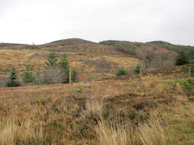
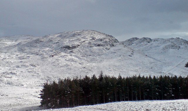
Beinn Dubh is known for its rugged terrain, characterized by steep slopes and rocky outcrops. The hill is covered in a mixture of grasses, heather, and shrubs, providing a habitat for a variety of wildlife including deer, birds, and other small mammals.

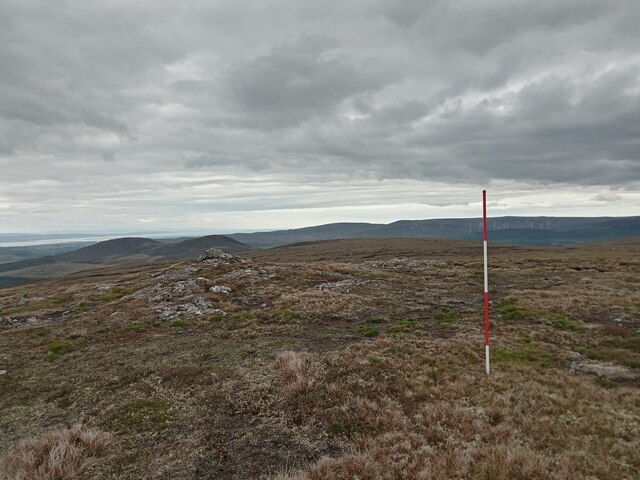
The summit of Beinn Dubh offers breathtaking views of the surrounding landscape, with the rolling hills of Inverness-shire stretching out in all directions. On a clear day, it is possible to see as far as the Cairngorms and the Isle of Skye.

Overall, Beinn Dubh is a challenging yet rewarding hike for those looking to experience the beauty of the Scottish Highlands. Its remote location and natural beauty make it a must-visit destination for outdoor enthusiasts in the area.

If you have any feedback on the listing, please let us know in the comments section below.

Beinn Dubh Images

Images are sourced within 2km of 57.366048/-4.1479046 or Grid Reference NH7032. Thanks to Geograph Open Source API. All images are credited.
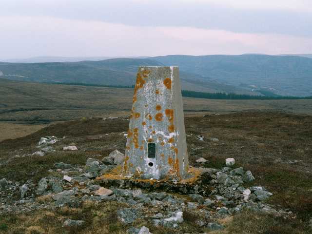
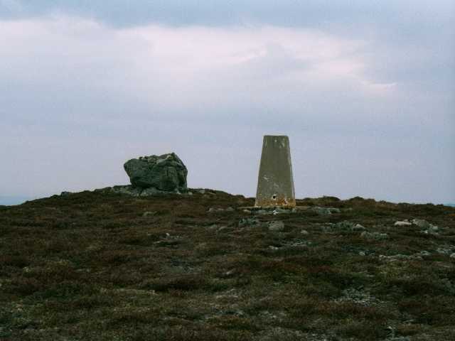
Woodland above Gaich
Woodland path near Inverarnie
Uisge Dubh Area of clear felled timber on the left of the Uisge Dubh, which runs through the bottom of the valley.
Uisge Dubh
Area of clear felled timber on the left of the Uisge Dubh, which runs through the bottom of the valley.
The Uisge Dubh The Uisge Dubh, just downstream of the main waterfall.
The Uisge Dubh
The Uisge Dubh, just downstream of the main waterfall.
Waterfall on the Uisge Dubh This waterfall is just downstream from a new intake weir for the Farr Hydro scheme.
Waterfall on the Uisge Dubh
This waterfall is just downstream from a new intake weir for the Farr Hydro scheme.
Farr Hydro Intake Weir Water is piped to the power station here. <a href="https://www.geograph.org.uk/photo/4996226">NH6931 : Farr Hydro-electric Power Station</a>
Farr Hydro Intake Weir
Water is piped to the power station here. NH6931 : Farr Hydro-electric Power Station
Peaty Pond on Meall na Fuar-ghlaic It is always nice to find a pond at the top of a hill. Particularly if your water is running low, as mine was. Though light brown in colour the water was clear - I filled up my containers and suffered no ill effects, so if anyone else ventures into the Western edge of this grid-square in years to come I can guarantee that the water from here is perfectly safe for drinking!
While it has its own name, and is quite a presence, this hill to me had the feel of just being part of Beinn Dubh, further East. The dip between them is negligible. In fact another contributor to this square says that Beinn Dubh trig point's official name is this hill's, which pretty much backs up my point.
Peaty Pond on Meall na Fuar-ghlaic
It is always nice to find a pond at the top of a hill. Particularly if your water is running low, as mine was. Though light brown in colour the water was clear - I filled up my containers and suffered no ill effects, so if anyone else ventures into the Western edge of this grid-square in years to come I can guarantee that the water from here is perfectly safe for drinking! While it has its own name, and is quite a presence, this hill to me had the feel of just being part of Beinn Dubh, further East. The dip between them is negligible. In fact another contributor to this square says that Beinn Dubh trig point's official name is this hill's, which pretty much backs up my point.
An Eye-Catching Rock near  Beinn Dubh This looked precarious from a distance, but once up close it was obvious that this rock will remain in place long after the world has blown itself up at some unspecified date in the future!
Due to its prominence on the horizon, it also appears, initially, to be bigger than it actually is - it is just over six feet tall. I like to think it had a name once though, and it probably did, but we shall never know...
An Eye-Catching Rock near Beinn Dubh
This looked precarious from a distance, but once up close it was obvious that this rock will remain in place long after the world has blown itself up at some unspecified date in the future! Due to its prominence on the horizon, it also appears, initially, to be bigger than it actually is - it is just over six feet tall. I like to think it had a name once though, and it probably did, but we shall never know...
Beinn Dubh Summit The big boulder (If I remember correctly the bit on the far right of it is actually a separate rock) across from the trig point is marked on the map as a cairn. Personally I wouldn't classify it as such - it is a big boulder with a few unfeasibly heavy stones piled on top of it. Whatever my opinions though, that's what they get called round here, as I came across a couple more in this area.
The trig pillar, like a few others round here, is in remarkably good condition - maybe Highland concrete is superior in some way?!
Beinn Dubh Summit
The big boulder (If I remember correctly the bit on the far right of it is actually a separate rock) across from the trig point is marked on the map as a cairn. Personally I wouldn't classify it as such - it is a big boulder with a few unfeasibly heavy stones piled on top of it. Whatever my opinions though, that's what they get called round here, as I came across a couple more in this area. The trig pillar, like a few others round here, is in remarkably good condition - maybe Highland concrete is superior in some way?!
View SouthWest from Beinn Dubh Summit Beinn Dubh is a very common hill name in Scotland. Translated from the Gaelic it simply means 'black hill'.
The Walk Highlands website has an audio recording of a fairly elderly sounding gentleman reading out the names of all Scotland's notable hills (ie the ones that are on the most commonly used hill-bagging lists). Translations are given for the Gaelic names too. The pronunciations take some getting used to as the letters used often seem to have no relation whatsoever to the sound of the word (viewed from an English-speaking perspective of course!)
This hill isn't important enough to be on anything more than minor hill lists, but there are more important Beinn Dhubs around. So I know that it should be pronounced 'Bain [rhyming with rain] Doo [rhyming with too]'.
Lots of hills in Scotland start with 'Ben', the most famous example being Ben Nevis of course. This is simply an anglicisation of the old Gaelic word 'Beinn', sometimes spelt 'Bheinn'.
View SouthWest from Beinn Dubh Summit
Beinn Dubh is a very common hill name in Scotland. Translated from the Gaelic it simply means 'black hill'. The Walk Highlands website has an audio recording of a fairly elderly sounding gentleman reading out the names of all Scotland's notable hills (ie the ones that are on the most commonly used hill-bagging lists). Translations are given for the Gaelic names too. The pronunciations take some getting used to as the letters used often seem to have no relation whatsoever to the sound of the word (viewed from an English-speaking perspective of course!) This hill isn't important enough to be on anything more than minor hill lists, but there are more important Beinn Dhubs around. So I know that it should be pronounced 'Bain [rhyming with rain] Doo [rhyming with too]'. Lots of hills in Scotland start with 'Ben', the most famous example being Ben Nevis of course. This is simply an anglicisation of the old Gaelic word 'Beinn', sometimes spelt 'Bheinn'.
Valley between Beinn Dubh and Beinn nan Cailleach The burn running through the valley is already quite established, despite this being very close to its source.
It is impossible to tell from the map whether it has a name at this point. What is certain, however, is that the water in it will eventually be part of Allt na Fuar-ghlaic (Allt means burn, or stream, in Gaelic). The strange thing about this is that to the West of Beinn Dubh there is a hill called Meall na Fuar-ghlaic.
Having already found a translation for the hill name for a previous write-up, we now have a 'burn of the cold hollow' running well over a mile away from the 'round hill of the cold hollow', which actually has another stream with a completely unrelated name running down it. Where, or what, this cold hollow actually is I would be fascinated to find out!
Valley between Beinn Dubh and Beinn nan Cailleach
The burn running through the valley is already quite established, despite this being very close to its source. It is impossible to tell from the map whether it has a name at this point. What is certain, however, is that the water in it will eventually be part of Allt na Fuar-ghlaic (Allt means burn, or stream, in Gaelic). The strange thing about this is that to the West of Beinn Dubh there is a hill called Meall na Fuar-ghlaic. Having already found a translation for the hill name for a previous write-up, we now have a 'burn of the cold hollow' running well over a mile away from the 'round hill of the cold hollow', which actually has another stream with a completely unrelated name running down it. Where, or what, this cold hollow actually is I would be fascinated to find out!
Summit of Beinn na Cailleach I'm not too sure what the surveying, or ranging, pole was doing here but I came across a few on my travels in this area. I have never done much surveying myself - my main exposure to them has been through photographs in which the poles are used as an easy way to show scale. This one was the standard length of two metres with the red and white colouring alternating every 50cm. The spike at the end of the pole is included in the two metres length, incidentally (I had always been curious!)
One of the many Gaelic place-naming guides available online translates the hill name as 'hill of the old woman', which is a curious one - I do hope she didn't actually live up here.
Summit of Beinn na Cailleach
I'm not too sure what the surveying, or ranging, pole was doing here but I came across a few on my travels in this area. I have never done much surveying myself - my main exposure to them has been through photographs in which the poles are used as an easy way to show scale. This one was the standard length of two metres with the red and white colouring alternating every 50cm. The spike at the end of the pole is included in the two metres length, incidentally (I had always been curious!) One of the many Gaelic place-naming guides available online translates the hill name as 'hill of the old woman', which is a curious one - I do hope she didn't actually live up here.
Deer on the Upper Slopes of Beinn nan Cailleach I always wish I was quicker at getting my phone out of my pocket. The deer spotted me right away and had already largely dispersed by the time I took the picture - a few seconds before it was a far more impressive spectacle.
Considering that this stretch of hilly countryside is obviously some kind of shooting estate - there are occasional large cabin-sized wooden huts dotted about, and very good hard tracks throughout, one of which reaches more than 600 metres - I was surprised I didn't come across more deer than I did. But then again may be they realised long ago that they are here to be shot at, and are experts in human avoidance now.
Deer on the Upper Slopes of Beinn nan Cailleach
I always wish I was quicker at getting my phone out of my pocket. The deer spotted me right away and had already largely dispersed by the time I took the picture - a few seconds before it was a far more impressive spectacle. Considering that this stretch of hilly countryside is obviously some kind of shooting estate - there are occasional large cabin-sized wooden huts dotted about, and very good hard tracks throughout, one of which reaches more than 600 metres - I was surprised I didn't come across more deer than I did. But then again may be they realised long ago that they are here to be shot at, and are experts in human avoidance now.
Forestry Road This forestry road was reconstructed to allow access to transport windmills to build a wind farm at Farr. It is 8 miles long. The hill in the background looking north east is Meall Mor (492m)
Forestry Road
This forestry road was reconstructed to allow access to transport windmills to build a wind farm at Farr. It is 8 miles long. The hill in the background looking north east is Meall Mor (492m)
Beinn Dubh & Meall na Fuar-ghlaic Beinn Dubh, or the black hill (514 mtrs) stands in the foreground; over its shoulder peeps Meall na Fuar-ghlaic, the rounded hill of the cold hollow, living up to its name in a late fall of snow.
Beinn Dubh & Meall na Fuar-ghlaic
Beinn Dubh, or the black hill (514 mtrs) stands in the foreground; over its shoulder peeps Meall na Fuar-ghlaic, the rounded hill of the cold hollow, living up to its name in a late fall of snow.
Beinn Dubh - Trig Pillar S7257 The OS official name for this triangulation station is "Meall Na Fuar Ghlaic". This tertiary triangulation pillar was completed 10th August 1953 costing £27.3s.6d. OSBM flush levelling bracket S7257 is on the north face of the pillar.
Beinn Dubh - Trig Pillar S7257
The OS official name for this triangulation station is "Meall Na Fuar Ghlaic". This tertiary triangulation pillar was completed 10th August 1953 costing £27.3s.6d. OSBM flush levelling bracket S7257 is on the north face of the pillar.
Beinn Dubh, 514m The summit of Beinn Dubh, Inverness-shire. Trig pillar S7257 (OS name Meall Na Fuar Ghlaic) has a north facing flush bracket.
Beinn Dubh, 514m
The summit of Beinn Dubh, Inverness-shire. Trig pillar S7257 (OS name Meall Na Fuar Ghlaic) has a north facing flush bracket.
Outcrop on Beinn Dubh A large boulder occupies the summit of Beinn Dubh, just north of the trig pillar.
Outcrop on Beinn Dubh
A large boulder occupies the summit of Beinn Dubh, just north of the trig pillar.
Show me another place!

Beinn Dubh is located at Grid Ref: NH7032 (Lat: 57.366048, Lng: -4.1479046)

Unitary Authority: Highland

Police Authority: Highlands and Islands

What 3 Words

///swims.snug.tequila. Near Milton of Leys, Highland

Nearby Locations

Beinn Dubh

Related Wikis

Inverernie

Inverernie (Gaelic: Inbhir Fhearna) is a small settlement, with a local shop, within Farr and the wider area of Strathnairn in the Highlands of Scotland...

Farr, Strathnairn

Farr (Gaelic: Fàrr) is a large area in Strathnairn, about 12 kilometres (7.5 mi) south of Inverness, in the Highland of Scotland. Much of the area is spread...

Strathnairn

Strathnairn (Gaelic: Srath Narann) is an area of the Scottish Highlands approximately 8 miles southwest of Inverness, bordering the Monadhliath Mountains...

Balnafoich

Balnafoich (Scottish Gaelic: Baile na Faich meaning Township of the Green Field) was once only a small croft, but is now a little settlement lying 7 miles...

Nearby Amenities

Located within 500m of 57.366048,-4.1479046
Ele: 513
Ele Ft: 1685
Man Made: survey_point
Natural: peak
Source: OS7
Lat/Long: 57.3657154/-4.1481115
The data included in this document is from www.openstreetmap.org. The data is made available under ODbL.

Have you been to Beinn Dubh?

Leave your review of Beinn Dubh below (or comments, questions and feedback).