Creag Uchdag

Hill, Mountain in Perthshire

Scotland

Creag Uchdag

Creag Bheag Being spied on from a bouldery outcrop at Creag Bheag (the 'little crag').
Creag Bheag Credit: Alan O'Dowd

Creag Uchdag is a prominent hill located in Perthshire, Scotland. It is situated approximately 15 kilometers northeast of the town of Crieff and stands at an elevation of 879 meters (2,884 feet) above sea level. The hill is part of the Grampian Mountains and offers breathtaking panoramic views of the surrounding landscape.

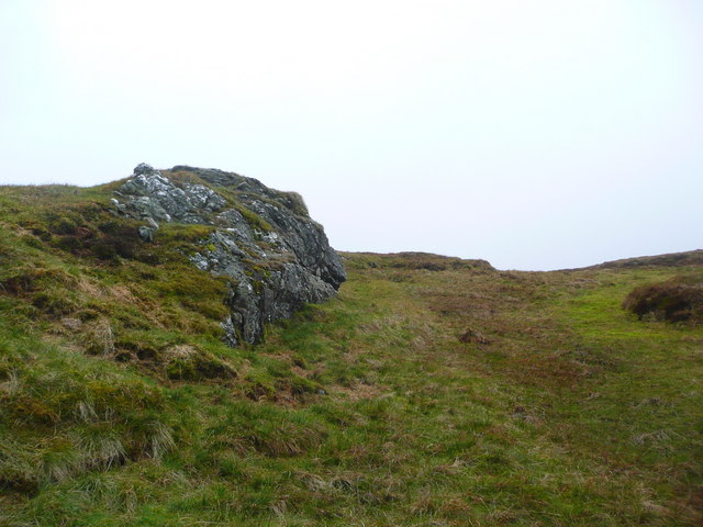
Creag Uchdag is known for its distinctive cone-shaped summit, which is easily recognizable from a distance. The hill is primarily composed of ancient rocks, including schists and quartzites, which give it a rugged and imposing appearance. Its slopes are covered in patches of heather and grasses, creating a picturesque scene throughout the year.

The hill is a popular destination for hikers and outdoor enthusiasts, thanks to its relatively accessible routes and stunning vistas. Several well-marked trails lead to the summit, offering a range of difficulty levels to cater to different abilities. Along the way, visitors may encounter a variety of wildlife, including red deer and birds of prey.

On clear days, the summit of Creag Uchdag offers breathtaking views over the surrounding countryside, including Loch Turret and the Ochil Hills. On the horizon, the distant peaks of the Scottish Highlands can be seen, adding to the allure of this natural gem.

Overall, Creag Uchdag is a captivating hill in Perthshire, Scotland, that provides both a challenging hike and a rewarding experience for nature lovers and adventurers alike.

If you have any feedback on the listing, please let us know in the comments section below.

Creag Uchdag Images

Images are sourced within 2km of 56.465273/-4.0981257 or Grid Reference NN7032. Thanks to Geograph Open Source API. All images are credited.

Creag Bheag Being spied on from a bouldery outcrop at Creag Bheag (the 'little crag').
Creag Bheag
Being spied on from a bouldery outcrop at Creag Bheag (the 'little crag').
Trig point on Creag Uchdag ('crag of hollows') Decorated with a bit of fleece on top!

The silhouettes of the Tarmachan Ridge and, most prominently, the Ben Lawers group, are visible in the distance.
Trig point on Creag Uchdag ('crag of hollows')
Decorated with a bit of fleece on top! The silhouettes of the Tarmachan Ridge and, most prominently, the Ben Lawers group, are visible in the distance.
Creag Uchdag ('crag of hollows') The summit of a rather sprawling Corbett (Scottish mountain over 2,500ft but less than 3,000ft above sea level, with a drop of at least 500ft) at the head of Glen Lednock.
Creag Uchdag ('crag of hollows')
The summit of a rather sprawling Corbett (Scottish mountain over 2,500ft but less than 3,000ft above sea level, with a drop of at least 500ft) at the head of Glen Lednock.
Toll na Poite ('hollow of the pot') The peaty pool to the left of the hillock on the right is named Toll na Poite on the 1:25,000 scale map.
Toll na Poite ('hollow of the pot')
The peaty pool to the left of the hillock on the right is named Toll na Poite on the 1:25,000 scale map.
The flank of Meall Dubh Mòr Looking from Meall Dubh Mòr ('the big, black, round hill') across Coire an Eachdarra ('corrie of the pound or poind-fold'), a name which suggests an enclosure for holding livestock.
The flank of Meall Dubh Mòr
Looking from Meall Dubh Mòr ('the big, black, round hill') across Coire an Eachdarra ('corrie of the pound or poind-fold'), a name which suggests an enclosure for holding livestock.
Rock outcrop below Creag nan Eun On a windy day, this provided a reasonably sheltered lunch-stop.
Rock outcrop below Creag nan Eun
On a windy day, this provided a reasonably sheltered lunch-stop.
Craggy outcrops on the western side of Creag Uchdag
A grassy outlier on Creag Uchdag A small grassy hillock on the western flank of the Corbett; other hills in the moorland above Ardeonaig lie beyond.
A grassy outlier on Creag Uchdag
A small grassy hillock on the western flank of the Corbett; other hills in the moorland above Ardeonaig lie beyond.
Upper waters of the Eas Domhain A tributary of the Finglen Burn, this rises high on Creag Uchdag.
Upper waters of the Eas Domhain
A tributary of the Finglen Burn, this rises high on Creag Uchdag.
Creag Uchdag - just south of the summit ridge
Along the summit ridge of Creag Uchdag It's not really a 'ridge', more a long grassy field with a series of disused boundary fences running through it, but the actual summit and trig lie on one of the bumps in the middle distance.
Along the summit ridge of Creag Uchdag
It's not really a 'ridge', more a long grassy field with a series of disused boundary fences running through it, but the actual summit and trig lie on one of the bumps in the middle distance.
Creag Uchdag - summit trig At the summit of the hill, the trig pillar bears flushbracket number S6473, and looks down towards Loch Lednock and its dam in <a href="https://www.geograph.org.uk/gridref/NN7228">NN7228</a>.
Creag Uchdag - summit trig
At the summit of the hill, the trig pillar bears flushbracket number S6473, and looks down towards Loch Lednock and its dam in NN7228.
NW along the summit ridge of Creag Uchdag
North across Meall Ramhar to Meall nan Oighreag An area of slightly eroded peat lies at the bealach between Creag Uchdag and Meall nan Oighreag. The distant hills are on the far side of Loch Tay.
North across Meall Ramhar to Meall nan Oighreag
An area of slightly eroded peat lies at the bealach between Creag Uchdag and Meall nan Oighreag. The distant hills are on the far side of Loch Tay.
On the boggy bealach heading for Meall nan Oighreag The grassy northern slopes of Creag Uchdag (behind us) give way to this rather boggy pass, before climbing again on drier ground to Meall nan Oighreag on the skyline.
On the boggy bealach heading for Meall nan Oighreag
The grassy northern slopes of Creag Uchdag (behind us) give way to this rather boggy pass, before climbing again on drier ground to Meall nan Oighreag on the skyline.
In the peat hags Despite appearances, the 'bog' was actually no more than a couple of inches deep at any point, and quite easy to walk through. This sort of ground isn't always quite so obliging.
In the peat hags
Despite appearances, the 'bog' was actually no more than a couple of inches deep at any point, and quite easy to walk through. This sort of ground isn't always quite so obliging.
Abandoned mine buildings on the south side of Meall nan Oighreag A small lead mine of rather uncertain age was worked just uphill from this point; these ruined buildings are associated with that, and possibly provided some rudimentary shelter for the miners.
Abandoned mine buildings on the south side of Meall nan Oighreag
A small lead mine of rather uncertain age was worked just uphill from this point; these ruined buildings are associated with that, and possibly provided some rudimentary shelter for the miners.
Lead mine buildings The ruins of a 2- or 3-room building on the south side of Meall nan Oighreag, which is associated with the disused lead mine on the hill just above them.
Lead mine buildings
The ruins of a 2- or 3-room building on the south side of Meall nan Oighreag, which is associated with the disused lead mine on the hill just above them.
Show me another place!

Creag Uchdag is located at Grid Ref: NN7032 (Lat: 56.465273, Lng: -4.0981257)

Unitary Authority: Perth and Kinross

Police Authority: Tayside

What 3 Words

///target.defected.sagging. Near Comrie, Perth & Kinross

Nearby Locations

Creag Uchdag

Related Wikis

Ardeonaig

Ardeonaig (Gaelic: Aird Eòdhanaig) is a hamlet on the southern shore of Loch Tay in the Stirling Council area of Scotland. It is approximately 7 miles...

Creagan na Beinne

Creagan na Beinne is a hill in the Scottish Highlands lying to the south-east of Loch Tay in the group of rolling hills and moors whose highest point in...

Tomnadashan

Tomnadashan was a hamlet southwest of Ardtalnaig in Scotland. John Campbell, 2nd Marquess of Breadalbane tried to mine copper, gold, and sulphur there...

Loch Tay

Loch Tay (Scottish Gaelic: Loch Tatha) is a freshwater loch in the central highlands of Scotland, in the Perth and Kinross and Stirling council areas....

Nearby Amenities

Located within 500m of 56.465273,-4.0981257
Creag Uchdag
Corbett: yes
Description: Convex crag
Ele: 879
Marilyn: yes
Munro: no
Natural: peak
Prominence: 273
Lat/Long: 56.4652129/-4.0981355
The data included in this document is from www.openstreetmap.org. The data is made available under ODbL.

Have you been to Creag Uchdag?

Leave your review of Creag Uchdag below (or comments, questions and feedback).