Banc Trawsnant

Hill, Mountain in Cardiganshire

Wales

Banc Trawsnant

Dyffryn Melindwr Viewed from Bwlch Nant-yr-arian Visitor Centre.
Dyffryn Melindwr Credit: John Lucas

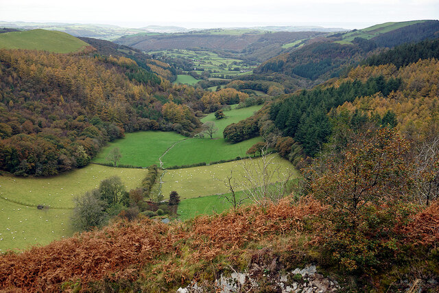
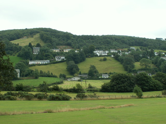
Banc Trawsnant is a prominent hill located in the county of Cardiganshire, Wales. Standing at an elevation of approximately 1,394 feet (425 meters), it offers commanding views of the surrounding countryside and is a popular destination for hikers and nature enthusiasts.

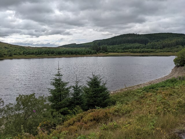
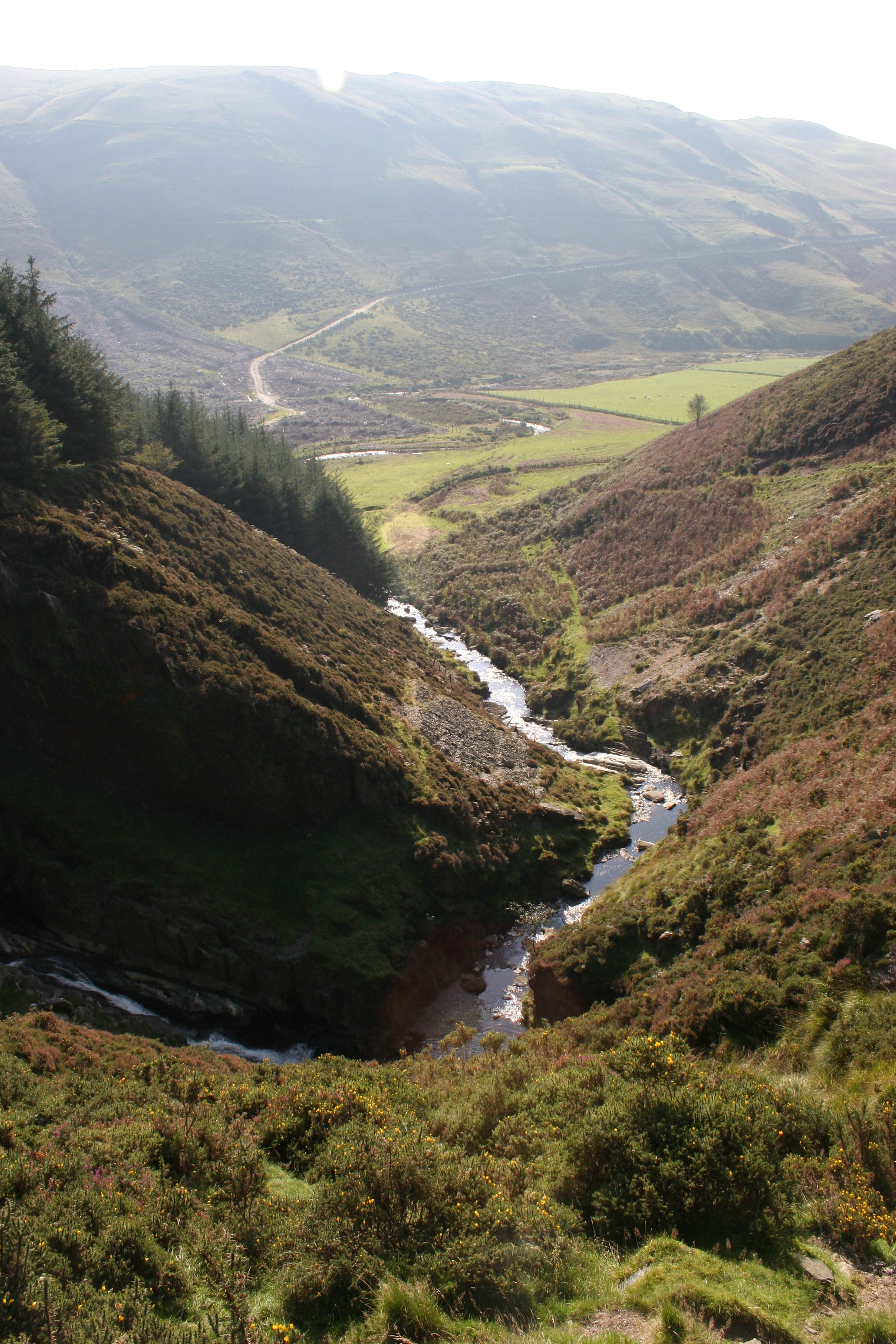
The hill is situated in the rugged and picturesque Cambrian Mountains, which are known for their scenic beauty and diverse wildlife. Banc Trawsnant is covered in lush grasslands and heath, with scattered patches of woodland dotting its slopes. This creates a rich and varied habitat for a wide range of plant and animal species, making it a haven for biodiversity.

The summit of Banc Trawsnant provides panoramic vistas of the surrounding landscape, including the nearby Teifi Valley and the distant peaks of the Brecon Beacons National Park. On clear days, it is even possible to catch a glimpse of the stunning Cardigan Bay on the west coast of Wales.

The hill is easily accessible via a network of footpaths and trails that wind their way up its slopes, making it a popular spot for walkers of all abilities. The ascent can be challenging in parts, particularly for those with limited experience, but the effort is rewarded with breathtaking views and a sense of tranquility.

Overall, Banc Trawsnant is a natural gem in Cardiganshire, offering visitors a chance to immerse themselves in the beauty of the Welsh countryside and experience the peacefulness of the Cambrian Mountains.

If you have any feedback on the listing, please let us know in the comments section below.

Banc Trawsnant Images

Images are sourced within 2km of 52.431992/-3.9019932 or Grid Reference SN7083. Thanks to Geograph Open Source API. All images are credited.

Dyffryn Melindwr Viewed from Bwlch Nant-yr-arian Visitor Centre.
Dyffryn Melindwr
Viewed from Bwlch Nant-yr-arian Visitor Centre.
Path leading down to Llyn Nant-yr-arian Strangely, the OS don't name this significant area of water on any map (available to me). The Nant-yr-arian café is visible on the right. A haven after a bracing walk (or ride) in the hills hereabouts!
Path leading down to Llyn Nant-yr-arian
Strangely, the OS don't name this significant area of water on any map (available to me). The Nant-yr-arian café is visible on the right. A haven after a bracing walk (or ride) in the hills hereabouts!
Pen-darren Near Nant-yr-arian Visitor Centre. Red kites are circulating above, waiting for the 2.00 feeding time.
Pen-darren
Near Nant-yr-arian Visitor Centre. Red kites are circulating above, waiting for the 2.00 feeding time.
Cyclists on the hill A steep climb at Nant-yr-arian.
Cyclists on the hill
A steep climb at Nant-yr-arian.
Mountain bike track near Llyn Pendam
Forestry road near Esgair Gorlan
Mountain bike track Nant-yr-Arian
Forestry road junction near Llyn Syfydrin
Red kites over Bwlch Nant-yr-Arian from <a href="https://www.geograph.org.uk/photo/19769">SN7181 : Bwlch Nant Yr Arian</a> by Cered:
Bwlch Nant Yr Arian Visitor Centre is located on the A44 between Aberystwyth and Llangurig.
Red Kite feeding can be enjoyed every day at 3pm(2pm winter), offering spectacular views of the birds in a wild and wonderful setting. Two scenic waymarked walks with breathtaking views begin at the Visitor Centre, as does the All Ability Lakeside Trail giving everyone the opportunity to enjoy the natural beauty of the area. The centre also has three single track mountain bike routes offering epic rides for the more adventurous, and two waymarked horse routes.
Red kites over Bwlch Nant-yr-Arian
from SN7181 : Bwlch Nant Yr Arian by Cered: Bwlch Nant Yr Arian Visitor Centre is located on the A44 between Aberystwyth and Llangurig. Red Kite feeding can be enjoyed every day at 3pm(2pm winter), offering spectacular views of the birds in a wild and wonderful setting. Two scenic waymarked walks with breathtaking views begin at the Visitor Centre, as does the All Ability Lakeside Trail giving everyone the opportunity to enjoy the natural beauty of the area. The centre also has three single track mountain bike routes offering epic rides for the more adventurous, and two waymarked horse routes.
The southern end of Llyn Blaenmelindwr
Llyn Blaenmelindwr
Llyn Blaenmelindwr
A road junction below Mynydd March
The road into the forest
A rock wall above the track It seems that the forest track was blasted through bedrock. This track has effectively replaced the Byway Open to All Traffic which runs parallel about 50 metres away to the left.
A rock wall above the track
It seems that the forest track was blasted through bedrock. This track has effectively replaced the Byway Open to All Traffic which runs parallel about 50 metres away to the left.
A well-surfaced forestry track This is relatively new, I think, and has effectively replaced the Byway shown on the map, behind the trees on the left.
A well-surfaced forestry track
This is relatively new, I think, and has effectively replaced the Byway shown on the map, behind the trees on the left.
Trail markers at the junction Catering for runners, horse riders and cyclists. Pedestrians have to find their own way.
Trail markers at the junction
Catering for runners, horse riders and cyclists. Pedestrians have to find their own way.
Markers for the bike trails The label of the post is 'Y Derwydd Meddw' - 'The Drunken Druid', which is perhaps the name of a trail.
Markers for the bike trails
The label of the post is 'Y Derwydd Meddw' - 'The Drunken Druid', which is perhaps the name of a trail.
Show me another place!

Banc Trawsnant is located at Grid Ref: SN7083 (Lat: 52.431992, Lng: -3.9019932)

Unitary Authority: Ceredigion

Police Authority: Dyfed Powys

What 3 Words

///jazz.assure.neatly. Near Bow Street, Ceredigion

Nearby Locations

Llyn Pendam Banc Trawsnant

Related Wikis

Cwmerfyn

Cwmerfyn (historically Cwm-erfin or Cwmerfin) is a hamlet in the community of Trefeurig, Ceredigion, Wales, nine miles (14 km) by road east of Aberystwyth...

Cwmsymlog

Cwmsymlog is a short valley, sheltering a hamlet of the same name, in Ceredigion, in the west of Wales. Once an important mining area, but the mining slowly...

Craig-y-pistyll

Craig-y-pistyll is a Site of Special Scientific Interest in Ceredigion, west Wales. It is a reservoir with a dam at one end which supplies water to the...

Cwmbrwyno

Cwmbrwyno is a hamlet in the community of Melindwr, Ceredigion, Wales, which is 71.2 miles (114.7 km) from Cardiff and 172.3 miles (277.3 km) from London...

Dollwen

Dollwen is a hamlet in the community of Melindwr, Ceredigion, Wales, which is 72.1 miles (116 km) from Cardiff and 173.6 miles (279.4 km) from London...

Goginan

Goginan is a small village in Ceredigion, about 7 miles outside Aberystwyth on the A44 between Ponterwyd and Capel Bangor. The Afon Melindwr runs through...

Daren

Daren is a hamlet bach in the community of Trefeurig, Ceredigion, Wales, which is 73.2 miles (117.7 km) from Cardiff and 174.5 miles (280.8 km) from London...

Pen-bont-rhyd-y-beddau

Pen-bont-rhyd-y-beddau is a small village in the community of Trefeurig, Ceredigion, Wales, which is 73.7 miles (118.6 km) from Cardiff and 174.8 miles...

Have you been to Banc Trawsnant?

Leave your review of Banc Trawsnant below (or comments, questions and feedback).