Banc y Garn
Hill, Mountain in Cardiganshire
Wales
Banc y Garn

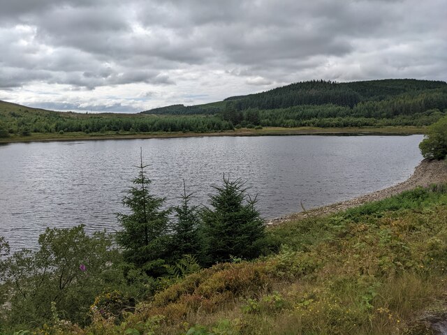
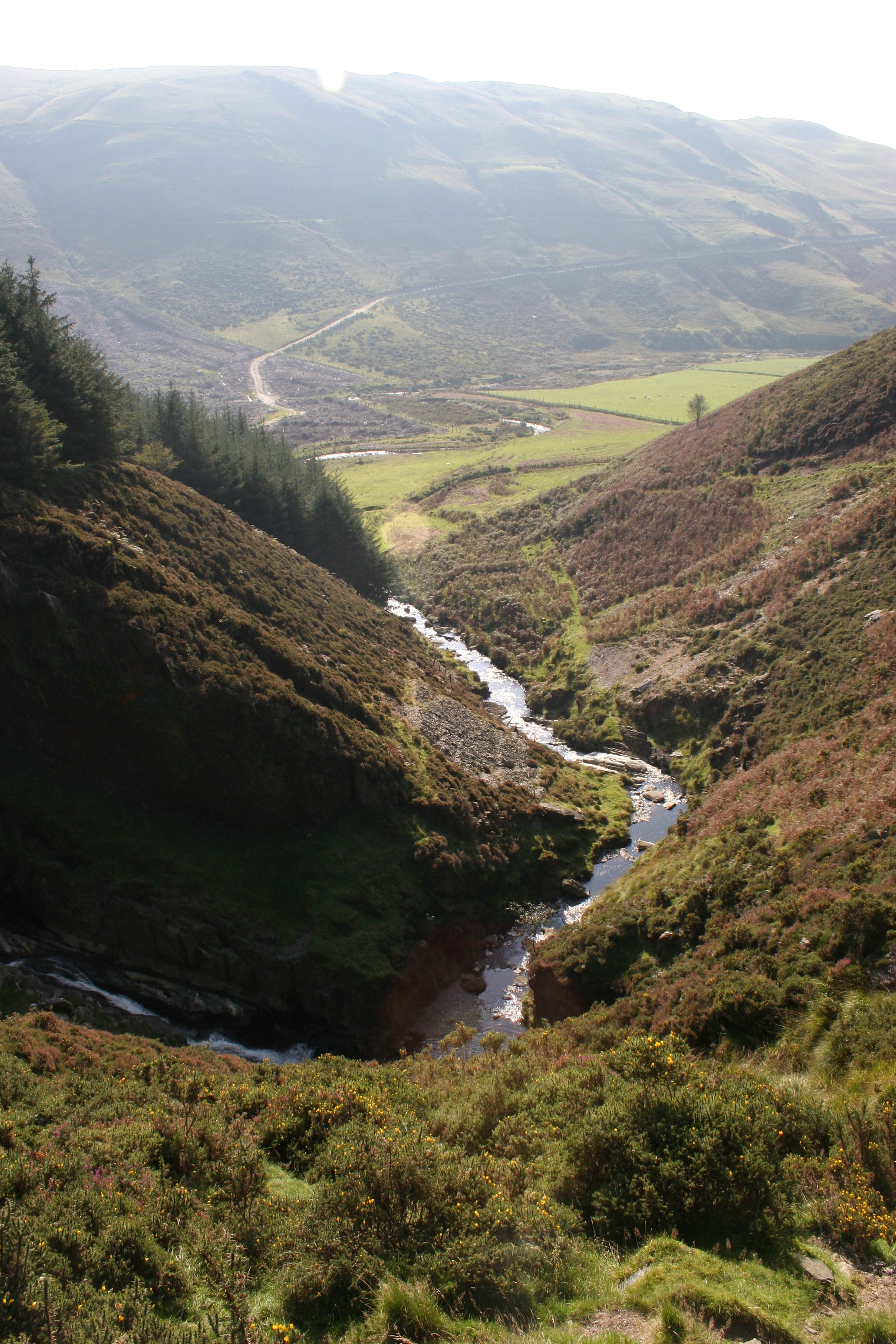
Banc y Garn is a prominent hill located in Cardiganshire, Wales. It is situated in the southern part of the county, near the village of Llanddewi Brefi. Rising to an elevation of approximately 482 meters (1,582 feet), Banc y Garn offers breathtaking panoramic views of the surrounding landscape.
The hill is part of the Cambrian Mountains, a range known for its rugged beauty and rich natural heritage. Banc y Garn stands out due to its distinctive conical shape and steep slopes, which are covered with heather, grasses, and scattered rocks. This terrain provides a habitat for various plant and animal species, including mountain birds, wildflowers, and grazing livestock.
Access to the summit of Banc y Garn is relatively easy, with several footpaths leading up to its peak. The hill is a popular destination for hikers, nature enthusiasts, and photographers, who are drawn to its picturesque vistas and tranquil atmosphere. On a clear day, one can enjoy sweeping views of the surrounding countryside, encompassing rolling green hills, meandering rivers, and distant mountains.
Visitors to Banc y Garn can also explore the nearby Llanddewi Brefi, a charming village with a rich history and traditional Welsh culture. The village offers amenities such as local pubs, cafes, and accommodations for those seeking to stay longer and fully immerse themselves in the area's beauty.
In summary, Banc y Garn is a striking hill in Cardiganshire, Wales, offering stunning views and a chance to connect with the natural wonders of the Cambrian Mountains. It is a must-visit destination for outdoor enthusiasts and those looking to appreciate the beauty of the Welsh countryside.
If you have any feedback on the listing, please let us know in the comments section below.
Banc y Garn Images
Images are sourced within 2km of 52.442272/-3.9040252 or Grid Reference SN7084. Thanks to Geograph Open Source API. All images are credited.


Banc y Garn is located at Grid Ref: SN7084 (Lat: 52.442272, Lng: -3.9040252)
Unitary Authority: Ceredigion
Police Authority: Dyfed Powys
What 3 Words
///shackles.starfish.crowds. Near Bow Street, Ceredigion
Nearby Locations
Related Wikis

Cwmsymlog
Cwmsymlog is a short valley, sheltering a hamlet of the same name, in Ceredigion, in the west of Wales. Once an important mining area, but the mining slowly...
Craig-y-pistyll
Craig-y-pistyll is a Site of Special Scientific Interest in Ceredigion, west Wales. It is a reservoir with a dam at one end which supplies water to the...

Cwmerfyn
Cwmerfyn (historically Cwm-erfin or Cwmerfin) is a hamlet in the community of Trefeurig, Ceredigion, Wales, nine miles (14 km) by road east of Aberystwyth...

Bont Goch
Bont Goch (also known as Bontgoch or Elerch) is a village in Ceredigion, Wales, 2 miles (3.2 km) northeast of Aberystwyth. With Talybont, it is in the...

Pen-bont-rhyd-y-beddau
Pen-bont-rhyd-y-beddau is a small village in the community of Trefeurig, Ceredigion, Wales, which is 73.7 miles (118.6 km) from Cardiff and 174.8 miles...
Daren
Daren is a hamlet bach in the community of Trefeurig, Ceredigion, Wales, which is 73.2 miles (117.7 km) from Cardiff and 174.5 miles (280.8 km) from London...
Pen-Rhiw-Newydd
Penrhiwnewydd is a hamlet in the community of Trefeurig, Ceredigion, Wales, which is 74.1 miles (119.2 km) from Cardiff and 175.3 miles (282 km) from London...
Cwmbrwyno
Cwmbrwyno is a hamlet in the community of Melindwr, Ceredigion, Wales, which is 71.2 miles (114.7 km) from Cardiff and 172.3 miles (277.3 km) from London...
Have you been to Banc y Garn?
Leave your review of Banc y Garn below (or comments, questions and feedback).