Garrel Hill

Hill, Mountain in Stirlingshire

Scotland

Garrel Hill

View up forestry track to Drumbuoy
View up forestry track to Drumbuoy Credit: Thoma

Garrel Hill is a prominent hill located in Stirlingshire, Scotland. Situated approximately 5 miles southwest of the town of Doune, it is part of the southern edge of the Scottish Highlands. With an elevation of 1,256 feet (383 meters), Garrel Hill offers breathtaking panoramic views of the surrounding countryside.

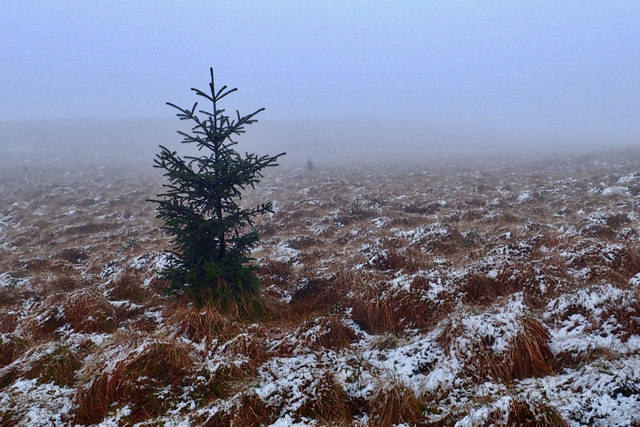
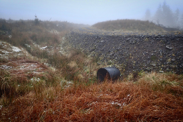
The hill is primarily composed of quartzite, a hard and durable rock that gives it a distinctive appearance. Its slopes are covered in heather and grass, providing a haven for various wildlife species. The summit of Garrel Hill is marked by a large cairn, which serves as a navigational landmark and a point of interest for hikers and climbers.

Garrel Hill is a popular destination for outdoor enthusiasts, offering a range of activities such as hillwalking, hiking, and nature observation. There are several well-defined paths leading to the summit, catering to different levels of fitness and experience. The ascent can be moderately challenging, especially in adverse weather conditions, but the rewarding views at the top make it worthwhile.

From the summit, visitors can enjoy stunning vistas across Stirlingshire, including the Ochil Hills, the Trossachs, and even the distant peaks of the Scottish Highlands. On clear days, it is possible to see as far as Ben Lomond and the Loch Lomond and The Trossachs National Park.

Overall, Garrel Hill offers a memorable outdoor experience, combining natural beauty, physical activity, and breathtaking views, making it a must-visit destination for nature enthusiasts and outdoor adventurers in Stirlingshire.

If you have any feedback on the listing, please let us know in the comments section below.

Garrel Hill Images

Images are sourced within 2km of 56.004867/-4.0792067 or Grid Reference NS7081. Thanks to Geograph Open Source API. All images are credited.

View up forestry track to Drumbuoy
Logging road, Carron Valley Forest
Clearing, Carron Valley Forest
Logging road, Carron Valley Forest There was little sign of recent use, but further on there was a big clearfelled area from around six months earlier.  The "rude shouty man" keep out sign was crying wolf at the east end, but no signage at the west end of the road.
Logging road, Carron Valley Forest
There was little sign of recent use, but further on there was a big clearfelled area from around six months earlier. The "rude shouty man" keep out sign was crying wolf at the east end, but no signage at the west end of the road.
Garrel Hill View along the Birken Burn from near Johnnie's Dam.
Garrel Hill
View along the Birken Burn from near Johnnie's Dam.
Path from Tomtain to Kilsyth The sign helps walkers on Tomtain to find the start of the path downhill to Kilsyth.
Path from Tomtain to Kilsyth
The sign helps walkers on Tomtain to find the start of the path downhill to Kilsyth.
Garrel Hill cairn A typical Campsies "summit", Garrel Hill's top is barely higher than its surroundings. It's interesting to compare this picture with those taken a few years ago, e.g. <a href="https://www.geograph.org.uk/photo/1932970">NS7081 : Garrel Hill cairn</a>, with new plantings around the cairn starting to grow up; also lots of bog cotton in June as compared to April. The drystane dyke that runs over Tomtain and on along the Campsies can be seen behind the cairn.
Garrel Hill cairn
A typical Campsies "summit", Garrel Hill's top is barely higher than its surroundings. It's interesting to compare this picture with those taken a few years ago, e.g. NS7081 : Garrel Hill cairn, with new plantings around the cairn starting to grow up; also lots of bog cotton in June as compared to April. The drystane dyke that runs over Tomtain and on along the Campsies can be seen behind the cairn.
Carron Valley forest north of Garrell Hill Forest shown on the map has been felled recently giving more open views north from this point on the east side of Garrell Hill.
Carron Valley forest north of Garrell Hill
Forest shown on the map has been felled recently giving more open views north from this point on the east side of Garrell Hill.
Garrel Burn and Carron Valley Reservoir from the air Built in 1935-39 in response to the droughts of 1931 & 1933, the reservoir has a capacity of over 4500 million gallons (20,400 million litres).
Garrel Burn and Carron Valley Reservoir from the air
Built in 1935-39 in response to the droughts of 1931 & 1933, the reservoir has a capacity of over 4500 million gallons (20,400 million litres).
Self sown tree, Garrel Hill
Culvert under forestry track
Footpath to Kilsyth
Footpath to Kilsyth
Forest track junction
Tomtain towards Hunt Hill
Forestry, Carron Valley
Rough grazing in the Kilsyth Hills The flat expanse of Scotland's central belt is visible in the distance.
Rough grazing in the Kilsyth Hills
The flat expanse of Scotland's central belt is visible in the distance.
Through the trees in the Carron Valley Forest
Show me another place!

Garrel Hill is located at Grid Ref: NS7081 (Lat: 56.004867, Lng: -4.0792067)

Unitary Authority: North Lanarkshire

Police Authority: Lanarkshire

What 3 Words

///stretcher.concerned.trimmer. Near Kilsyth, North Lanarkshire

Nearby Locations

Garrel Hill

Related Wikis

Peggie's Spout

Peggie's Spout is a waterfall of Scotland. == See also == Waterfalls of Scotland == References ==

Duncarron

Duncarron is a modern reproduction of a fortified village from the early Middle Ages of Scotland. It is the reconstruction of a typical residence of a...

Kilsyth

Kilsyth (; Scottish Gaelic Cill Saidhe) is a town and civil parish in North Lanarkshire, roughly halfway between Glasgow and Stirling in Scotland. The...

Kilsyth railway station

Kilsyth Old station served the town of Kilsyth in Scotland. It was the original terminus of the Kelvin Valley Railway. == History == The station opened...

Nearby Amenities

Located within 500m of 56.004867,-4.0792067
Garrel Hill
Ele: 453
Natural: peak
Lat/Long: 56.0048234/-4.0784976
The data included in this document is from www.openstreetmap.org. The data is made available under ODbL.

Have you been to Garrel Hill?

Leave your review of Garrel Hill below (or comments, questions and feedback).