Black Hill

Hill, Mountain in Ayrshire

Scotland

Black Hill
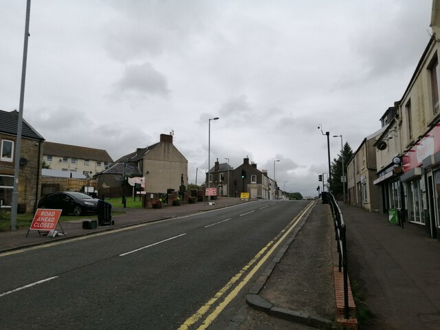
A70 passing through Muirkirk The picture looks along Muirkirk Main Street which is also the A70. Temporary road signs warn that the road further east is currently closed: <span class="nowrap"><a title="https://www.southlanarkshire.gov.uk/view/news/article/1046/Plan_ahead_for_A70_roadworks_closure" rel="nofollow ugc noopener" href="https://www.southlanarkshire.gov.uk/view/news/article/1046/Plan_ahead_for_A70_roadworks_closure">Link</a><img style="margin-left:2px;" alt="External link" title="External link - shift click to open in new window" src="https://s1.geograph.org.uk/img/external.png" width="10" height="10"/></span> Fortunately my journey went west.
A70 passing through Muirkirk Credit: Alec MacKinnon

Black Hill is a prominent hill located in Ayrshire, Scotland. Situated approximately 10 miles northeast of Ayr, it forms part of the Clyde Muirshiel Regional Park. Standing at an elevation of 640 meters (2,100 feet), it is known as one of the highest hills in the area.

The hill is characterized by its distinctive black appearance, which is a result of the dark-colored basalt rock that forms its summit. This volcanic rock, created from ancient lava flows, gives the hill its name.

Black Hill offers stunning panoramic views of the surrounding countryside, including the Firth of Clyde and the Isle of Arran. On clear days, the peaks of the Arrochar Alps and the hills of the Southern Uplands can also be seen.

The hill is a popular destination for outdoor enthusiasts, attracting hikers, walkers, and nature lovers. Several well-marked trails lead to the summit, providing visitors with an opportunity to explore the diverse flora and fauna of the area. The hill is home to a variety of bird species, such as golden eagles, peregrine falcons, and red kites, making it a haven for birdwatchers.

Black Hill is easily accessible, with a car park located nearby for visitors' convenience. Its location within the Clyde Muirshiel Regional Park ensures that it remains protected and well-maintained, providing visitors with a tranquil and picturesque setting to enjoy the natural beauty of Ayrshire.

If you have any feedback on the listing, please let us know in the comments section below.

Black Hill Images

Images are sourced within 2km of 55.53862/-4.0558542 or Grid Reference NS7029. Thanks to Geograph Open Source API. All images are credited.

A70 passing through Muirkirk The picture looks along Muirkirk Main Street which is also the A70. Temporary road signs warn that the road further east is currently closed: <span class="nowrap"><a title="https://www.southlanarkshire.gov.uk/view/news/article/1046/Plan_ahead_for_A70_roadworks_closure" rel="nofollow ugc noopener" href="https://www.southlanarkshire.gov.uk/view/news/article/1046/Plan_ahead_for_A70_roadworks_closure">Link</a><img style="margin-left:2px;" alt="External link" title="External link - shift click to open in new window" src="https://s1.geograph.org.uk/img/external.png" width="10" height="10"/></span> Fortunately my journey went west.
A70 passing through Muirkirk
The picture looks along Muirkirk Main Street which is also the A70. Temporary road signs warn that the road further east is currently closed: LinkExternal link Fortunately my journey went west.
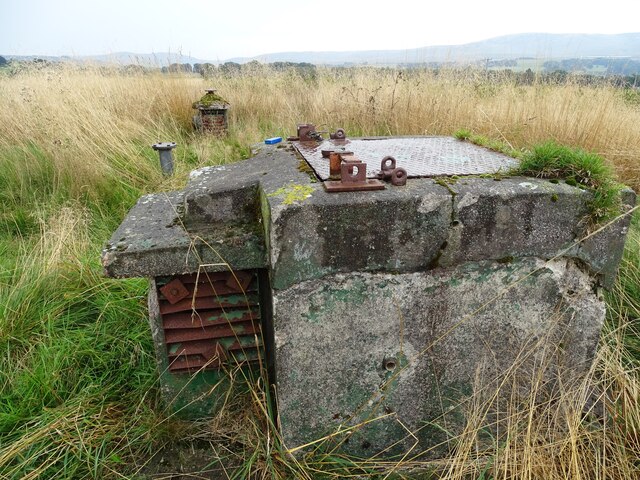
R.O.C. Bunker An old R.O.C. bunker.
R.O.C. Bunker
An old R.O.C. bunker.
Remains of Lamonburn All that remains of Lamonburn, which was formerly an old farm steading.
Photo taken on the 20th March, 2022.
Remains of Lamonburn
All that remains of Lamonburn, which was formerly an old farm steading. Photo taken on the 20th March, 2022.
Lamonburn Bridge The wee road bridge over the Lamon Burn.
Photo taken on the 20th March 2022.
Lamonburn Bridge
The wee road bridge over the Lamon Burn. Photo taken on the 20th March 2022.
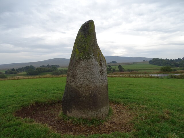
Lightshaw Standing Stone The Lightshaw standing stone, with Cairn Table in the distance.
Lightshaw Standing Stone
The Lightshaw standing stone, with Cairn Table in the distance.
Ancient Cairn The remains of an ancient cairn near Lamonburn Plantation.
This photo was taken on the 30th August 2022.
Ancient Cairn
The remains of an ancient cairn near Lamonburn Plantation. This photo was taken on the 30th August 2022.
Track leading to Priesthill View towards Waterhead
Track leading to Priesthill
View towards Waterhead
Waterhead
Waterhead
Waterhead
Waterhead
B743 junction with lane to Netherwood
Bridge over the Greenock Water On the track to Priesthill.
Bridge over the Greenock Water
On the track to Priesthill.
Road junction near Waterhead
Modern fank on the track to Prieshill These corrugated iron fanks are not as attractive as the old stone built ones - and they won't last so long.
Modern fank on the track to Prieshill
These corrugated iron fanks are not as attractive as the old stone built ones - and they won't last so long.
Small quarry by the track to Priesthill
Herdwick sheep by the Priesthill track These are just a small group of quite a large flock on these hills.
Herdwick sheep by the Priesthill track
These are just a small group of quite a large flock on these hills.
Small quarry by the track to Priesthill
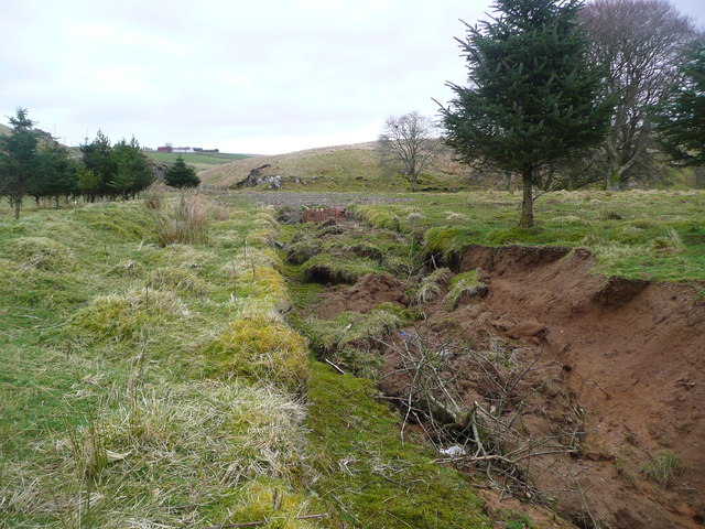
A funny thing no longer happens on the way to the sea! See <a title="https://www.geograph.org.uk/photo/284882" href="https://www.geograph.org.uk/photo/284882">Link</a>  and <a title="https://www.geograph.org.uk/photo/3893204" href="https://www.geograph.org.uk/photo/3893204">Link</a>  The errant channel has now been blocked off;  this former 'diversion' may have been linked to the activities of Scottish Coal to carry out a total diversion of the Ponesk Burn further downstream to permit exploitation of open-cast coal west of Glenbuck.
A funny thing no longer happens on the way to the sea!
See Link and Link The errant channel has now been blocked off; this former 'diversion' may have been linked to the activities of Scottish Coal to carry out a total diversion of the Ponesk Burn further downstream to permit exploitation of open-cast coal west of Glenbuck.
The blocked up 'alternative' course of the Ponesk Burn See <a title="https://www.geograph.org.uk/photo/284882" href="https://www.geograph.org.uk/photo/284882">Link</a> and <a title="https://www.geograph.org.uk/photo/3893068" href="https://www.geograph.org.uk/photo/3893068">Link</a>

This former 'diversion' may have been linked to the activities of Scottish Coal to carry out a total diversion of the Ponesk Burn further downstream to permit exploitation of open-cast coal west of Glenbuck.
The blocked up 'alternative' course of the Ponesk Burn
See Link and Link This former 'diversion' may have been linked to the activities of Scottish Coal to carry out a total diversion of the Ponesk Burn further downstream to permit exploitation of open-cast coal west of Glenbuck.
Show me another place!

Black Hill is located at Grid Ref: NS7029 (Lat: 55.53862, Lng: -4.0558542)

Unitary Authority: East Ayrshire

Police Authority: Ayrshire

What 3 Words

///films.physical.testy. Near Muirkirk, East Ayrshire

Nearby Locations

Black Hill

Related Wikis

Muirkirk

Muirkirk (Scottish Gaelic: Eaglais an t-Slèibh) is a small village in East Ayrshire, southwest Scotland. It is located on the north bank of the River Ayr...

Muirkirk railway station

Muirkirk railway station was a railway station serving the village of Muirkirk, East Ayrshire, Scotland. == First station == The station opened on 9 August...

Garpel Water

The Garpel Water is a river near Muirkirk, Scotland. It flows under the Sanquhar bridge and Tibbie's Brig. It flows into the River Ayr.

Glenbuck railway station

Glenbuck railway station served the village of Glenbuck in Ayrshire, Scotland. == Opening == The Caledonian Railway extended a line from Douglas to Muirkirk...

Nearby Amenities

Located within 500m of 55.53862,-4.0558542
Black Hill
Corbett: no
Donald: no
Ele: 357
Graham: no
Marilyn: no
Munro: no
Natural: peak
Lat/Long: 55.5383984/-4.0565218
The data included in this document is from www.openstreetmap.org. The data is made available under ODbL.

Have you been to Black Hill?

Leave your review of Black Hill below (or comments, questions and feedback).