Bennan

Hill, Mountain in Kirkcudbrightshire

Scotland

Bennan

The tussocky summit of Wether Hill The summit area of Wether Hill with Lawglass beyond and Cairnsmore of Carsphairn in the far distance.
The tussocky summit of Wether Hill Credit: Colin Kinnear

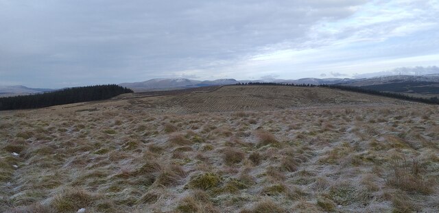
Bennan is a hill located in Kirkcudbrightshire, Scotland. Standing at an elevation of approximately 1,759 feet (536 meters), it is known for its rugged beauty and panoramic views. The hill is situated in the heart of the Galloway Forest Park, which is renowned for its vast expanses of woodland and diverse wildlife.

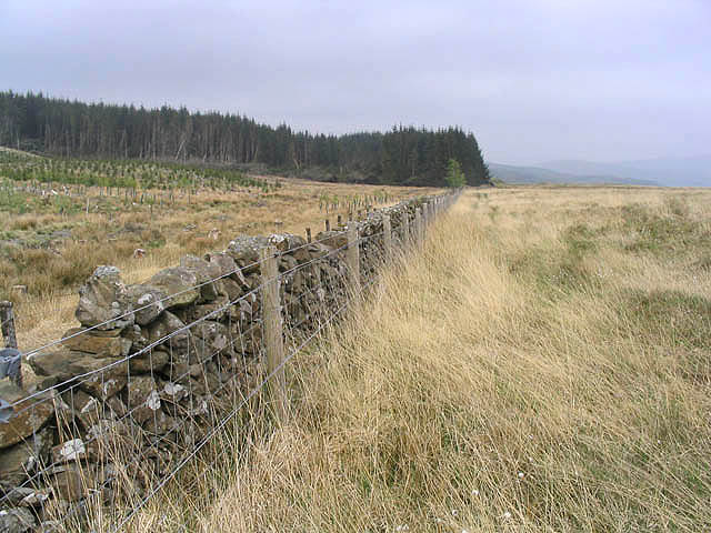
Bennan is a popular destination for outdoor enthusiasts, offering a range of activities such as hiking, mountain biking, and birdwatching. The hill is accessible via various well-maintained trails, providing visitors with different options to explore its slopes. The terrain is predominantly heather-covered moorland, interspersed with rocky outcrops and small streams.

From the summit of Bennan, visitors are rewarded with breathtaking vistas across the surrounding countryside. On clear days, it is possible to see as far as the Solway Firth and the Isle of Man. The hill is particularly renowned for its stunning sunsets, which attract photographers and nature lovers alike.

The area surrounding Bennan is home to a variety of wildlife, including red deer, roe deer, and numerous bird species such as golden eagles and peregrine falcons. It is not uncommon to spot these animals while exploring the hillside.

Whether visitors are seeking a challenging hike, a peaceful spot for a picnic, or simply a chance to immerse themselves in the natural beauty of the Scottish countryside, Bennan in Kirkcudbrightshire offers a memorable experience for all.

If you have any feedback on the listing, please let us know in the comments section below.

Bennan Images

Images are sourced within 2km of 55.177762/-4.0453488 or Grid Reference NX6988. Thanks to Geograph Open Source API. All images are credited.

The tussocky summit of Wether Hill The summit area of Wether Hill with Lawglass beyond and Cairnsmore of Carsphairn in the far distance.
The tussocky summit of Wether Hill
The summit area of Wether Hill with Lawglass beyond and Cairnsmore of Carsphairn in the far distance.
Tuley tubes and forest On the slopes of Troston Hill at the summit of the B729 Carsphairn to Moniaive road.
Tuley tubes and forest
On the slopes of Troston Hill at the summit of the B729 Carsphairn to Moniaive road.
Forestry clear fell area Near Pointfoot Hill.
Forestry clear fell area
Near Pointfoot Hill.
Log ends A recently felled pile of logs marked and ready for transportation.
Log ends
A recently felled pile of logs marked and ready for transportation.
Wind damaged trees Some trees in the foreground have been completely uprooted and stripped the trees immediately behind, in forestry to the east of Pointfoot Hill.
Wind damaged trees
Some trees in the foreground have been completely uprooted and stripped the trees immediately behind, in forestry to the east of Pointfoot Hill.
A small burn at the head of Pointfoot Glen
Brown Rig Mature forestry and new planting to the left of the dyke and rough grazing to the right.
Brown Rig
Mature forestry and new planting to the left of the dyke and rough grazing to the right.
An expanse of clear fell, Troston Estate
Forestry vehicle, Minnygryle Forest Forwarder about to load up with timber.
Forestry vehicle, Minnygryle Forest
Forwarder about to load up with timber.
Foumart Stane, Trostan Estate No doubt before the forest was planted this "stane" would have much less vegetation around it and would look very different than it does today.
Foumart Stane, Trostan Estate
No doubt before the forest was planted this "stane" would have much less vegetation around it and would look very different than it does today.
Old quarry, Minnygryle Forest This small quarry would be used to extract road metal to build the extensive forest road network in this area.  Nature is steadily reclaiming the site.
Old quarry, Minnygryle Forest
This small quarry would be used to extract road metal to build the extensive forest road network in this area. Nature is steadily reclaiming the site.
Various stages of growth within Minnygryle Forest Note the wind blown trees on the west face of the older trees
Various stages of growth within Minnygryle Forest
Note the wind blown trees on the west face of the older trees
Forest Lochan, Minnygryle Forest The Lochan's surface is almost covered with potamogeton weed
Forest Lochan, Minnygryle Forest
The Lochan's surface is almost covered with potamogeton weed
Old sheep pens amongst clear fell, Minnygryle Forest Once a very important part of upland sheep farming, these pens have been hidden from view amongst a sea of trees.  Revealed once more - for a short time, before the trees strangle them once again.
Old sheep pens amongst clear fell, Minnygryle Forest
Once a very important part of upland sheep farming, these pens have been hidden from view amongst a sea of trees. Revealed once more - for a short time, before the trees strangle them once again.
Outbuilding near Minnygryle
The western aspect of Minnygryle
Old building near Minnygryle
Margree Forest View towards Lawglass.
Margree Forest
View towards Lawglass.
Show me another place!

Bennan is located at Grid Ref: NX6988 (Lat: 55.177762, Lng: -4.0453488)

Unitary Authority: Dumfries and Galloway

Police Authority: Dumfries and Galloway

What 3 Words

///cobble.shirt.collected. Near Thornhill, Dumfries & Galloway

Nearby Locations

Knocksting Loch Bennan

Related Wikis

Craigdarroch

"Craigdarroch, An Accessory to Murder" is an expansion set for the board game Kill Doctor Lucky Craigdarroch is a house near Moniaive, Dumfries and Galloway...

Carsphairn and Scaur Hills

The Carsphairn and Scaur Hills are the western and eastern hills respectively of a hill range in the Southern Uplands of Scotland. Ordnance Survey maps...

Loch Skae

Loch Skae is a small, upland freshwater loch to the north of Blackcraig Hill, approximately 18 miles (29 km) west of Dumfries, Scotland, 0.5 mi (0.80 km...

Lochinvar

Lochinvar (or Lan Var) is a loch in the civil parish of Dalry in the historic county of Kirkcudbrightshire, Dumfries and Galloway Scotland. It is located...

Loch Howie

Loch Howie is a small, narrow, upland freshwater loch on the north side of Blackcraig Hill, approximately 18 miles (29 km) west of Dumfries, Scotland....

Moniaive

Moniaive ( 'monny-IVE'; Scottish Gaelic: Am Moine Naomh, "The Holy Moor") is a village in the Parish of Glencairn, in Dumfries and Galloway, southwest...

Moniaive railway station

Moniaive railway station is the closed station terminus of the Cairn Valley Light Railway (CVR) branch, from Dumfries. It served the rural area of Moniaive...

Barscobe Castle

Barscobe Castle is a 17th-century tower house in Balmaclellan, Kirkcudbrightshire, Scotland. It is a typical house of a country laird, and according to...

Nearby Amenities

Located within 500m of 55.177762,-4.0453488
Bennan
Ele: 346
Natural: peak
Lat/Long: 55.17792/-4.0449575
The data included in this document is from www.openstreetmap.org. The data is made available under ODbL.

Have you been to Bennan?

Leave your review of Bennan below (or comments, questions and feedback).