Hall Hill

Hill, Mountain in Dumfriesshire

Scotland

Hall Hill

A76 towards New Cumnock
A76 towards New Cumnock Credit: Steven Brown

Hall Hill is a prominent hill located in the county of Dumfriesshire, in the southern region of Scotland. With an elevation of approximately 1,171 feet (357 meters), it stands as a notable landmark in the area. The hill is situated near the village of Closeburn, in the picturesque Nith Valley, offering visitors breathtaking panoramic views of the surrounding countryside.

Hall Hill is a popular destination for outdoor enthusiasts, hikers, and nature lovers, as it provides various walking trails and paths to explore its diverse landscape. The hill is predominantly covered in heather and grass, with scattered patches of woodland and rocky outcrops, creating an enchanting natural setting.

At the summit of Hall Hill, visitors can marvel at the stunning vistas stretching across the Nith Valley, with rolling hills, meandering rivers, and lush farmland filling the eye. On clear days, it is even possible to spot the peaks of the Southern Uplands in the distance.

The area surrounding Hall Hill is rich in wildlife, with numerous species of birds, such as buzzards and kestrels, soaring above, and occasional sightings of red deer and hares. The hill is also home to a variety of wildflowers and plant life, adding to its overall beauty and charm.

Overall, Hall Hill in Dumfriesshire is a remarkable natural feature, offering visitors a chance to immerse themselves in the scenic splendor and tranquility of the Scottish countryside. Whether it's a leisurely walk or a challenging hike, this hill provides a rewarding experience for all who venture to its summit.

If you have any feedback on the listing, please let us know in the comments section below.
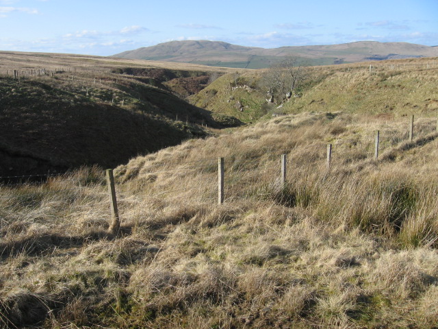
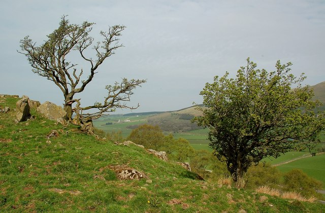
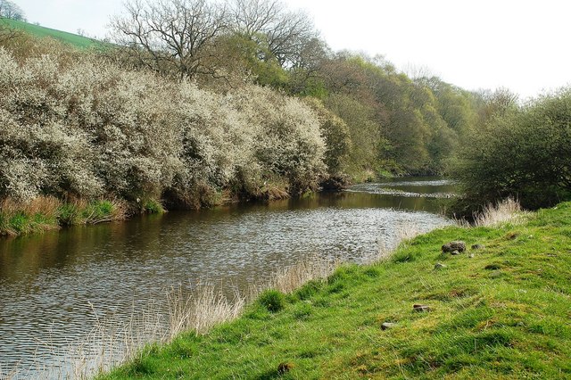
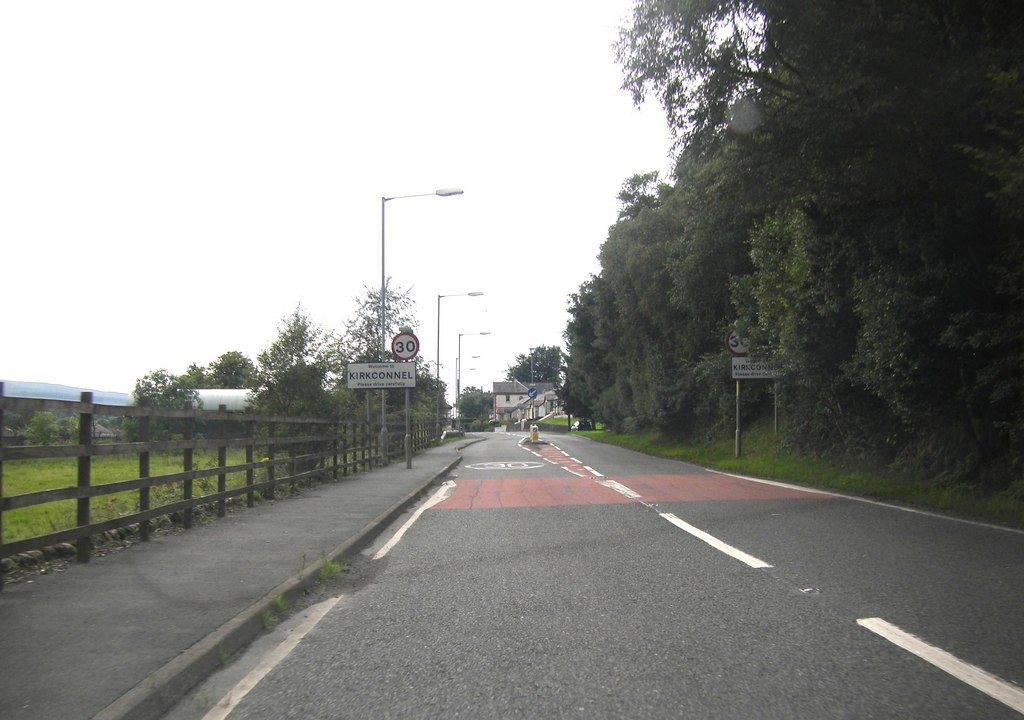
Hall Hill Images

Images are sourced within 2km of 55.388066/-4.0698995 or Grid Reference NS6812. Thanks to Geograph Open Source API. All images are credited.

A76 towards New Cumnock
A76 west of Kirkconnel
Forest Edge
Forest Edge
March Burn
March Burn
High Cairn Farm
High Cairn Farm
Towards High Cairn Farm
Polneul Burn
Polneul Burn
Polneul Burn
Polneul Burn
Polhote Burn
Polhote Burn
The River Nith. Looking downstream.
The River Nith.
Looking downstream.
Between river and railway Beef cattle are kept on the land in the foreground. View east of the road to Glen Hall and Niviston.
Between river and railway
Beef cattle are kept on the land in the foreground. View east of the road to Glen Hall and Niviston.
Marchburn Cottage The ruin of Marchburn Cottage with Corsencon Hill in the background. The  March Burn defines the march between Dumfriesshire and Ayrshire as well as the Dumfries & Galloway and Strathclyde
Marchburn Cottage
The ruin of Marchburn Cottage with Corsencon Hill in the background. The March Burn defines the march between Dumfriesshire and Ayrshire as well as the Dumfries & Galloway and Strathclyde
Niviston Track leading up to Niviston farmhouse which lies on Dempster's Burn above the River Nith.
Niviston
Track leading up to Niviston farmhouse which lies on Dempster's Burn above the River Nith.
Hillhead from coal conveyor Mostly rough pasture. Taken from the track beside the conveyor from Glenmuckloch opencast. The original track as shown on the OS map can be seen in the mid-foreground.
Hillhead from coal conveyor
Mostly rough pasture. Taken from the track beside the conveyor from Glenmuckloch opencast. The original track as shown on the OS map can be seen in the mid-foreground.
Laigh Cairn & a view towards Corsencon Hill
Marchburn Cottage
Marchburn Cottage
Above Park Burn Straggly hawthorns on the grazing land above Park Burn, close to the A76 near New Cumnock.
Above Park Burn
Straggly hawthorns on the grazing land above Park Burn, close to the A76 near New Cumnock.
Looking Down the River Nith Looking downstream on a fine but hazy April morning.  The Blackthorn bushes on the far bank were in full bloom.
Looking Down the River Nith
Looking downstream on a fine but hazy April morning. The Blackthorn bushes on the far bank were in full bloom.
Show me another place!

Hall Hill is located at Grid Ref: NS6812 (Lat: 55.388066, Lng: -4.0698995)

Unitary Authority: Dumfries and Galloway

Police Authority: Dumfries and Galloway

What 3 Words

///jump.remit.uplifting. Near Kirkconnel, Dumfries & Galloway

Nearby Locations

Hall Hill

Related Wikis

Kelloside

Kelloside is a historic place south of Kirkconnel parish and the River Nith in Dumfries and Galloway, Dumfriesshire, Scotland. Old Kelloside is located...

Kirkconnel

Kirkconnel (Gaelic: Cille Chonbhaill) is a small parish in Dumfries and Galloway, southwestern Scotland. It is located on the A76 near the head of Nithsdale...

Kirkconnel railway station

Kirkconnel railway station is a railway station in the town of Kirkconnel, Dumfries and Galloway, Scotland. The station is unstaffed, owned by Network...

Kelloholm

Kelloholm is a village in Dumfries and Galloway, Scotland. It has a primary school, a public house and several shops. Kelloholm lies next to Kirkconnel...

Nearby Amenities

Located within 500m of 55.388066,-4.0698995
Power: pole
Lat/Long: 55.3861738/-4.063796
Power: pole
Lat/Long: 55.3864739/-4.0650808
Power: pole
Lat/Long: 55.3867649/-4.0662663
Power: pole
Lat/Long: 55.3870483/-4.0674814
Power: pole
Lat/Long: 55.3873835/-4.0687796
Power: pole
Lat/Long: 55.3877156/-4.070228
Power: pole
Lat/Long: 55.3880874/-4.0717434
Power: pole
Lat/Long: 55.3886237/-4.0740206
Power: pole
Lat/Long: 55.3890807/-4.0759947
Power: pole
Lat/Long: 55.3893351/-4.0770756
Power: pole
Lat/Long: 55.3859765/-4.0642252
Power: pole
Lat/Long: 55.386285/-4.0653624
Power: pole
Lat/Long: 55.3866156/-4.0666016
Power: pole
Lat/Long: 55.3869127/-4.0676933
Power: pole
Lat/Long: 55.3875862/-4.0702548
Power: pole
Lat/Long: 55.388095/-4.072194
Power: pole
Lat/Long: 55.3884881/-4.0739911
Power: pole
Lat/Long: 55.3888781/-4.076035
Power: pole
Lat/Long: 55.3890746/-4.0771239
Power: pole
Lat/Long: 55.3910076/-4.0746956
Power: pole
Lat/Long: 55.3909292/-4.0736663
Power: pole
Lat/Long: 55.3908341/-4.0726484
Power: pole
Lat/Long: 55.3907108/-4.0712098
Power: pole
Lat/Long: 55.3905952/-4.0698616
Power: pole
Lat/Long: 55.3904834/-4.0684773
Power: pole
Lat/Long: 55.3903626/-4.0670635
Power: pole
Lat/Long: 55.3902406/-4.0656453
Power: pole
Lat/Long: 55.3901262/-4.0642903
Power: pole
Lat/Long: 55.390017/-4.0629716
The data included in this document is from www.openstreetmap.org. The data is made available under ODbL.

Have you been to Hall Hill?

Leave your review of Hall Hill below (or comments, questions and feedback).