Carleatheran

Hill, Mountain in Stirlingshire

Scotland

Carleatheran

Unnamed reservoir A small reservoir formed by damming the two Blackspouts.
Unnamed reservoir Credit: Stephen Coyne

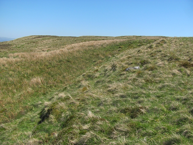
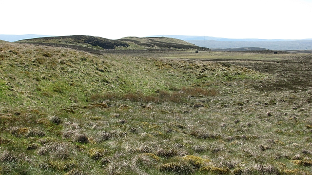
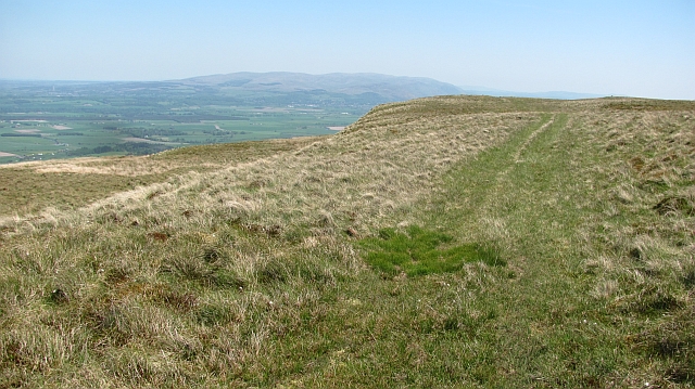
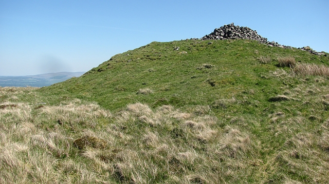
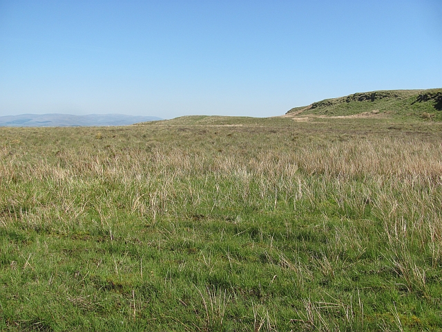
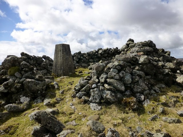
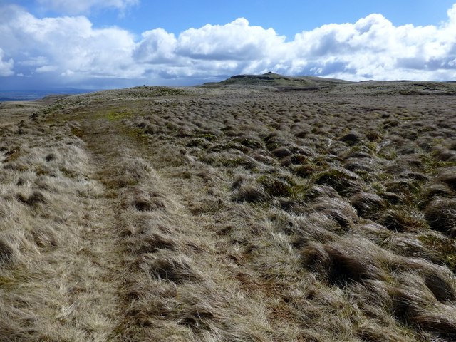
Carleatheran is a prominent hill located in the county of Stirlingshire, Scotland. Standing at an elevation of approximately 411 meters (1,348 feet), it offers breathtaking panoramic views of the surrounding landscape. Situated in the southern part of the Campsie Fells, Carleatheran is a popular destination for hikers and nature enthusiasts.

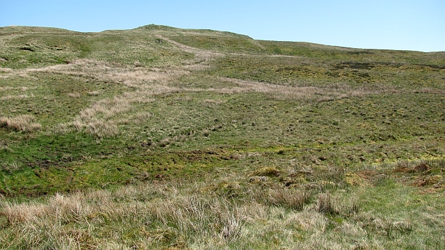
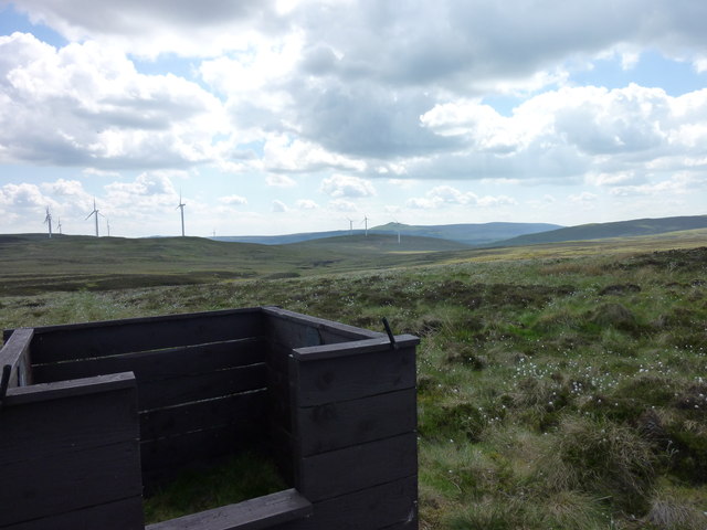
The hill is known for its diverse flora and fauna, with a wide range of plant species and wildlife calling it home. Its slopes are covered in heather, grasses, and scattered trees, creating a picturesque scene throughout the year. The hill is particularly renowned for its vibrant display of blooming heather during the summer months, attracting visitors from far and wide.

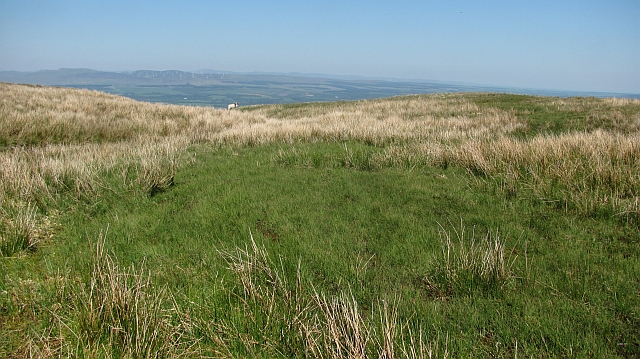
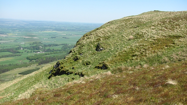
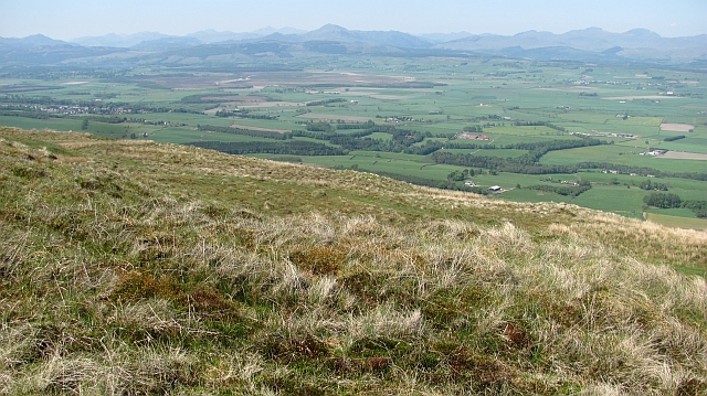
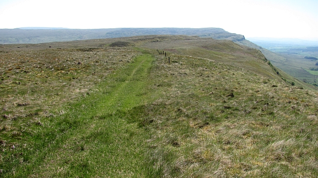
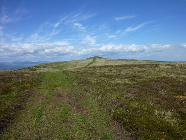
Carleatheran is easily accessible, with various footpaths and trails leading to its summit. One of the most popular routes starts from the village of Lennoxtown, taking hikers along a well-marked path that gradually ascends the hill. The trail offers stunning views of the surrounding countryside and, on clear days, even offers glimpses of Loch Lomond and the Trossachs National Park.

At the summit, hikers are rewarded with breathtaking vistas of Stirlingshire and beyond. The hill provides an ideal vantage point for observing the nearby Campsie Glen and the meandering River Kelvin. On a clear day, the view stretches as far as the nearby cities of Glasgow and Stirling.

Overall, Carleatheran is a natural gem in Stirlingshire, offering a memorable outdoor experience with its stunning views, diverse flora and fauna, and accessible hiking trails.

If you have any feedback on the listing, please let us know in the comments section below.
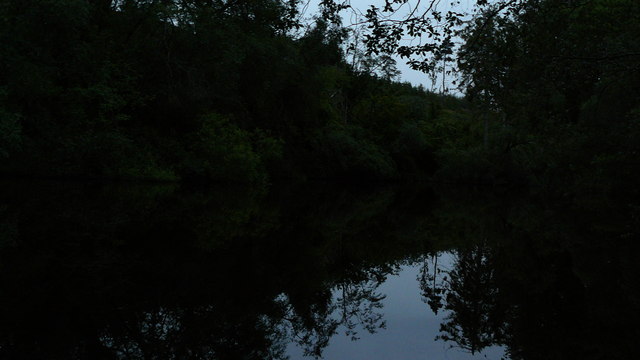
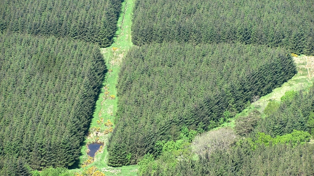
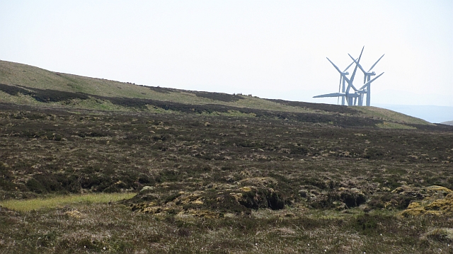
Carleatheran Images

Images are sourced within 2km of 56.101582/-4.1110309 or Grid Reference NS6891. Thanks to Geograph Open Source API. All images are credited.

Unnamed reservoir A small reservoir formed by damming the two Blackspouts.
Unnamed reservoir
A small reservoir formed by damming the two Blackspouts.
On the Gargunnock Hills Rough moorland which is managed as a grouse moor even though the heather is outnumbered by the grass. The mapped track is an exaggeration - there is a strip of flattened grass from four wheel drive vehicles and some churned up bog, but nothing to suggest a proper two dashed line track.
On the Gargunnock Hills
Rough moorland which is managed as a grouse moor even though the heather is outnumbered by the grass. The mapped track is an exaggeration - there is a strip of flattened grass from four wheel drive vehicles and some churned up bog, but nothing to suggest a proper two dashed line track.
Blair Moss Wood Conifer plantation beneath the Gargunnock Hills escarpment.
Blair Moss Wood
Conifer plantation beneath the Gargunnock Hills escarpment.
Bog, Carleatheran Peat bogs on the Gargunnock Hills plateau with the Earlsburn wind farm in the background.
Bog, Carleatheran
Peat bogs on the Gargunnock Hills plateau with the Earlsburn wind farm in the background.
On the Gargunnock Hills Grassy moorland on the plateau east of Carleatheran.
On the Gargunnock Hills
Grassy moorland on the plateau east of Carleatheran.
Moorland on the Gargunnock Hills On the edge of the steep scarp above Gargunnock.
Moorland on the Gargunnock Hills
On the edge of the steep scarp above Gargunnock.
Carleatheran Loch Now a bog.
Carleatheran Loch
Now a bog.
Trap landscape, Carleatheran The stepped landscape of successive lava flows on the Gargunnock Hills. Soon to the north the hill falls steeply towards the lowlands around the River Forth.
Trap landscape, Carleatheran
The stepped landscape of successive lava flows on the Gargunnock Hills. Soon to the north the hill falls steeply towards the lowlands around the River Forth.
Quadbike track on Carleatheran Grassy moorland at the top of the Gargunnock Hills scarp.
Quadbike track on Carleatheran
Grassy moorland at the top of the Gargunnock Hills scarp.
Carleatheran summit The cairn at the top of the Gargunnock Hills.  It is uncertain if the grassy mound is a cairn as well. It appears to be made of boulders rather than another step of basalt.
Carleatheran summit
The cairn at the top of the Gargunnock Hills. It is uncertain if the grassy mound is a cairn as well. It appears to be made of boulders rather than another step of basalt.
Gargunnock Hills traps, Tulmore An expanse of flat terrain above the steep Gargunnock Hills scarp. The flatness is the top of a lava flow, now a resistant layer of basalt. The next flow can be seen as a step (hence the term trap) on the right.  (We are told the term "trap" comes from Swedish, but it is of course an English word too.)
Gargunnock Hills traps, Tulmore
An expanse of flat terrain above the steep Gargunnock Hills scarp. The flatness is the top of a lava flow, now a resistant layer of basalt. The next flow can be seen as a step (hence the term trap) on the right. (We are told the term "trap" comes from Swedish, but it is of course an English word too.)
Above Black Craig Grassy moorland on the Gargunnock Hills with fine views of the Forth plain beneath the steep scarp.  Quite a few Highland Perthshire hills are clearly visible from Ben Venue to Ben Vorlich.
Above Black Craig
Grassy moorland on the Gargunnock Hills with fine views of the Forth plain beneath the steep scarp. Quite a few Highland Perthshire hills are clearly visible from Ben Venue to Ben Vorlich.
Path above Standmilane Crags Exaggerated somewhat to road status by the Ordnance Survey, this is a quad bike track of flattened grass with some deep boggy bits which runs the length of the escarpment. The view is towards Stronend above Fintry. Progress off the path is liable to be slow and frustrating, this is rough country.
Path above Standmilane Crags
Exaggerated somewhat to road status by the Ordnance Survey, this is a quad bike track of flattened grass with some deep boggy bits which runs the length of the escarpment. The view is towards Stronend above Fintry. Progress off the path is liable to be slow and frustrating, this is rough country.
Earlsburn Windfarm from the North Looking back to windfarm from the northernmost turbine.
Earlsburn Windfarm from the North
Looking back to windfarm from the northernmost turbine.
Moorland South of Carleatheran Looking across remote moorland to the windfarm from a line of grouse butts. The terrain north of here is tough going unless ATV or sheep tracks can be found.
Moorland South of Carleatheran
Looking across remote moorland to the windfarm from a line of grouse butts. The terrain north of here is tough going unless ATV or sheep tracks can be found.
Approaching Carleatheran from the South The track marked on the map actually continues further than indicated and eventually leads to the summit of Carleatheran.
Approaching Carleatheran from the South
The track marked on the map actually continues further than indicated and eventually leads to the summit of Carleatheran.
Carleatheran Summit First hill of the morning walking in from the north from Ballochleam then straight up to the east of Lees Hill with Jim Bloomer.
Name: Carleatheran
Hill number: 1661
Height: 485m / 1591ft
Area: 26A: Central Scotland from Dumbarton to Montrose
Class: Ma,4
Grid ref: NS 68790 91870
Summit feature: no feature: ground 3m W of trig point in shelter
Drop: 168m
Col: 317m  NS655896
Carleatheran Summit
First hill of the morning walking in from the north from Ballochleam then straight up to the east of Lees Hill with Jim Bloomer. Name: Carleatheran Hill number: 1661 Height: 485m / 1591ft Area: 26A: Central Scotland from Dumbarton to Montrose Class: Ma,4 Grid ref: NS 68790 91870 Summit feature: no feature: ground 3m W of trig point in shelter Drop: 168m Col: 317m NS655896
View East Towards Carleatheran A view east towards Carleatheran from the quad bike track that runs along the top of this escarpment.
View East Towards Carleatheran
A view east towards Carleatheran from the quad bike track that runs along the top of this escarpment.
Show me another place!

Carleatheran is located at Grid Ref: NS6891 (Lat: 56.101582, Lng: -4.1110309)

Unitary Authority: Stirling

Police Authority: Forth Valley

What 3 Words

///charm.solicitor.scanner. Near Kippen, Stirling

Nearby Locations

Carleatheran

Related Wikis

Gargunnock Hills

The Gargunnock Hills are a range of hills west of the city of Stirling, Scotland. They culminate in the peak of Carleatheran, whose 485-metre (1,591 ft...

Leckie Broch

Leckie Broch is an iron-age broch located in Stirlingshire, Scotland. == Location == Just above the confluence of two streams with deep gulleys on the...
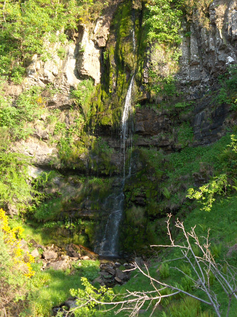
Downie's Loup

Downie's Loup is a waterfall of Scotland located near the village of Gargunnock. == See also == Waterfalls of Scotland == References ==

Stirling (UK Parliament constituency)

Stirling is a county constituency of the House of Commons of the Parliament of the United Kingdom. It elects one Member of Parliament (MP) by the first...

Nearby Amenities

Located within 500m of 56.101582,-4.1110309
Carleatheran
Corbett: no
Ele: 485
Ele Ft: 1593
Graham: no
Man Made: survey_point
Marilyn: yes
Munro: no
Natural: peak
Prominence: 168
Source: survey;bing
Source Name: os opendata
Lat/Long: 56.1015839/-4.110993
The data included in this document is from www.openstreetmap.org. The data is made available under ODbL.

Have you been to Carleatheran?

Leave your review of Carleatheran below (or comments, questions and feedback).