Waterside Hill

Hill, Mountain in Kirkcudbrightshire

Scotland

Waterside Hill

Access bridge to fields An farm access bridge over a disused railway track near Parton.
Access bridge to fields Credit: Colin Kinnear

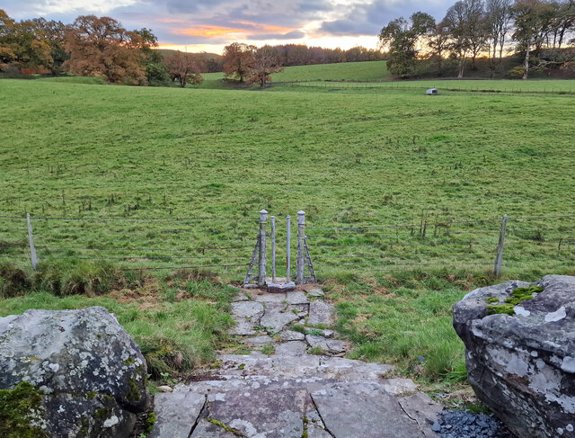
Waterside Hill is a prominent hill located in the region of Kirkcudbrightshire, Scotland. Situated in the southern part of the country, it forms part of the wider Galloway Hills range, which is known for its stunning natural beauty and diverse wildlife.

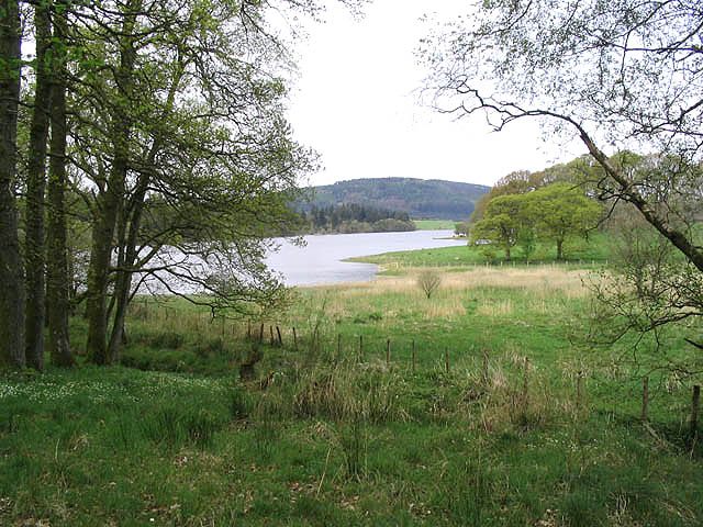
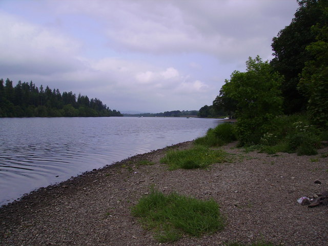
Rising to an elevation of approximately 307 meters (1,007 feet), Waterside Hill offers breathtaking panoramic views of the surrounding countryside. Its location near the Solway Firth provides visitors with the opportunity to enjoy vistas of the shimmering waters and the picturesque coastal landscapes beyond.

The hill is characterized by its gentle slopes and lush greenery, making it a popular destination for hikers and nature enthusiasts. Several well-marked trails traverse the area, providing visitors with a variety of options for exploring the hill and its surroundings. These paths wind through dense forests, across open moorland, and up to the summit, rewarding climbers with breathtaking views.

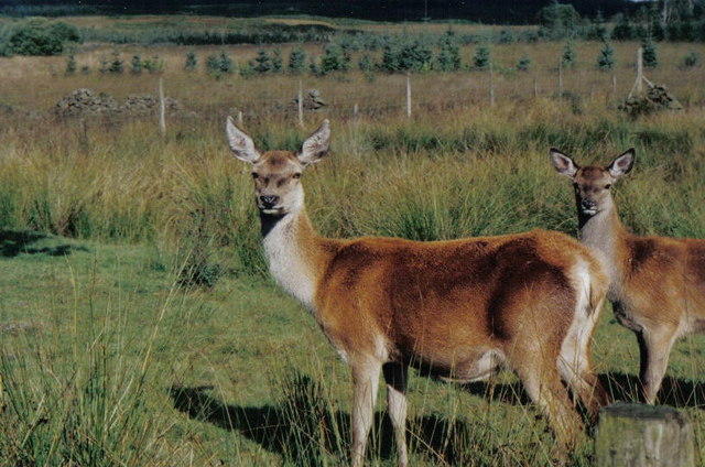
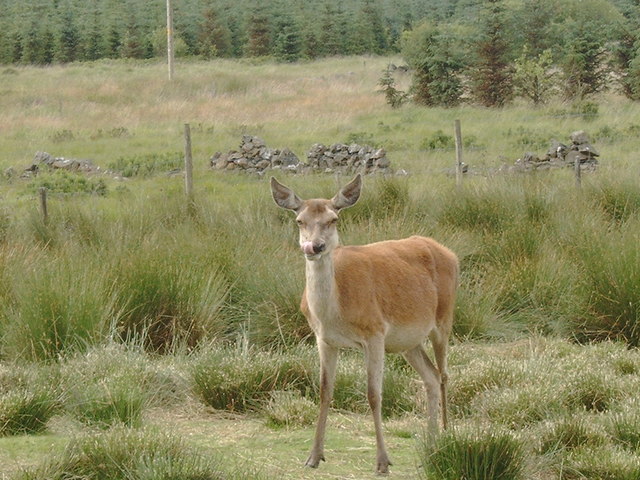
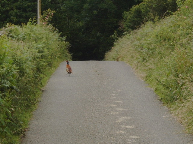
The flora and fauna of Waterside Hill are diverse and abundant. The hill is home to a wide range of plant species, including heather, bracken, and various deciduous and coniferous trees. Wildlife enthusiasts may spot red deer, roe deer, and a variety of bird species, including buzzards and kestrels.

In addition to its natural beauty, Waterside Hill also holds historical significance. The remains of an ancient hillfort can be found on its slopes, which adds an element of intrigue and interest to the area.

Overall, Waterside Hill is a captivating destination for those seeking tranquility, outdoor activities, and an appreciation for the natural wonders of Scotland's Kirkcudbrightshire region.

If you have any feedback on the listing, please let us know in the comments section below.

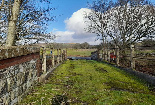
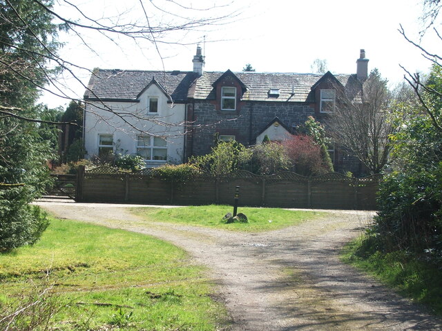
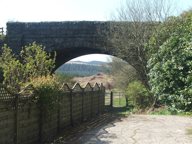
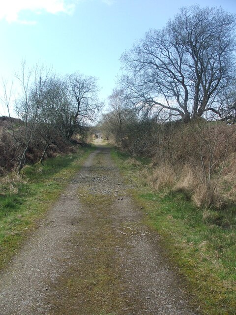
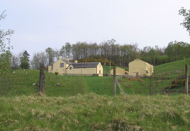
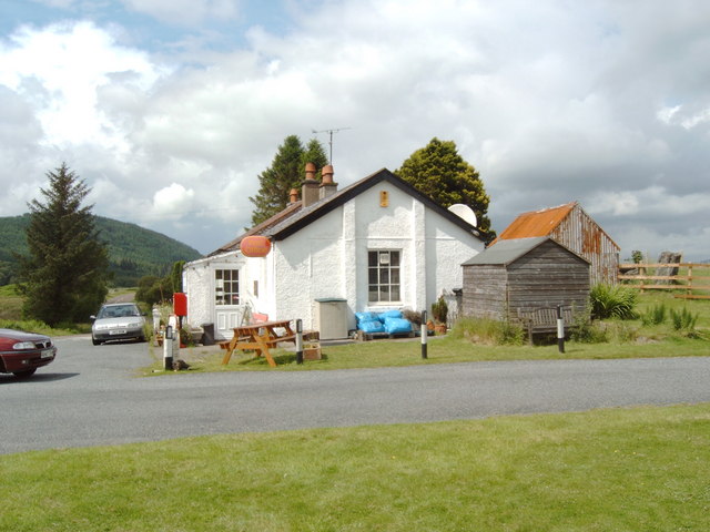
Waterside Hill Images

Images are sourced within 2km of 55.008803/-4.0730827 or Grid Reference NX6770. Thanks to Geograph Open Source API. All images are credited.

Access bridge to fields An farm access bridge over a disused railway track near Parton.
Access bridge to fields
An farm access bridge over a disused railway track near Parton.
Old railway Some of this building at Mossdale by the disused railway line was New Galloway Station.  New Galloway is 5 miles to the north but because of the terrain the railway line could not always go through larger settlements.   There are 4 milestones along the road from New Galloway giving the distance to the station.
Old railway
Some of this building at Mossdale by the disused railway line was New Galloway Station. New Galloway is 5 miles to the north but because of the terrain the railway line could not always go through larger settlements. There are 4 milestones along the road from New Galloway giving the distance to the station.
Old railway This bridge carries the A762 over the disused railway line at Mossdale.   The railway between Castle Douglas and Port Patrick was built in 1863.
Old railway
This bridge carries the A762 over the disused railway line at Mossdale. The railway between Castle Douglas and Port Patrick was built in 1863.
Old railway Travelling generally westwards but following the contours, the next big town reached along this dismantled Castle Douglas to Port Patrick railway would be Newton Stewart.
Old railway
Travelling generally westwards but following the contours, the next big town reached along this dismantled Castle Douglas to Port Patrick railway would be Newton Stewart.
Hensol House - Unusual Gate to Field This unusual gate, just to the south of Hensol House, is designed to let people into the field, but not let the livestock escape.
Hensol House - Unusual Gate to Field
This unusual gate, just to the south of Hensol House, is designed to let people into the field, but not let the livestock escape.
Parton The village of Parton.  The building with the clock tower is a self catering cottage.  In the garden of one of the cottages further on is a communal 8 seater privy (now unused)
Parton
The village of Parton. The building with the clock tower is a self catering cottage. In the garden of one of the cottages further on is a communal 8 seater privy (now unused)
Loch Ken Viaduct Former railway viaduct, now (sadly) in private hands and closed to walkers and cyclists.
Loch Ken Viaduct
Former railway viaduct, now (sadly) in private hands and closed to walkers and cyclists.
A group of kayakers paddling north on the Loch
Field with deer, Mossdale These deer were seen in a field at Mossdale, down a tiny lane to the right of the Post Office.
Field with deer, Mossdale
These deer were seen in a field at Mossdale, down a tiny lane to the right of the Post Office.
Gate entrance and gatehouse This is the main entrance to the Hensol estate.
Gate entrance and gatehouse
This is the main entrance to the Hensol estate.
Parton Privy Communal toilet block, for the row of eight cottages at Parton.  It is no longer used today for its original purpose.  One of the cubicals has been preserved.
Parton Privy
Communal toilet block, for the row of eight cottages at Parton. It is no longer used today for its original purpose. One of the cubicals has been preserved.
Loch Ken Viewed from the edge of a small wood near Drumrash.
Loch Ken
Viewed from the edge of a small wood near Drumrash.
Glenlaggan Buildings on Glenlaggan Park where there are lodges to buy or rent and caravan berths with spectacular views to Loch Ken and Galloway Forest Park.
Glenlaggan
Buildings on Glenlaggan Park where there are lodges to buy or rent and caravan berths with spectacular views to Loch Ken and Galloway Forest Park.
Loch Ken Looking northwest up the Loch from the shore near Glenlaggan
Loch Ken
Looking northwest up the Loch from the shore near Glenlaggan
Mossdale Post Office and Store
Oh Deer in a pen in Mossdale
Oh Deer
in a pen in Mossdale
Pheasant in the road at Airds of Kells
Little Drumrash, Parton.
Show me another place!

Waterside Hill is located at Grid Ref: NX6770 (Lat: 55.008803, Lng: -4.0730827)

Unitary Authority: Dumfries and Galloway

Police Authority: Dumfries and Galloway

What 3 Words

///converged.purple.risk. Near Castle Douglas, Dumfries & Galloway

Related Wikis

Airds of Kells

Airds of Kells is a farm and small estate in the historical county of Kirkcudbrightshire in the parish of Kells, Dumfries and Galloway, Scotland. The...

Loch Ken

Loch Ken is a 9 miles (14 km) long freshwater loch in the historic county of Kirkcudbrightshire in Dumfries and Galloway, Scotland. It lies in the Glenkens...

New Galloway railway station

New Galloway railway station served the town of New Galloway in Dumfries and Galloway, Scotland, from 1861 to 1965 on the Portpatrick and Wigtownshire...

Parton railway station (Portpatrick and Wigtownshire Joint Railway)

Parton railway station served the hamlet of Parton, Dumfries and Galloway, Scotland, from 1861 to 1965 on the Portpatrick and Wigtownshire Joint Railway...

Parton, Dumfries and Galloway

Parton is a hamlet situated on the banks of the River Dee in the historical county of Kirkcudbrightshire, Dumfries and Galloway, Scotland. == Notable... ==

Kirkcudbrightshire

Kirkcudbrightshire ( kur-KOO-brish-ər, -⁠eer; Scots: [kərˈku(d)brəʃər]), or the County of Kirkcudbright or the Stewartry of Kirkcudbright is one of the...

Ironmacannie Mill

Ironmacannie Mill is a historic watermill near Balmaclellan in Dumfries and Galloway, Scotland. Built in the 18th and 19th centuries, on the site of an...

Galloway

Galloway (Scottish Gaelic: Gall-Ghàidhealaibh [ˈkal̪ˠaɣəl̪ˠu]; Scots: Gallowa; Latin: Gallovidia) is a region in southwestern Scotland comprising the historic...

Nearby Amenities

Located within 500m of 55.008803,-4.0730827
Power: pole
Lat/Long: 55.0060339/-4.0783531
Power: pole
Lat/Long: 55.0053494/-4.0780996
Power: pole
Lat/Long: 55.0055758/-4.0767533
Power: pole
Lat/Long: 55.0062008/-4.0792241
Power: pole
Lat/Long: 55.0111836/-4.0788247
Power: pole
Lat/Long: 55.0107877/-4.0774693
Power: pole
Lat/Long: 55.0103808/-4.0760119
Power: pole
Lat/Long: 55.0101079/-4.0750771
Power: pole
Lat/Long: 55.0097595/-4.0738428
Power: pole
Lat/Long: 55.0095402/-4.0730717
Power: pole
Lat/Long: 55.0098752/-4.0724662
Power: pole
Lat/Long: 55.0101396/-4.0719903
Power: pole
Lat/Long: 55.0106317/-4.0710917
Power: pole
Lat/Long: 55.0110362/-4.0703757
Power: pole
Lat/Long: 55.0109509/-4.0691541
Power: pole
Lat/Long: 55.0108522/-4.0676819
Power: pole
Lat/Long: 55.0107913/-4.0666834
Power: pole
Lat/Long: 55.0104076/-4.0795406
Power: pole
Lat/Long: 55.0096243/-4.0802842
Power: pole
Lat/Long: 55.0080052/-4.0805816
Power: pole
Lat/Long: 55.0073631/-4.0797616
The data included in this document is from www.openstreetmap.org. The data is made available under ODbL.

Have you been to Waterside Hill?

Leave your review of Waterside Hill below (or comments, questions and feedback).